The Pembrokeshire Coast National Park was designated in 1952 because of its varied geology and dramatic coastal features. Some of these classic landscapes have been captured below.
Bays
A bay is an open, curving feature cut into the coastline. In Pembrokeshire, bays can be big or small. St Brides Bay is a large feature that gives the county its distinctive shape when seen on a map. It is almost as though a giant has taken a bite out of the side of the county.
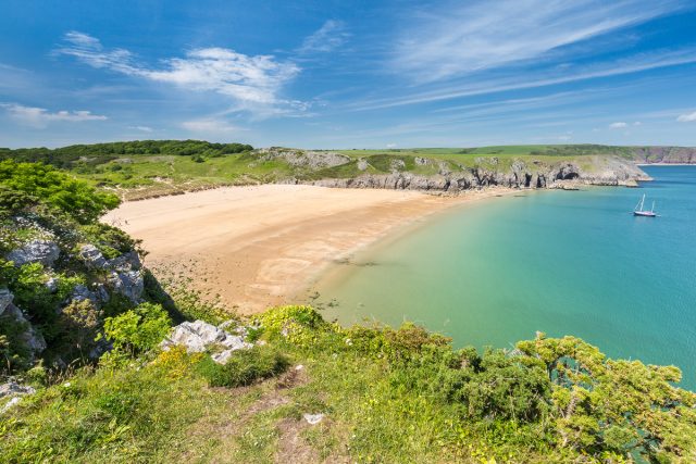
Other bays are smaller. Barafundle Bay, in the south of the county, is a beautiful bay and is very popular with visitors. The bay nestles between cliffs, and marks the end of the Carboniferous Limestone cliffs of the Castlemartin Peninsula to the south-west, and the beginning of the red sandstone rocks of Devonian Age at Stackpole Quay, to the north-east.
Beaches
Pembrokeshire is noted for the quality of its beaches and water. Few areas of Britain can boast the number of beautiful beaches that Pembrokeshire has. They vary in size and type, from Whitesands in the north to the long stretch of sand at Tenby to the boulder beach at Caerbwdy.
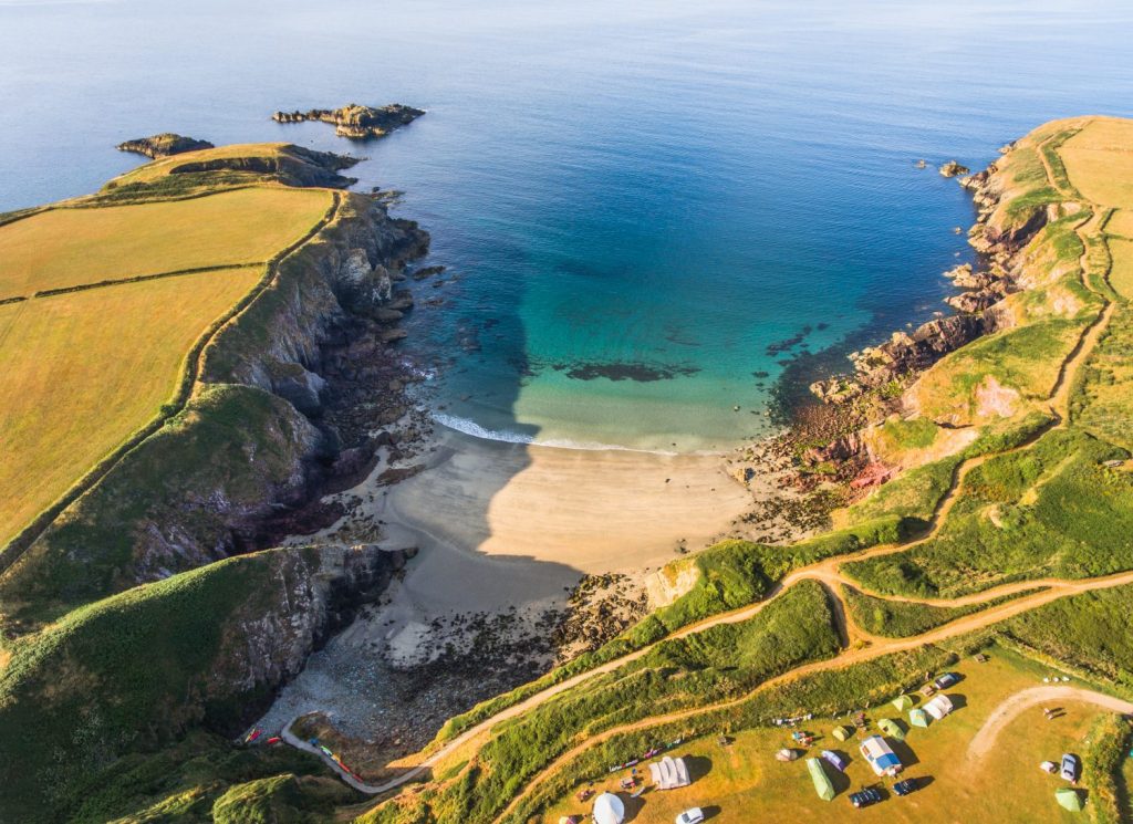
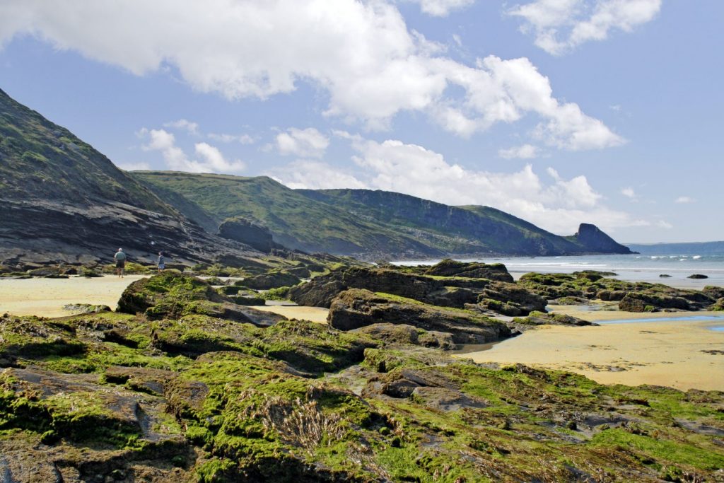
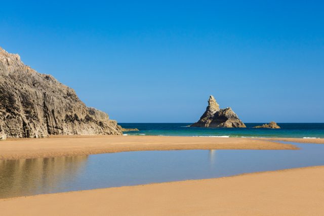
Broad Haven South is an example of a sandy beach in Pembrokeshire. It is tucked between the limestone headlands of Stackpole and St Govans in the south of the county, and is protected from the worst of the weather by these headlands. The limestone cliffs are pitted with caves, and erosion and change in sea level have left an islet and a rocky stack, that can be seen in the picture below. The stack is known locally as Church Rock.
Broad Haven has a wide sandy beach that stretches back inland where a sand dune system is developing. Close to the sea, the beach is generally flatter, and at low tide the sand is rippled. These ripples are caused by wave action, and are at right-angles to the incoming waves.
Further away from the sea the beach becomes steeper as it meets the dune system, and marram grass begins to take hold. At the northern end of the beach a stream from the adjacent lake system of Bosherston flows onto the beach. This flow is intermittent, but a channel exists for much of the year, and in the winter months, when the sea is rough, saltwater flows up this channel and fills a lagoon at the top of the beach. It is interesting to note that the shape of the beach can change very quickly depending on the weather and sea conditions. In summer the beach is much flatter, but in winter large amounts of sand are deposited, forming high banks, and deep channels.
Caves
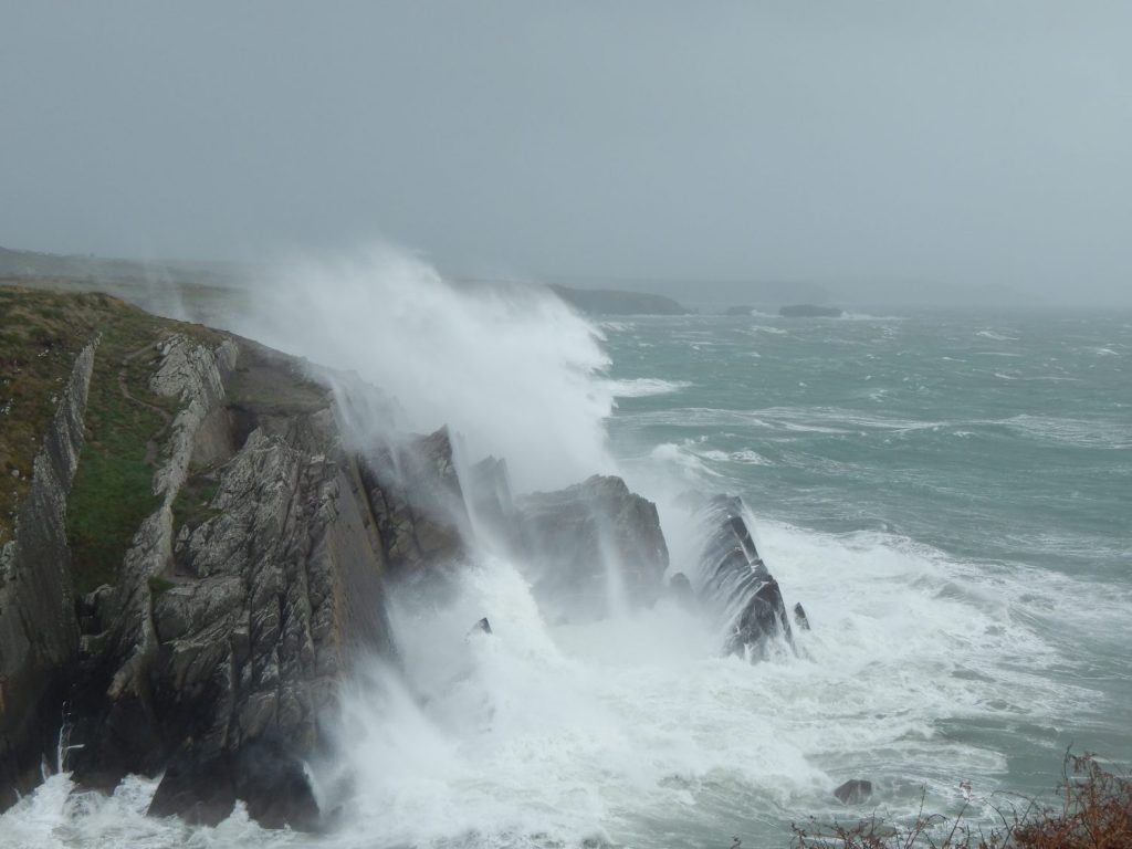
Sea caves are a common feature of the Pembrokeshire coastline. They were formed when weaknesses in the underlying rock (bedding planes and joints) were eroded by wave action. The weaknesses allowed rocks to be chiselled away by the force of the waves, or in the case of the limestone in the south of the county, to be dissolved.
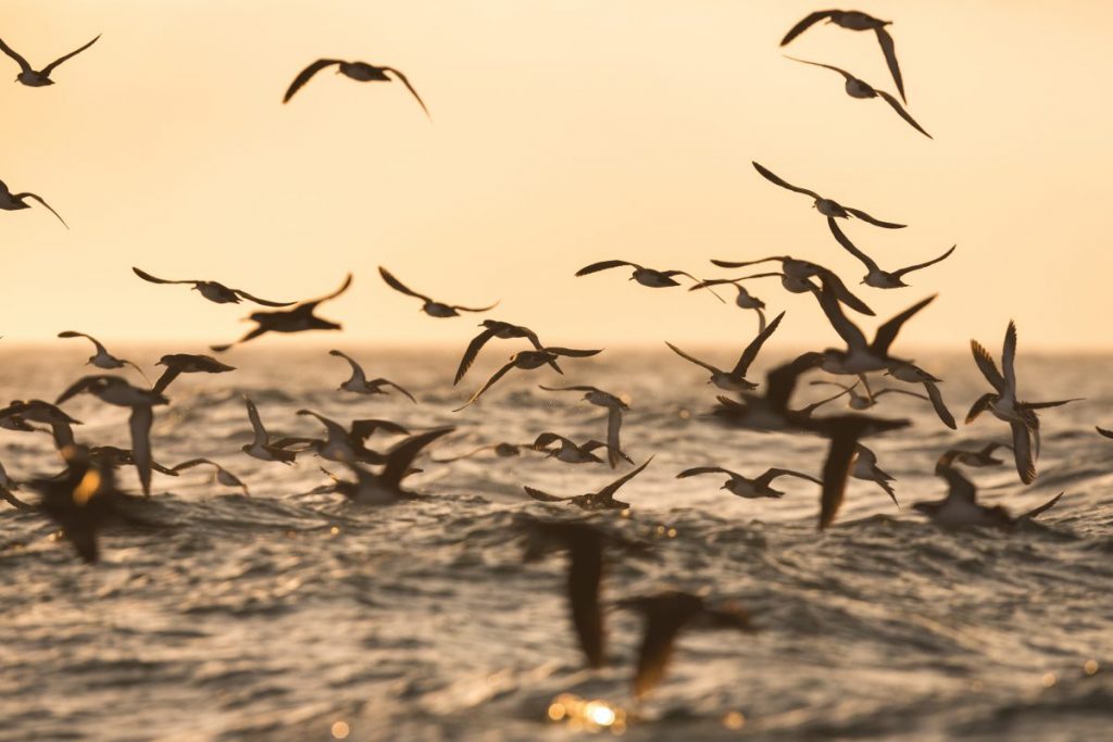
Over many thousands of years small fissures have become larger, forming caves of various sizes. Sea caves provide an important habitat for a number of creatures that live along the Pembrokeshire Coast. Grey seals are known to use them as safe places for giving birth to their pups. Some seabirds also use the ledges of rock to nest. At Stackpole Head, close to Barafundle Bay, a colony of guillemots use caves as a nest site. At Flimston, kittiwakes nest in a collapsed cave system.
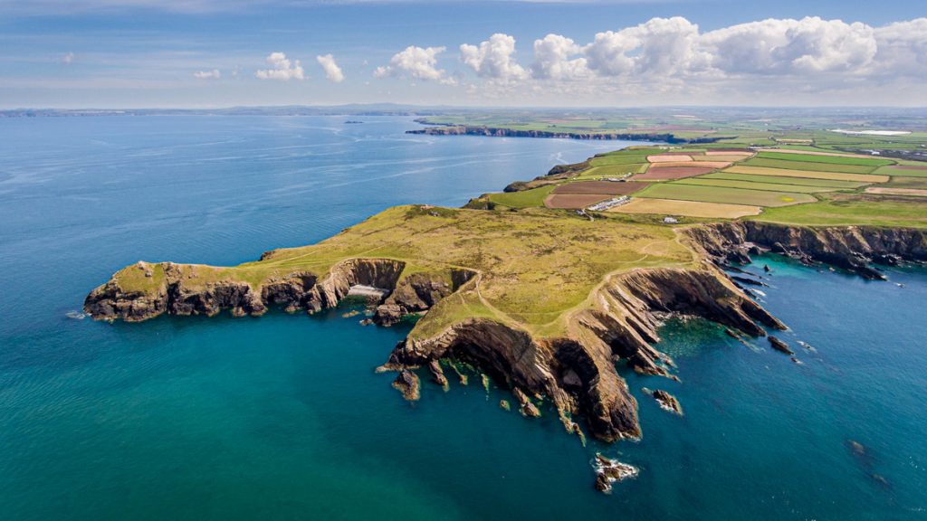
Cliffs
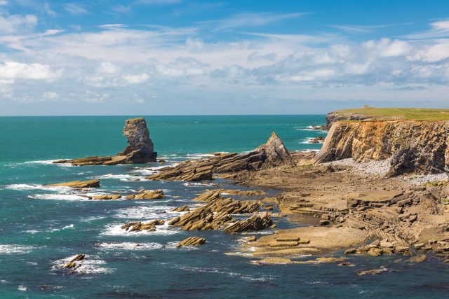
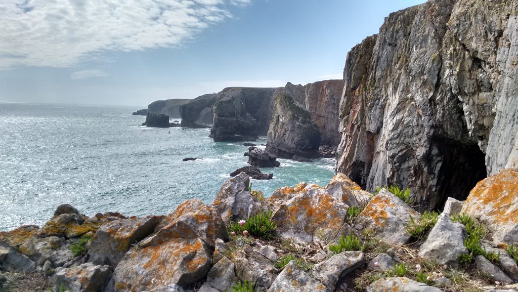
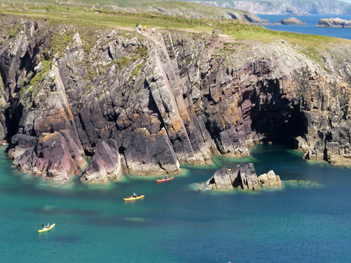
The landscape of the Castlemartin Peninsula has been created by the erosion of the rock found there. This is Carboniferous limestone, and where rock meets the sea produces some fantastic coastal scenery, and some of the finest sights in Pembrokeshire.
Limestone is a sedimentary rock made from the remains of dead sea creatures, such as coral. As the creatures died, their remains sank to the seabed, and built up thick layers. These layers were then squashed by immense pressure to form limestone.
The cliffs at St Govan’s Head are made of limestone. The clifftop is generally flat, but there are hollows where the limestone has been dissolved by water. On the tip of St Govan’s Head, the rock is more exposed and forms a rough carpet of broken and cracked fragments.
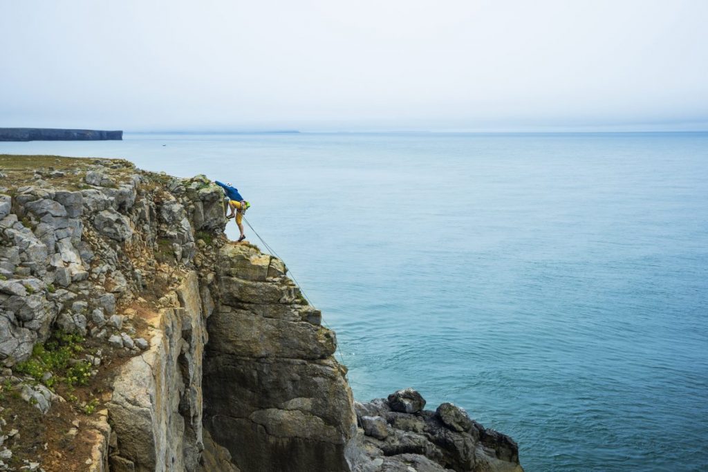
The limestone of the cliffs is steep and sheer and the area is popular with climbers and walkers. At the base boulder beaches are formed, where the sea has undercut the base of the cliff, causing parts of the cliff to collapse.
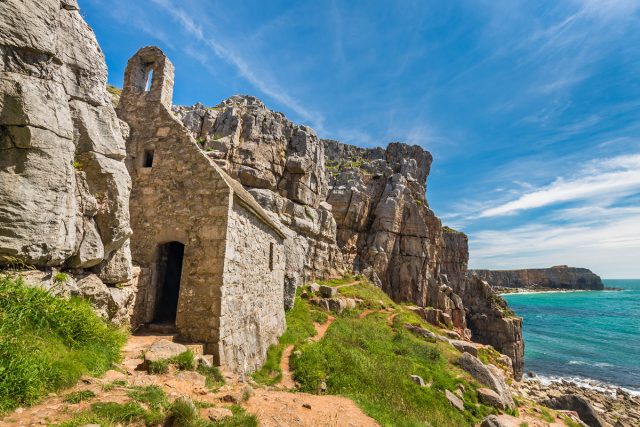
St Govan’s also attracts visitors to the small chapel set in a cleft in the cliffs. The large numbers of people visiting one small area causes erosion to the thin soil and grass. Some of the worst affected areas have been fenced off to encourage regeneration. Where the cliffs have fallen, people have been redirected for their own safety.
Coves
The heavily indented rocky coastline of Pembrokeshire has examples of many coastal features, from majestic headlands to spectacular sweeping bays. It is possible to overlook some of the smaller features, such as the numerous coves and small bays, which are often characterised by having narrow entrances.
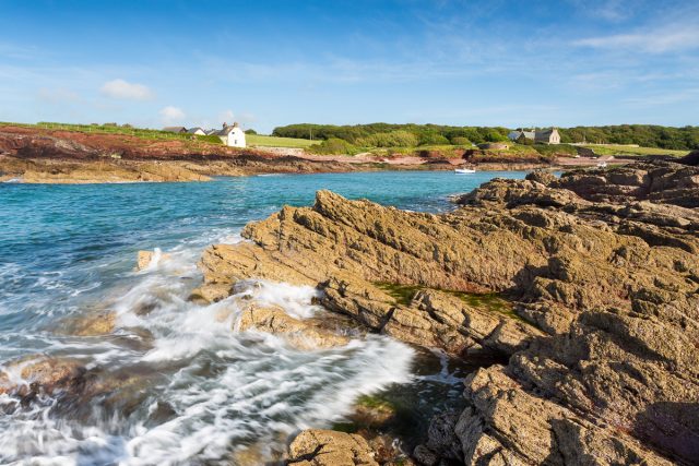
St Brides Haven is a pretty cove, tucked into the south-eastern corner of St Brides Bay. The rocks of the bay are Old Red Sandstone, giving the cliffs around a characteristic red colour. The cove is at the end of a valley, approached along a gently sloping road. The bay is shallow at low tide, and rockpools are exposed.
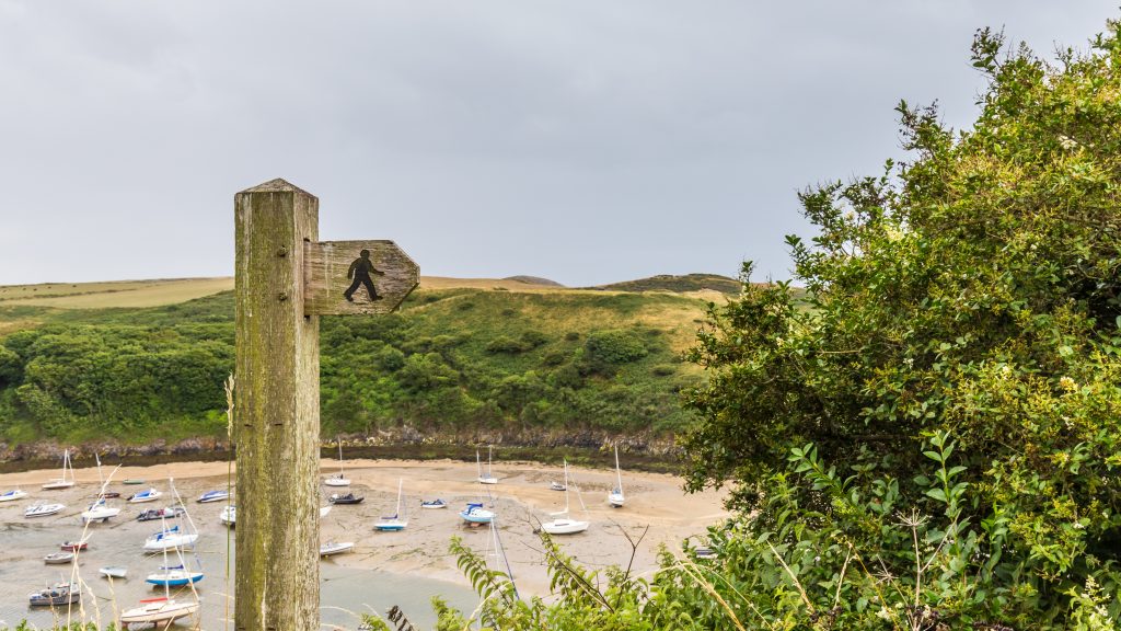
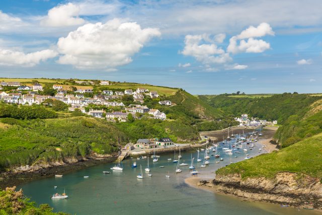
Harbours
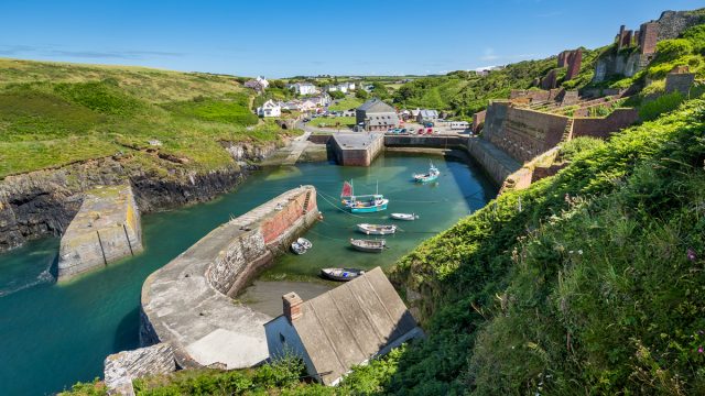
A harbour is a place where a seagoing vessel can seek shelter from bad weather and unload cargo and passengers onto the land. People have adapted and added to the natural bays, coves and headlands of Pembrokeshire, to build safe havens for their boats.
A look on a map of the Pembrokeshire coastline shows many harbours, some quite small, others larger. Many were used in times past, when Pembrokeshire was an important place in the production of fertiliser, made from burning limestone, and from mining coal.
These harbours are called havens, the word haven meaning shelter – Lydstep Haven, Little Haven, Martin’s Haven. The Welsh word porth means door or harbour, and can be found in the north of the county in place names such as Porthgain and Porth Clais. Furthermore, the word quay indicates a place where vessels could land cargo and people, and is found in place names such as Cresswell Quay and Stackpole Quay.
Islands
There are six main islands off the coast of Pembrokeshire, and all of them are in the National Park. Five of these islands have been inhabited at some point in their history. You can find out more about the six main islands by clicking the links below:
- Caldey
- St Margaret’s
- Skokholm
- Skomer
- Grassholm
- Ramsey
Gateholm Island is an islet at the western end of Marloes Sands and is just one of many off the Pembrokeshire Coast. The cliffs, headlands and offshore islets consist of Devonian sandstone, sedimentary rock, made from grains of sand. Millions of years ago these grains were squashed by immense pressure to form new rocks. Since then movements of the earth have tipped the rocks sideways.
Sandstone is a soft rock, and can be worn away by the action of the sea. Gateholm used to be part of the mainland, but the sea has worn away the rock in between, leaving an islet close to the cliffs. In years to come the sea will further erode, and the gap between Gateholm and the mainland will become larger.
A tombolo is formed when an islet is connected to the mainland by a beach. At Gateholm water surrounds the islet at high tide, cutting it off from the mainland. But at low tide the islet can be reached from the beach, simply by walking across the sand and rocks.
Rias
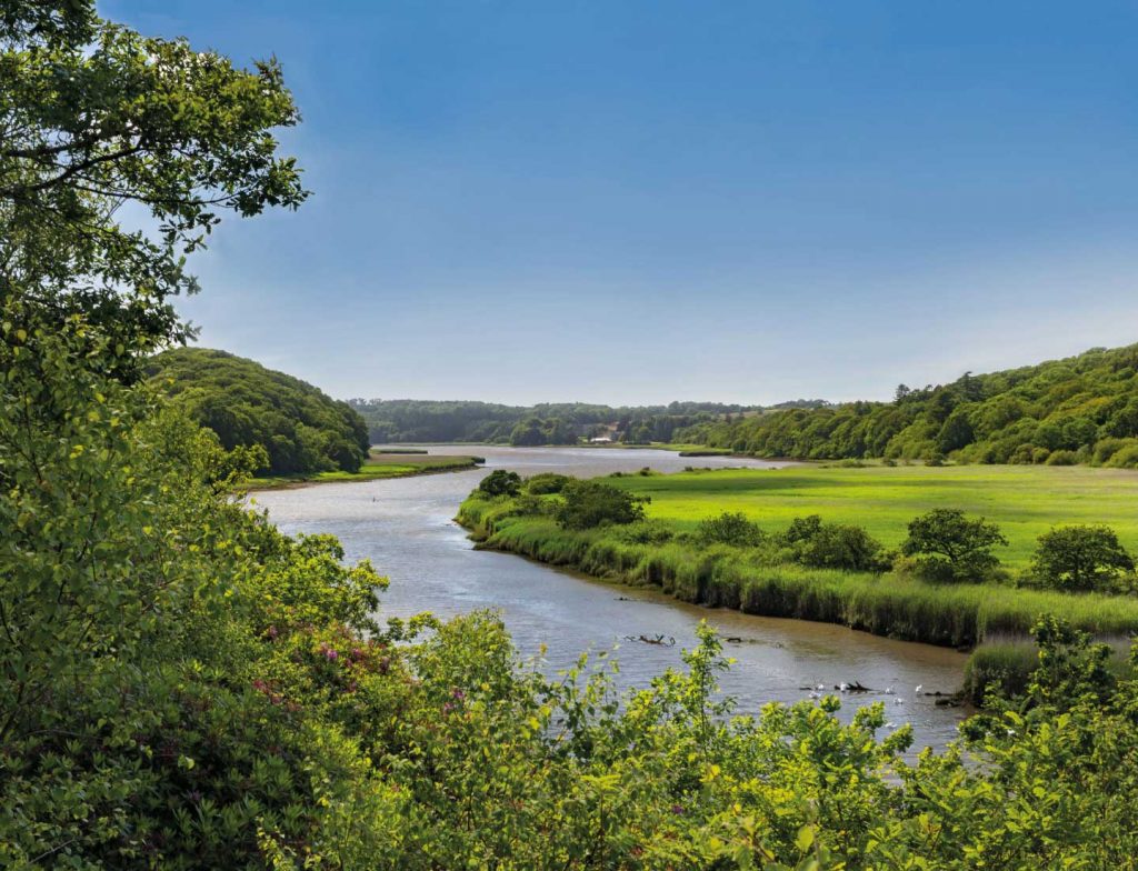
A ria is a submerged coastal valley. The ria at Solva was eroded between two and four million years ago. At the end of the Ice Age, meltwater from glaciers cut deep into the rocks forming a steep-sided river valley. The valley was later flooded as sea levels rose, forming the ria we see today.
The rocks at Solva are Cambrian Sandstone. Sandstone is a sedimentary rock, made from sand which was deposited millions of years ago. This sand was then squashed under immense pressure to form rock. Sandstone is a rock that can be quite easily eroded.
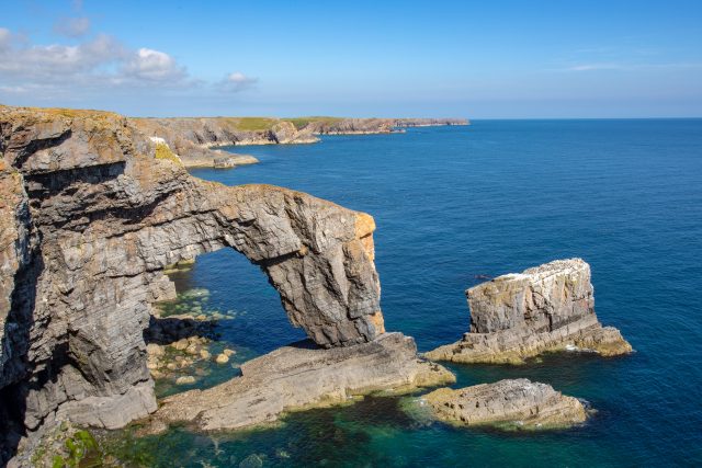
Sea Arches
The Green Bridge of Wales is one of the most famous landmarks in Wales, and one of the most spectacular sites on the Pembrokeshire Coast. It is located close to Castlemartin in the south of the county, and is adjacent to the Stack Rocks and the Cauldron.
The Green Bridge is a limestone arch. It is the limestone of the South Pembrokeshire Coast that is responsible for some of the most beautiful natural features. The arch formed when the sea wore away the rock underneath.
Once the arch was a promontory of rock, jutting into the sea. It was solid, with no hole or arch to be seen. Weaknesses in the rock, known as joints and bedding planes, allowed the sea and the force of the waves to wear away the rock. At first, it is likely that a cave was formed in each side of the spur. As the sea gradually washed more rock away, the two caves joined together to make an arch.
In 2017 the Green Bridge was damaged by storms Ophelia and Brian. One day in the future the centre of the arch will collapse, and the arch will become a stack.
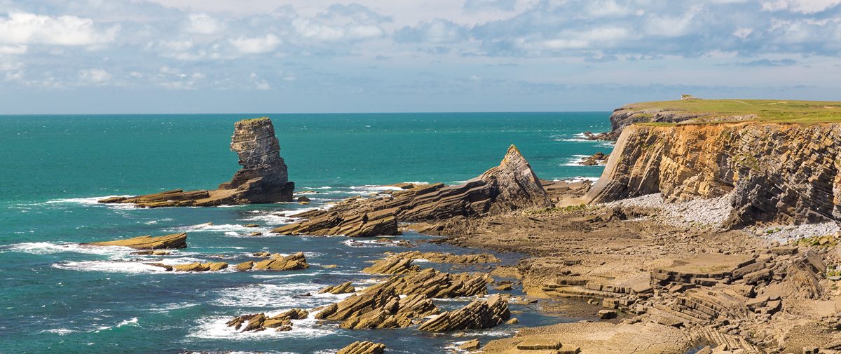
Stacks
Stacks are isolated pillars of rock which rise steeply from the sea. Around the Pembrokeshire Coast there are a number of stacks, which were once part of the mainland. However, over time the sea has worked into weaknesses in the rock, known as joints and bedding planes, and worn it away. What is left is a stack that is separate from the mainland. Some stacks form from arches, such as the Green Bridge of Wales.
The two Carboniferous Limestone stacks found at Castlemartin, known as Stack Rocks, are important nesting sites for guillemots and kittiwakes, two of the many species of seabirds found on the Pembrokeshire Coast. The birds return to the stacks in spring, and can be viewed from the mainland throughout the spring and early summer. Locally the Stack Rocks are known as the Elegug Stacks, after the Welsh word for Guillemot – Heligog.
Pen y Holt Stack is found in Pen y Holt Bay, along the coast from Stack Rocks, and is in the MOD-owned Castlemartin Range. It is only accessible through walks organised by the Pembrokeshire Coast National Park Authority (see our events page for more details). The presence of several submerged ledges offshore and a resistant platform beneath the stack itself, means that the stack is relatively protected from the full force of the strongest waves. Despite its precarious appearance, the stack is a refuge for vegetation above the limits of wave action.