The impacts of the invasive non-native plant Himalayan balsam (Impatiens glandulifera) are well documented in the literature for having a detrimental impact on ecosystem service provision (Coakley and Petti. 2021). Whilst research and trials are under way using biological control (Pollard et al, 2022) manual control methods can have a meaningful impact at appropriate scales and encourage more community participation in control and monitoring.
Download Toolkit to implement catchment control of an invasive plant (Himalayan balsam) (PDF)
Table of contents
- Introduction
- Species selection
- Selecting a Catchment/Action area
3.1 Areas of existing action
3.2 Known issues/existing concerns
3.3 Areas of high biodiversity value
3.4 Impact on organisational assets or operations
3.5 Resources and the state of an existing infestation
3.6 Fuzzy boundaries - The Strategic Catchment approach
- Partners and stakeholders
- Survey and data management
6.1 Desktop studies
6.2 Remote sensing
6.3 Google Streetview
6.4 Rapid catchment mapping
6.5 Detailed catchment mapping
6.5.1 Data management
6.5.2 Firefly maps
6.6 Record density and time spent each season
6.7 Understanding what influences control effort/cost/time
6.8 Budgeting for control - Control strategy
7.1. Control methods - Working with people
8.1 Contractors
8.2 Working with communities and volunteers
8.3 Landowners - Environmental Impacts
9.1 Dealing with protected species
9.2. What is otter mitigation practically? - Exit Strategy – The monitoring and maintenance phase
10.1 Monitoring the visual change
10.2 What does a monitoring and maintenance strategy entail?
10.3 How long does the monitoring and maintenance phase last for?
10.4 Who to undertake monitoring and maintenance?
10.5 What to record for the monitoring phase?
10.6 Who to undertake the maintenance?
10.7 When to undertake monitoring and maintenance ‘reducing resource’
10.8 Where to prioritise ‘reduced resource’
10.9 How to manage outbreaks during the monitoring and maintenance strategy?
10.10 Pathway Analysis - Site recovery and mitigation
- Monitoring and evaluation
- Project staffing
- Conclusion – Balsam is beatable!
- References
Glossary
Catchment Approach (to invasive species control) – adapted from the catchments.ie website (opens in new window).
A catchment approach is essential to a successful, efficient control and long-term management strategy for Invasive Non-Native Species (INNS) in the context of this document, Himalayan Balsam. Balsam must be removed in the upper reaches of the catchment first i.e., highest tributary or site where present followed by downstream work eliminating the chance of re-infestation from up-stream areas.
Access – Cutting of vegetation outside of the nesting season to allow physical access directly, but also to encourage germination of the seedbank indirectly by removing competition and cover in the short term.
Area infestation – An area of land highlighted as having balsam present, either dense or sporadic. an area of land highlighted for balsam infestation which can be sporadic within that area or dense infestation (the area to control and monitor). This is recorded using GIS polygons.
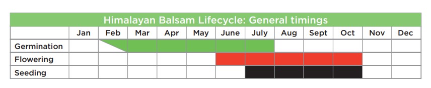
Balsam control season – Balsam can be controlled at all life stages between March and November, life cycle timings may differ according to locations and may differ within some habitats.
Dispersal pathway – Balsam can be spread via human means (contaminated footwear/machinery tracks, direct seed share) and natural means (water, animals). A farmyard has a mixture of dispersal pathways, an isolated site where humans rarely access may only have natural means of dispersal. Biosecurity procedures and control look to reduce dispersal pathways.
High intensity Control (HIC) – This is consistent, control visits with the most efficient control methods used. High Intensity control does require a budget for contractors and a dedicated project officer to co-ordinate the control by various stakeholders. A thorough control strategy is used for achieving site, sub-catchment or whole catchment near eradication with Himalayan balsam. Resource input is likely to be consistent for the balsam control season for at least two seasons. The methods used may include a mixture of manual, mechanical and if deemed necessary chemical control using paid and unpaid labour. Control must include the full extent of balsam infestation to produce reduction in densities i.e. source, outside edge and satellite areas.
Monitoring and maintenance (M and M) – Monitoring the condition of newly created asset and maintaining the asset to the desired condition following a high intensity control phase on site, sub-catchment or catchment balsam infestation. This phase is essentially a planned exit strategy as area infestation polygons are low density/near eradicated.
Outbreaks – An environmental or human event which causes a sudden random infestation of Himalayan balsam which would require a rapid response depending on the location within a project area.
Outside edge – The outer most edge or extent of an area infestation where no balsam is recorded above this point.
Satellite infestation – An area of balsam isolated from a wider infestation due to early invasion. There are areas of land or water in proximity to a satellite infestation where no balsam is present but left uncontrolled the satellite is likely to be the source in these areas via natural or manmade dispersal pathways. A satellite infestation is considered a high priority for control before it becomes a wider landscape source.
Source – The highest or furthest point at a site or catchment where balsam occurs. Control here is the most strategic in a landscape context and efficient as reinfestation should not occur by natural means. A source infestation may be in proximity to water causing wider spread within that catchment and or an isolated ‘satellite’ infestation in the early stages of wider landscape invasion.
1. Introduction
The impacts of the invasive non-native plant Himalayan balsam (Impatiens glandulifera) are well documented for having a detrimental impact on ecosystem service provision (Coakley and Petti. 2021). While research and trials are underway using biological control (Pollard et al, 2022), manual control methods can have a meaningful impact at appropriate scales and encourage more community participation in control and monitoring.
Between 2016 and 2021 Pembrokeshire Coast National Park Authority (PCNPA) employed an INNS coordinator to mobilise and direct the resources of volunteers, community groups, PCNPA staff and landowners in a sustainable, top-down, catchment based approach to INNS management.
The Stitch in Time project demonstrates a successful model of community management of the widely spread invasive non-native species Himalayan balsam. This document shares the learning from the project and is intended to provide individuals, community groups, businesses and statutory organisations with the tools and knowledge needed to plan execute and evidence the benefits of a community INNS project with a coordinated catchment approach to control.
The approach described is practical, cost-effective, easily replicated and builds in a planned exit strategy in the form of a monitoring and maintenance phase. The methods and rational for Himalayan balsam control within this document could in theory be applied to an annual invasive plant species where the plant main dispersal mechanism is by seed with a relatively short seedbank longevity and is not harmful or toxic upon touch.
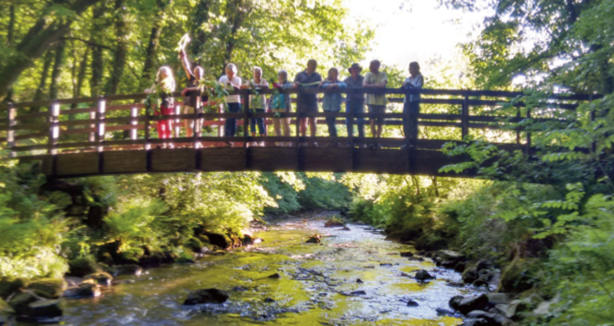
We would particularly like to thank a community led project (Poppit marsh balsam eradication, Cymdeithas Llandudoch/St Dogmaels Community Association) funded by the Sustainable Development Fund that led to the Stitch in Time project.
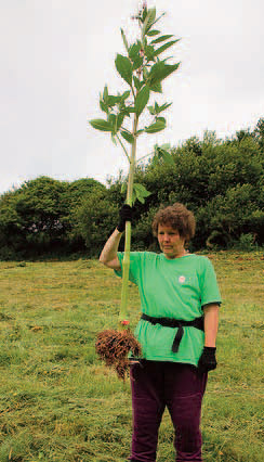
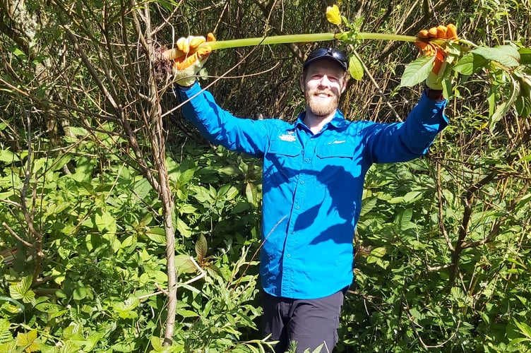
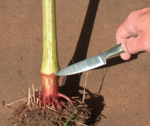
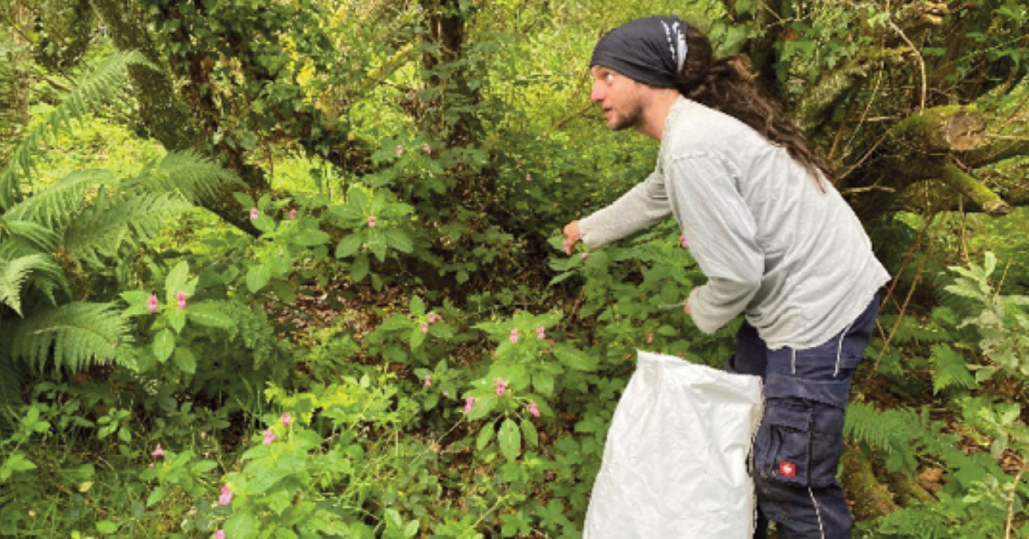
Gill Wislocki (pictured) holding a large Himalayan balsam stem, Gill and Cymdeithas Llandudoch members were key in developing and implementing successful community-based control of Himalayan balsam.
2. Species selection
Species selection for the project was guided by the Pembrokeshire Local Nature Partnership INNS Action Plan which ensures a strategic approach across Pembrokeshire to the monitoring, control and/or eradication of INNS in the county where both practicable and appropriate to safeguard the native biodiversity of Pembrokeshire.
The Pembrokeshire INNS action plan adopts the Great Britain (GB) strategy for INNS which follows the three-stage hierarchical approach adopted by the Convention on Biological Diversity which details prevention, detection/surveillance and control/eradication as the three main ways of dealing with invasive species (with prevention given the highest priority).
In developing the INNS action plan for Pembrokeshire current national data from the GB Non-Native Species Secretariat (GBNNSS), local records from West Wales Biodiversity Information Centre (WWBIC), information held by Natural Resources Wales (NRW) and discussions with the relevant County Recorders were used to draft a list of species which could be of concern to biodiversity conservation in Pembrokeshire.
Lead partners then used local knowledge and professional judgement to pare this list down to 36 species of concern in Pembrokeshire which are considered high priority for action based upon presence or likely future presence in the county, threat to native biodiversity, damage to infrastructure or property and available control measures.
Himalayan balsam and Japanese knotweed were identified as high priority widespread species of concern which also have known control mechanisms and were therefore targeted for practical action by the Stitch in Time project in Pembrokeshire.
3. Selecting a Catchment/Action area
Within Pembrokeshire Coast National Park, selecting an area for strategic action was necessary to allow us to focus limited resources on achieving and maintaining control of target INNS. This a major change from our previous more ad hoc approach.
The following considerations were helpful in deciding where to focus our approach.
3.1 Areas of existing action
It is useful to map areas of existing action to find out where nature conservation organisations, statutory organisations, communities and individuals are already involved in INNS control. To consider the scope and efficacy of that control is a useful way to find gaps that might need to be filled to achieve the desired output.
3.2 Known issues/existing concerns
Canvas potential partners, community members and the local nature partnership. Even in the absence of detailed and comprehensive surveys it is likely that many stakeholders will be able to highlight areas of concern and will have areas of concern regarding INNS impact and which areas they think would be ideal for focussed action.
3.3 Areas of high biodiversity value
Consider the potential impact on designated features, habitats and species of concern; for example, a catchment with a wetland SSSI/SAC or networks of marshy grasslands and mires would be a higher priority than highly improved farm landscape. This can also be used to target specific tributaries within a river catchment if resources do not exist to tackle a whole catchment (Nevern is a good example of this).
3.4 Impact on organisational assets or operations
Considering land ownership, potential impacts and legal obligations can help you to locate partners who might benefit from a strategic approach and therefore may be willing to bring resources to the table.
3.5 Resources and the state of an existing infestation
The high impact control phase is likely to last three to four years at a site with small scale maintenance required for at least another three to four years or longer. Therefore, it is important to ensure that you do not take on more than you can maintain!
It can be tempting to tackle the worst areas first, but far greater value for money might be obtained from tackling a smaller and more recent infestation in an area with high potential for impact on biodiversity. This rationale might also be used to split catchments, for example you may decide to attempt to eradicate balsam from biodiverse headwaters as a priority, while accepting a riparian infestation with little opportunity to spread into important habitats along the main river where it goes through improved farmland.
3.6 Fuzzy boundaries
However you define your action area, keep the boundaries fuzzy to allow you flexibility to account for land ownership boundaries or cultural links such as animal movements. You may want to consider other methods of potential transfer and consider whether this may warrant the inclusion of additional areas outside of the catchment within your zone of action.
4. The Strategic Catchment approach
While a number of organisations and individuals are involved with INNS control in the National Park and Pembrokeshire, the approach is often piecemeal. For example, due to land ownership, treatment may not eradicate the target species at a particular site and only control it up to a certain boundary. Such containment efforts imply indefinite treatment costs, and by leaving a source of infection, do not necessarily prevent species spread to new areas.
Systematic eradication (or near eradication) from a defensible area is the most cost-effective solution in the long term, as management is reduced to preventing or treating any reinfestation.
“The Catchment Based Approach (CaBA) embeds collaborative working at a river catchment scale, delivering a range of environmental, social and economic benefits and protecting our precious water environments for the benefit of us all.”
– Catchment Based Approach website (opens in new window) adapted from catchments.ie website (opens in new window).
The CaBA employs tactics which take account of the way Himalayan balsam spreads. Watercourses are a major dispersal pathway for INNS, allowing for rapid dispersal downstream along water features. Catchments, or sections of catchments are therefore an appropriate scale at which to work. Geographic Information Systems (GIS) enabled the project to take a tactical approach within the catchment, based on Hortensian stream order and drainage basins. This means that Himalayan balsam must be removed in the upper reaches of the catchment first ie highest tributary or site where present followed by downstream work eliminating the chance of reinfestation from upstream areas.
Balsam is also able to invade habitats away from water and can also spread upstream, although more slowly. Identifying and targeting these resulting ‘outside edges’ and ‘off-stream’ infestations are also critical; failure to do so will result in eventual reinfestation of the whole catchment or site.
Sometimes it can be challenging getting others to accept this way of working as it is natural to want to work on sites of interest to them rather than elsewhere in the catchment. Persevere as it is an essential element of the approach.
In an infested catchment where balsam is infesting an area of high value but the catchment is not under strategic control measures, it may be necessary to make an exception. Pushing the infestation back to the river corridor is the only option and as eradication is impossible it has to be accepted that continuous annual management will be required. This is however better than doing nothing when there is a risk of spread of the outside edge to potentially a headwater of an adjacent catchment.
As noted by Cuda (et al, 2020) riparian infestations across Europe over the last 20 years have led to more invasion of habitats away from water, especially forests. The authors note that these areas are more sustainable to focus control resources and mitigation action/awareness rather than the riparian source populations.
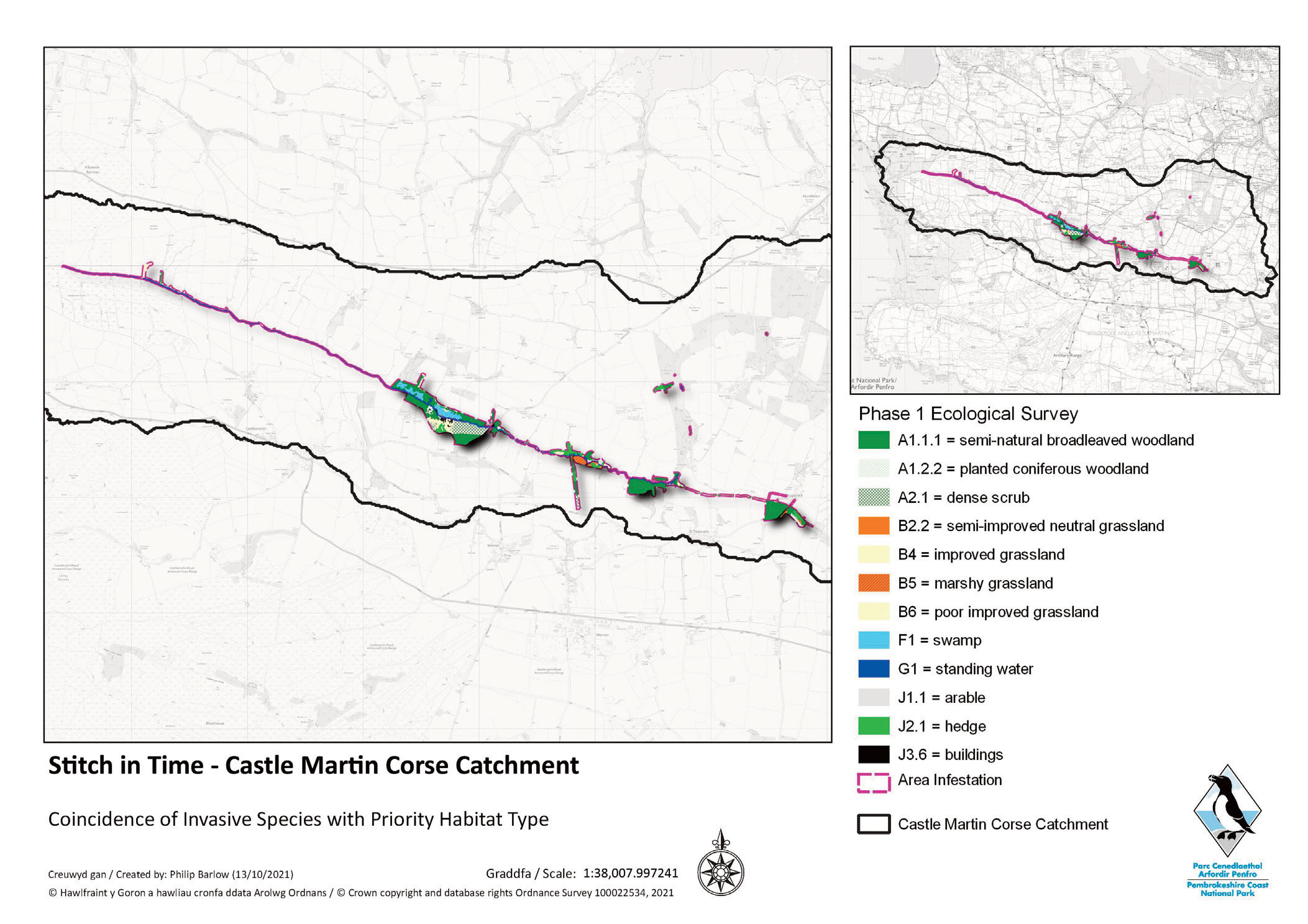
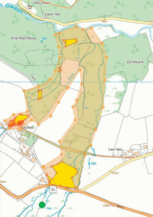
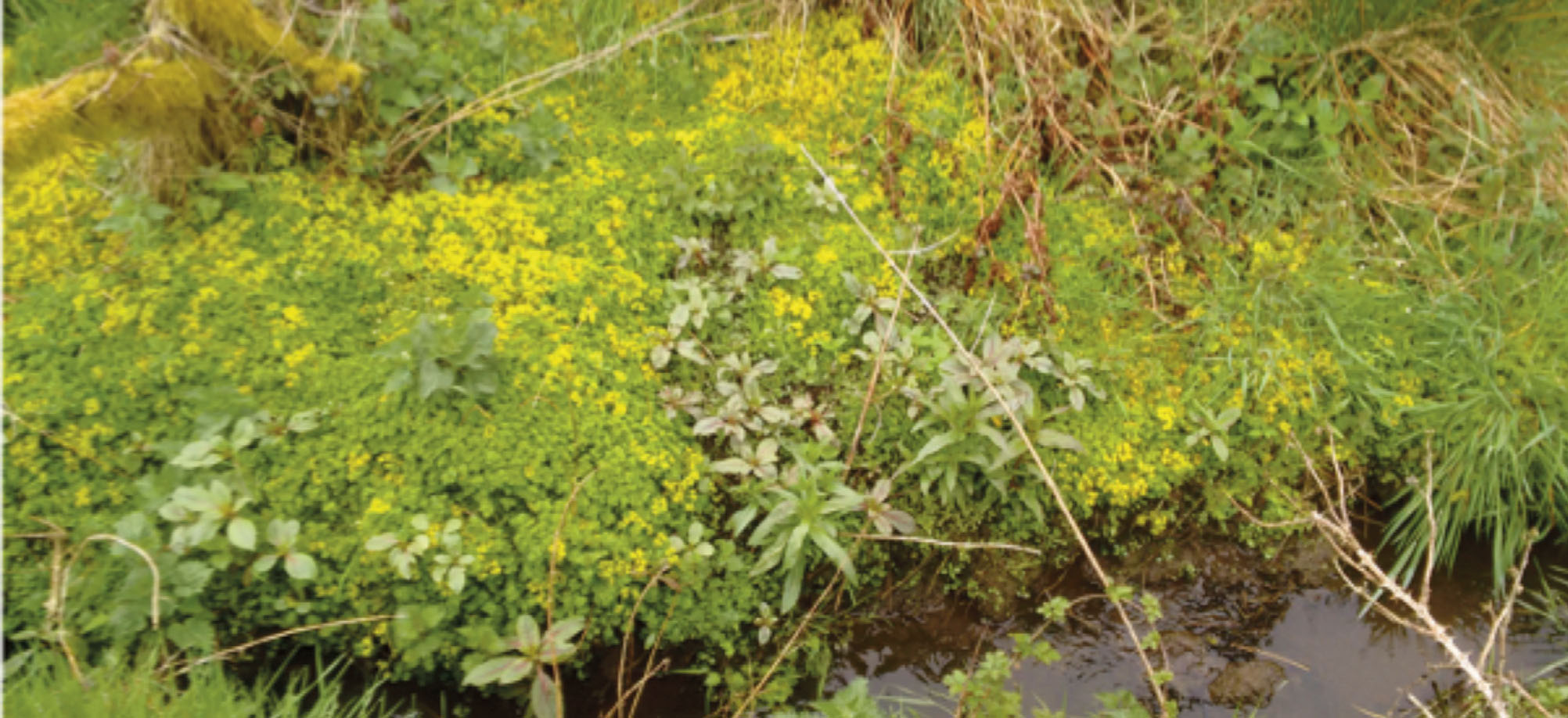
This is our reasoning for focussing on outside edges. As Himalayan balsam spreads away from water and invades other habitats such as the woodland corridors and hedges, the furthest point/location of a balsam stem is the outside edge. This outside edge is then a source of balsam to the immediate areas it is yet to invade and may not be near water. Effective control can push it back to the riparian source, as show in the diagram below.
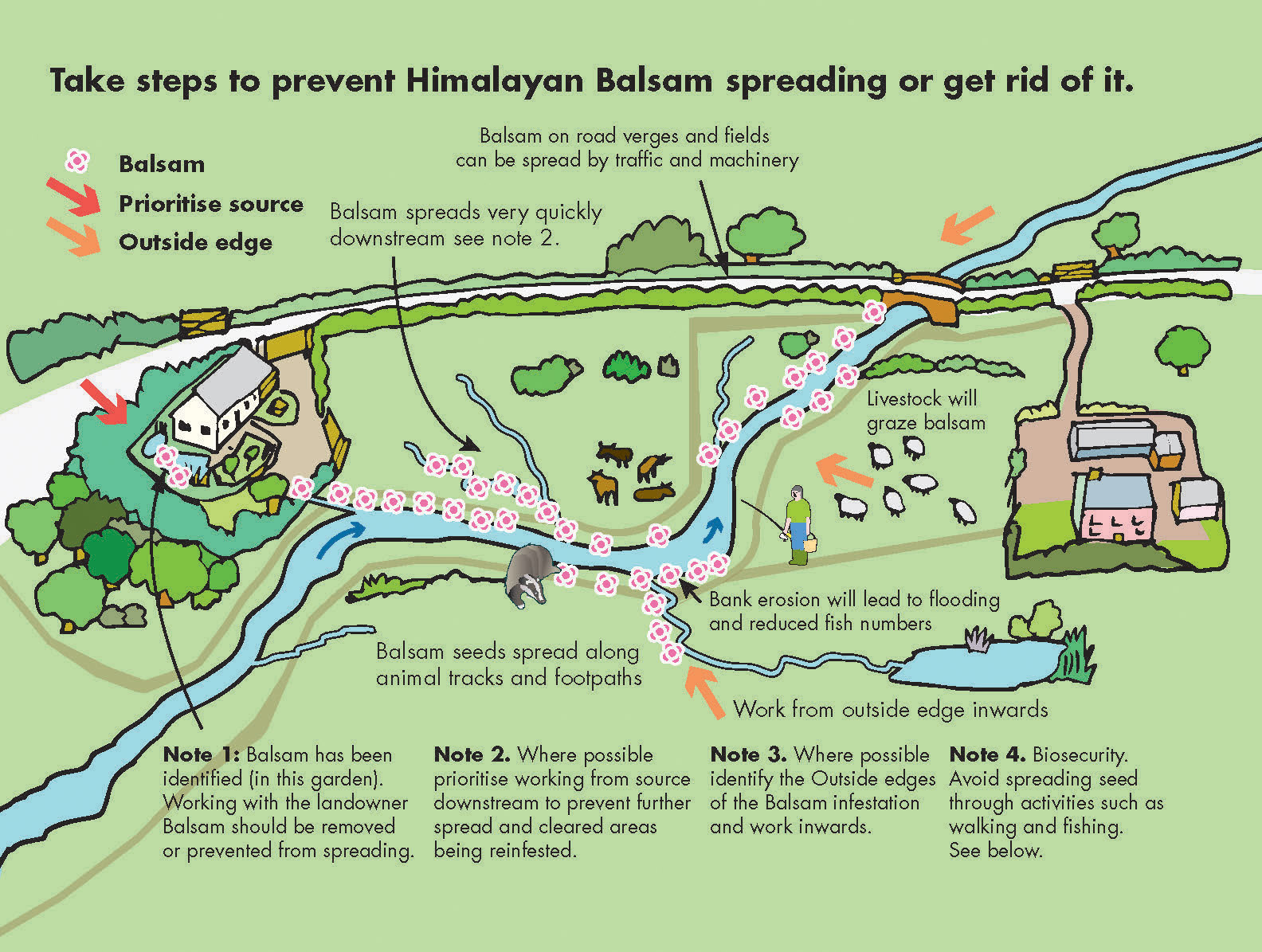
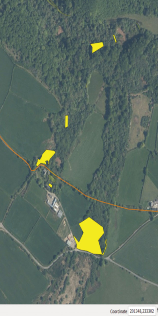
The white area below shows a large area infestation polygon in orange leading away from water situated in its core, almost to the catchment boundary marked in red dash. An outside edge is the furthest point balsam is recorded; this may have originated from water.
5. Partners and stakeholders
Ideally during this catchment selection phase, potential partners and stakeholders are identified within a project area, this is important to understand any shared priorities as soon as possible before control is undertaken. The potential partners and stakeholders are key in helping to delivering a monitoring and maintenance phase post control.
Landowners- private, Farm business/tenants/private land managers, garden centres etc.
Local people – within project catchment
Contractors – landscaping, quarries, landscape management/garden maintenance-cutting
Utilities – Dŵr Cymru and Western Power through power cable maintenance/their contractors
Local Authority – highways delivery, verge management marking
Natural Resources Wales – consents, advice, delivery partner
Conservation Organisations – Wildlife Trust, National Trust, Pembrokeshire Ramblers, River Trust
Community cooperatives – local or county
Community volunteer groups – local or county
6. Survey and data management
cornerstone principles that must be implemented during the survey of an invasive annual plant species such as Himalayan balsam is mapping presence and absence on where they occur in the landscape. Water, therefore, is key.
This may sound like common sense, but this must be applied at the scale of your project whether it is a site, sub-site or whole catchment. Once historical andverified up-to-date survey data is analysed and contextualised a catchment-based strategy can be applied, as presence and absence data will reveal source infestations, satellite or isolated infestations as well as large area infestations with outside edges.
6.1 Desktop studies
In the initial stages you are likely to be reliant on desktop studies to provide a baseline of what is already known about INNS distribution in your area of responsibility or catchment.
The 2 main sources of existing information are your Local Environmental Record Centres (LERC’s) and the National Biodiversity Network (NBN) Atlas. In our experience the amount of INNS records is still quite low and can only give an indication of the likely presence within a catchment, and a field survey will be required to gain a full picture.
Not everyone submits records of INNS, especially if they are quite common (e.g. Himalayan balsam along a riverbank). Talking to local recorders, staff members or community councillors who work in your target area may provide further information about distribution and hotspots
6.2 Remote sensing
Although there is no doubt that remote sensing appears to offer opportunities, for the duration of the project we were not able to find an accessible reliable method to help us rapidly map species distribution through spectral signature.
The methods described below are useful and reasonably rapid over small catchments with moderate infestations of Himalayan balsam.
6.3 Google Street view
Google Earth is particularly useful for scouting highways and even covers the Pembrokeshire Coast Path! Japanese knotweed can be distinguished from other similar looking species such as hazel; dead knotweed stems can be distinguished due to their shape in winter especially if the stand is large. Highly noticeable flowers such as Himalayan balsam, crocosmia, lesser knotweed and Himalayan knotweed can all be identified via dropping the Google peg man on a location and in some instances can reveal an infestation leading away from a highway. In a
landscape context look at the geographical features ie is water present? The peg man can be used to verify presence and depending on picture quality, the extent can also be estimated, however ground truthing ie visiting a site to verify the record, is required.
Remember to note/record absence as well as presence and that historical layer dates differ across locations.
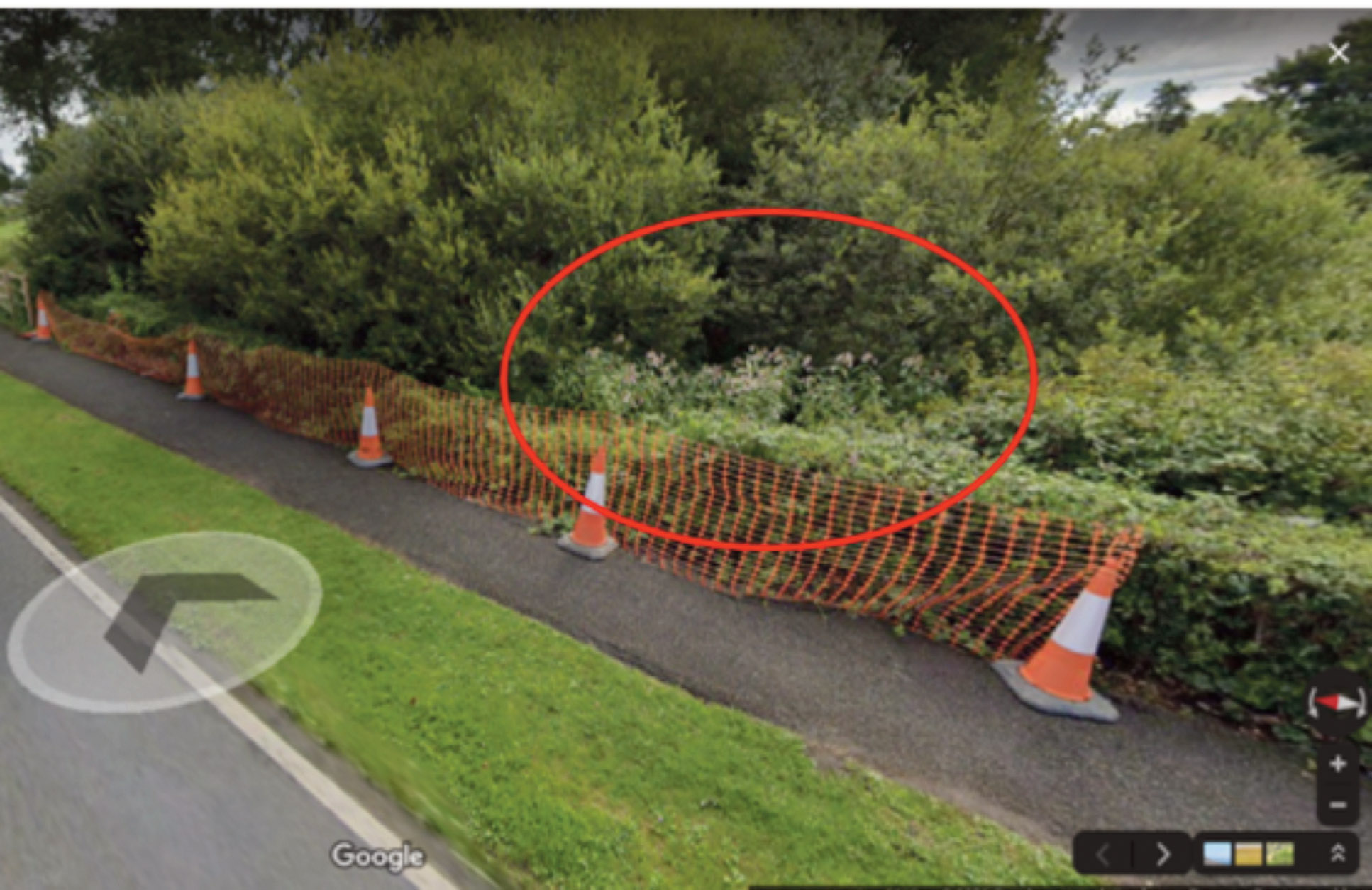
Screen shot of Himalayan balsam visible within willow near road bridge, Ritec Tenby.
6.4 Rapid Catchment mapping
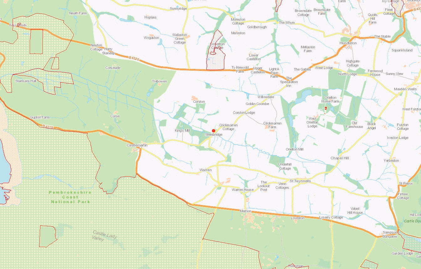
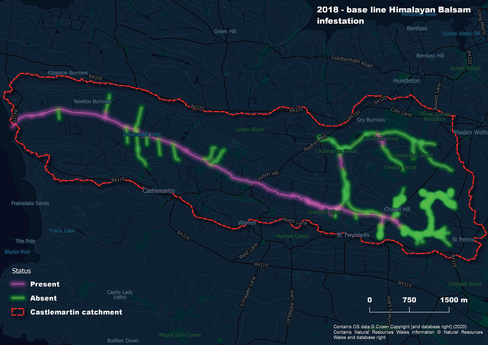
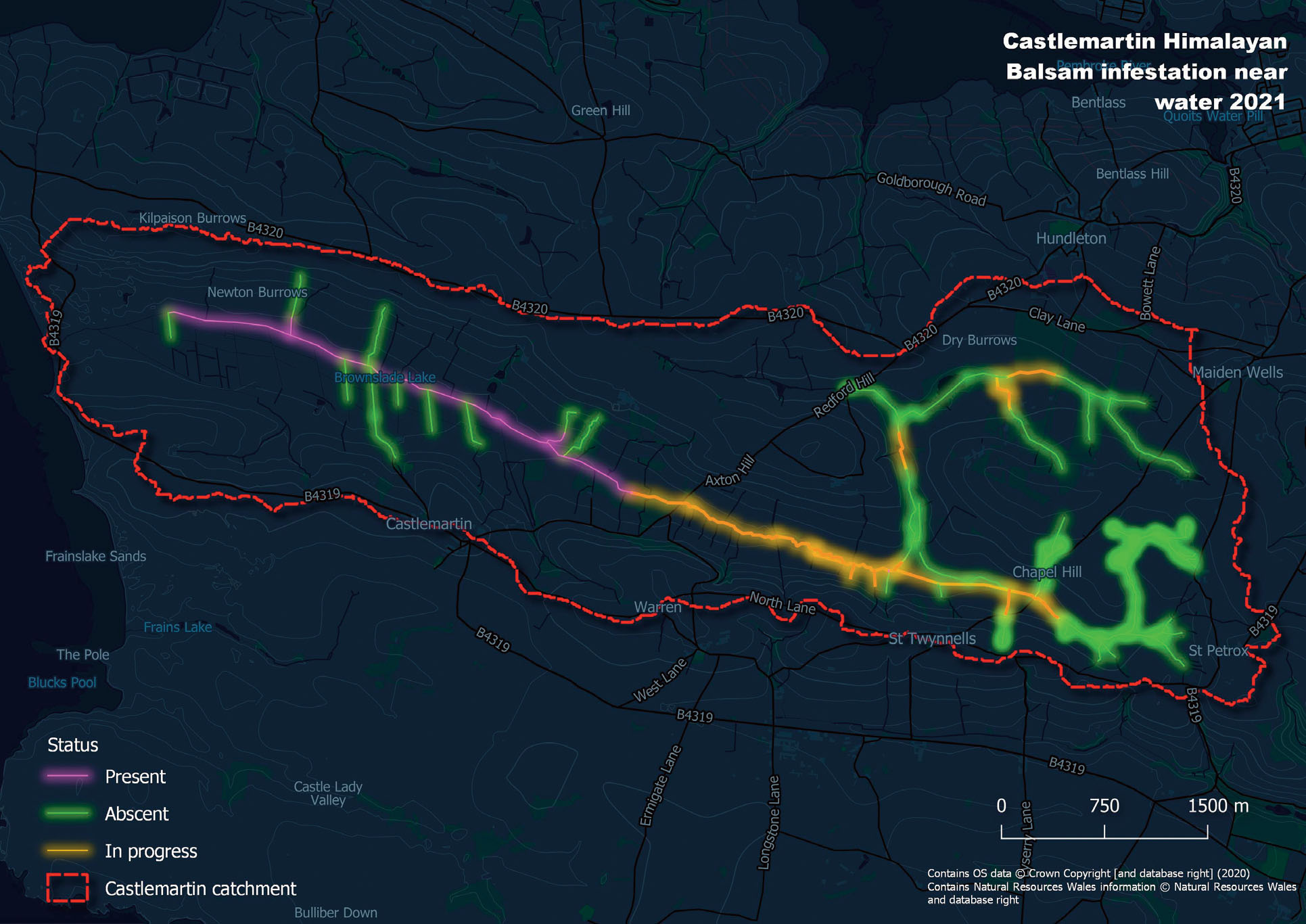
Rapid Catchment Survey Method for Himalayan balsam: Case Study Castlemartin
Following the identification of a single known record of balsam within the Castlemartin catchment (red dot below) the aim of the survey was to provide a rapid survey to establish the extent of the balsam infestation across the catchment. This can tell you whether you are dealing with a full catchment infestation or perhaps a much smaller infestation on a couple of small tributaries.
The screenshot below shows the one record NRW held for Himalayan balsam until 2018, small red dot roughly centre of catchment.
In 2018 a rapid catchment survey was carried out using binoculars in peak flowering season accessing areas and water courses in particular using Public Rights of Way, road bridges and the use of vantage points and scanning likely areas. This method rapidly adds more presence/absence records to the catchment map and begins to build a picture of the extent of the infestation.
Phase one habitat data can then be used for Himalayan balsam to extrapolate the likely distribution based on knowledge of existing records and habitats likely to be infested. Once a balsam infestation has been verified (ground truthed) on a certain habitat type you can then highlight other areas with that habitat within the catchment. These should then be surveyed as presence is more likely, especially if the site is above a record of balsam near water.
For the Castlemartin catchment these habitat types included drainage ditch systems, unmanaged riparian woodlands, marshy grasslands, wayleaves for electricity pylons and edges/hedges of productive fields adjacent to existing infestations. When used in conjunction with other desktop methods described above a potential estimation of area infestation is possible before starting on the ground survey in any depth
Take photos using fixed points
If you carry out a survey in peak flowering time, then this is a good opportunity to take photos at natural fixed points such as a tree or fence line or ideally install temporary posts as in the event you are able to proceed with control the following spring there will be no opportunity to capture a before and after photograph unless you section an area to leave out of control.
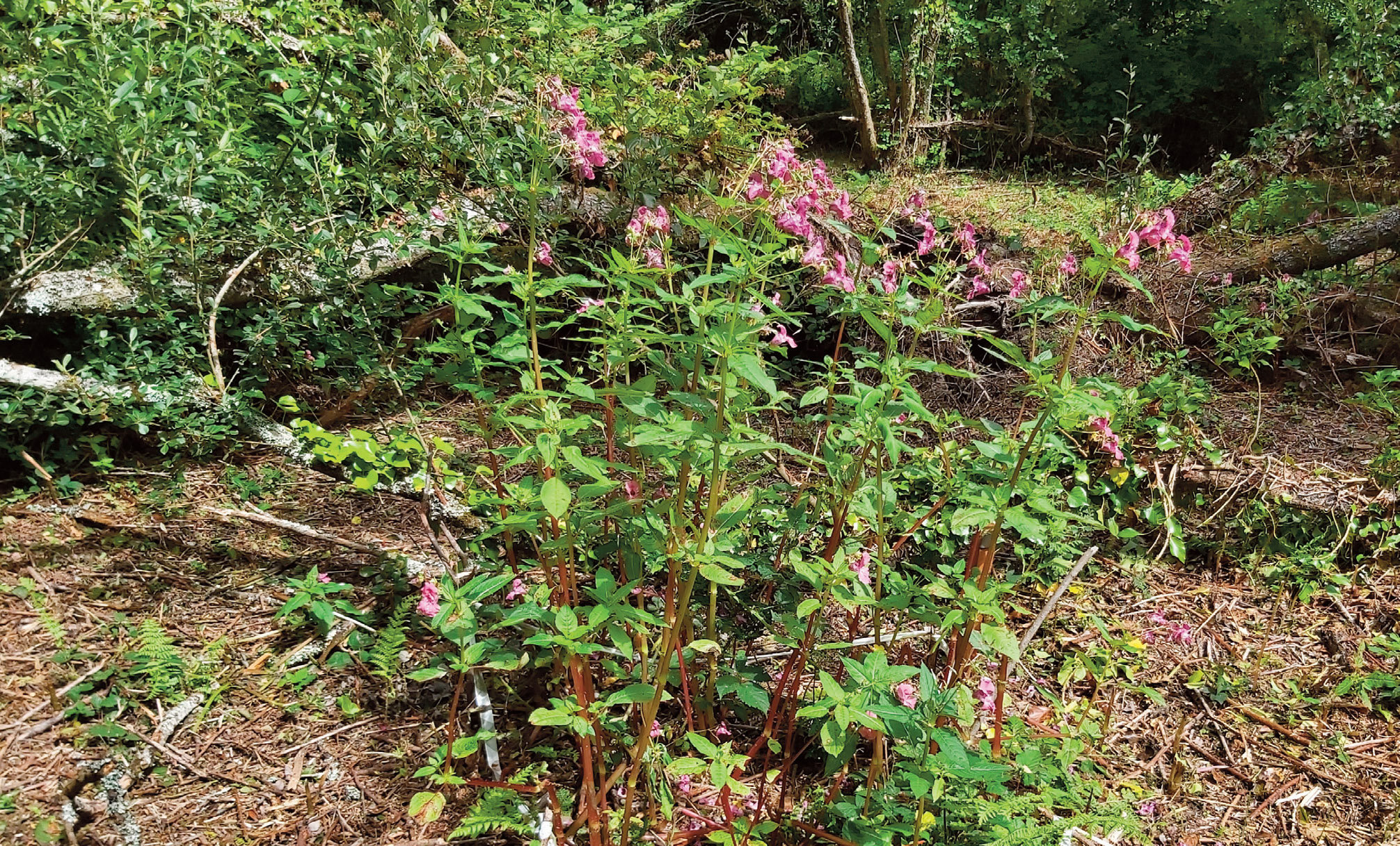
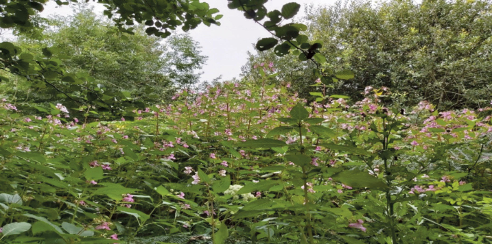
An area of Himalaya balsam is left to flower
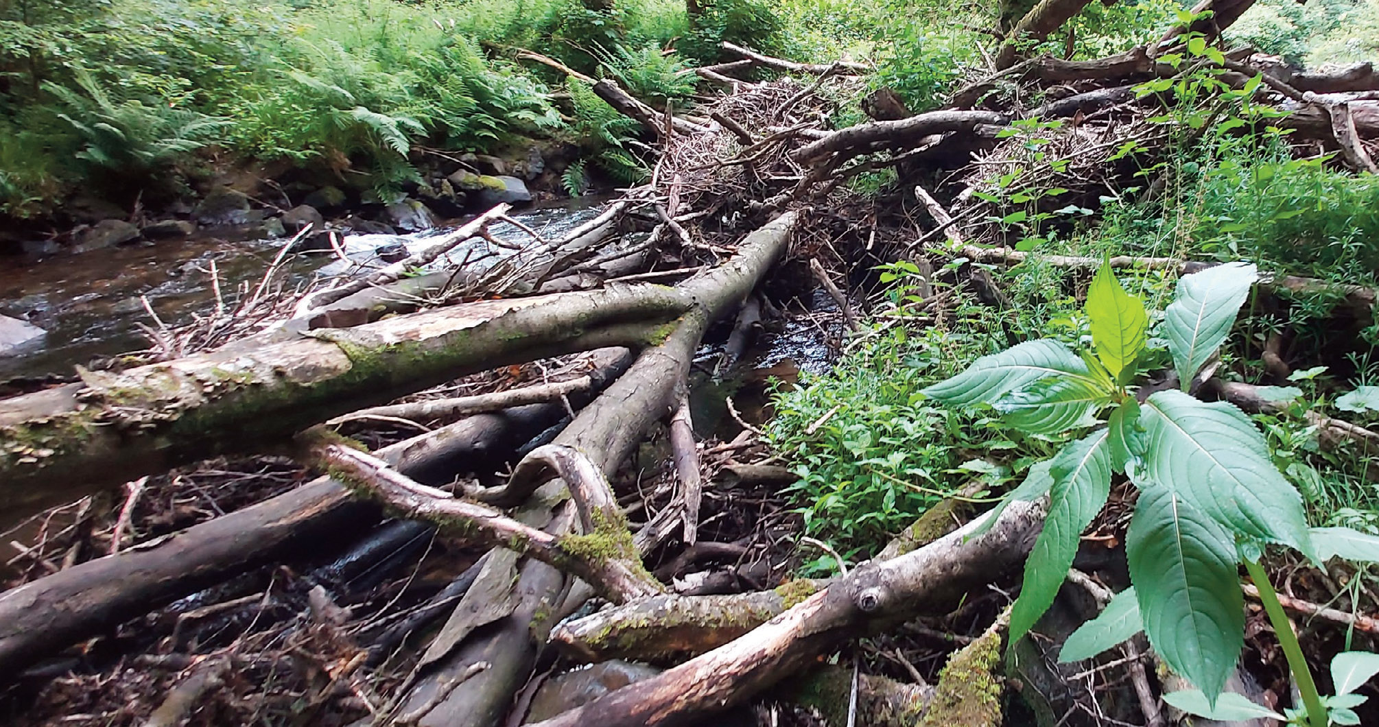
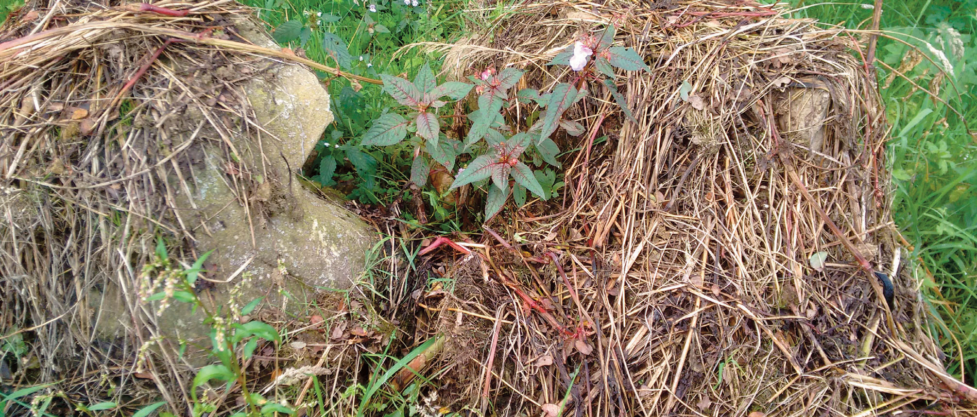
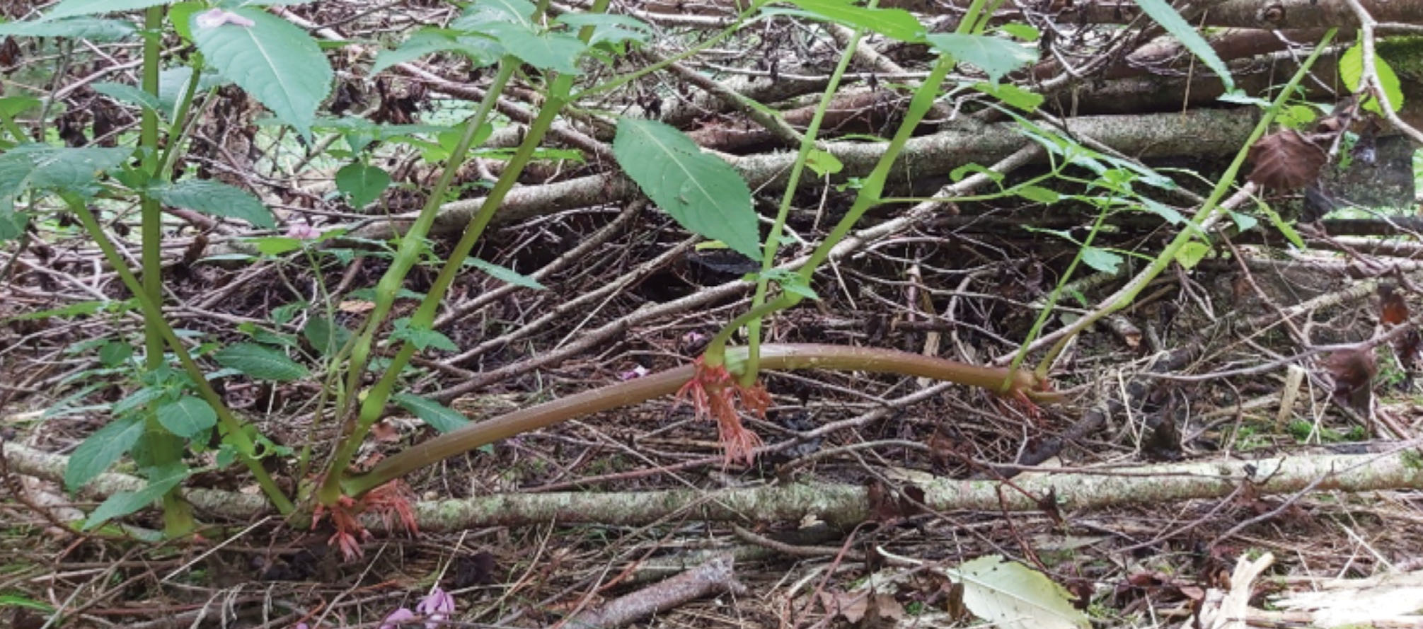
Identifying areas with tree- fall or build-up of sediment in a river or stream can act as an indicator that a population of balsam persists above you. As a few plants get a roothold within a river treefall they may disperse seeds onto the banks where balsam is now able to invade the adjacent habitats creating outside edges from the river. Beavers anyone?
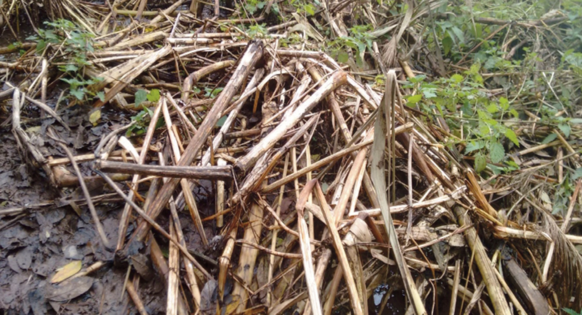
While detailed surveys of Himalayan balsam are best carried out during the growing and flowering season, it is sometimes necessary to wait until winter to access a site when vegetation has died back. There are limits on trying to spot dead stems with binoculars and you really need to get close to ensure you are identifying balsam in its winter state, the sheer density is a good start to winter identification of stems.
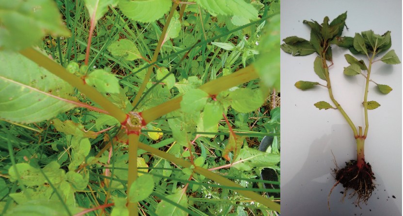
Himalayan balsam stems in winter can be easily identified once you get your eye in. Balsam dries out, the stems can be very sturdy or papery. The nodes and roots are often visible. The main confusion is with the umbelliferae family (hemlock, hogweed) which have lines along their dead stems, very weak, papery and a sheaf at the node with often green growth at the base of the stem throughout the year.
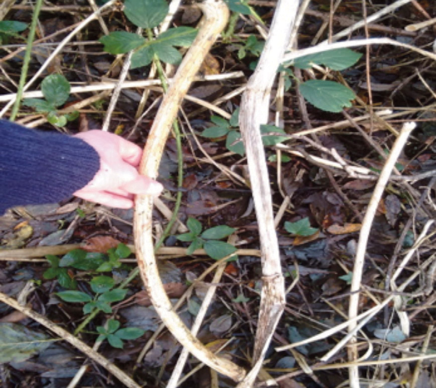
Shown here is Himalayan balsam is being held next to a hemlock water dropwort stem. Small balsam stems may also be confused with dried bluebells.
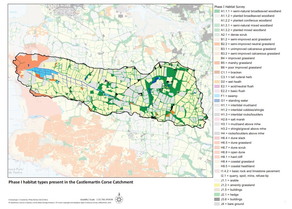
Phase one data for the Castlemartin Corse catchment below providing habitat types
Two days in July 2018 were used to understand the extent of the infestation through rapid mapping and three days in November 2018 to thoroughly walk the sites and record balsam absence and presence. Point records were created for the Castlemartin Corse catchment. The original NRW point record is blue almost in the centre of the catchment map below with our data added
6.5 Detailed Catchment Mapping
The survey above will provide a good estimation of the likely size of the infestation in the catchment. However more detailed survey will be required to map the extent of the infestation using polygons, to estimate the cover/density of infestations and also the habitat within which the infestation occurs and whether any preparatory treatment ( ie scrub control) will be needed to provide access for management. This is also a good point to collect information on potential impacts on protected species eg otter or dormouse. As discussed further on, volunteers are essential to the INNS project so it is also helpful to think about whether these will be suitable sites for volunteer control.
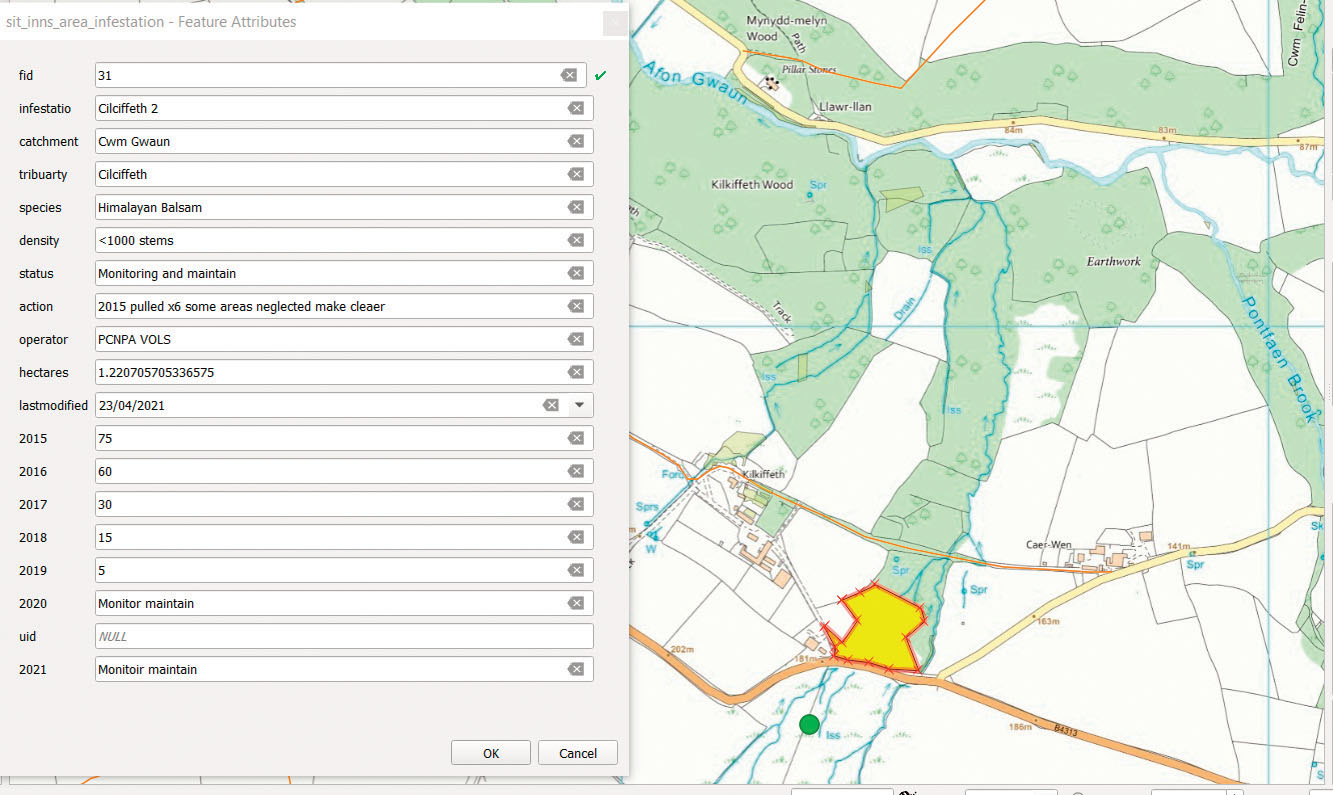
Point records are useful for mapping extent of presence, absence and isolated areas allowing a strategic view at a glance. Area infestation is calculated by digitising polygons using GIS. Polygons highlight the area infestation, whether it is a dense area of balsam or where the target species is more sporadic in an area, it is still mapped with the density recorded in the attribute table for each polygon.
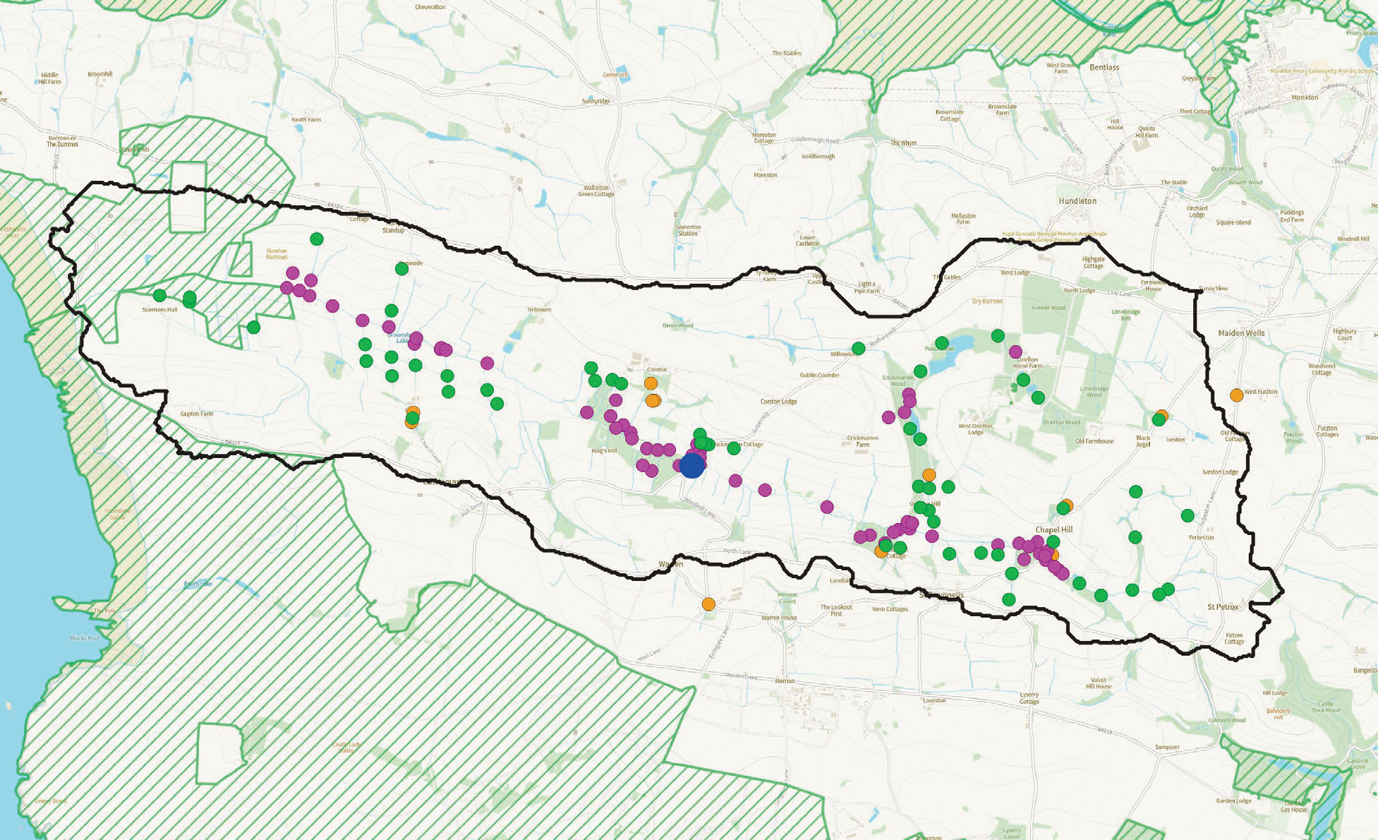
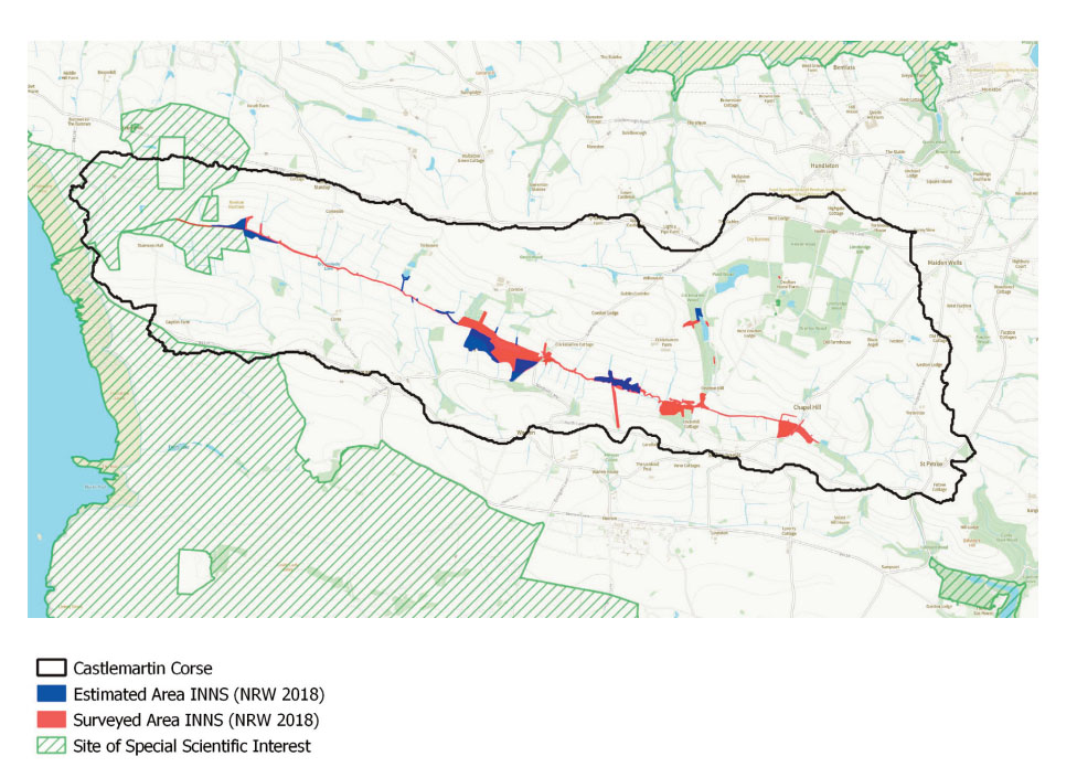
Not all areas were accessed during November due to permissions or time. The polygons in blue on the map below show the areas that are estimated to harbour balsam using the rationality of likelihood of occurrence due to habitat type, proximity to water and the presence of balsam above or higher upstream of the area.
As the project got underway the estimated (blue) polygons were verified and in two instances the red (verified) polygons were extended in the area. The large pink polygon at the end of the catchment is a SSSI.
Semi natural broadleaved woodland which is essentially the riparian corridor in this catchment was the habitat type with the most occurrence of balsam.
6.5.1 Data management
It is worth giving a bit of consideration to how you collect and store your data and how you will update it and map it to show the progress of your work. For example in contiguous infestations where does one polygon end and another begin? How will you show progress? Do you want to track changes in density of species or just presence/absence? Will you record control effort at a catchment scale or at a site scale? Our mistake was thinking about this afterwards!
Here is what we did – as mentioned above, the attribute table in GIS holds the site details for each polygon. A visual estimation provides the percentage of balsam coverage per year.
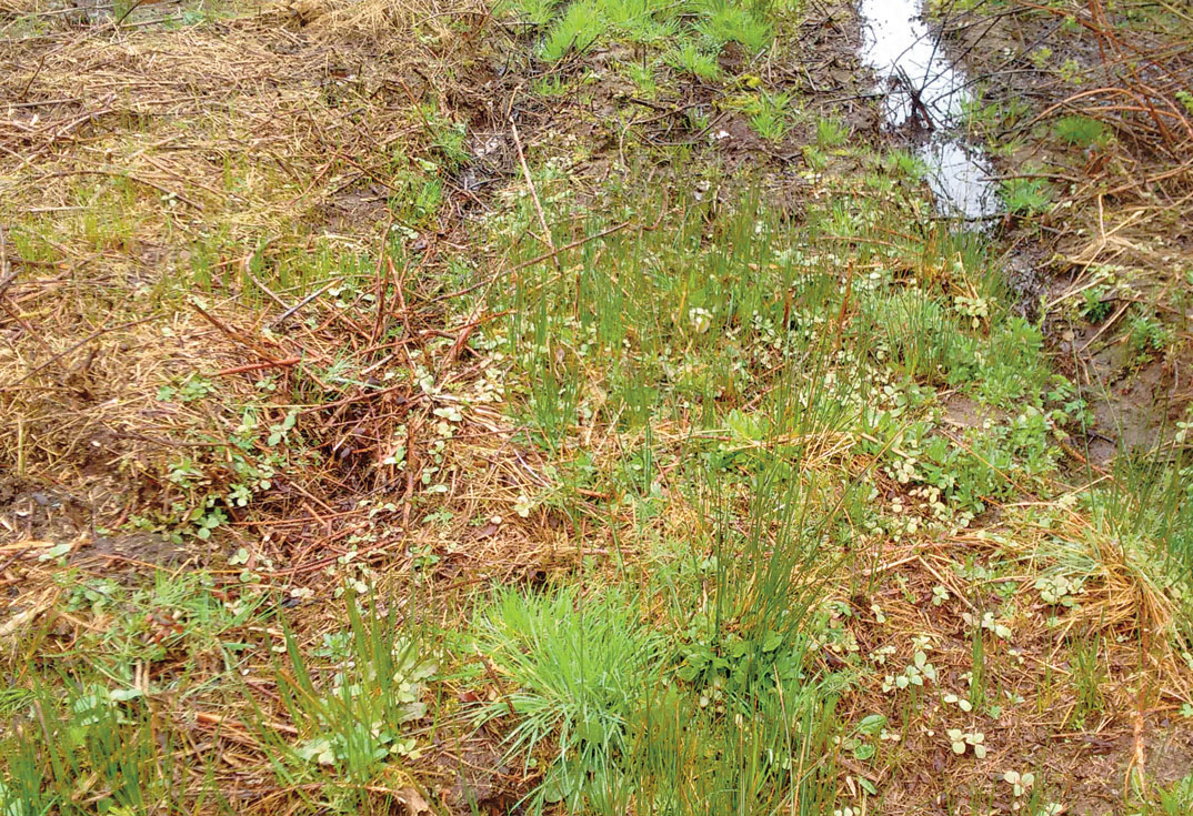
All Water requires survey; the polygons highlight the areas where your practical work will focus, and at least a biannual survey of the entire tributary area, to include adjacent woodland area, is required to ensure all target species populations have been included in control.
Shown below, the yellow polygons represent the area infestation of Himalayan balsam, the orange polygon shows the area extent that also requires survey, ideally once in a season dropping off to every other year. The water above these areas should also be surveyed to ensure absence (green dot).
Effective balsam survey requires ALL water to be surveyed, absence and presence to be verified and area infestation mapped. Verifying absence every two seasons is ideal.
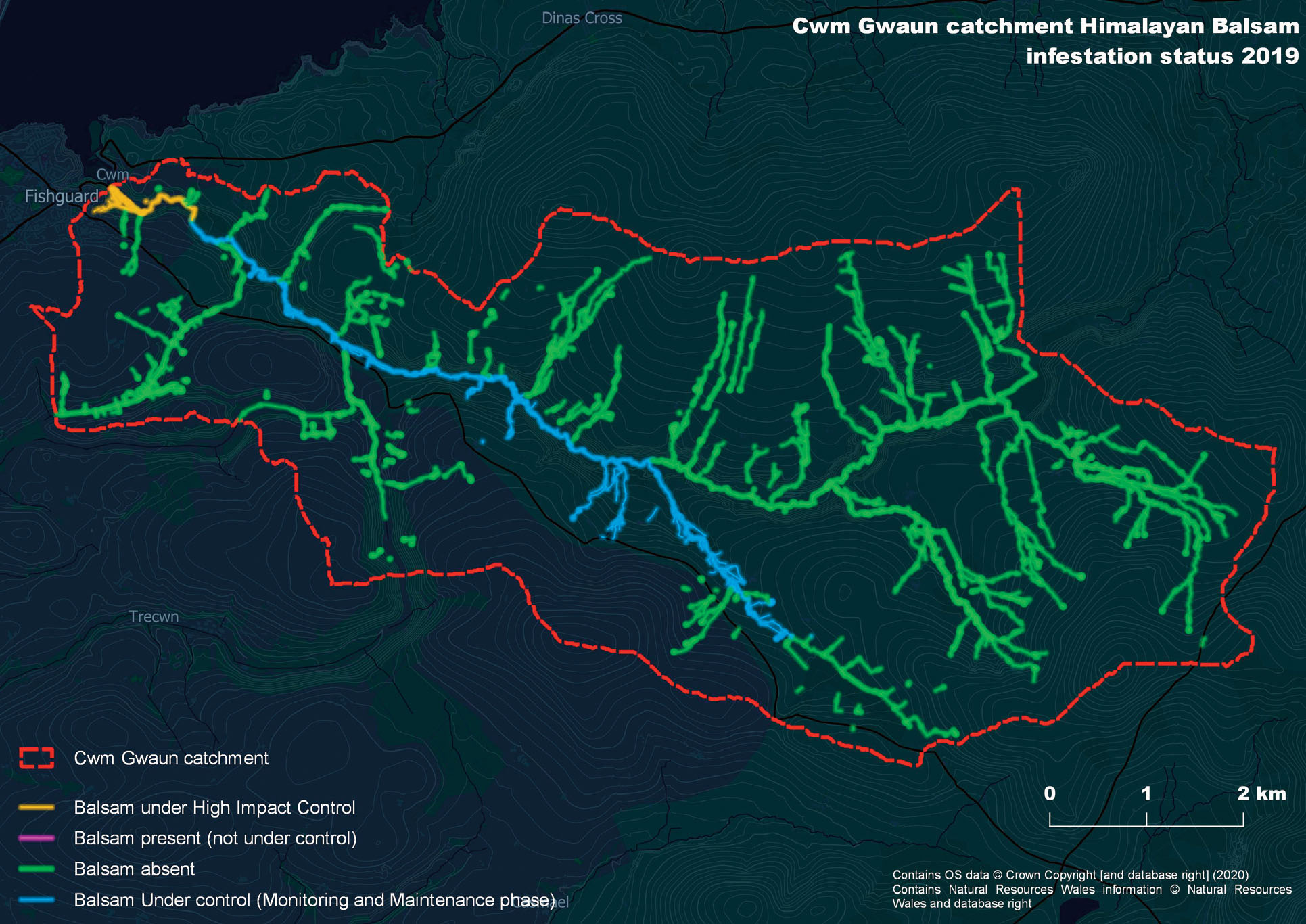
6.5.2 Firefly maps
We found our polygon data did not show up well on a large catchment scale such as Cwm Gwaun and did not give the impact we wanted. We therefore added line data to give a simplified but high impact overview of catchment progress. Any polygon near water highlighted the area as pink for present, green for absent based on the point absence and presence survey data. Areas surveyed as absence should ideally be monitored biannually to ensure balsam absence at designated survey points ie bridge, stream-river confluence and/or a farmyard with water source.
Smaller coastal catchments such as Castlemartin Corse overlaying line, polygon data and colour coding them according to the status provided a great overview of catchment status at this smaller scale. The extent and area infestation can be appreciated at a glance and high priority areas such as source sites and satellite or isolated populations identified.
Shown below is the Castlemartin Corse catchment showing presence and absence of firefly lines derived from point data.
Shown below is the Castlemartin Corse catchment firefly lines, presence, absence and in progress, note the two satellite or isolated infestations in orange away from the main stream.
6.6. Record density and time spent each season
To demonstrate sustainability in the approach observed, density of Himalayan balsam is estimated and the change tracked over the years. The effort/time from staff, volunteers, landowners and contractors is also recorded. It is important to mention this data requirement to your contractor to note the days worked on particular sites.
As control gets underway infestation polygons change in status from in progress to monitor and maintain. A polygon will change to ‘monitor and maintenance’ once the density of the invasive plant is 20% or less. This can happen within two or three seasons.
Estimating density using quadrats would produce more accurate density estimations, on the scale worked during this project estimating polygon density as a percentage and then taking an average from all polygons associated with a site helped us to monitor the change in density against the time or resource used, this results in a site cost curve against density which can then be used for the entire catchment. Bare this data handling in mind, how you will record it and how you designate your sites ie a site may have a number of polygons associated – we took an average each season across the polygons as the density changed to produce the season’s density estimate. It may be more accurate to record and
report the density change of each polygon as you will lose specific detail by taking an average.
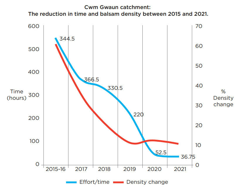
The graphs below show a key pattern which is replicated across all of our sites. The resource invested rises over the first few years to a peak of just over 250 hours per annum. This then falls steeply and for the last 2 years has been stable at around 25 hours. We can now plan our exit strategy based on the likely resource required to monitor and maintain the catchment – as ‘controlled’ as around 3.5 days per annum for the coastal catchment of Porthgain area. This demonstrates sustainability in the methods being applied across all four project catchments.
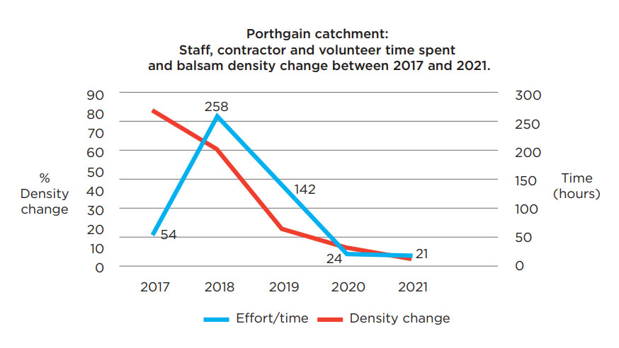
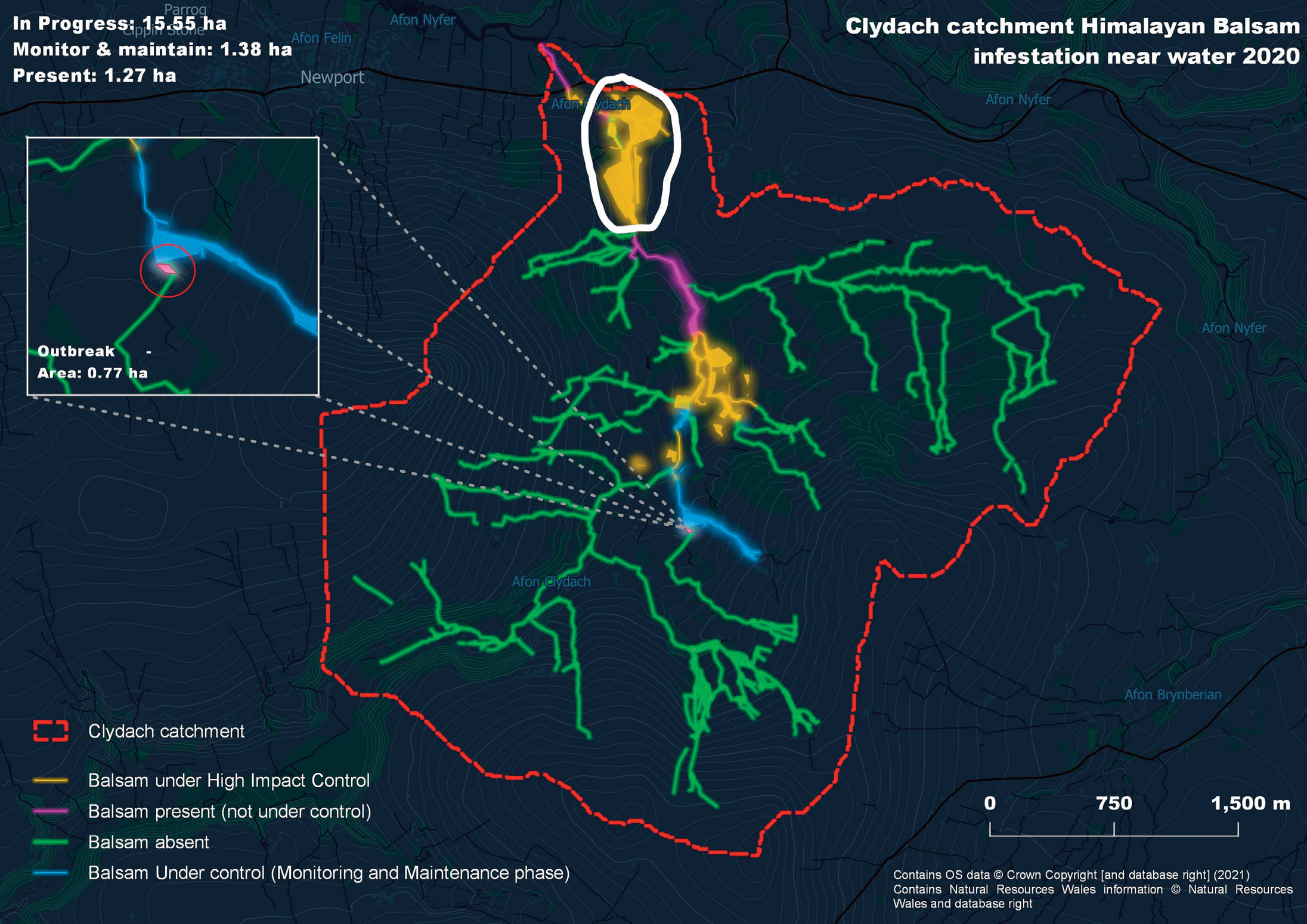
The Porthgain area infestation totalled ca. 4.89ha of which, 3.36ha in 2021 were considered under monitoring and maintenance with 1.53ha at the end of the catchment receiving a higher intensity of control which will switch to monitoring and maintenance in 2022.
The Cwm Gwaun area infestation totalled ca. 8.93ha, in 2021. 1.76ha was under high intensity control with the remaining 6.97ha under monitoring and maintenance, requiring less resource input to maintain the output of balsam near eradicated.
The graphs demonstrate sustainability in the catchment approach applied, we could suggest approximately 37 hours over a season in the Cwm Gwaun catchment will maintain the output of balsam near eradication. Twenty one hours over a season will maintain the output at Porthgain.
6.7 Understanding what influences control effort/cost/time
It is possible to forecast the cost or resource required at site, sub catchment or catchment in advance. Although this will always be an estimate and require flexibility as a control season gets underway.
Once an area has been mapped at an agreed scale for presence and/or absence near water, large area infestations are digitized as polygons to provide an area in hectares. The habitat type via phase 1 and contours on an Ordinance Survey can help determine any safety issues at a glance for each polygon and the habitat type will help indicate what control methods will be required for the season. This can initially be achieved on the desk top but a site visit is a must.
The following influence the time or money needed to control and invasive annual:
- terrain/slopes
- habitat type
- density of the target sp.
- area/ the extent target sp.
- access and winter vegetation management
- local conditions/plant life history
These impact the time taken to cover the area in control once. The key to success is repeating the visits in good time, consistently and thoroughly with effective control methods
Time to cover a site in control (cutting, pulling or use of machine) could be estimated ideally by a contractor or a person with practical knowledge on land management such as a farmer, gardening contractor or a National Park Authority Warden or Ranger.
A contractor will be able to estimate the time it will take to cover a site and this can be multiplied for an approximate estimate for the season.
NOTE: a site visit is the number of days or time in hours it takes to cover the site in effective control/monitoring once, not a day visit, the larger the area or complex the terrain of a small area the longer it will take to cover in effective and thorough control.
When the first cut is undertaken in May or if hand pulling begins in April, the actual time it takes to cover the site will be known. The estimate of time/cost for the season can then be updated.
The budget and area to include in control can be revised to reflect the actual time taken. Ideally all areas that have received winter work or access work is still included to make the most of that investment and any areas less strategic excluded.
Contractor day rates are varied for tasks such as strimming, using handtools/pulling. Generally <£200 per day.
A contractor using flail/machinery/ is more costly between £300-600 a day, biosecurity procedure must also be budgeted for and clear if contractor is providing, the landowner or project. Ideally cleaning of any machine in an area with INNS is standard.
Steep sites will require rope and harness or even a remote flail, this significantly raises the cost, rope and harness would be a consistent cost for the first 3 seasons and will be required when monitoring. Can you justify this cost? is the area strategic enough?
The cost of cutting to improve access to a site should be a one-off cost undertaken outside of the nesting season, with minimal maintenance undertaken in tandem with control after the first season.
The cost of vegetation management to access an infestation when within dense scrub again should really be a one-off cost in the first season or the cost could be spread over seasons if a site is receiving control in stages due to its large size and dense infestation or perhaps strategic chunks are just easier to manage. What can delay both winter work and control is untimely application for consents to work in or near designated sites for winter access cutting and or balsam control.
Local conditions may influence when balsam flowers, in early June for example with seed pods ripe to burst end of June/very early July therefore April and May are key control months in reducing plant numbers. A lesson from the project is that control visits should continue until late October.
Sustainable balsam control requires consistent timing, frequency and being thorough with an effective control method.
6.8 Budgeting for control
The cost of balsam control is estimated by understanding the time required to cover the area once in control multiplied by the control season April/May to October/November. Once this estimate of time is understood then an hourly or day rate can be applied from a contractor.
The number of contractors/operatives allocated in almost all work contractors work in pairs (it is safer). Using 20 persons on strimmers may make one good hit and employ lots of people but you will get the same results using two strimmers and one person on a suitable machine (flail) if the access and terrain is suitable.
Catchment location, habitat type/surrounding vegetation will influence the method of control required through the April-October, seven-month control season – strimming, mechanical flail, hand tools/hand pulling, a mixture of all is likely in year 1.
Can you access the site? You may need to improve/cut access to a site before you even reach balsam area. If your machine is going to be crossing small streams/very wet muddy areas consider the frequency of this and if you can mitigate the impact through adding substrate or a temporary platform.
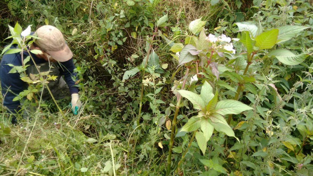
Can you access the area of infestation? Balsam within thick bramble, gorse, thick blackthorn, scrub will need reducing so you can access the area but also trigger the germination effect. Larger areas can be done in sections, islands can be left to provide cover and controlled by hand later in the season. Ditch networks may need improved access through taking off low branches etc.
Case study: Pontfaen Brook vs Cilciffeth
These two tributaries were balsam sources for the wider Cwm Gwaun catchment where control and monitoring have been consistent since 2015. The tributaries differ in habitat type, they have similarities in surrounding land use being silage cut, sheep or cattle grazing, the area infestations are close in size, and a large number of hours have been spent controlling and now for balsam monitoring.
The main difference and important lessons learned between these two sites are that volunteers are key but so is paid labour in the form of contractors or staff.
Pontfaen Brook is not suitable for a group of volunteers due to terrain and permissions but is very strategic. The two volunteers that did work at Pontfaen were core volunteers to the project contributing full days, sometimes three days in a row at the same areas of Pontfaen Brook, the majority of the recorded hours spent on Pontfaen control was staff time, contractors and these two core volunteers, one asked never to work at that site again!
The concentration of Himalayan balsam in wet ditch networks means that the area to cover in effective control may be small but the effort required is still large therefore initial costs.
The larger polygons at Cilciffeth have hosted some large volunteer work parties, although particular areas have tricky access here also a majority of the time spent here is volunteer and staff time with no contractor cost.
Pontfaen Brook Total polygon area infestation 1.61ha
Total time 2015-2021: 351 hours
| Accumulative time volunteers, staff, contractors (hrs) | Percentage polygon change in balsam density | ||
| April-Oct Pontfaen brook | |||
| 2015/2016 | 173 | 80 | |
| 2017 | 90 | 50 | |
| 2018 | 53 | 25 | |
| 2019 | 20.5 | 15 | |
| 2020 | 7.5 | 5 | |
| 2021 | 7 | 5 | |
Cilciffeth Total polygon area infestation: 1.57ha
Total time 2015-2021: 504.75 hours
| Year | Accumulative time volunteers, staff, contractors (hrs) | Percentage polygon % change in balsam density |
| April-Oct Cilciffeth | ||
| 2015/2016 | 306.5 | 75 |
| 2017 | 61 | 30 |
| 2018 | 43 | 15 |
| 2019 | 68 | 5 |
| 2020 | 17 | 5 |
| 2021 | 9.25 | 3 |
Case Study: Chapel Hill, Castemartin Corse, total area infestation: 28.45ha.
Surrounding land use concentrates the Himalayan balsam infestation in deciduous woodland (polygons 4 and 5 – Chapel Hill wood – 90% density), marshy grassland/willow and scrub (polygon 2- 50% density) and roadside hedge (polygon 3 – 50% density). The Corse stream is highlighted in yellow.
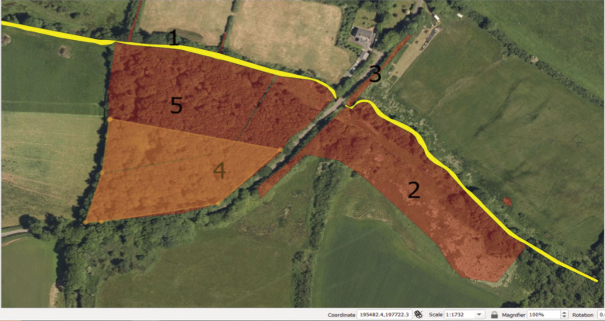
Initially Chapel Hill Wood (polygon 4 and 5) was split approximately in half (orange polygon) where winter vegetation was cut for access in 2019 and balsam control initiated in the 2019 season and this was undertaken by a contractor using between two and six operatives.
The decision to split Chapel Hill wood was quality over quantity, to ensure we had access and bramble cleared where balsam was present, but not spreading our resource too thinly. Splitting the site also meant we could leave cover and pollinator resource from bramble and get an idea how the otter was using this site through the camera trap.
Due to the balsam density within Polygons 5 and 4 a majority of the bramble would need to be reduced for effective control methods later in the season. Chapel Hill Wood was not a suitable site for volunteers to work in until 2020 with one volunteer group working in these polygons between May and September 2021 with support on four occasions with a contractor as well as the Project Officer leading the events and working with the contractor when the group cancelled due to weather or other commitments.
Minimal access cutting and bramble/scrub clearance with brushcutter (staff/contractor) was undertaken in polygon 2, due to the extensive clearance required in Chapel Hill Wood we decided to only keep access routes open and undertake balsam control more selectively by hand and using hand tools.
Polygon 5 was included in control during 2020, polygon 4 only received access/bramble cutting in 2019, hand pulling rogue plants.
Chapel Hill
Polygons 4 and 5 total 2.13ha, polygon 3 road/field hedge total 0.03ha and polygon 2 marshy grassland/willow scrub total 1.11ha, the Corse river highlighted in yellow.
| Chapel Hill | Polygon 4, 2, 3 | Polygon 5, 4, 3, 2 | Polygon 5, 4, 3,2 |
| Year | 2019 | 2020 | 2021 |
| contractor visits | 11 | 12 | 4 |
| number of operatives | 2-6 persons | 2-3 persons | 1 person |
| Volunteer hrs | 0 | 24 | 250.5 |
| Approx. staff time hrs | 42 | 51 | 60 |
Using a contractor and flail was possible at Chapel Hill wood with further site preparation such as clearing fallen trees and removing lower branches, this additional work was not budgeted for as well as the higher cost for using flail versus day rate for operatives on brush cutter. On large sites with good access the flail is more efficient for winter cutting and initial balsam control rather than up to 6 operatives on strimmers/hand tools, with hindsight. The example using flail in winter, tree clearance and the balsam control schedule for Chapel Hill Wood is provided below
The more you undertake outside the nesting season the easier access and control will be to undertake, strike a balance by splitting large sites and using less intensive methods on others.
Site Schedule – example
2021/2022 winter cut needed: estimated total cost £1,765
Contract flail at £375 per day
3 days during either November, December, January (£1,125)
Contract brushcutter/saws
2 persons, 2 days during either November, December, January (£640)
Balsam control
Contract flail 3 days May – July (£3,375)
August, September, October follow up with brush cutter/hand
2 persons 2 days per month at £160 per day (£1,920)
Estimated site cost 2022: £7,060
Balsam germinating in May 2020, Polygon 5 following the winter access/bramble cut
What about the following years?
If all has gone to plan and very little balsam escaped your efforts, then the following season year 2 effort may reduce slightly, deciding on this requires a site visit in spring as balsam germinates. Minimal maintenance is required of access and areas initially included in scrub control can be left until the first control visit as any regrowth will still be too small/low for nesting birds to utilise. The first control visit can start in late May or early June with one flail cut if needed, strimmer and hand pulling will continue through year 2 replacing flail completely.
The year 3 should now see a reduction in time required therefore cost, no flail for access or control, control from late May on strimmers should be minimal focussing by hand through to October.
The year 4 site is now requiring more searching to locate populations of rogue plants, this is easier to achieve from June but still important to maintain the visits until October and be thorough.
Areas previously cut with flail to aid access to balsam is beginning to scrub over if that’s the desired outcome allow this to happen. You may want to maintain small paths here so the entire ‘historical’ infestation area can be monitored thoroughly with ease.
Near eradication
The site has entered monitoring and maintenance year 5 the first visit can take place in late June/July and then August/September/October, reducing to perhaps three or four visits in total.
Year 6 onwards.
NOTE: a site visit is the number of days it takes to cover the site in effective control/monitoring not a day visit.
On a site by site basis it is possible to reach monitoring and maintenance (near-eradication) the following season or season/year 3 depending on the age and location of the infestation, ie an outbreak area should not have an established seedbank and it should be prevented from establishing one.
7. Control strategy
Encourage germination in the short term to reduce the seed bank swiftly
Any winter cutting for access to balsam will temporarily remove competition from other species potentially increasing the initial germination as more light and resources are available.
Below, dense bramble has been cut outside the nesting season, early May cut the first germination, repeat visits are required due to successive germination ideally once every 3-4 weeks as well as dealing with missed stems.
Regardless of using manual or mechanical methods of control in the first 3 seasons, control is high intensity. This refers to the overall control strategy of being consistent and frequent with control visits to ensure plants are removed swiftly as soon as they are large enough to deal with.
Being thorough is key to success.
It is certainly feasible to ‘pluck’ baby balsam during March if you can justify the effort, cutting large areas of balsam in late April/May with strimmer or machine will encourage more germination as competition from balsam is removed more balsam can germinate. Within three to four weeks the original area cut will still harbour balsam due to this germination effect as well as having to control stems that were not effectively cut in the first visit. This is repeated throughout the potential seven-month control season although from July manual methods
replace strimming generally.
Stem must be cut below the bottom node (or the plant will regenerate more stems)
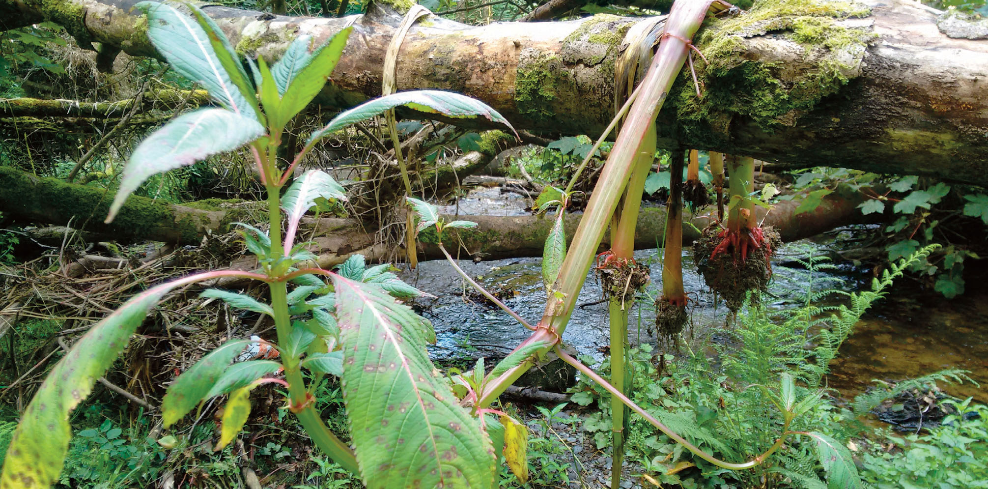
Balsam plucked in late March on a source tributary, this particular area is the highest location where balsam is recorded for this sub catchment which justifies this early control.
Balsam plucked on the Afon Gwaun when the project had included the main river following success at the two source tributaries.
The Density of balsam, surrounding vegetation (habitat type) and terrain will influence your control methods (as well as landowner permissions)
Balsam control work – 12 months of the year!
Control season from March/April to late October, working outside the nesting season (November to late February) to create access means that work to control Himalayan balsam can take place all year round, winter work followed by control. Himalayan balsam lifecycle timings can vary due to location, aspect and water.
The days of organising two balsam bash events in a season are a thing of the past in Pembrokeshire! Consistency of control through the season with winter preparation means that the Himalayan balsam control project activities can take place over 12 months!
7.1 Control methods
Several methods used to control Himalayan balsam, timing and being thorough unites them all, and they are shown below:
Manual
The most common method to deal with balsam is pulling by hand and or using hand tools such as slashers. This is the primary method for controlling Himalayan balsam where terrain and access may prevent mechanical cutting or where the density is low and sporadic enabling no impact on non-target plants. Manual control is more selective and generally a cheaper form of control although labour intensive with repeat visits over a season still produce costs.
Although small, plucking these small balsam plants by hand early season is better than waiting for your access to be impeded by other vegetation in May/June with potentially more and larger balsam to deal with.
Balsam to be plucked in April on a source tributary of Cwm Gwaun, Pontfaen brook
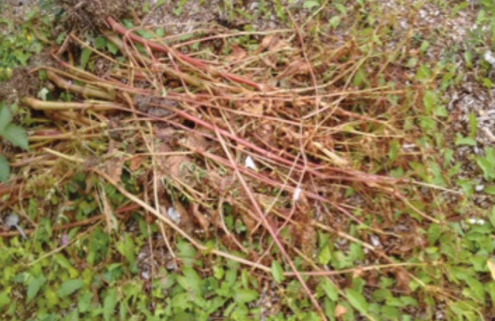
Effective manual control is achieved by ensuring plants that are pulled are not allowed to regenerate from nodes by creating piles of pulled balsam that get moist. Ideally a large pile of balsam is slashed before leaving the site and or checked and turned every few weeks until all plant material is dry or rotting.
Individual stems pulled or handfuls of stems can be placed on branches, bramble, bracken, fences or boulders to dry out. If you make a pile, check it within a few weeks!
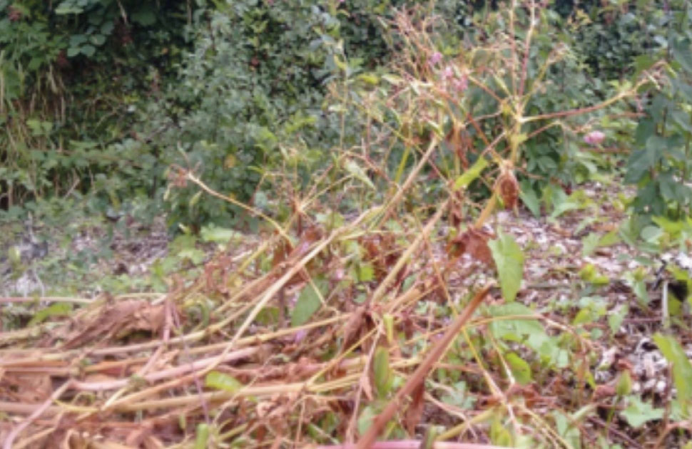
Previous seasons balsam stems left on bramble to dry out
Pulled stems with earth still attached will flower and set seed; it is good practice to snap pulled stems or pull off the substrate attached and/or cut below the bottom node. Once you get in the habit of pulling and snapping you save time as you are effectively control the plant through this action rather than having to keep an eye on stems that have not been snapped or slashed. Manual methods can be used throughout a control season in tandem with other methods. It is a good biosecure practice to use a brush or boot scrape on leaving a balsam site.
Balsam has been pulled and hung on a branch with earth still attached, the stem has arched towards the light, this plant will flower and set seed.
The stems below have been pulled and left on the ground without cutting the stem, the stem has arched enabling the seeds to be dispersed. Always pull and snap or slash!
Mechanical
Using a strimmer is an excellent way to tackle a larger dense infestation of balsam. Effective control requires ensuring plants are cut below the bottom node to prevent regeneration from one stem to three or four new stems. Depending on the sites, aspect stems may develop a bottom node when six to ten inches high during late April/May. The larger the area to cover the more labour intensive as repeat visits will be required with the brush cutter until July when manual methods take over
An experienced user will be able to avoid non-target species. When working with a buddy, it is preferable to use a blade as cord spreads plastic which often cannot be retrieved.
Electric brushcutters are lighter and don’t require fuel although batteries are expensive.
Using machines such as flail mowers are a more cost-effective method of dealing with a large dense site over several hectares rather than employing eight persons on eight strimmers, providing the terrain is suitable for the machine to access or access created.
Depending on the site (open, exposed, shady, aspect) the first cut is best undertaken when the plants are larger, ideally from late May allowing the bottom node and stem diameter to develop. Costs may be higher in season one from using a machine but they are short term with manual control and/or strimmers taking over from July, using a machine on the same area the following seasons will be limited, if any. It is likely winter access work will be required to get the machine in and get access to the balsam for the first season on large infestations within scrub
A MUST for using any machinery with tyres or tracks on a site with a Himalayan balsam seedbank is to ensure the machine is clean on leaving the site; budget the time and cash for this important task to take place in a designated agreed area on site with the landowner.
Germinating balsam in an area where a machine has been accessing, this has the potential to transfer seeds and in this case small plants off site through tyres or tracks – CLEAN THE MACHINE!
Chemical
Due to the success with manual and mechanical methods using herbicides is rarely applicable unless the site for whatever reason is unsafe to carry out organic methods of control.
Grazing
This project has not organised grazing to control balsam over the project areas. Grazing balsam is often indirectly taking place if stock is present. Grazing certainly has its worth and may be more suited to long term maintenance of a site rather than the principle means of control at a highly strategic site.
For control to be effective we must cut below the bottom node, for grazing to be effective stems must be chomped below the bottom node, this doesn’t always take place due to the particular livestock’s taste for balsam, the density of the balsam that the stock is tackling and the availability of more desirable vegetation. A human follow-up will be required to deal with ineffective control following on from grazing. However a site positioned lower down in a catchment on a main river may not justify manual or mechanical control but grazing could
help make a start until your project progress that far.
During seeding time (generally July/August onwards) stock will be moving through balsam which may spread the balsam locally or wider if the stock is taken off the site as well as machines used for transport. This pathway of spread is low but it is a risk and worth considering.
The huge advantage to having stock (cattle, horse, sheep or goat) on site is that access routes will be maintained and new ones created through their movements, always ensure the site is stock proof. Goats are less fussy but can jump, bare that in mind.
Flowering balsam and Bagging seed
Adopting a zero-flower policy is key, ideally balsam is cut mechanically or manually every three or four weeks from April/May. You may have started plucking in March/April if strategic enough – reducing the germinating seedbank over each visit.
Flowering balsam can still be cut and/or pulled so long as precautions are taken to prevent regeneration ie snapping, cutting, drying out the stems and checking them.
A stem in flower pulled up without being cut, with substrate still attached will set and disperse seed even if left on top of other vegetation to dry out or just placed on the ground. Balsam stems hold water and can sustain from very little in contact from roots.
Balsam nodes need little contact if any, this plant was left on the branch to dry, it fell off, and with minimal contact it is thriving!
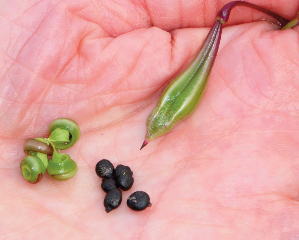
The flowers drop off to reveal a small green seed pod; at this stage the seeds within the pods are not yet mature enough to add to the seedbank. Providing the stems that hold these young seed capsules are cut to reduce the resource reaching the developing pod they then will desiccate and not develop.
Depending on the site aspect within a couple of weeks the pods will contain seeds which are viable, generally these are black when fully mature and the pods look fit to bulge.
On a site-by-site basis bagging complete seed heads can help reduce the seed entering the system and contribute meaningfully to your control efforts.
If seeds have developed then apply this method on sites that are strategic enough to justify the effort, such as a catchment source or an isolated satellite area and during late season monitoring and maintenance visits in the future.
It surprised us how much bullying a balsam seed head will take before pinging seed although by end of August/September – even small pods will burst including those plants that have germinated late which only reach five inches.
Bagging balsam pods is ideally a task for two people to maintain a sense of sanity and humour, wearing safety glasses, one armed with secateurs and the other with a heavy-duty animal feed sack. Cut the stem below the flower head and bag, repeat this trying to limit plant material other than the seed heads to save bag room.
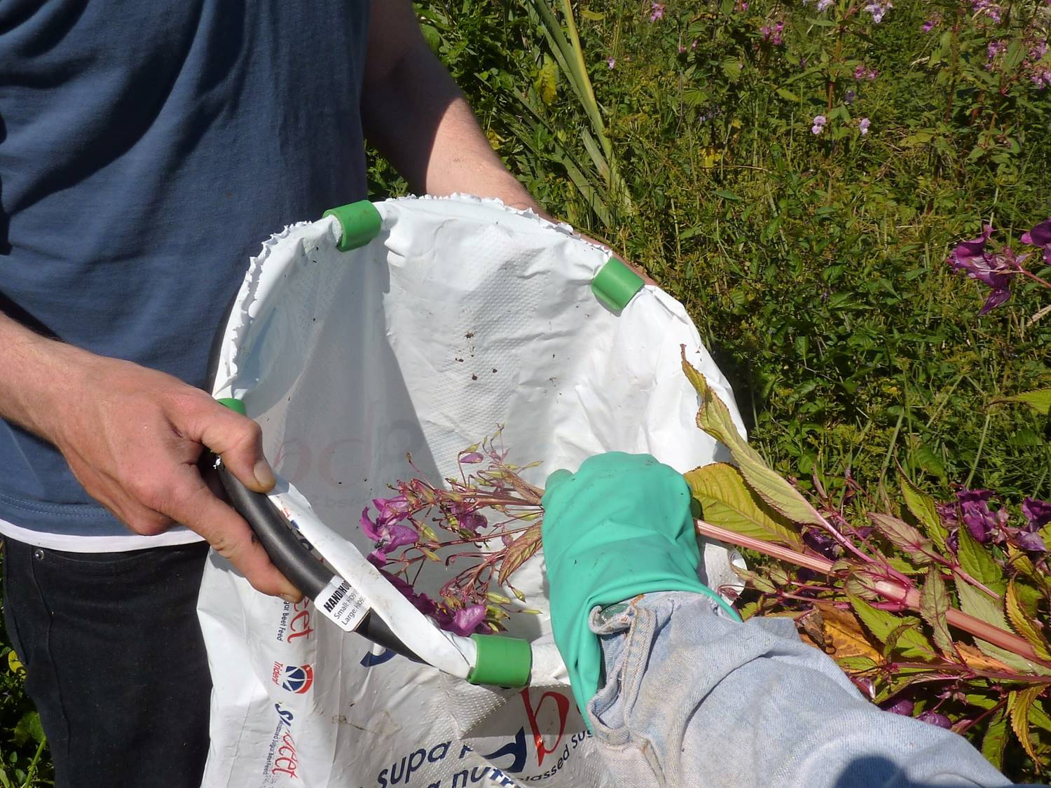
Some seed will escape until you find your rhythm but a vast majority of the seed is captured even by a novice. Sack contents remain to rot on site in a safe discrete location away from water. After three seasons empty the slime mass into a container or an area of the site away from water in late spring and check that nothing will germinate.
Seeds will germinate if you use a clear bag and other vegetation will catch your sack so heavy-duty chicken/animal feed sacks are best. If you see a bee enter a flower with mature pods wait for it to exit until you bag it.
Undertaking this method requires time – it is worth it if you can justify it but remember bagging seed is not the preferred method and is better undertaken on low density, highly strategic sites or during monitoring and maintenance.
Site A – 6 July one balsam in flower
Site A – 10 August all in flower and producing viable seed, all flower heads are bagged, not exploding on contact, another couple of weeks and they will. North facing aspect.
Bagging of seed/flower heads is suitable for volunteers who are keen, this isn’t the task for volunteers who aren’t really interested as it takes time and concentration.
On a dense stand of balsam accidentally triggering a few pods to explode can have a domino effect, so yes, it’s important to know when to walk away and plan accordingly for that area in time for the following season
For bio secure practice ensure hair is covered, outer layers are given a shake, as well as using the boot scrape or brush before leaving site.
One to walk away from and plan for next season!
8. Working with People
8.1 Contractors
INNS management is a good job for volunteers but contractors are absolutely essential when working at scale. Contractors were valuable in the following ways:
Sites with a very high infestation where volunteer groups would struggle to make an impact and may become discouraged. As infestations decline it becomes less cost-effective to deploy contractors and groups of volunteers can begin to take on the site.
To ensure consistency of effort, which is critical to our approach, contractors can then also be used support volunteer efforts for example if there is a gap left by volunteers due to poor weather or poor turnout due to holidays. A rapid deployment of contractors can plug a gap and ensure volunteer efforts are maintained and motivation remains high.
Sites which are less pleasant or less safe for volunteers to work on such as tributary ditch networks often leading from farms or in wet dense vegetation or steep areas.
Sites where landowners are unwilling to allow access for volunteers – this is not the end of the project, there will often be good reasons for a landowner not wanting volunteers on the land (land use, harvest timing, stock rotation/exclusion, general safety of a group of people rather than a pair of contractors and parking capacity). National Park Authority staff and/or contractors have been used on the few instance where volunteers have not been allowed.
As well as the usual countryside contractor base, we found this work is attractive to gardening and landscape type contractors and one person businesses. We worked with five contractors on the project. Many contractors had originally not carried out this kind of work before and over
the course of the project have become experts themselves and have fed back to us on methods and timings.
Throughout the project we have found it is best to utilise the same contractor on the same sites or sections of river. This means that the contractor gets to know the site and also provides reassurance for landowners due to relationship building with the contractor. In this way the contractor plays a role in keeping landowners engaged and on board with the project and can also provide feedback in order to head off any potential problems.
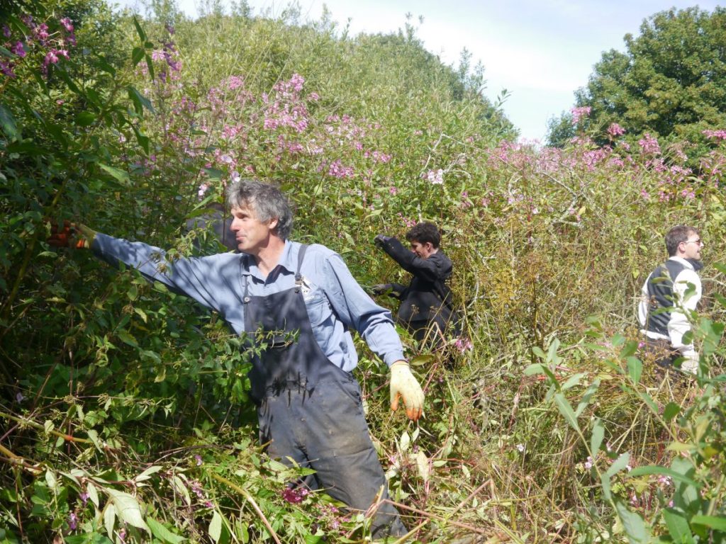
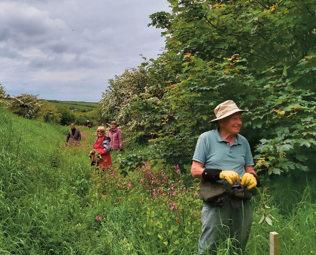
8.2 Working with communities and volunteers
Community groups and volunteers have been a huge asset to our INNS project in terms of commitment of volunteer hours and also local knowledge. Because they are also more likely to be local to the control area they can also have a unique role in the monitoring and maintenance of projects once the high intensity control phase is over.
We have found the expectations with regards to community and volunteer groups can be a little unrealistic. There seems to be an expectation that once ‘trained’, these groups should be able to organise and carry out this work themselves, to become entirely self-sustaining and in many cases to represent the entire exit strategy for a project once project officer support, training and funding has been withdrawn following the end of project funding.
A catchment or landscape-scale approach to INNS requires dealing with multiple landowners, co-ordinating the deployment of contractors on sites, unsuitable for volunteers, ensuring that sites are visited regularly enough to ensure effective control – even during periods of bad weather and to make a commitment to doing this for three to five plus years! It’s a big ask and the bigger and more complex the area, the bigger the ask. We are not saying this never happens – we have a great example in Pembrokeshire Coast National Park, but you will quickly alienate your groups if this is your expectation.
In practice, the way we engage with community groups has been more nuanced than that and we have gathered some of our experiences here and we hope this will help you to decide how to involve community groups in your INNS project and some of the things you might want to take into consideration.
Many community groups will be geographically limited, often around settlements or popular places, and in many cases it is not easy to persuade these groups to work outside of these areas. By mapping these community groups areas across your project area you can get a feel for how community groups can contribute to your project and where the gaps are which may need to be filled with regional or county-wide volunteer groups.
The scale of effort required during the first couple of years of the high impact control phase is significant ie about every three weeks. This is outside of the scope of most groups. For large or heavily infested sites it will be necessary to supplement their efforts with additional volunteer groups or contractors. As infestation area declines this may become more manageable.
Community groups come in different forms. Some are used to carrying out practical tasks and are fully insured and carry out their own risk assessments and provide their own task leaders with first aid qualifications. These groups are able to work independently of the project co-ordinator. Where this is not the case then the project co-ordinator will need to carry out adequate supervision and the usual duty of care to ensure community groups volunteering are provided with adequate insurance while participating in the project.
The involvement of community groups can be contingent on one or two dedicated individuals and therefore may be subject to changes in personal circumstances. It is important to check in regularly with community groups.
Not all sites or areas are suitable for community groups. Some sites are less appealing for various reasons eg attractive main river sites vs ditches in improved farmland.
One of our sites has a brewery and very welcoming landowners which made it an ideal site for adoption by a Park-wide volunteer group. This was successful for the first three seasons, and as the infestation became less dense over the same area, with a group of 15 volunteers looking for a dozen stems, this was not the most effective use their time; therefore, a more challenging infestation was identified, leaving the Project Officer, Area Ranger and landowner to monitor for any reoccurrence on the brewery land.
Through our INNS work in the National Park we have established a few basic models
Community-led
The community group takes the lead on all aspects of the project. This includes contacting landowners, carrying out control and seeking funding, In practice we find this is normally led by one or two very committed individuals. Groups will normally already be formed and have basic administration in place such as insurance. Generally a fairly modest defined geographic area. Case study St. Dogmaels
Community-Agency Partnership
All aspects are carried out jointly from survey through to contacting landowners and carrying out control. The project co-ordinator acts as a hub for direction and advice and this work is then carried out by the community. The project co-ordinator may be key in helping to remove barriers to control eg assisting with tricky sites (steep slopes) or heavily infested sites by the judicious input of staff or contractor resources. This increases the chances of success and builds confidence in the community regarding positive outcomes. Case study Moylegrove
Agency led
The project co-ordinator takes the lead on all aspect of the project. Deploying community groups to sites on a regular basis throughout the season. Generally a larger geographic area. Community groups may take on defined geographic areas within the catchment but the project coordinator takes on the overall coordination of the effort. Case study Cwm Gwaun
Case Study: Moylegrove
An infestation in a small coastal valley was being tackled by a small local community group. Their action was focussed on the lower part of the catchment. The Stitch in Time project was able to come in and help them to carry out a whole catchment survey which revealed larger infestations higher up the catchment area, some of which would have been difficult for the community to tackle alone. As a result, the co-ordinator is now working together with the community to re-prioritise their work and to assist by deploying contractors to areas which cannot be tackled by the community in the first instance. This approach should eventually lead to balsam being under control across the whole catchment and has indirectly led to the contractor being a de facto Project Officer due to a more consistent presence on the ground.
Case Study: Gwaun Valley
In the Gwaun Valley the National Park Authority had been carrying out control of knotweed and balsam on its own sites for many years. Although we had some success at individual sites, overall we did not seem to be getting on top of the problem. The Stitch in Time project was able to come in and apply a strategic approach to managing upstream and neighbouring infestations which has now reduced the resources spent on our own sites.
Case study: Cymdeithas Llandudoch/ St Dogmaels community association
Building on previous success at tackling another invasive plant species (Japanese knotweed), St Dogmael’s Community Association received £22,650 of SDF funding over 2 successive plant growing seasons to remove, prevent the spread and contain the over-whelming growth of Himalayan balsam on the challenging terrain at Cemaes Head.
Techniques employed were site-dependent and included flailing, chainsawing, brush cutting and hand pulling as appropriate. All the hard work and unbreakable determination has successfully reduced the occurrence of the plant from a density of 350 plants per m2 in places to just occasional rogue plants and isolated occurrences.
This successful community led project created the basis on which the Stitch in Time catchment control strategy was based.
8.3 Landowners
The first introduction of landowners to the project is usually when an initial request for permission to access and survey is made. This is the point at which you can raise awareness about INNS, the issues and pave the way for future requests for co-operation with control.
Landowners are busy people, so check that you have time to talk through the following:
- Hello, I coordinate a project on Himalayan balsam control, I want to gain permission to survey, especially water!!
- What hazards should I know about here? May I gain permission for control, access with volunteers, contractors?
- Where can we all park? What’s the land use, the history of the infestation, current management of the infestation?
- Are you, the landowner willing to input on control and monitoring? Could we discuss biosecurity issues? Do you lease or own land elsewhere in the catchment or further afield? What’s your neighbours called I need to see them please?
On a person by person basis it will become apparent how much detail is ‘safe’ to offload on the first visit. As a minimum, gain permission to access to survey with the landowner highlighting the site hazards and their understanding of the extent of the infestation so you understand how far and if you are crossing ownership boundaries and whether returning with a buddy will be safer.
A follow-up is then a good opportunity to provide feedback on findings, ask more questions and highlight what the owner can do now to mitigate any biosecurity issues. If there is no prospect of project control it is still worth floating the idea with the owner to see if they would like to be involved in a future project and what this would entail.
Indicating the significance of their land within the overall catchment is important or conversely highlighting particular areas of the site helps owners to understand the complexity of the task ahead and how vital their involvement is in a catchment context or if the target species have reached neighbouring land.
Across all catchments the first three questions to the Project Officer from a majority of landowners are:
- What are you to do with pollution?
- What are you to do with Planning? To which the answer must be ‘Nothing’ unless that’s the reason for your visit!
- How much is this going to cost me?
The role of landowners
In an ideal world the impact of Himalayan balsam is so obvious that landowners are happy to pay for control across their ownership or if a project grant is able to absorb the initial high costs. We do not expect landowners to pay for or practically take on all control; their participation is very welcome and should be encouraged but should not be a prerequisite to a funded project or community control being undertaken.
If a landowner can contribute time and/or cash then ensure it is spent wisely, the results of their input should be obvious and agreed at an appropriate area and scale such as around farm buildings, garden or the yard, not the farm ditches! The first action should be to assist the landowner/manager in mitigating any biosecurity issues through advice and practical assistance if possible.
At the start of the Stitch in Time project more time was focussed engaging with landowners on the most strategic areas of land requiring control i.e. a source tributary or an isolated area.
Where landowners are willing to be involved practically it is important to highlight the frequency of visits required in the medium term as its more likely an owner will pull balsam when the plant is more visible, therefore measures will need to be put in place to ensure nothing is missed before seeding as there will be lots to do.
Landowner monitoring a ditch for Himalayan balsam upper reaches of the Castlemartin Corse catchment.
A landowner agreed to undertake control around the vegetable garden in this photo.
A landowner has applied herbicide to balsam coming into a field while treating docks and thistle.
Landowners will want notice of contractor visits or volunteer work parties. It is sensible that the landowner influences/understands the frequency of the control schedule.
Flexibility and a person by person, farm by farm approach is essential.
Generally a majority of landowners within this project wanted 24 hours notice, becoming more flexible as the seasons progressed and a relationship developed with a lead volunteer, contractor or project officer.
Highlighting biosecurity issues is in the landowner’s interest although it may not seem welcome to begin with.
To date across Cwm Gwaun, Porthgain, Castlemartin Corse and Afon Clydach 80 landowners have been involved in the project since 2015. Securing survey access and hopefully control access is the desired outcome. A minority of landowners will undertake some control of Himalayan balsam, at least one landowner in each catchment has undertaken control during this project at some point which is great. A majority of landowners will have more of a role in monitoring for target species which is less time and can be tied in with day to day activities.
It is important to appreciate the neighbourly effect; often a landowner knew about me and the Stitch in Time project due to word of mouth from an earlier visit to a nearby farm when progressing through a catchment over days. This can have benefits in terms of friendly neighbourly pressure to ‘’get involved with this project, we are’’.
Over this project duration landowners have in the majority welcomed the project to reduce the target species over their land. This project has had a handful of refusals, most of which are overcome through seasonal engagement with the Project Officer, the main reasons for refusals are:
- Spiritual
- Ongoing issue with or dislike of the organisation you represent
- Misinformation on the species impacts/value for pollinators
- Position in catchment- i.e. ‘’sort what’s above me before including me’’
- Sentimental value
- Not interested, refuse to engage
It is interesting to note the original phase of this project included rhododendron ponticum as well as Himalayan balsam and Japanese knotweed. While permission for balsam and knotweed was generally given, Rhododendron permissions were few and far between, a common theme being planting by late relatives/ posed a sentimental value.
It is still possible to work downstream of a refusal area, for example a large outside edge (polygon extending away from water) pushing the balsam back to water and containing it there while you work on gaining permission. Containment is not ideal but gains can still be made.
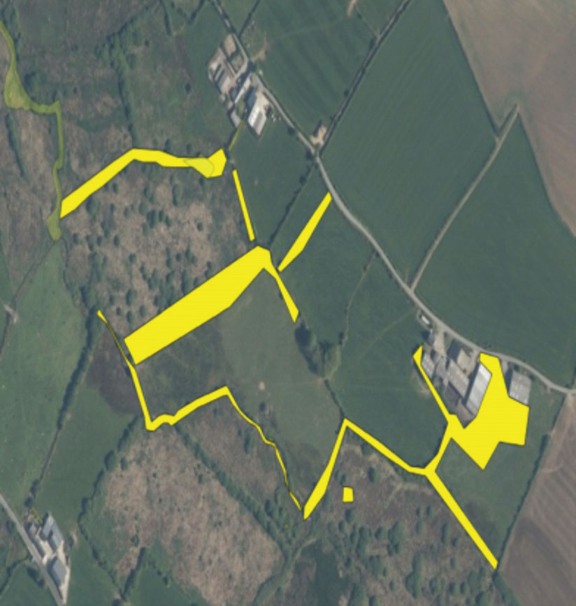
The area on the map below in pink is an area of refusal, despite this, the large area infestations below have been included in control due to interest from a community group and landowner.

9. Environmental Impacts
Tanner (et al. 2020) suggest that manual and chemical control methods used for Himalayan balsam control have a detrimental impact on the habitats invaded by balsam potentially doing more harm than good, therefore they favour the biological control method.
When carrying out vegetation management at a catchment scale it is important to consider your potential impact on protected species and the habitats we work within, as well as those of conservation concern. We therefore recommend you carry out an ecological impact assessment of your planned work. Otters were highlighted as a species which could potentially be impacted by our work.
9.1 Dealing with protected species
Case Study – Otters
Due to the riparian nature of the Himalayan balsam work there is high potential for disturbance of otters when carrying out strimming, pre-preparation of scrub management and balsam pulling work. It would be useful to budget for staff training and for securing appropriate ecological support. There are two main risks:
- Disturbance at a resting site or breeding/natal sites
- Loss of suitable resting or breeding sites in dense cover.
It is recommended that project staff/volunteers are trained to carry out surveys to identify otter signs and suitable habitat and structures for resting up or as potential use as a natal den. Natal dens have been located as far as 30m from the watercourse.
Natal dens
Natal dens can be found within habitat suitable for otter breeding, for example suitable structures or thickets within undisturbed areas of:
- Extensive reed beds
- Lakes and ponds
- Deciduous woodland
- Young conifer plantations
- Extensive areas of scrub
- Features such as large areas of block stone or boulders, and buildings/structures immediately adjacent to watercourses
- Most natal dens are linked to a watercourse, wetland or water body even if they are not immediately bankside. Survey within 30m of the water course is recommended.
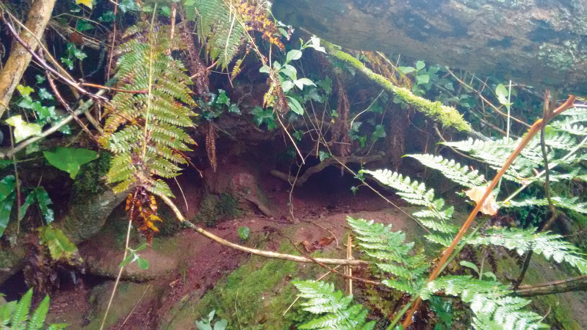
A possible abandoned otter natal den
Resting sites
These are areas used by otters for resting up. Dense thickets of scrub >4m x 4m which are located in more disturbed areas, or areas with little adjacent semi-natural habitat may possibly be used by otters for resting up.
Surveys
Surveys should be carried out by walking within the river itself where possible to give the best view of signs and habitats along the bank and to avoid disturbance to bankside vegetation.
An initial survey identifies the presence of bankside otter tracks, spraint sites and potential habitats for resting up (smaller areas of dense cover 4 x 4m) and potential structures for natal dens such as tree roots, where these structures or thickets are located in a larger undisturbed areas of habitat.
Identifying natal dens can be tricky but from experience of surveying otter breeding sites in Wales, field signs include:
- The sudden appearance of a heavily used path or paths from the water, usually into dense cover or an enclosed structure, such as a tree root system or a hollow trunk.
- A natal den, usually only visible at above-ground sites such as scrub thickets and reed beds.
- A latrine containing a very large number of spraints at the natal den, and usually within one to two metres of it.
- A cub play area – for example, a well-worn path around a tree or in a circle up and down the bank. At breeding sites that are used over a period of many years, some features such as cub play areas can be visible throughout the year
Any suitable structures or areas identified will need to be checked for use prior to work commencing. In the case of a resting site, work may need to be delayed for a few days, in the case of a breeding site it may need to be delayed for several months.
Trail cameras are a MUST to aid survey and monitor activity at well used crossing points or sprainting sites.
Although much of the scrub management associated with Himalayan balsam is temporary it may take time to reach appropriate density and consideration should be given to providing artificial resting sites. This is also an enjoyable and engaging activity for volunteers.
Camera trap for otters only ‘caught’ fox utilising this section of stream
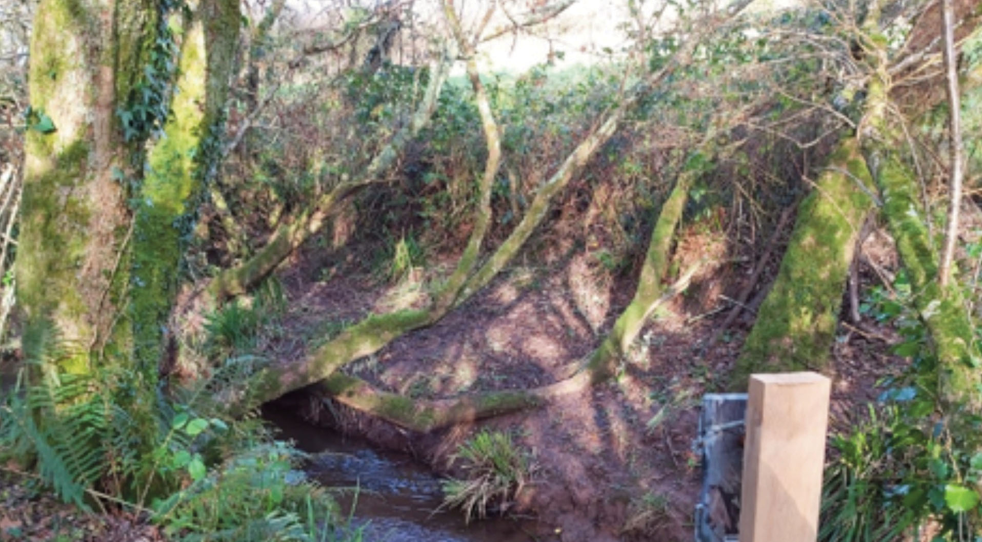
Checking local species recording forum for records of protected species is a good start to help consider what you are trying to mitigate.
9.2. What is otter mitigation practically?
Effective Himalayan balsam control does require short term scrub management whether that is for physical access to transit through a site or/and removal of bramble where Himalayan balsam is present within the growth.
It is therefore vital that before this scrub cutting takes place otter activity is surveyed by direct survey of otter tracks, spraint and access routes to and from water and through vegetation. Camera traps must also be used to confirm what the activity is i.e. is the otter displaying behaviour such as resting up, transit through the area, direct hunting/feeding or natal behaviour. Can the individual ‘captured’ on camera inform you the age and sex of the individual(s) and therefore indicate what the area is being used for?
Our main impact on otter is physical disturbance and the short-term removal of scrub/bramble cover so how do we mitigate and ensure we are not disturbing?
Utilising the services of an otter surveyor is key to ensuring correct identification of field signs and camera footage and the appropriate mitigation. Our project had a budget for this service.
After a formal contract with the otter consultancy reports were provided outlining a description of survey findings and management notes to inform our projects work on each site. In addition to this the consultant spent a day training the Project Officer in surveying otter signs and was a point of contact for any questions throughout.
Before winter vegetation control could take place a survey was undertaken to identify any recent otter activity as well as checking the camera traps. This was scheduled to take place by the Project Officer and to feed back to the consultant, however the first Covid-19 lockdown meant that the otter consultant then completed this task.
If otter activity is confirmed through field signs or footage of passing through the site, resting up or feeding the site should be avoided for 3 days and with a buffer of 15 metres where work can continue.
After the three days the process is repeated.
Consistent otter activity moving to and from water after the three days may indicate a female looking to use an area for natal den, the site would then need to be avoided for a few weeks to a month using a camera trap to inform on this until the activity ends.
Otter behaviour is not simple and mitigation will vary and can be adapted
Otter cam still, Castlemartin Corse, 0300, 16/02/2022
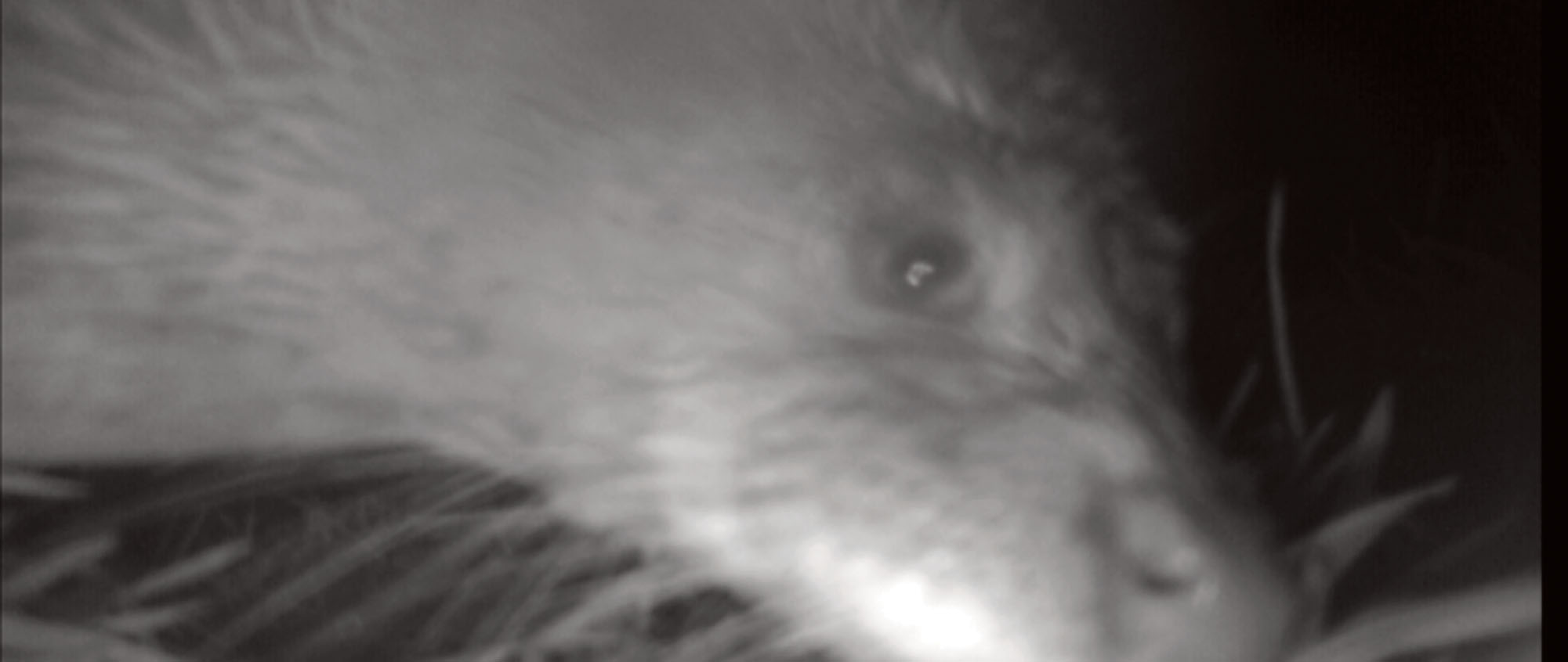
Otter Case Study: Castlemartin site Underhill
Following confirmation from the consultant that no otter activity was taking place a day before contractors were due, access routes were cut, leaving linear areas of scrub cover and only cutting one access route into the stream (see yellow polygons on screen shot below).
This was feasible due to there being a density of only a few hundred balsam stems within the scrub and the absence of otter activity the day before verified through survey. Balsam could be reached and pulled through the linear areas remaining. Indeed the absence of otter meant the contractors could have reduced more scrub cover however it was agreed efficient control could still take place leaving cover.
This created a buffer (‘or balsam break’) from the stream side infestation to the main woodland. Once the infestation in the woodland was controlled manual methods could be used from the water to control the stream side infestation again limiting the cover being removed while still ensuring balsam can be accessed. During the summer control hand pulling was used only.
A survey would still take place prior to contractor’s staff or volunteers balsam control and no dogs were permitted on any sites.
The screenshots below show the otter survey map (left) and the area infestation polygon data (right). The yellow polygons highlight the linear access routes created.
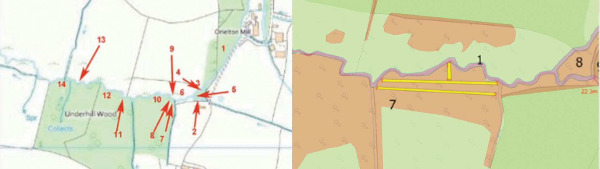
Spring 2020 after winter access, linear sections and stream scrub in place with linear access only, creating a balsam break or buffer from main woodland to the stream.
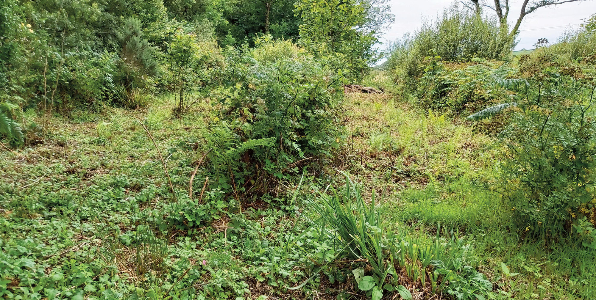
Autumn 2020 same site, last pulling visit, access maintained through trampling not cutting.
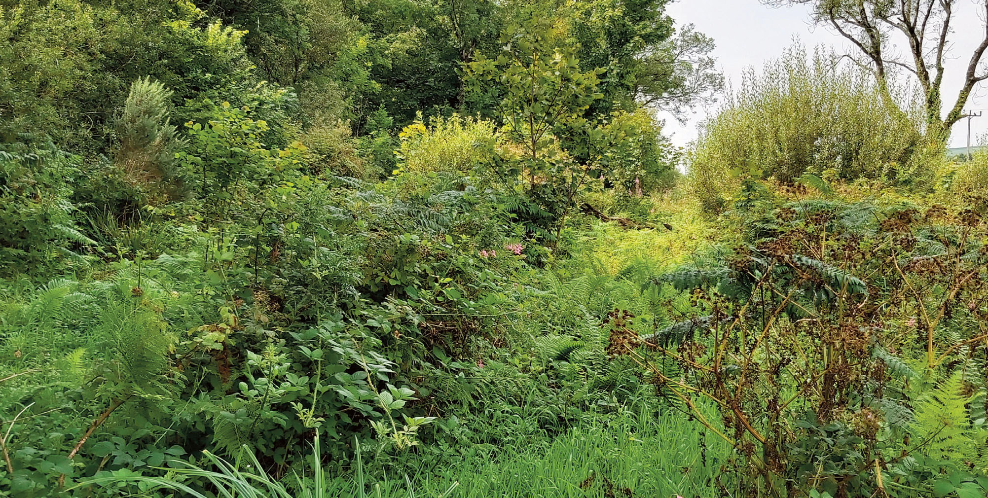
10. Exit Strategy – The monitoring and maintenance phase
The catchment monitoring and maintenance phase and is initiated when densities of the target species are either absent or present at a very low density. The aim of this plan is to ensure that outcomes are maintained over the long term and ensure that we are able to monitor, respond to outbreaks or new introductions rapidly and in a cost-effective manner.
During the impact control intensity phase, high intensity control phase, the annual resource investment peaks around year 2/3, then declines as we move towards the monitoring and maintenance phase. Through this monitoring and maintenance phase we hope to see a continued decline in the resource investment required to maintain outcomes.
Following a consistent and thorough control strategy over one control season, a local Himalayan balsam seedbank can be significantly reduced at a site due to the annual lifecycle and the possibility of encouraging germination during access works. This high intensity control phase requires commitment of time and resources which in as little as 2 or three seasons can demonstrate success through exhaustion of the seedbank.
Applying the catchment approach to control will lead to success if all pathways of dispersal are identified and included at the scale you are working, this can be at a full catchment scale, a part catchment scale or a site scale; providing source populations, satellite populations and full area infestation and extent is known and included. After a second season the balsam seedbank is significantly reduced, more so following a third season where the number of site visits and time to under-take control is reducing.
The project should initiate a monitoring and maintenance phase whereby sites are monitored through survey and where minimal control or effort is required to maintain a near eradicated or lower density of Himalayan balsam.
10.1 Monitoring the visual change
Monitoring how a site or sites react to control during the high intensity control phase is best done with fixed point markers. This provides a nice visual of the transition. An important consideration however is to ensure that the key picture is of the Himalayan balsam monoculture, ideally in flower is taken in the previous year. Think strategically: allow an area such as a square metre or a full site to flower with the aim of getting the picture you need then following up with control before seed pods develop, for example this could be towards the end of the operational area.
During the monitoring and maintenance phase these fixed-point markers should remain in situ for a number of years along with the continuation of photographic evidence to document the visual change. This could also provide a good location for other ecological monitoring
Fixed point marker number 3, Castlemartin Corse, Chapel Hill, July 2019 and August 2021
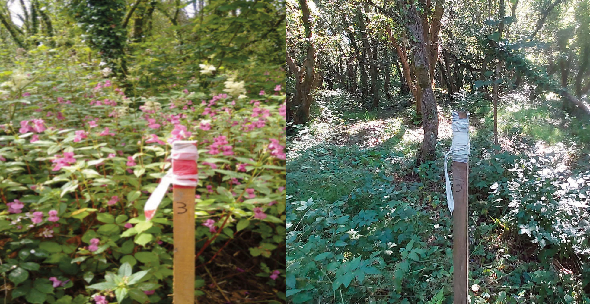
10.2 What does a monitoring and maintenance strategy entail?
Preparation – during your first high intensity control season start preparing for the monitoring and maintenance phase. The monitoring and maintenance strategy is a written plan outlining how ‘sites’ leading to a sub-catchment, and/or catchment infestations are maintained at a successfully controlled or near-eradicated state.
- By who – landowners, community organisations, volunteers, the public and staff all have a part to play in both monitoring and maintenance.
- By when – the monthly frequency and site maintenance will be reduced from the high intensity control phase.
- How – recording of observed density, time taken, and actual costs: standardising recording methods (areas/polygon refs and density estimating).
- Predicting cost OR time/effort required – this will be reduced significantly from the high intensity control phase.
Table 1: Example headings used on our projects, monitoring and maintenance plan
| Site name and type | Map Reference | Size (ha) | Details | Riparian corridor? | Control History | Current Status | Control methods | Who | 2021 Monitor and maintain plan | 2022 | 2023-25 |
| Area ABC
Satellite or source or outside infestation or All? |
1,2,3,4 | 50
|
Stock issues?
Access issues? Health and safety? Landowner contact |
Y/N water present? | 2019-2020 High intensity control
Total time 237 hours |
2021 Monitor and maintain | Mechanical 2019
Manual 2019-2021 Chemical N/A Grazing N/A
|
Staff?
Contractors? Volunteers? Or all? |
4 visits between June-October allow full day to cover area including maintenance Ca 29 hours for 2021 estimated
Actual time: 22 hours contractor |
3 visits
July-October Ca 22 hours Actual time 22 hours
Staff volunteers landowner |
2 visits reducing to 1 visit from July
Ca 12 hours for each season.
Staff volunteers landowner |
10.3 How long does the monitoring and maintenance phase last for?
By presuming a consistent and thorough high intensity control strategy has been in place at a site (sub catchment/catchments) for a minimum of three years then the monitoring and maintenance phase should follow for the next 2-4 seasons, then be reduced to a bi-annual, annual then every other year monitoring visit.
10.4 Who to undertake monitoring and maintenance?
‘Eyes and Ears’
Landowners: The majority of landowners across our project catchments and indeed most of the UK catchments are farmers, therefore there is a constant potential of observation (monitoring) providing that clear identification material or discussion is provided and that the flowering stages are highlighted as a key time to be vigilant.
The local community: Local groups, businesses and individuals that may have been involved by volunteering during the high intensity phase also have a part to play during the monitoring and maintenance of sites especially if near public access, public spaces or private land where continued access is agreed. All areas where volunteers are to carry out monitoring and maintenance must be safe to do so.
Case study: Volunteer groups and site adoption:
During 2016 an organisation called the Friends of the Pembrokeshire Coast National Park (FPCNP) adopted a key source area in the Gwaun Valley, often undertaking pulling events independently and reporting back stats (number of volunteers, time taken and estimated density/how many stems). This worked really well, however during 2018 and 2019 a majority of areas adopted at this site were not presenting enough balsam to warrant the time of 12 volunteers. It was then decided (2019) that the site would be monitored and maintained by PCNPA staff with the input of individuals from the group who were interested in looking for balsam whereas those who were keen to work on higher densities were introduced to other target areas in the catchment or adjacent catchment. The landowners of this particular site undertook control in the garden areas and would contact the Project Officer if the task became too much practically.
Not all volunteers want to look for low densities of balsam.
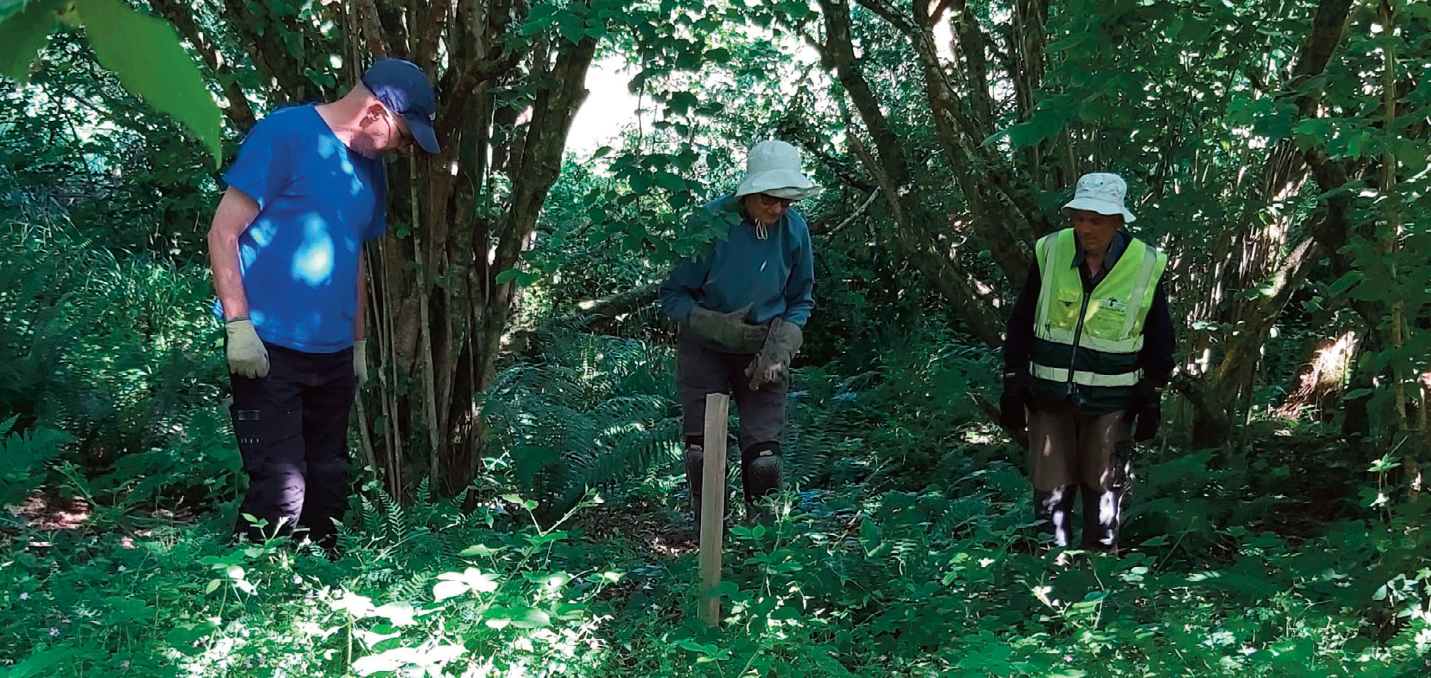
Who to record?
A point of contact should be provided which is secure (i.e. not tied to short term grants) this could be a local Ranger (National Trust or National Park even if outside their organisational boundary) alternatively the local authority (Pembrokeshire Nature Partnership), local record centre and/or the agreed contact of a local community group or volunteer.
In this project PCNPA staff (Rangers and Project Officer) are in the short term, with assistance from members of the community and landowners. Where access is unsafe or the area is beyond the capacity of staff and volunteers then contractors can be used, if the budget exists.
A dedicated Project Officer is key for co-ordination of delivery and a point of contact.
10.5 What to record for the monitoring phase?
The key information to be provided by the ‘observers’ – ‘where’ – ie name of farm, site, area. An estimate of density or numbers of flowers/stems observed tens – hundreds hopefully not thousands and if water is present or not.
In this project PCNPA staff (Rangers and to a lesser extent Project Officer and contractors) are undertaking the monitoring of defined areas where the state of polygons of the area of infestation can be reported on directly.
Record monitoring effort
Recording time is important during both high intensity phase and monitoring and maintenance as in both cases a reduction in time/resources should be observed, if not, or if plants continue to occur at varying or increasing densities then there will be a new or previously unidentified population dispersing via a pathway i.e. water, animal track or human.
To ensure thoroughness and consistency this is best introduced through dedicated site visits with the Project Officer or contractor ‘handing over’ and can be undertaken at the first monitoring visit for a majority of sites, a catchment in late May early June would be the first monitoring and maintenance months (see sub compartment monitoring below).
10.6 Who to undertake the maintenance?
This will depend on where and how many. If during a monitoring activity (dog walk, other biological recording or dedicated monitoring activity) a small number of balsam stems is recorded. It would make little sense for the recorder to leave the stems in situ, especially if in flower. If safe to do so the recorder should undertake the maintenance of the site following best practice method.
If the density of plants is beyond the capability of the recorder(s) or the area is not safe or does not have agreed access then the recorder should record as above – where, how many, near water etc. and report back as soon as possible to the point of contact i.e. National Park, community group chairperson, NRW or local recording forum. It should be made clear to the persons involved who they are to report to, the Project Officer or local Ranger is ideal. A decision can then be made if staff or a contractor is required to undertake the maintenance if beyond the capacity of the recorder. This maintenance should take place in good time and methods adapted to the state of the observed plants ie not in flower, in flower or seed pods present.
10.7 When to undertake monitoring and maintenance ‘reducing resource’
Following a high intensity control project a reduction in resource will be observed from year 3. Visits to the sites can start in late May or June rather than late March/April. The time taken to maintain rogue plants is reduced from days to hours. However some sites may show a significant change in just one season. It is prudent to ensure the first monitoring visit to any site is undertaken early July at the latest to ensure balsam is at its most visible and to control the plants effectively before seeding. After the first monitoring and maintenance season the actual time spent can be used to plan for the following season.
It’s important to note that you will still need to cover the historical area infestation, controlling the plants may take time as walking over the area will also take time especially if access underfoot is tricky, i.e. marshy grassland.
10.8 Where to prioritise ‘reduced resource’
If resources for invasive species control were constant and infinite, clearly linked to local resilience in ecosystem service provision then control work and subsequent monitoring and maintenance would take place across the whole target catchment, neighbouring catchments as well as any intra-catchment links i.e. farms/land owned or tenanted outside the target catchment a potential pathway for dispersal.
However this is not the case and unfortunately INNS projects tend to be short term i.e. less than 3 years which can only continue with new funding package or grants that are available.
Prioritising areas to control and thus monitoring should focus on the following:
Satellite populations: areas of Himalayan balsam isolated in a catchment or site from the wider infestation
The source area: water, garden, farm yard, the source may not be directly near a water spring but will often lead to water.
Water: springs, ditches leading to tributaries then a main river system. Therefore the hierarchy for monitoring and maintenance would be where control first started i.e. the source and its outside edges then where it follows water (if the source area isn’t near water). Even though the main river will likely have better access, it may have special designations or is an asset to a lead organisation, it is far more important to remove the risk of future infestation by ensuring the monitoring and maintenance strategy in the event of reduced resource is not losing the rationale of the catchment approach.
10.9 How to manage outbreaks during the monitoring and maintenance strategy?
Having an email or phone call from a volunteer or member of the public recording a large area of pink during a monitoring and maintenance strategy can be a little disheartening. Take solace in that the monitoring, recording and reporting is working. Then take these steps:
- Check permissions are in place (landowner/SSSI)
- Verify the record ASAP
- Undertake maintenance as normal and investigate the pathway
- Step back from undertaking control if the area is large, balsam showing viable pods is seeding (generally August) if rain is forecast consider if immediate action will make the situation worse, either way this site will now be logged as a high priority requiring a higher intensity, returning early in the following season but should not redirect resources from high up monitoring and maintenance, i.e. an
outbreak on a main river should not redirect monitoring resources on a tributary. - Some winter vegetation access work may be required, walking away to plan for more effective control is an option.
10.10 Pathway Analysis
A pathway is the means by which a species moves about the environment in a natural state i.e. wind or water. Humans can influence a pathway directly or intentionally ie the intentional introduction of a species from one area to another such as collecting plant specimens in the 1800 and allowing them to establish in the British Isles. Humans can also influence a species pathway indirectly or unintentionally, such as the accidental cutting of Japanese knotweed on road verge thus spreading fragments of the invasive plant and allowing to colonise the verge wider.
Undertaking a pathway analysis is crucial when managing invasive species and will inform any action on prevention, the ultimate goal in invasive species management.
The analysis allows reasoning into the likelihood that a pathway may occur, its potential impact, the risk to the catchment status is highlighted and suggested mitigation which can then form project actions that can then be timetabled (when and where) and designated (who and how).
On the following pages (table 2) summarises headings used in the Gwaun and Llanrhian catchments pathway analysis with an example on environmental/natural dispersal pathway.
Animals such as rabbits that range between different habitats often lead to and from Himalayan balsam.
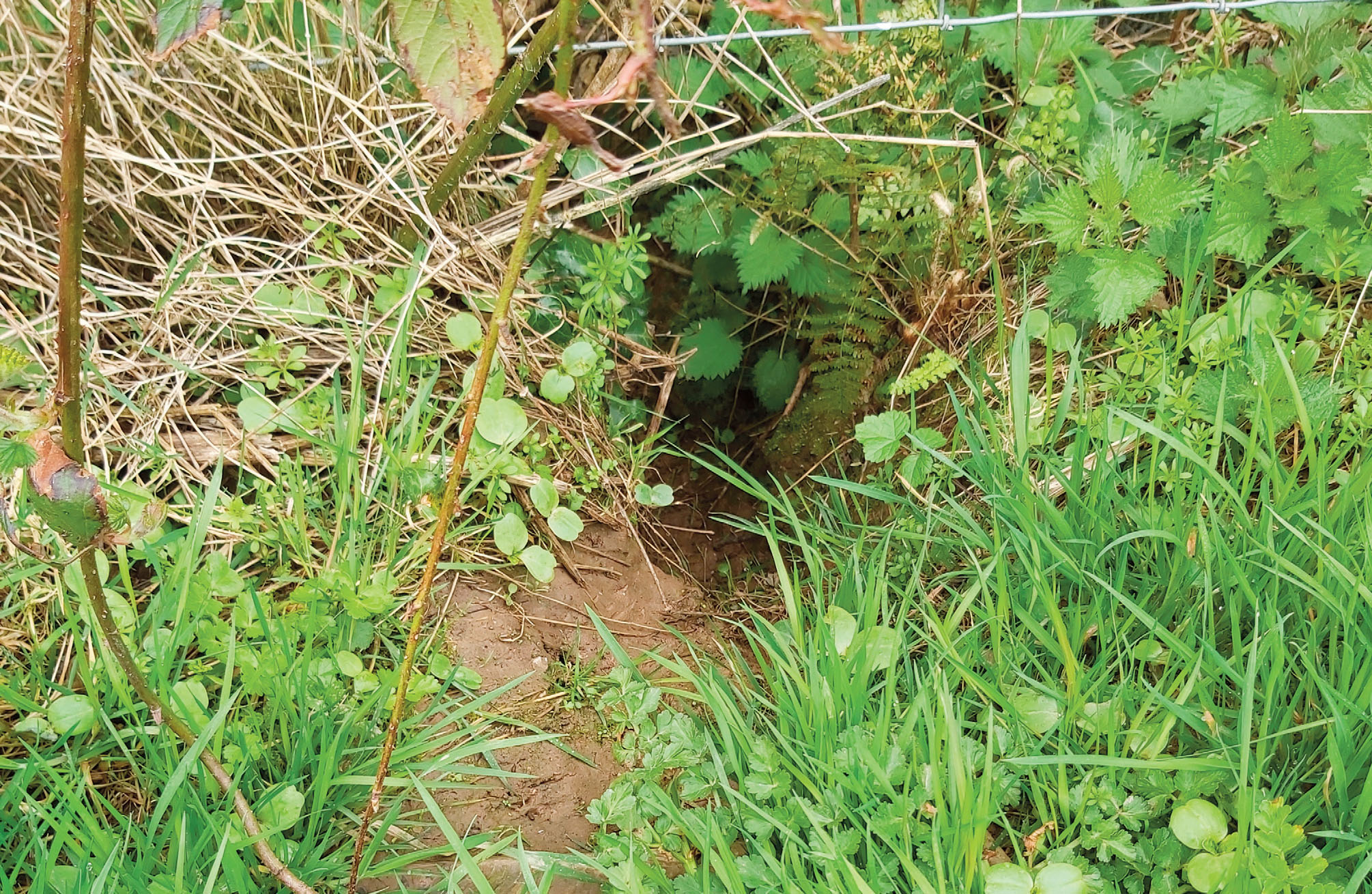
Table 2: showing Pathway analysis headings Cwm Gwaun and Porthgain
| Introduction/
dispersal pathway |
Likelihood of occurrence | Description | Potential Impact | Description | Risk to catchment status | Mitigation | Project actions | By whom | By when |
| Dispersal of seed by water pathway (environmental/natural- could also be wild animal movements | HIGH | Well documented natural dispersal method | HIGH | Seeds from a small number of flowering plants could be dispersed throughout the catchment leading to potential outbreaks across the catchment | HIGH | Prioritise outbreak response along watercourses. Catchment approach control prevents re infestation of controlled areas | Action 1: Maintain control in all areas where water is present, with particular focus on the tributaries | Action1: Contractor staff volunteers | Action 1:
June-October |
11. Site recovery and mitigation
As a site, sub catchment or catchment shifts status from high intensity control to a monitoring and maintenance strategy, particular sites may require resource to aid the recovery, ie the establishment of a desirable, native vegetation. To date the Stitch in Time project has not needed to disperse native seeds to help vegetation recover due to Himalayan balsam or Japanese knotweed control as in the vast majority of areas controlled there has been ample neighbouring natives to assist with recolonization and creation of more resilient and diverse vegetation structure.
The monitoring and maintenance strategy is a less intensive phase of target species control and sites that can be monitored not only for re-occurrence of the target species but also for how the site recovers. Ideally before high intensity control is undertaken a survey is commenced to capture a baseline of the species present – this could be just an informal species list of flora and fauna or more specialised using skilled staff, volunteers or a contracted consultancy. Any significant changes in the vegetation structure should be evident during the monitoring and maintenance phase. During the most recent Stitch in Time project ‘Sustainable Stitch in Time’ the project contracted an ecological consultancy
‘’Ecosulis’ to help monitor change using their biodiversity calculators as well as the visual fixed-point photographs.
The Cwm Gwaun ‘pioneer’ species noted during monitoring and maintenance included Urticaceae (the nettle family), Silene dioica (Red Campion) and filipendula ulmaria (Meadow Sweet (all colonising without the need for additional project recovery assistance, all in the area of previous balsam or knotweed stands. It may be that individuals, locals or volunteers would be happy to monitor sites change while monitoring and maintaining a small number of Himalayan balsam stems.
Penrallt site June 2020- 100% of this woodland harboured dense Himalayan balsam
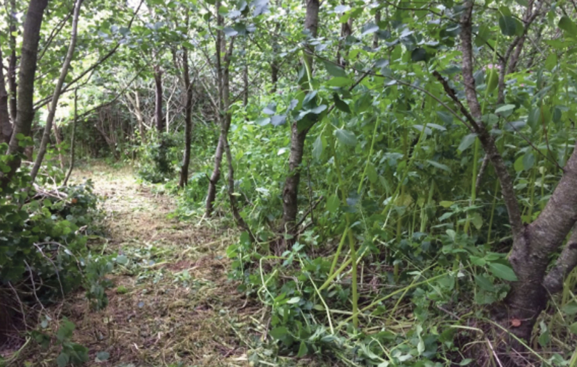
Penrallt site late May 2021 –the same woodland, balsam still persists, balsam density reduced, increasing light, reducing impact on other plants
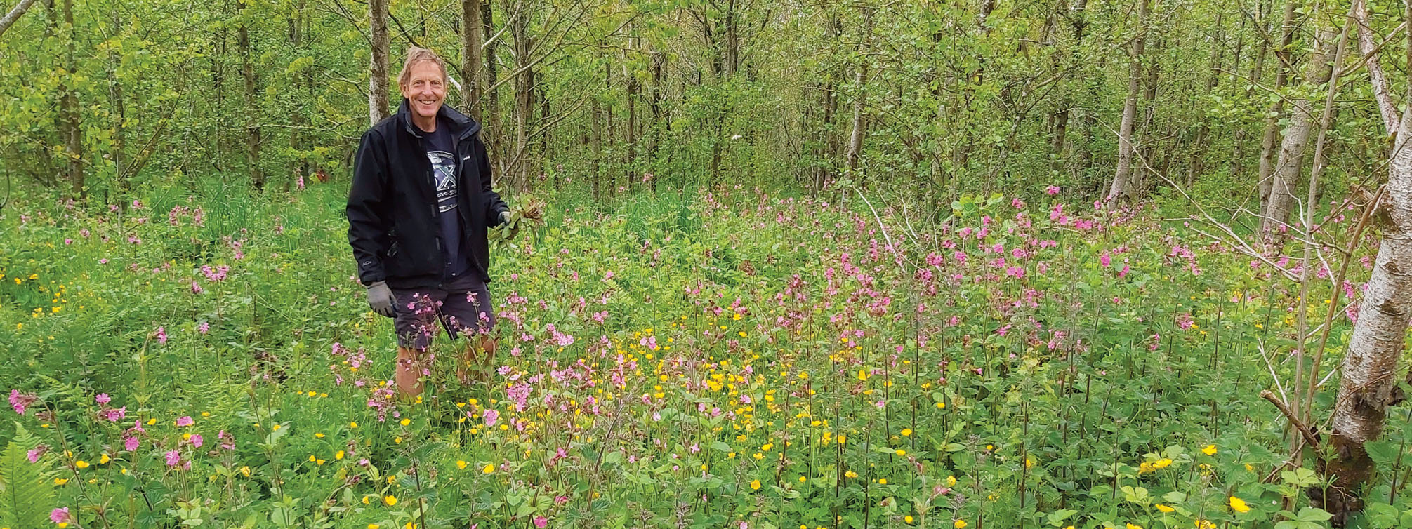
In all instances of Himalayan balsam control within this project site recovery has occurred naturally.
Case study – Penrallt
The photos below show a large area where access has been cut during winter, in May bluebells and celandine are visible alongside small balsam plants, by June balsam is waist high shading out any species below, often other plants / seeds are present already they just can’t compete with the density of Himalayan balsam, this site will need no additional recovery.
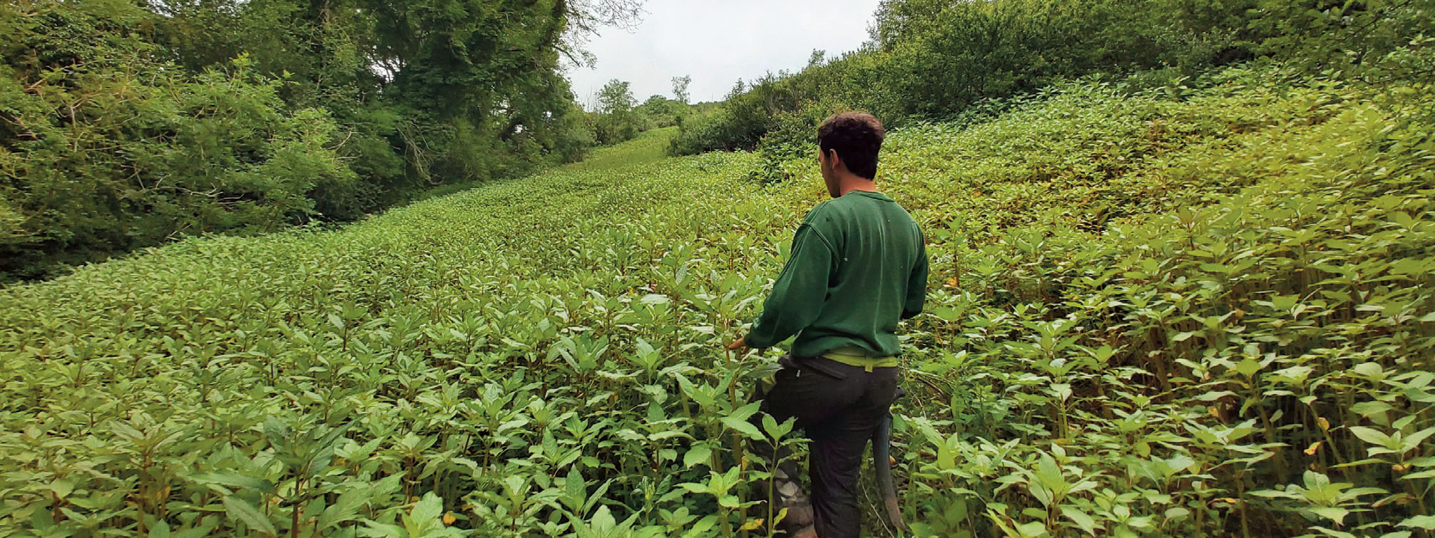
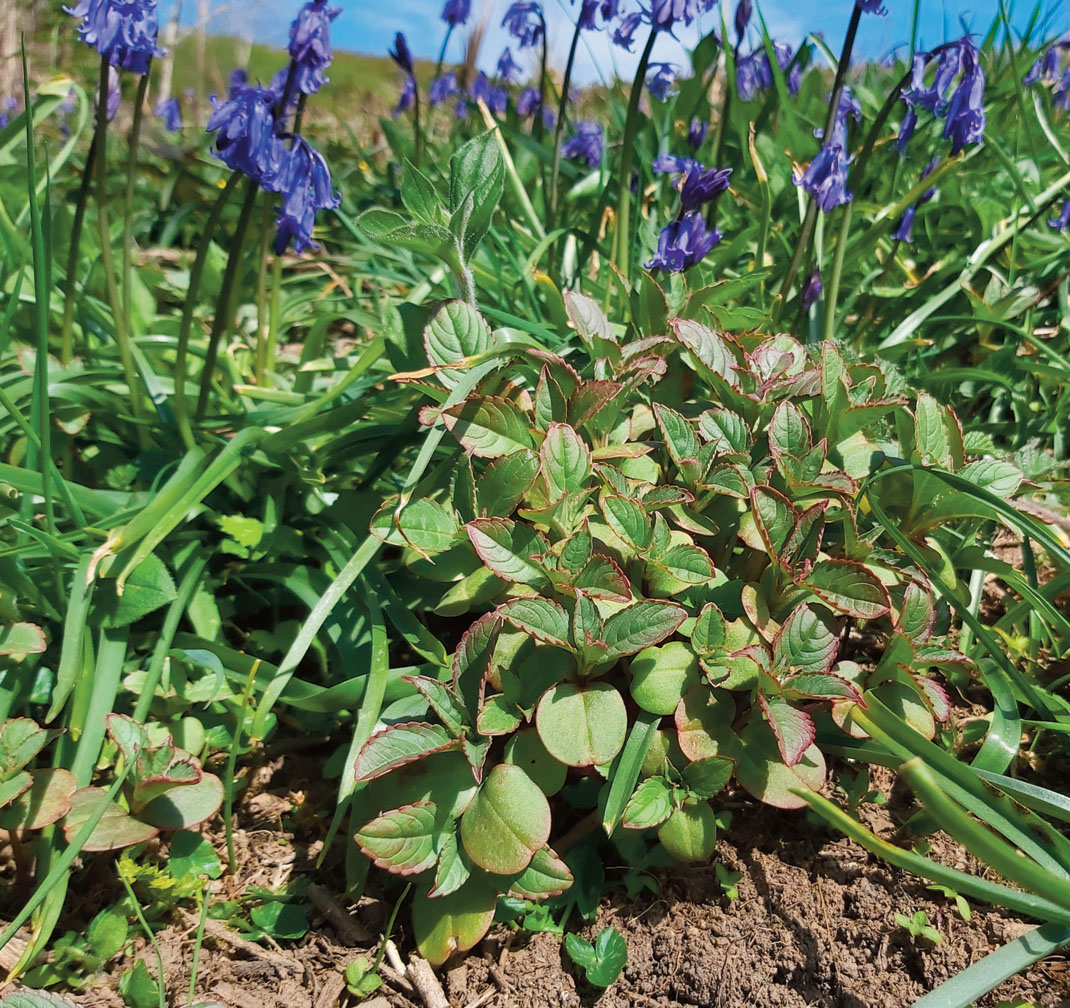
12. Monitoring and evaluation
If you are seeking external funding for your project, naturally you will need to tailor your outputs and your approach to meet the needs of your funder. Here we outline the information we collected or produced to help with monitoring and evaluation of our project and in demonstrating the impact we had.
This is a quick reference guide and more information can be obtained from our project monitoring and evaluation report
Volunteers and community groups
- Number of individual volunteers
- Number of volunteer hours donated
- Economic value of volunteer time.
- Number of volunteers reporting an increase in well-being during a single session of volunteering
- Story collection case studies (interviews with volunteers)
- Number of community groups engaged with the project
INNS management
- Number of hectares under management
- Site status – GIS Mapped output showing ha of sites with Control Underway/ Controlled/Not started
- Graphed co-incidence of controlled INNS with priority habitat and connectivity features
- Catchment cost curves demonstrating the cost effectiveness of co-ordinated sustained control for Himalayan Balsam
- Number of unexpected outbreaks
- Fixed point photographs.
- Before and after species lists
Events
- Number of people attending.
- Number of people will reporting an increased knowledge of INNS following the event.
- Number of people indicating they intend to apply the knowledge learnt at the event to their own situation
Toolkit
- Number of copies distributed/downloaded online
External Enquires
- Number of external enquiries answered by the project
- Impact of advice (monitored using follow up interviews)
Landowners
- Number of landowners engaged in the project
- Depth of Landowner engagement
- Landowner benefits (monitored using interviews)
Contractors
- Number of contractors working on project
13. Project Staffing
- INNS Co-ordinator. For a landscape scale project at least one member of staff dedicated to the project is an absolute necessity. Project outputs could simply not have been achieved without this role.
- Key staff tasks
- Liaising with landowners
- Survey, mapping and data management
- Managing and working with contractors and National Park staff
- Co-ordinating, training and leading volunteers
- Conducting practical INNS control
- Awareness raising
- Reporting
July 2019
Pictures – Fixed point marker post ‘1’ Chapel Hill wood, Polygon 5
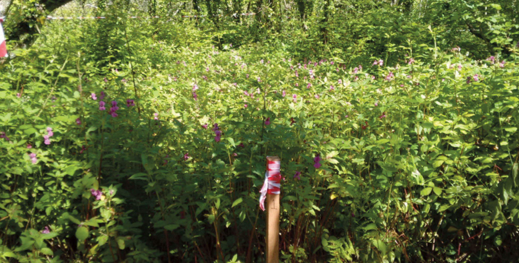
Winter 2019
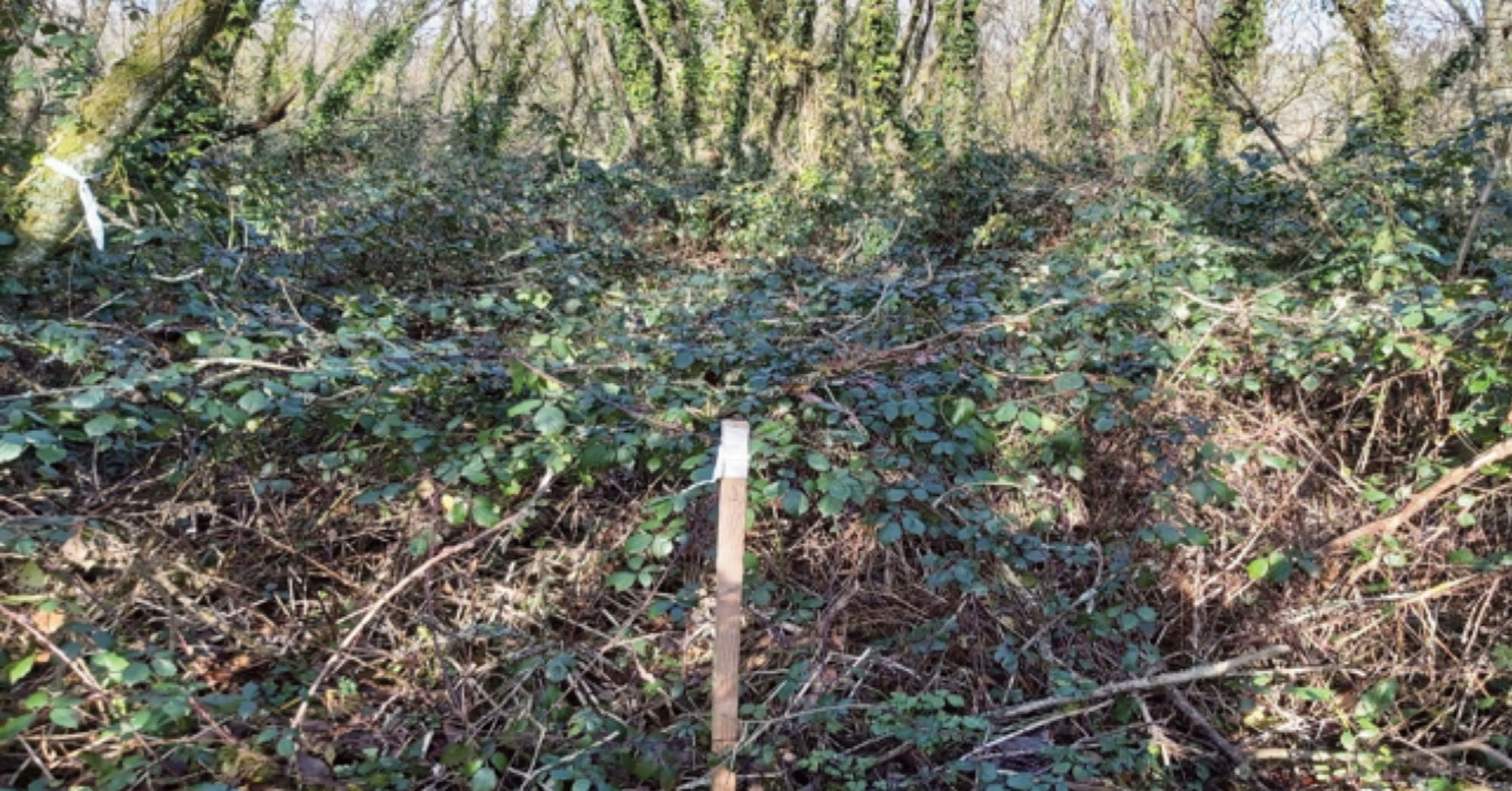
January 2020
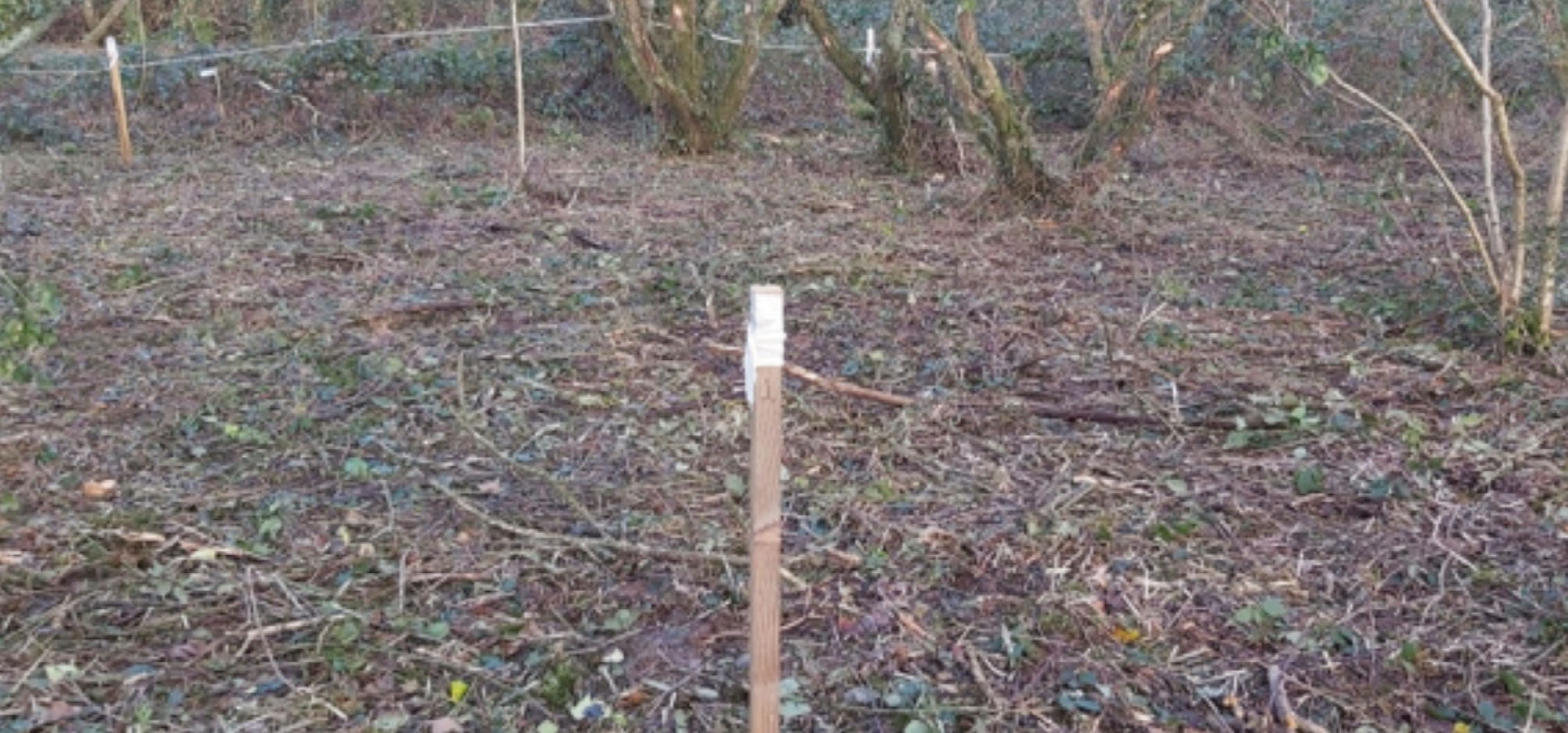
May 2021 With Pathways volunteers
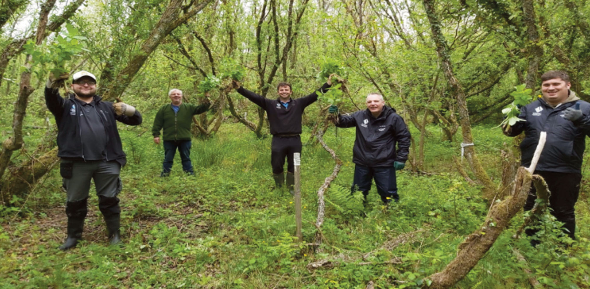
August 2021 – Chapel Hill wood will be considered in Monitoring and maintenance 2022
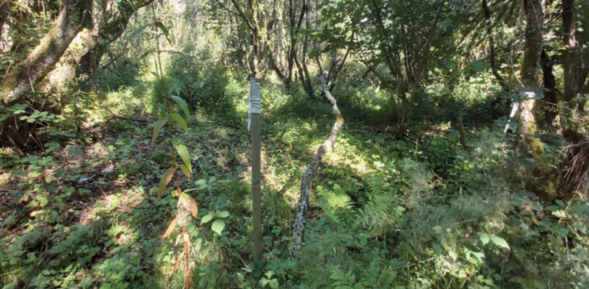
14. Conclusion- Balsam is beatable!
Sustainable Himalayan balsam control is achievable at a site, sub catchment or full catchment scale. Using the catchment rational and effective control methods communities, volunteers, landowners and contractors can make a huge difference helping to create more resilient space for nature free of this widely spread invasive plant and its associated negative impacts. A monitoring and maintenance plan safeguards the initial investment made and is able to stitch in time any future outbreaks.
References
S. Coakley, C. Petti
Impacts of the invasive Impatiens glandulifera: Lessons learned from one of Europe’s top invasive species. Biology, 10 (2021)10.3390/biology10070619
R.A. Tanner, A.C. Gange, A. Haughton
Himalayan balsam, Impatiens glandulifera: its ecology, invasion and management. Weed Res., 60 (1) (2020), 10.1111/wre.v60.110.1111/wre.12401
K.M. Pollard, A.C. Gange, M.K. Seier, C.A. Ellison, A semi-natural evaluation of the potential of the rust fungus Puccinia komarovii var. glanduliferae as a biocontrol agent of Impatiens glandulifera, Biological Control,Volume 165,2022 https://doi.org/10.1016/j.biocontrol.2021.104786.
Cuda.J, Skalove.H and Pysek.P (2020) Spread of Impatiens glandulifera from riparian habitats to forests and its associated impacts: insights from a new invasion. Weed Res.60, 8-15