New illustrated map aims to inspire more to explore St Davids on foot
A new illustrated map is aiming to engage and inspire visitors and locals alike to explore St Davids on foot, and discover the sites, sounds and stories of Britain’s smallest city.
The map, which was unveiled at Oriel y Parc Gallery and Visitor Centre on 13 August, was illustrated by Cardigan-based artist Hannah Rounding, who created the artwork with input from local people.
Hannah Rounding said:
“The map features well-known landmarks such as St David’s Cathedral, the Bishops Palace and Oriel y Parc, but also shows lesser-known locations such as Penitent’s Bridge, the Community Garden and the RNLI Barometer, alongside the array of wildlife which can be found in the city and the surrounding area.
“I’m extremely grateful for all the local knowledge that people shared with me as part of the project, which has added such a lot of additional information that hopefully will interest people and encourage them to explore more of the area’s many hidden gems.”
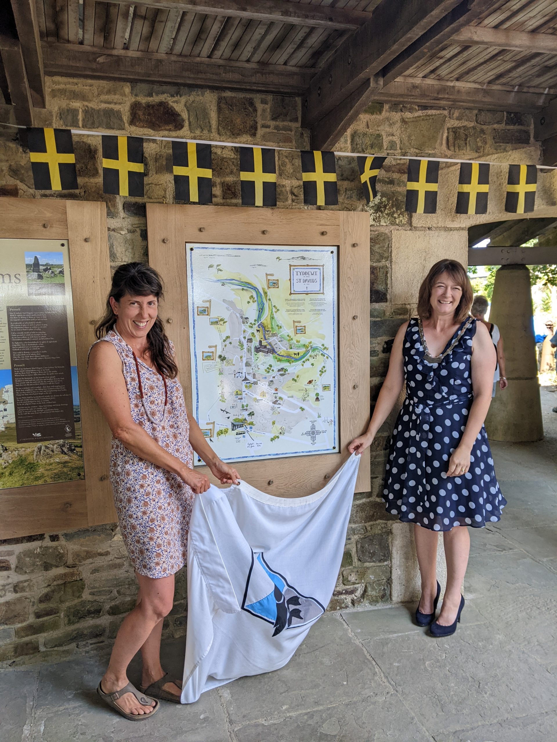
The map was unveiled by artist Hannah Rounding and Deputy Mayor of St Davids, Cllr Emma Evans.
For those who are unable to walk far, there are mobility scooters available to hire from Oriel y Parc and the Celtic Coaster coastal bus, which stops at various popular locations around the St Davids Peninsula, stops just outside the car park at Oriel y Parc.
Oriel y Parc Gallery and Visitor Centre in St Davids is owned and managed by the Pembrokeshire Coast National Park Authority, working in partnership with Amgueddfa Cymru – National Museum Wales.
To find out more about Oriel y Parc, including the range of exhibitions that are on display, visit the Oriel y Parc website, email info@orielyparc.co.uk or call 01437 720392.