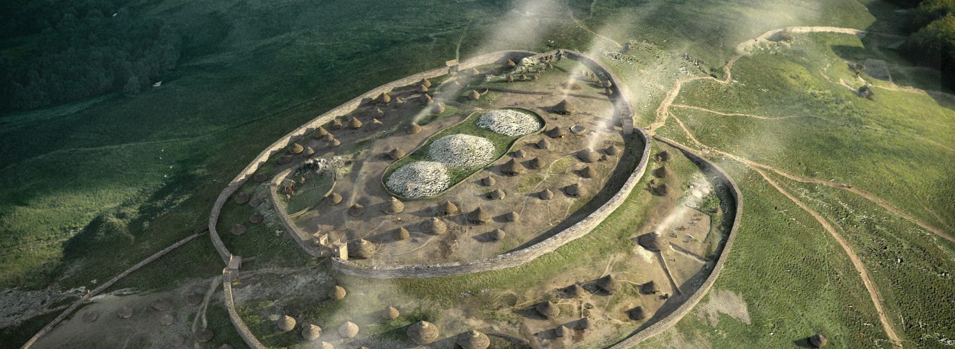
Dominating the skyline just west of Crymych is Foel Drygarn. This steep, sheep grazed hill is topped by rocky outcrops, three Bronze Age burial cairns, and an Iron Age fort with more than 270 hut platforms!
Built around 4,000 years ago and positioned right on the summit, the cairns can be seen from afar. These monuments probably symbolised the influence of a powerful family or group of spiritual leaders over the landscape.
The Iron Age fort was constructed more than a millennium later, around 2,000 – 2,700 years ago. Nevertheless, its occupants seem to have understood and respected the sacred nature of the burial cairns. They chose not to remove stones from the cairns to build their fortifications. They also built a low wall around the burial mounds, keeping them separate from the daily life of the fort.
High banks and stone walls enclosed the Iron Age fort, protecting its roundhouses and storage barns. Click here to view a 360° reconstruction of how the gateway on the northeastern slope might have looked.
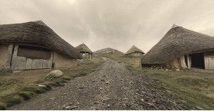
The hillfort would have been a place of residence for local leaders over many generations. People living in the fort spun wool, wove cloth and worked metal. Within the fort they probably traded, held markets, and gathered together for meetings, festivities and rituals. The wider Iron Age community lived close to the land, grazing animals, growing crops, and hunting. They were excellent woodworkers who coppiced oak, ash and hazel trees and made charcoal.
Excavations and Surveys
The only excavation of Foel Drygarn was by an antiquarian named Sabine Baring-Gould. He excavated part of the fort in 1899, finding Iron Age and Romano-British pottery, spindle whorls, whetstones, a shale bangle, pieces of iron, oil lamps and glass beads. These finds are kept at Tenby Museum.
The Royal Commission for Historical Monuments in Wales used aerial photography to record Foel Drygarn’s archaeological features. In low winter light, the shadows of hundreds of roundhouse platforms can be seen.
LiDAR, a method of laser scanning the landscape, has been used to survey Foel Drygarn more recently. For the first time we have a highly detailed 3D digital model of the hill. The LiDAR data has revealed features that were previously unknown. It is also the basis of the reconstruction illustration at the top of the page.
Creative Work by local school children
Our recent interpretation project included visits to Foel Drygarn by two local schools to explore this important archaeological site. The children imagined what life was like in the Iron Age hillfort, and created these artworks and pieces of writing in response.


Protecting our heritage
Foel Drygarn is a scheduled monument. This means it is protected by law, making it illegal to disturb or alter the site. The wider landscape is also a Site of Special Scientific Interest. You can help care for this important archaeological site. If you notice any disturbance or damage on your visit, please report it Dyfed-Powys Police. For further information about Heritage Crime, visit Heritage Watch.