
Page Contents:
Pembrokeshire’s Startegic Scale Projects
SP1 – Use nature-based solutions to improve flooding and water quality
SP2 – Improve Pembrokeshire’s rivers for fish and biodiversity
SP3 – Rebalance urban drainage to improve our rivers
Pembrokeshire’s Strategic Scale Projects
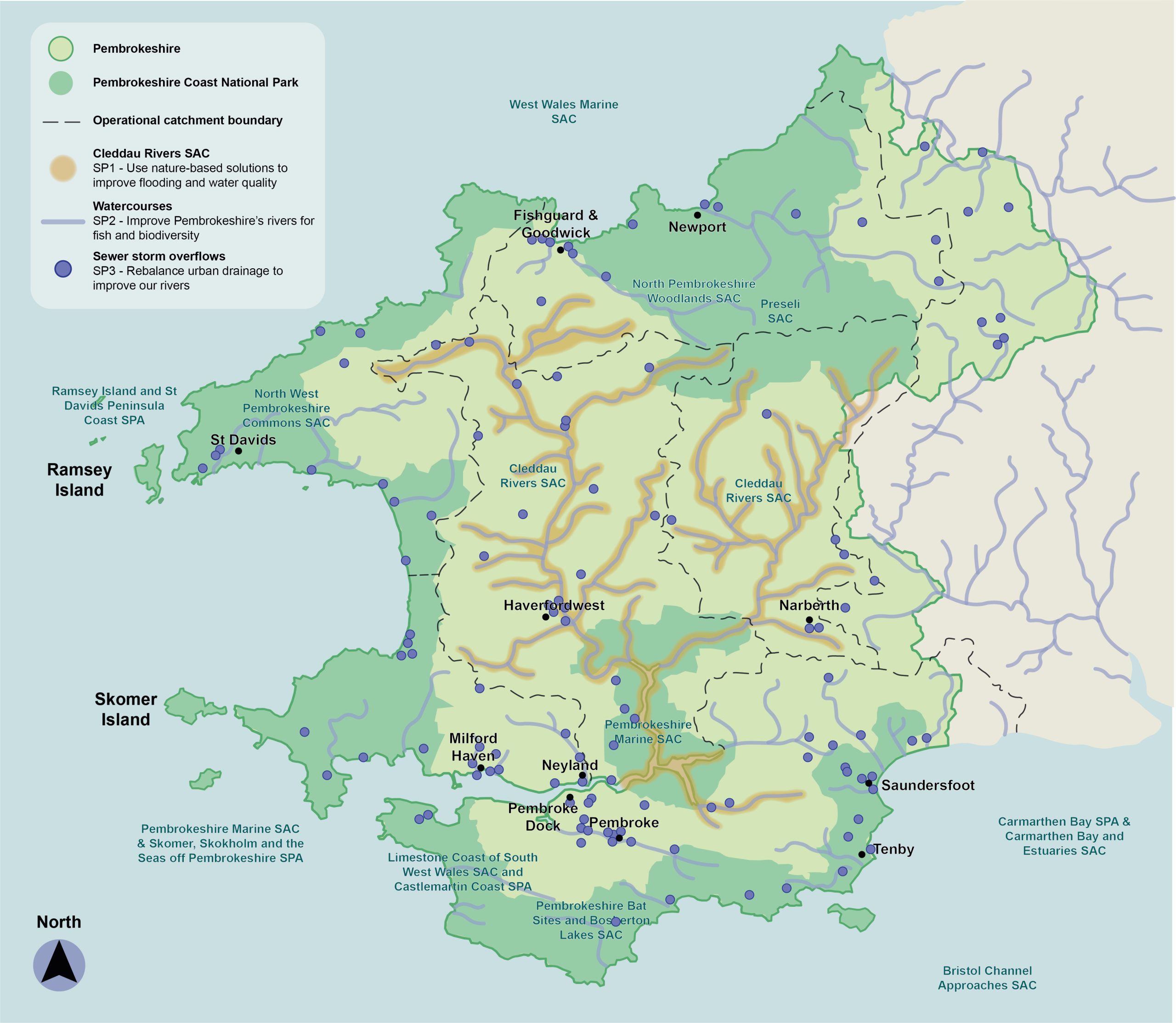
5.1 Three high-level strategic projects have been identified across Pembrokeshire. These are not location-specific but apply across the landscape and catchment scale. These three projects aim to address key pressures facing Pembrokeshire today, including flooding, water quality and biodiversity decline, particularly within Pembrokeshire’s rivers.
Figure 5.1: Overview of Strategic GI Projects in Pembrokeshire
SP1 – Use nature-based solutions to improve flooding and water quality
5.2 Due to historical human interventions, much of the landscape in Pembrokeshire has been altered to aid land drainage. This has involved the use of land drains, field ditches as well as physical alterations to rivers and streams. Land-use practices can adversely impact flood risk, water quality and aquatic environments. As a result, some of Pembrokeshire’s rivers are under threat from water nutrient levels – of particular concern are the Cleddau Rivers, which are protected as Special Areas for Conservation (SAC) and Sites of Special Scientific Interest (SSSI). In order to avoid exacerbating the situation, all new development within the catchments of SAC rivers must demonstrate that they do not increase nutrient loads in the rivers in order to obtain planning permission. This is leading to a crisis in the development industry.
5.3 Simple interventions and alterations to agricultural practices and land-use can make significant improvements to flood risk, resilience and water quality. The following examples are all synergistic with respect to delivering improvements on both fronts – the retention of water within the landscape has the benefit of both reducing nutrient-laden run-off and improving flood resilience.
5.4 Examples of possible interventions include:
- Creating riparian buffer strips, reducing grazing in proximity to watercourses
- Formalising areas of livestock watering, so enabling the erection of fences along watercourse to protect them from bank erosion, bank poaching and manure impact
- Planting of field margins and shelter belts with trees / shrubs to increase water retention within tree and shrub planting
- Use of regenerative farming techniques to minimise ploughing and thus reduce the area and time during which there is bare earth in the landscape
- Creating natural dams within small watercourses, slowing flow and increasing diversity of habitats within the landscape
- Taking land out of intensive agriculture, either through rewilding initiatives, or through amendments to agricultural practices to lessen the nutrient input to the land
5.5 ‘Ecosystem Enterprise Partnership – Building Natural Solutions’ is an existing project, led by the Pembrokeshire Coastal Forum, specifically aimed at unlocking the current impasse in the development industry associated with nutrient loading in rivers. The results of this project have been combined into the Pembrokeshire Nature Partnership Land Use Planning Tool. This maps areas of risk and opportunities in the landscape with respect to nutrient run-off to watercourses. It also enables mapping of areas of opportunity to improve natural management of flooding. These mapping resources should be used to seed a process of identification, prioritisation and delivery of interventions to deliver benefits in the landscape that would improve both flooding resilience and water quality.
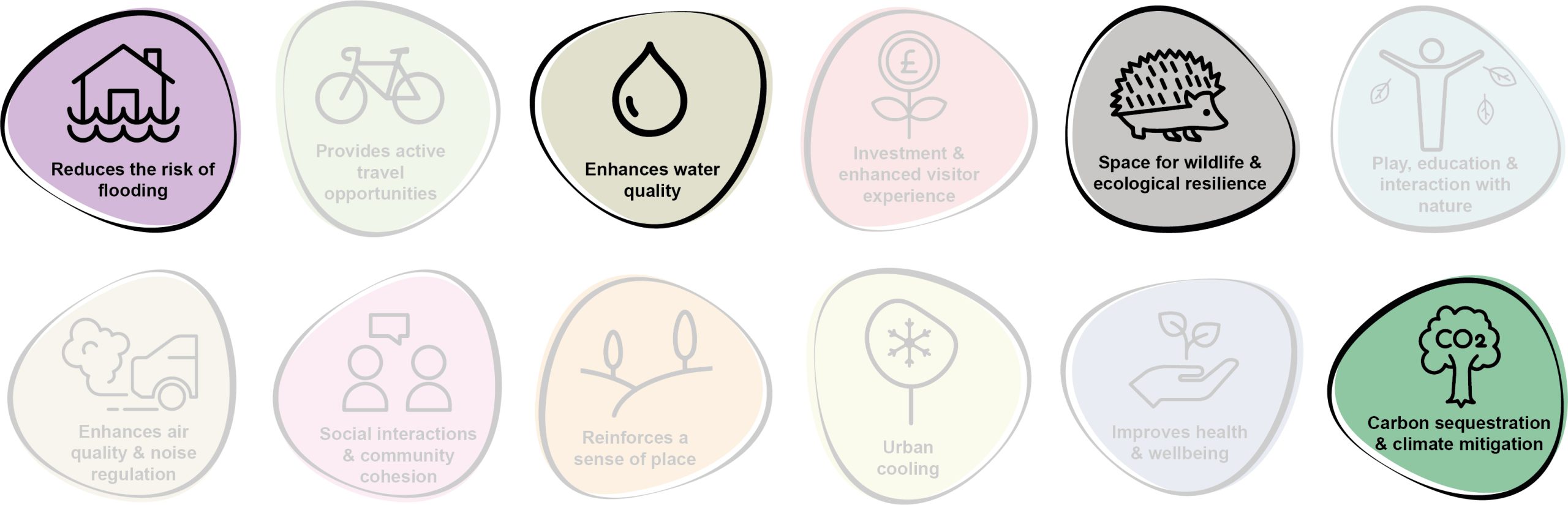
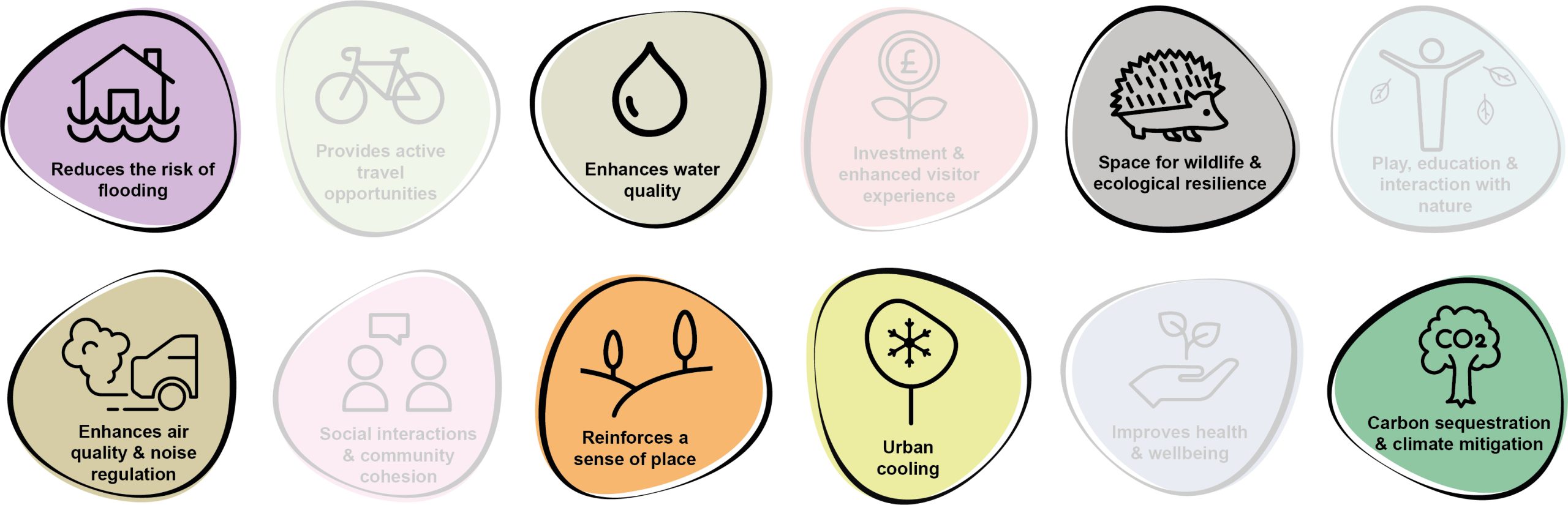
5.6 Benefits of the project, as depicted in Figure 5.2 below, include:
- Reduction of the risk of flooding
- Enhancement of water quality
- Space for wildlife and ecological resilience
- Carbon sequestration and climate mitigation
Figure 5.2: Benefits of the project
Delivery of nature-based solutions and ecosystem services
5.7 Land use management since the Second World War has involved increased drainage of the land, in a drive to maximise the efficiency of farmland. This has led to a reduction in diversity of habitats, and the loss of wetlands, wet-grassland and associated wet terrestrial habitats. It has also increased flood risk, as it increases the speed and volume of water flow down catchments, reducing the buffering effect of the landscape during heavy and prolonged rainfall events. Increased drainage of wet soils also has a detrimental effect on the ability of that soil to sequester carbon. Increased run-off from intensively farmed agricultural land also increases the nutrient loading on rivers and streams.
5.8 Through the use of techniques such as riparian buffer strips, reducing bank erosion and poaching, planting of shelter belts and field margins and the creation of natural dams within small watercourses, the ability of the landscape to absorb and buffer rainfall can be significantly increased. The introduction of regenerative farming practices or low-intensity systems can increase the water retention and carbon sequestration capacity of soils and ecosystems. This would have a concomitant beneficial impact on flood risk, water quality and on tackling climate change.
Delivery Mechanisms
5.9 Significant work has already been undertaken by the Pembrokeshire Coastal Forum and Pembrokeshire Nature Partnership to assimilate data held within the Land Use Planning Tool. The first step for this project would therefore be to forge a relationship with these organisations in order that the next steps can be collaboratively taken forward.
5.10 With project partners in place, it is proposed that the first steps of the project would be twofold:
- To take the existing dataset and use it to cross-correlate against land ownership of project partners and stakeholders, thus providing areas of the county for early-stage intervention projects for which landowner or riparian owner negotiations may be less onerous.
- To undertake a funding scoping exercise, to identify means of funding the project’s expansion from the initial, projects based on stakeholder-owned land to a wider, catchment or county-scale delivery. One option for ongoing funding is a nutrients trading scheme, whereby developers make contributions to a fund that can then be used to fund changes to land-use and agricultural practice that reduce nutrient inputs in the same catchment within which the development is to occur.
5.11 Once areas of key opportunity have been ground-truthed and defined, it would be necessary to engage with landowners and land occupiers / graziers in order to present these opportunities and discuss their impacts on current land-use. This may lead to the loss of some opportunities for reasons of commercial and physical agricultural constraints.
5.12 The proposed physical interventions and amendments to land management could be delivered by the landowners themselves, or by external agricultural contractors.
Potential partners
- Pembrokeshire Coastal Forum
- West Wales Rivers Trust
- Afonydd Cymru
- Natural Resources Wales (NRW)
- Angling clubs and organisations
- Dwr Cymru Welsh Water
- Amber International
- Landowners
Outline cost
£: <250k
5.13 An initial feasibility and prioritisation study as well as delivery of early-stage quick-win small-scale intervention projects would involve limited capital investment. The feasibility of developing a nutrients trading scheme should also be investigated
£££: £1m – £5m
5.14 Subsequent expansion to form a county-wide project with multiple projects would increase costs.
Potential funding opportunities
- UK Community Renewal Fund
- UK Shared Prosperity Fund
- Bespoke scheme to utilise developer contributions to deliver nutrient management projects (nutrient trading scheme)
- Nature Networks Fund (funded by the Welsh Government and administered by the National Lottery Heritage Fund in Wales)
- National Lottery Community Fund
- Local Places for Nature Fund
- NRW grants
- Welsh Water Community Fund
- Ofwat Innovation Fund
- Emerging Welsh Government Sustainable Farming Scheme
- National Forest for Wales – The Woodland Investment Grant (National Lottery Heritage Fund – Round 1)
Timescale
Quick win (<1 year)
5.15 An initial feasibility and prioritisation study, as well as delivery of small scale intervention projects would be relatively straightforward to deliver.
Medium-term (1-5 years)
5.16 Subsequent expansion to county-wide projects would require comprehensive planning, design and consultation.
Potential constraints
5.17 A key constraint for the project would be landowner / occupier / grazier agreements, as there may be a perceived risk to farm viability associated with some loss of land to riparian margins / shelter belts / field margin planting etc. There may also be resistance to alteration of watercourses with respect to land drainage and riparian-owner concerns. These concerns should be countered with the availability of agricultural payments for environmental goods and services, and hence the delayed launch of the Welsh Government’s Sustainable Farming Scheme is a potential constraint in this regard. Initiating a nutrients trading scheme may ameliorate this risk by providing a sustainable, ongoing source of funding.
Maintenance and stewardship
5.18 There may be some initial maintenance required of newly planted river margins, or of newly re-exposed river banks or channels.
5.19 Maintenance of the softworks would be required as part of the 60 month establishment phase, including the replacement of failed trees. If fencing is installed to keep livestock out of watercourses, ongoing maintenance would be required. Changes to farming practices would need to be sustained into the long term, hence financial sustainability of this farming model is key.
Monitoring for success
5.20 Subject to availability of funding, monitoring of the success of the project should be undertaken through simple citizen science, using the existing body of citizen scientists, angling clubs and other stakeholders to help monitor the effect of interventions. Techniques could include monitoring of water quality using simple hand-held equipment, or installation of a simple stream-gauge to monitor streamflow, for example.
5.21 Existing NRW monitoring stations could also provide information on the effects on watercourse flow, river water quality and the response of the watercourse to rainfall events.
Next steps
5.22 Establish a working group with those already undertaking this work in the county – including Pembrokeshire Nature Partnership and Pembrokeshire Coastal Forum.
5.23 Review the state of knowledge in Pembrokeshire catchments and identify areas for further survey in order to inform feasibility and prioritisation work for quick-win projects. This should also for the first stage of a funding scoping exercise.
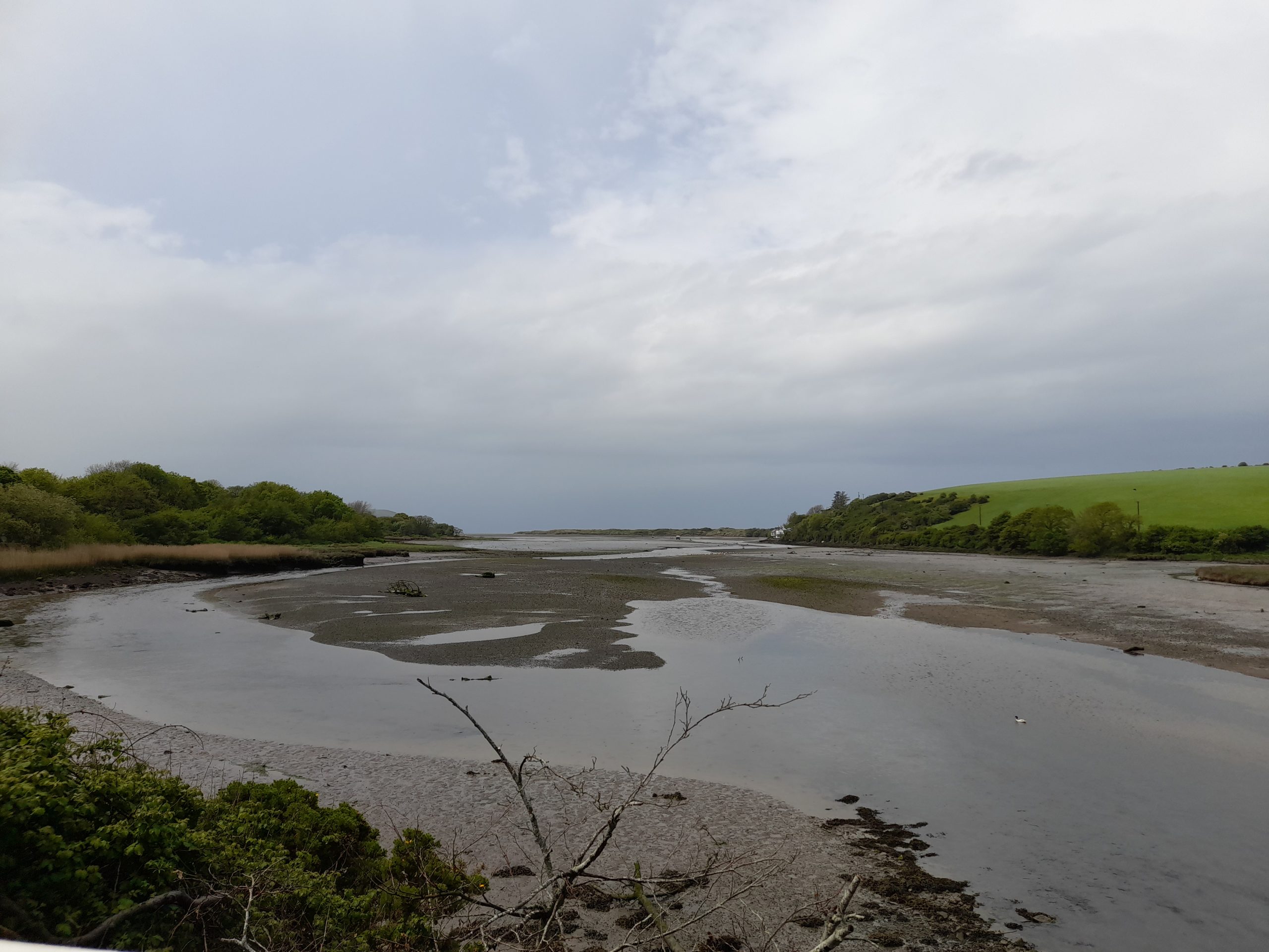
Figure 5.3: Pembrokeshire
SP2 – Improve Pembrokeshire’s rivers for fish and biodiversity
5.24 Human activity has resulted in alterations to the rivers and streams of Pembrokeshire in the past, largely associated with power generation, navigation and flood protection. As a result, many reaches of the county’s rivers and streams are characterised by artificial structures such as weirs, dams, sluices or constrained within hard structures such as culverts and river walls. These structures can provide a barrier to the movement of aquatic species, and specifically fish migration. This affects species such as salmon and sewin, eel and lamprey. They can also be detrimental to other species and habitats, including otter. Many structures that were intended to improve the environment, have inadvertently had an adverse effect on these habitats and resulted in increased flood risk.
5.25 Afonydd Cymru and Swansea University have embarked on a project, Reconnecting the Salmon Rivers Of Wales, aimed at removing 17 barriers to fish migration across Wales, including some in Pembrokeshire on the Western and Eastern Cleddau. The opportunity exists to build on this project to explore the potential for further improvements to rivers and streams across Pembrokeshire. Through their Barrier Atlas and Barrier App, Amber International has mobilised citizen scientists to map barriers on rivers across Europe. Their focus is primarily in the Balkans and Eastern Europe, however, their work also extends across Wales. The Barrier Atlas lists at least 30 barriers (weirs, dams or sluices) on watercourses in the county, and there are many stretches of culverted and walled sections of rivers and streams that could benefit from the use of soft engineering and other nature-based solutions to improve habitat, reduce barriers to fish migration and potentially improve downstream flood risk.
5.26 This project would build on the body of evidence already collected and held by the West Wales Rivers Trust, Afonydd Cymru, Natural Resources Wales (NRW) and others to compile a county atlas of barriers and structures within and along watercourses. It would then utilise this historical work, plus new assessments where necessary, to provide the basis for prioritisation of interventions based on need, deliverability and cost. Proposals should then be taken forward for practical delivery of improvements in high priority, or quick-win areas and / or to compile bids for funding for more significant channel improvements.
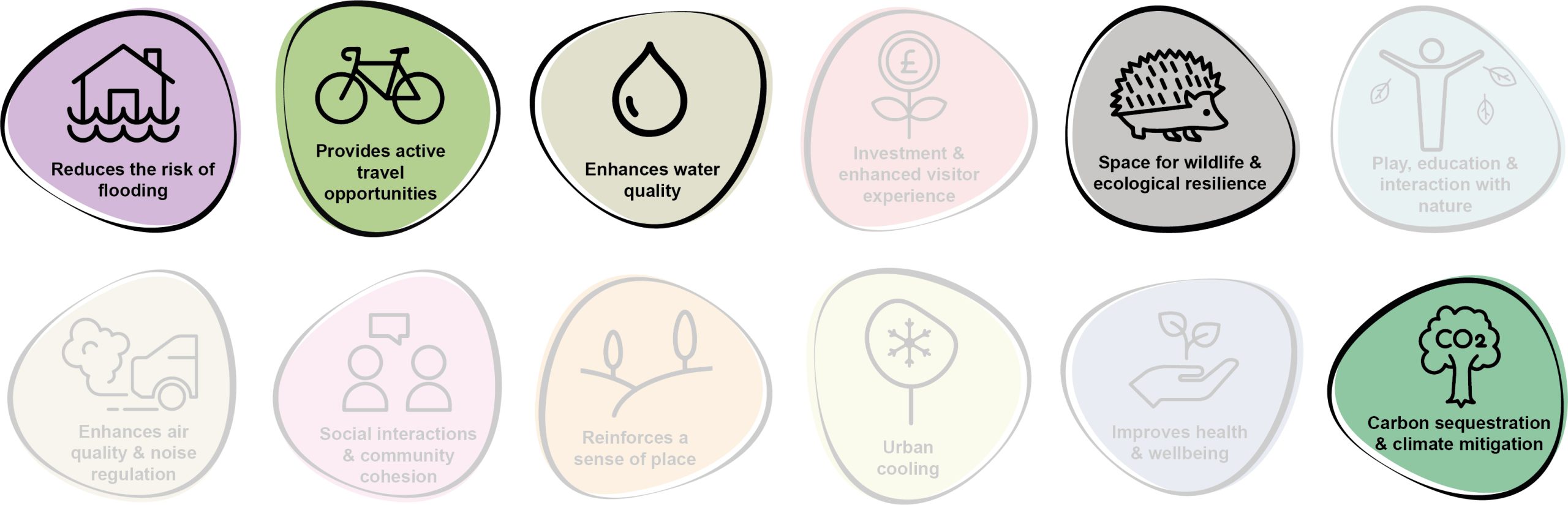
5.27 Benefits of the project, as depicted in Figure 5.4 below, include:
- Reduction of the risk of flooding
- Provision of active travel opportunities
- Enhancement of water quality
- Space for wildlife and ecological resilience
- Carbon sequestration and climate mitigation
Figure 5.4: Benefits of the project
Delivery of nature-based solutions and ecosystem services
5.28 At present, migratory fish species are under pressure from a number of factors. Barriers to migration are a significant issue within the county, which can be addressed through their removal or alternatively by retrofitting these barriers with suitable alternative routes for aquatic life. Replacement of hard engineered structures with planted margins and natural banks – reconnecting the watercourse with its surrounds – would provide an increased variety of habitats both within the watercourse and on the banks. More resilient ecosystems can in turn deliver increased ecosystem services, in terms of climate resilience and increased value for leisure and amenity (for example through improved fish stocks).
5.29 Whilst hard engineering would remain part of the toolbox to manage human interaction within our rivers and streams, there is increasing recognition that aims of protecting and enhancing biodiversity, and of reducing flood risk require approaches that work with, rather than seek to constrain, natural processes. Many of the structures within Pembrokeshire’s rivers and streams have a detrimental effect on flood risk downstream, particularly where stretches are culverted, straightened and canalised. Reconnecting river stretches with their banks and floodplains would help deliver a nature-based approach to flood management.
Delivery mechanisms
5.30 Work already undertaken by West Wales Rivers Trust, Afonydd Cymru and NRW has provided some of the feasibility and prioritisation work, but it is envisaged that further desk based work and ground truthing would be required in order to inform a study that can be used to prioritise areas for intervention and identify areas where the combination of scale of project and stakeholder cooperation can enable quick-wins.
5.31 Possible interventions may include relatively simple works to remove small scale barriers such as debris dams and sluices or river wall sections. However, more complex engineering works would involve the removal of larger weirs or fish passage retrofitting. Smaller projects may be achievable within the scope of initial funding, with larger projects anticipated to require seed funding through this project in order to gain momentum and form separate, standalone projects.
Potential partners
- West Wales Rivers Trust
- Afonydd Cymru
- NRW
- Angling clubs and organisations
- Dwr Cymru Welsh Water
- Amber International
- Landowners
Outline cost
5.32 An initial feasibility and prioritisation study, as well as delivery of early-stage quick-win barrier removal / bank rewilding / structure removal projects would need limited capital investment. However, subsequent larger-scale barrier removal / bank rewilding / structure removal projects would require substantial funding.
Potential funding opportunities
- Nature Networks Fund (funded by the Welsh Government and administered by the National Lottery Heritage Fund in Wales)
- National Lottery Community Fund
- Local Places for Nature Fund
- NRW grants
- Dwr Cymru Welsh Water Community Fund
- Ofwat Innovation Fund
- Emerging Welsh Government Sustainable Farming Scheme
Timescale
Quick win (<1 year)
5.33 An initial feasibility and prioritisation study, as well as delivery of early-stage quick-win barrier removal / bank rewilding / structure removal projects would be relatively straightforward to deliver.
Medium-term (1-5 years)
5.34 Subsequent larger-scale barrier removal / bank rewilding / structure removal projects would require comprehensive planning, design and consultation.
Potential constraints
5.35 Initial constraints are limited to the availability of existing data and existing studies on barriers, structures and engineered banks from existing projects – it is hoped that this would be made available by partner organisations to help seed the project.
5.36 Constraints regarding delivery would largely be associated with the need for landowner involvement and consent. For structures on larger rivers, there may also be a requirement for planning permission, Flood Risk Activity Permit and hydrological modelling.
Maintenance and stewardship
5.37 There may be some initial maintenance required of newly planted river margins, or of newly re-exposed river banks or channels.
Monitoring for success
5.38 Utilise the existing body of citizen scientists, angling clubs and other stakeholders to help monitor the effect of interventions. Existing NRW monitoring stations may also provide information on the effects on watercourse flow, river water quality and the response of the watercourse to rainfall events.
Next steps
5.39 Establish a working group with those already undertaking this work in the county – West Wales Rivers Trust, Afonydd Cymru, Swansea University and others.
5.40 Review the state of knowledge in Pembrokeshire catchments and identify areas for further survey in order to inform feasibility and prioritisation work.
Figure 5.5: Pembrokeshire
SP3 – Rebalance urban drainage to improve our rivers
5.41 Pembrokeshire has suffered from twin issues in the past, in the form of surface water flooding events and also incidents where foul sewage has overflowed and resulted in flooding (known as Combined Storm Overflows (CSOs)). These overflows originate from increased pressure on sewer systems due to the input of storm water to old sewage systems that take both rainwater and foul effluent. Large areas of impermeable land use, drained directly via pipes into the sewers and then rivers, exacerbate both of these issues. Implementation of Sustainable Drainage Systems (SuDS) interventions which divert storm water from combined sewers could reduce pressure on infrastructure, helping to reduce fluvial influence in times of flooding.
5.42 Examples of SuDS that should be delivered on a site-specific basis include:
- Utilisation of street tree planting within tree pits, which are fed by storm sewer runs, thus taking water out of the wider sewer system
- Identification of areas where surface water (historic streams, ditches and land drains) enters combined sewers and feeds into watercourses or soakaways
- Identification of areas where storm sewer flow can be drained to ground in soakaways
- Creation of wetlands, rain gardens, swales, attenuation basins and other features into which stormwater can be fed, providing a means of slowing flow during rainfall events and lessening rapid flow towards streams and rivers
- Identification of areas where stormwater sewers discharge to sewers which carry foul effluent, capturing this discharge and carrying it to soakaways, rain gardens, swales, attenuation basins or watercourses thus reducing the risk of combined storm overflows
- Retrofitting of areas with a high percentage of impermeable cover with permeable paving, swales and rain gardens
5.43 Dwr Cymru Welsh Water has undertaken work to map areas of high impermeable cover, including known points where surface water enters sewers which carry foul effluent. Detailed records of combined storm overflow events have been assimilated, providing indicators of areas where surface water flows are affecting the performance of the foul sewerage infrastructure. These datasets, combined with flood risk mapping, should be leveraged to help identify areas where SuDS interventions might be best targeted across the county. A series of priority pilot projects should be identified based on the need for intervention and on the feasibility of delivery. An options appraisal for priority projects would identify possible SuDS opportunities for delivery.
5.44 Benefits of the project, as depicted below in Figure 5.6, include:
- Reduction of the risk of flooding
- Enhancement of water quality
- Space for wildlife and ecological resilience
- Enhancement of air quality and noise regulation
- Reinforcement of a sense of place
- Urban cooling
- Carbon sequestration and climate mitigation
Figure 5.6: Benefits of the project
Delivery of nature-based solutions and ecosystem services
5.45 SuDS interventions mimic drainage in nature where precipitation is absorbed into the ground, slowed by vegetation. The quantity and quality of water that ends of up in local watercourses is therefore improved, helping to alleviate flooding and reduce CSOs. Sustainable management of water in urban areas also ensures towns are more resilient to the pressures of climate change and population growth.
Delivery mechanisms
5.46 Performance improvements with respect to CSOs form part of the obligations of Dwr Cymru Welsh Water in order to provide ongoing environmental improvement. Responsibility for stormwater sewerage sits with Dwr Cymru Welsh Water or the Local Authority and so partnership would be necessary for successful delivery of the project. An example of such a partnership working well is the Rainscape Project in Llanelli.
5.47 Existing datasets relating to the sewer infrastructure should be collated and combined to create a SuDS risks and opportunities map. Data from both Dwr Cymru Welsh Water and Pembrokeshire County Council (PCC) would be required. A ranking process should be undertaken to create a list of priority pilot projects, where the potential delivery benefits of SuDS retrofitting to the sewer infrastructure are ascertained.
5.48 This should then be progressed to an options appraisal process for each priority pilot project, assessing which SuDS intervention(s) should be progressed.
Potential partners
- Dwr Cymru Welsh Water
- PCC Highways and Transport Department
- PCC StreetCare / Amenity Maintenance Team
- Property owners / landlords / freeholders (where opportunities exist on large industrial or retail parks, for example)
- West Wales Rivers Trust and Afonydd Cymru
- Natural Resources Wales (NRW)
Outline cost
5.49 The risk and opportunity mapping, listing priority pilot projects and options appraisal would be relatively low cost. However, the delivery of SuDS retro-fitting would require significant capital investment, dependent on the scale and number of interventions.
Potential funding opportunities
- Dwr Cymru Welsh Water funding
- UK Community Renewal Fund
- UK Shared Prosperity Fund
- Nature Networks Fund (funded by the Welsh Government and administered by the National Lottery Heritage Fund in Wales)
- National Lottery Community Fund
- Local Places for Nature Fund
- NRW grants
- Ofwat Innovation Fund
Timescale
Quick win (<1 year)
5.50 The risk and opportunity mapping, listing priority pilot projects and options appraisal would be relatively straightforward to deliver.
Medium-term (1-5 years)
5.51 Subsequent delivery of SuDS retro-fitting would require comprehensive planning, design and consultation.
Potential constraints
5.52 Cooperation with Dwr Cymru Welsh Water would be vital to the successful delivery of this project, so early buy-in would be crucial. Constraints thereafter would be focussed on the physical deliverability of retrofit solutions in often tightly laid out urban centres, amongst the myriad of above and below ground constraints.
Maintenance and stewardship
5.53 All SuDS interventions would result in an element of maintenance over their lifetime (decades). It is anticipated that these features would be adopted by either Dwr Cymru Welsh Water or PCC and become part of their ongoing asset register for maintenance and upkeep.
Monitoring for success
5.54 Subject to availability of funding, monitoring of the success of the project could be undertaken through simple citizen science, using the existing body of citizen scientists, angling clubs and other stakeholders to help monitor the effectiveness of interventions. Techniques could include monitoring of water quality using simple hand-held equipment, or installation of a simple stream-gauge to monitor streamflow.
5.55 Existing NRW monitoring stations would also provide information relating to the effects on watercourse flow, river water quality as well as the watercourse’s response to rainfall events.
Next steps
5.56 Establish a collaboration agreement or similar with Dwr Cymru Welsh Water.
5.57 Gather the various datasets already compiled by both Dwr Cymru Welsh Water and PCC into a combined digital dataset from which the risks, opportunities and options appraisal processes should be based.
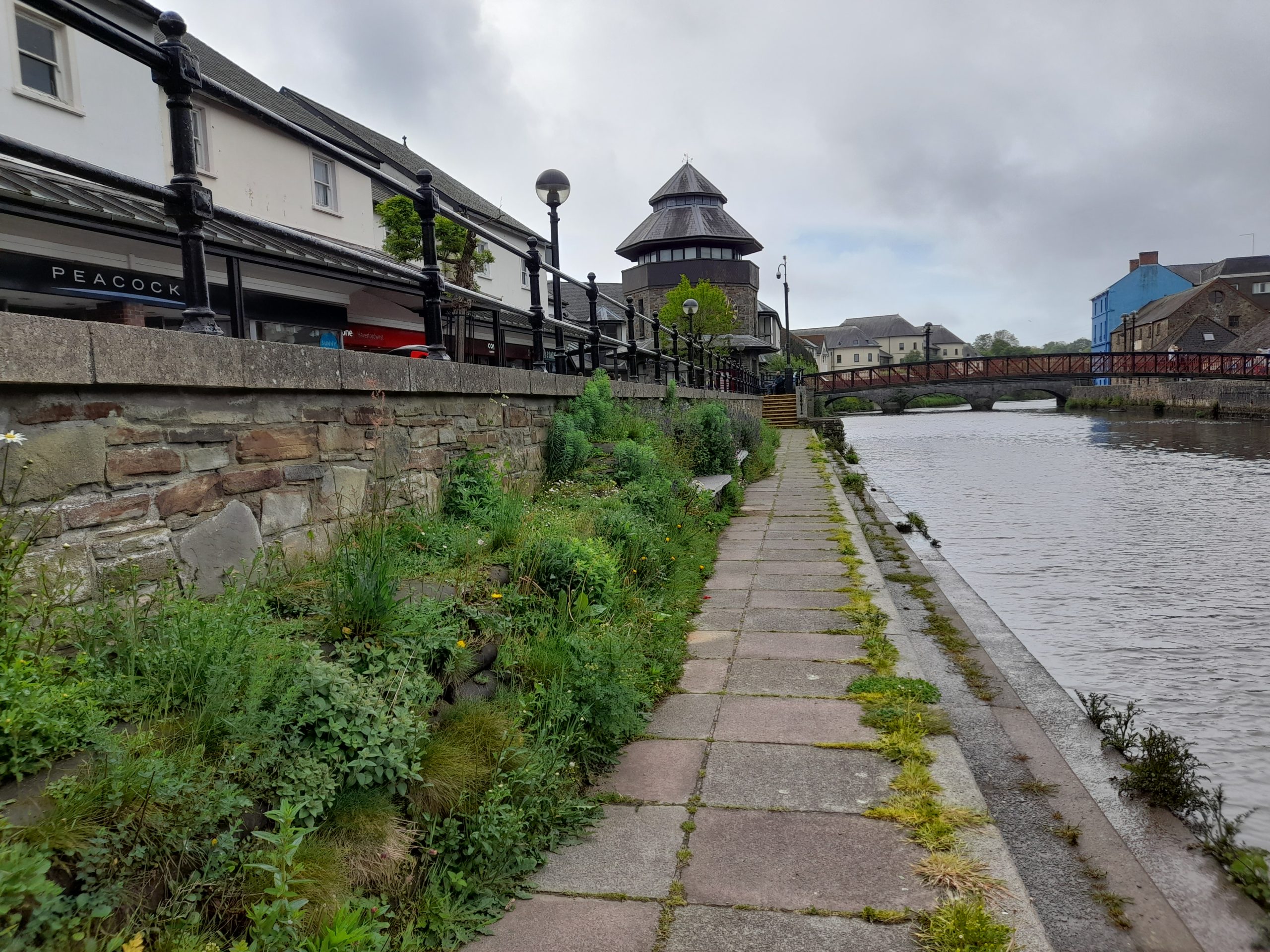
Figure 5.7: Pembrokeshire
Previous Chapter:
Pembrokeshire’s Strategic Green Infrastructure
Return to homepage:
Homepage