Page Contents:
A Portrait of Saundersfoot’s Green Infrastructure
Saundersfoot
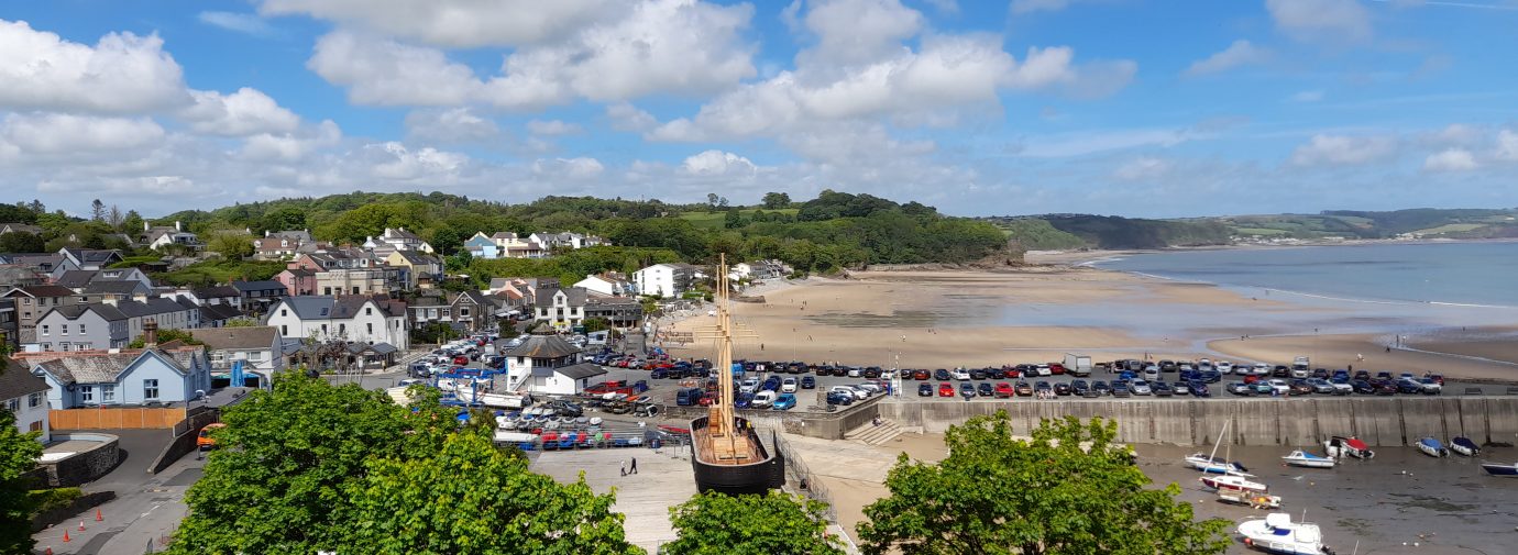
Figure 10.1: Saundersfoot
A Portrait of Saundersfoot’s Green Infrastructure
10.1 Saundersfoot is a large village on the south eastern coast of Pembrokeshire, with a population of over 3,000 and located within the Pembrokeshire Coast National Park. A relatively low-lying coastal settlement with medieval origins, the Saundersfoot Conservation Area lies at the eastern edge of the town and contains numerous listed cottages and buildings with maritime characteristics. There is modern tourism development along the coast as well, partially owing to the popular Saundersfoot Beach and Coppet Hall Beach. The marine environment around Saundersfoot is internationally recognised for its ecological value through the Carmarthen Bay Special Protection Area (SPA), and the Carmarthen Bay and Estuaries / Bristol Channel Approaches Special Area of Conservation (SAC) designations. The area is also nationally recognised through the Waterwynch Bay to Saundersfoot Harbour Site of Special Scientific Interest (SSSI) and Saundersfoot – Telpyn Coast SSSI designations.
10.2 Areas of public open space are relatively limited within Saundersfoot, with the beaches and Pembrokeshire Coast Path providing the most significant recreation asset for visitors and tourists. National Cycle Network (NCN) route 4 also passes north-south through the town. A somewhat fragmented network of Public Rights of Way (PRoW) exists in the western residential neighbourhoods of Saundersfoot, with few direct connections to the coast or into the wider Pembrokeshire Coast National Park. The Incline, a Scheduled Monument and public footpath, could be better integrated into the existing network of public rights of way to improve connectivity between the western and eastern sides of town.
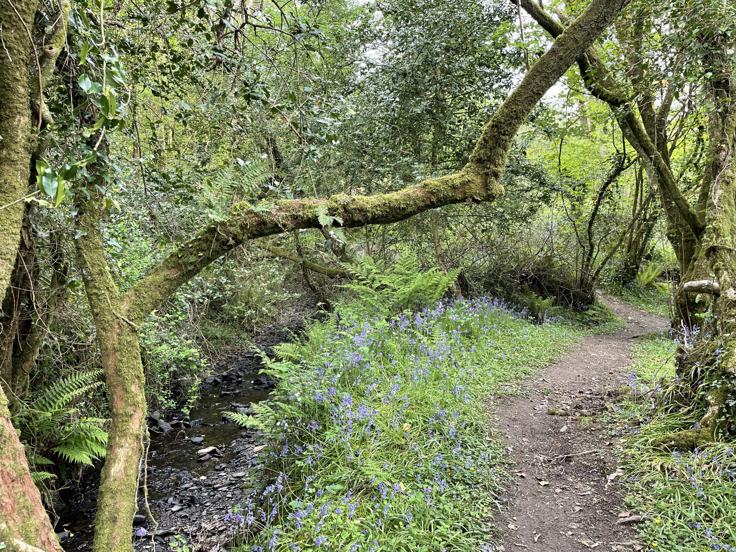
10.3 Dense areas of woodland, frequently ancient, cover areas of Saundersfoot and the surrounding countryside, including at Rhode Wood to the south and The Plantation. Meandering belts of woodland following river valleys extend from King George’s Field and separate the northern and southern residential areas of Saundersfoot. These woodland corridors offer opportunities to create connections for wildlife and people between the densely settled coastal zone in the east to the rural landscape in the west.
Figure 10.2: GI Opportunities within Saundersfoot
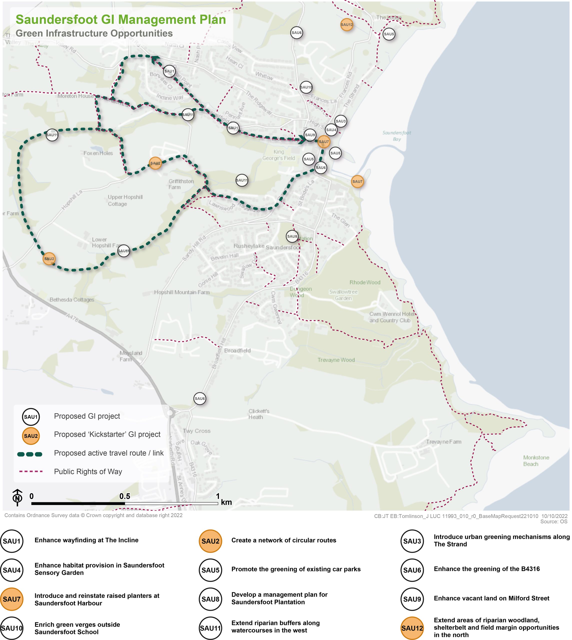
Kickstarter Projects
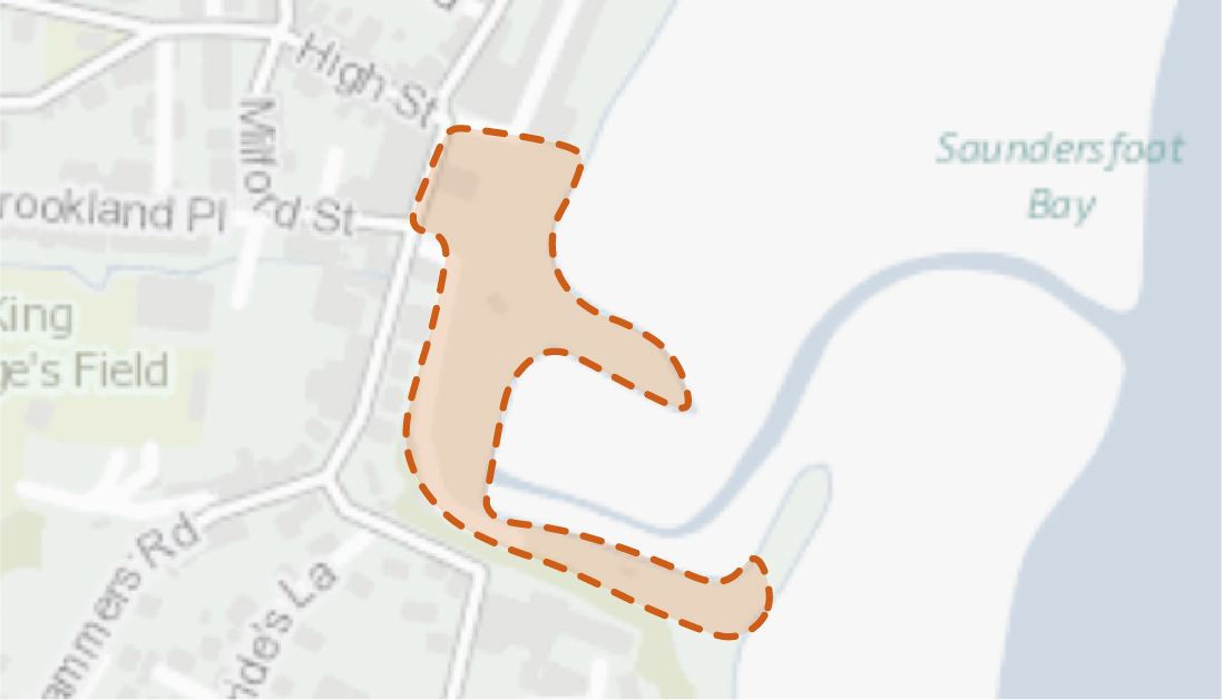
SAU2 – Create a network of circular routes
10.4 The opportunity exists to create a series of promoted circular walks to the west of Saundersfoot, helping to connect visitors and residents to the wider Pembrokeshire Coast National Park landscape, whilst also promoting active lifestyles. The settlement currently boasts a network of Public Rights of Way (PRoW) which offer a range of walking opportunities, including a bridleway accommodated on Moreton Lane with adjoining public footpaths radiating along its route. This project, therefore, proposes the utilisation of these existing routes, supplemented with new paths to create attractive circuitous routes which facilitate interactions with nature. The existing public footpath at The Incline, the former route of a tramroad incline formation, should also be incorporated within the proposals to provide a hierarchy of circuitous routes. The design of these routes offers the opportunity to promote accessibility and inclusivity for a range of users, including walkers and wheelchair users.
10.5 The establishment of these circuitous routes would enhance the recreational offer at both the local and strategic scale. The potential integration of a range of robust, low maintenance street furniture, interpretation, signage and incidental natural play features along the routes would also help to enhance their recreational offer. However, the creation of any new sections of PRoW would require an assessment of the natural habitat to determine if the introduction of public access is sustainable and should be promoted. Potential conflicts between biodiversity and recreational access opportunities would need to be assessed. Consideration should be given to the introduction of a ‘code of conduct’ for appropriate behaviour on ecologically sensitive sections of the route to help encourage more responsible recreation.
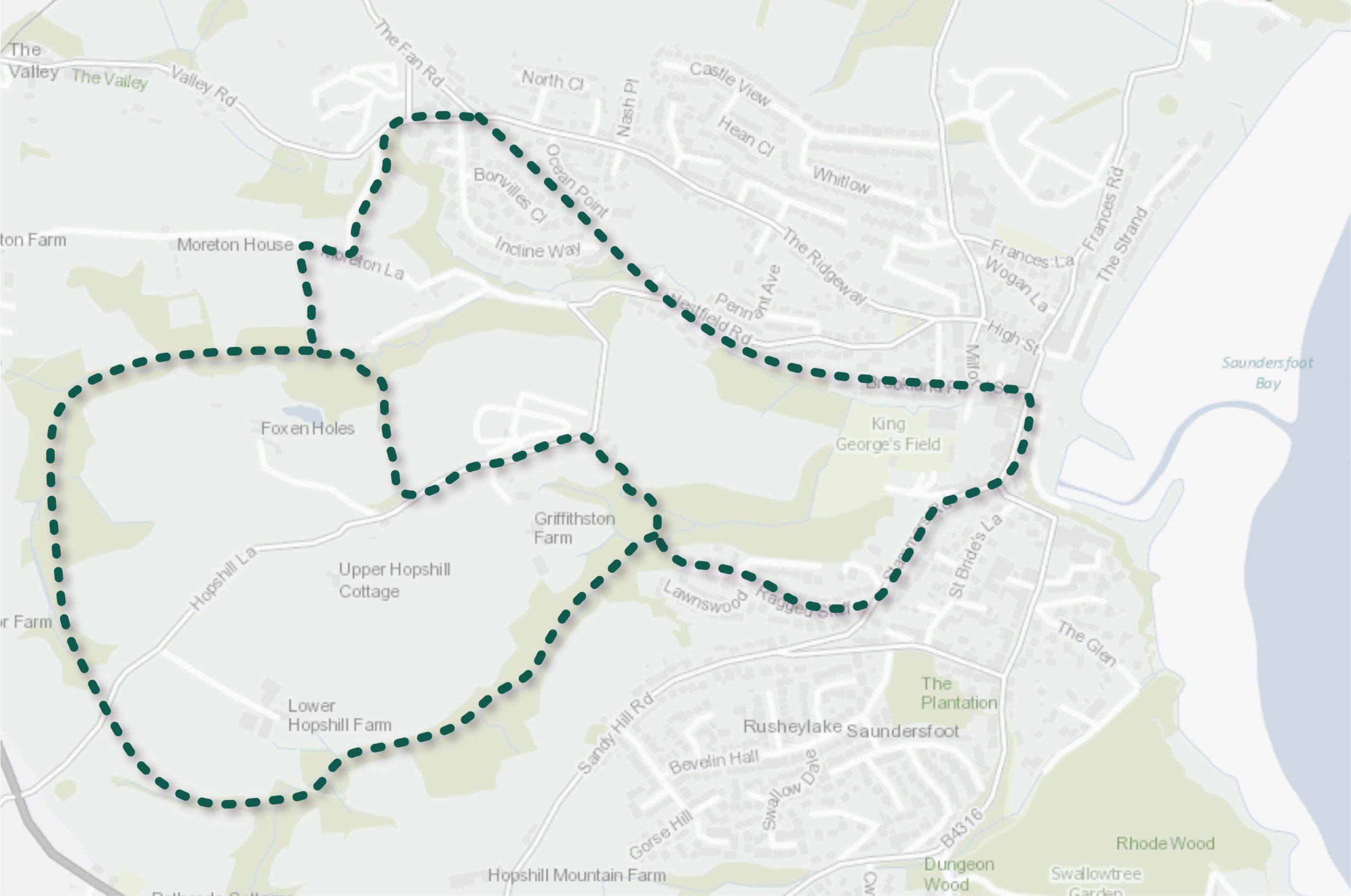
Figure 10.3: SAU2
Benefits of the project
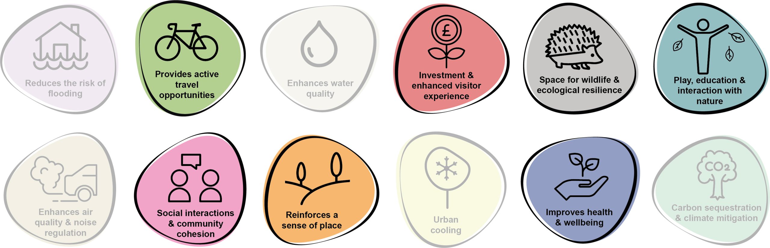
10.6 Benefits of the project, as depicted in Figure 10.4 below, include:
- Provides active travel opportunities
- Investment & enhanced visitor experience
- Space for wildlife and ecological resilience
- Play, education and interaction with nature
- Social interaction and community cohesion
- Reinforces a sense of place
- Improves health and wellbeing
- Carbon sequestration & climate mitigation
Figure 10.4: Benefits
Delivery mechanisms
10.7 A grant application would be required to secure funding for the capital works, including the production of promotional material, street furniture and signage, associated with this project.
10.8 However, significant external funding and allocation of staff resource would be required if new sections of PRoW were required to deliver the project. The project would need to be underpinned by cooperative landowners and a sustainability assessment to determine the appropriateness of introducing public access.
Potential partners
- Pembrokeshire Coast National Authority (PCNPA);
- Landowners; and
- Natural Resources Wales
Outline cost
10.9 The costs of the project would be dependent on the degree to which the proposed route alignments would re-use the existing PRoW network as well as the extent of proposed street furniture and associated signage.
Potential funding opportunities
- PCNPA
Timescale
10.10 The timescales for the implementation of proposals which involve the re-use of existing PRoW to create circuitous recreational routes would be short to medium term in duration. However, where the designation of new PRoW is required, this would be more onerous and longer term.
Potential constraints
10.11 If the project re-uses existing PRoW, securing the necessary funds for delivery of the project and ensuring community buy-in would form the principal constraints.
10.12 If the project creates new sections of PRoW, this would likely be complex, with competing demands. This includes the requirement for significant external funding and liaison with local landowners to ensure buy-in on privately owned land. It would be necessary to engage with landowners and land occupiers in order to present these opportunities and discuss their impacts on current land-use. However, a key unknown for the project would be the time needed to gain these landowner consents.
10.13 The project may also require localised vegetation clearance along some sections of the route. This would need to be undertaken to avoid the bird nesting season and in liaison with an ecologist or Ecological Clerk of Works (ECoW).
Maintenance and stewardship
10.14 Ongoing annual maintenance of the hard surfacing of the routes would be required to ensure access is maintained throughout the year. Landscape management works would also be required to ensure the retention of sightlines across the route.
Monitoring for success
10.15 The opportunity exists to install sensors or counters to monitor the usage of the routes as part of the wider active travel network within the county.
Next steps
10.16 Engage with the PCNPA to ascertain appetite and budget to progress with an assessment, feasibility study and optioneering exercise to identify the proposed network of circuitous routes.
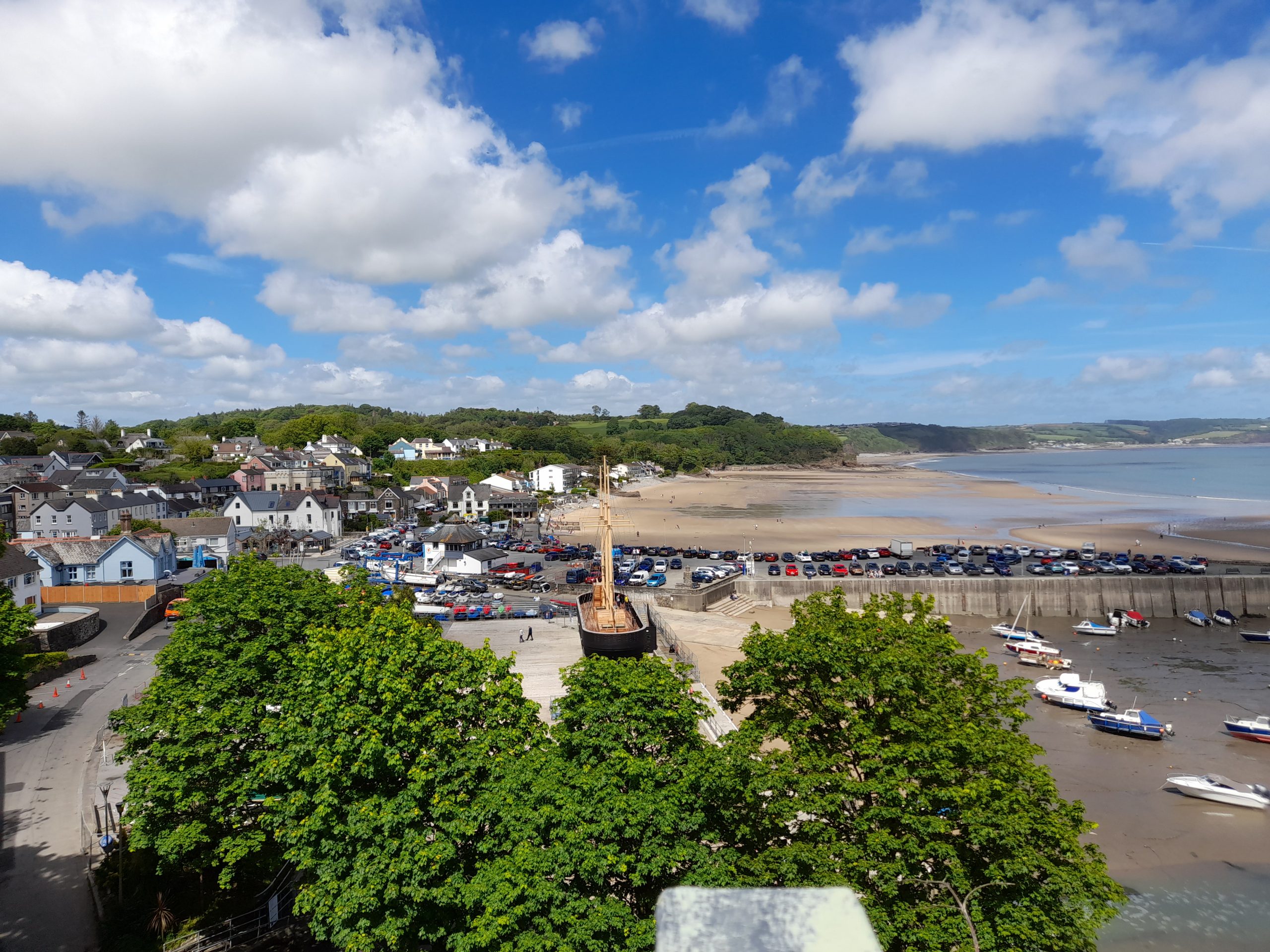
Figure 10.5: Saundersfoot
SAU 7 – Introduce and reinstate raised planters at Saundersfoot Harbour
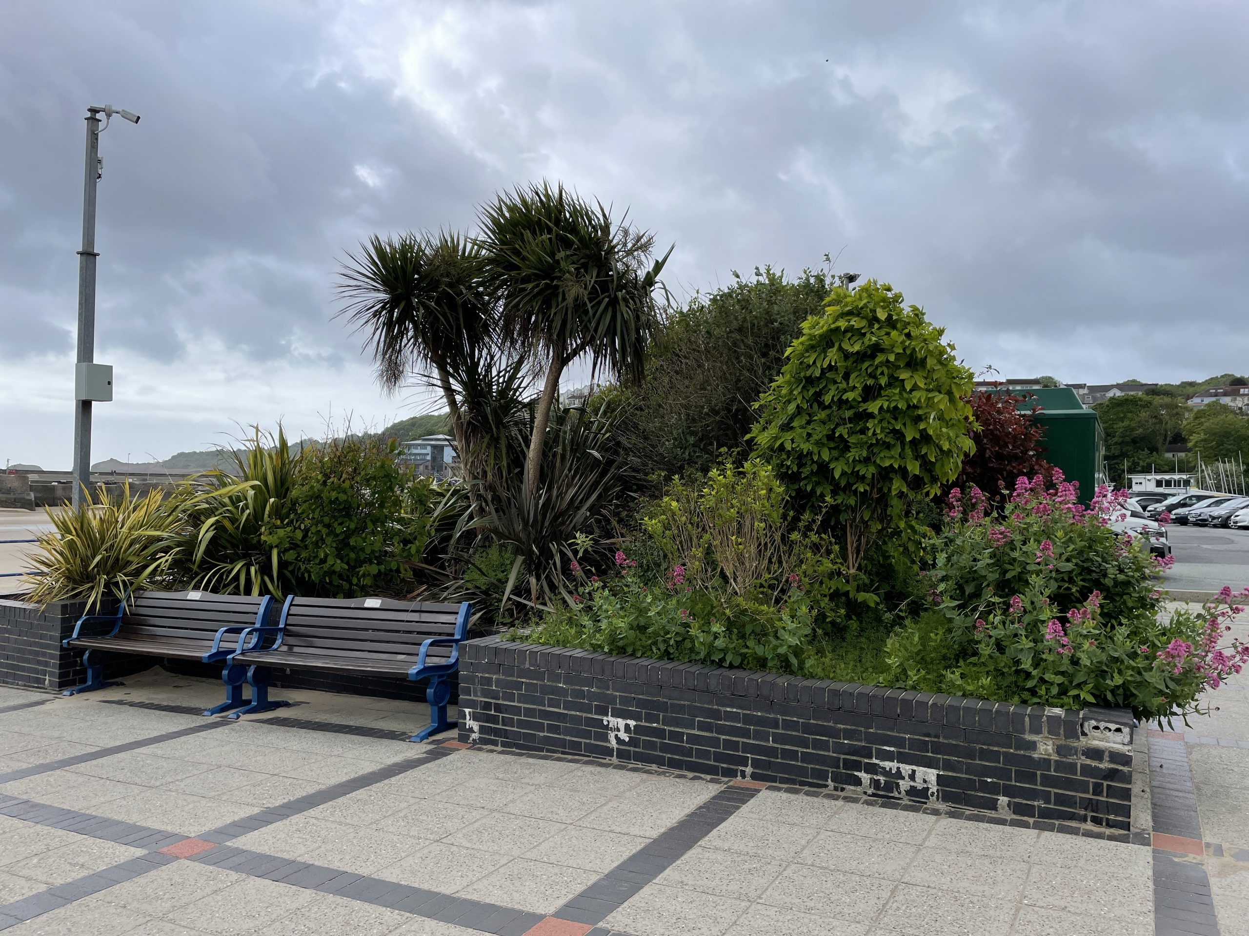
10.17 Ocean Square would benefit from the addition of raised planters along Saundersfoot Harbour towards the Wales International Coastal Centre, broadly following the alignment of the existing cycle route. This should be coupled with re-planting the existing raised brick planters next to the car park with native, salt-tolerant perennials to attract pollinators. Additional tree planting should also be considered in areas of hard landscape to delineate key entrances to the harbour (e.g. from The Strand / High Street entrance). This would complement the existing planters on Stammers Road. These planters should be maintained with native nectar rich flowers.
10.18 As much of Saundersfoot Harbour falls within Flood Zones 2 and 3, the planters could also function as Sustainable Drainage Systems (SuDS). Rain garden planters provide appealing adaptation features which can be used to regulate surface water flows and reduce surface water flood risk. Rain garden planters utilise rainwater that can be diverted directly into the planter where the soil absorbs and stores the rainwater for the plants to use, known as bioretention.
10.19 Signage should be used to communicate the function of the planters and help raise awareness regarding the importance of pollinators.
Figure 10.6: SAU7
Benefits of the project
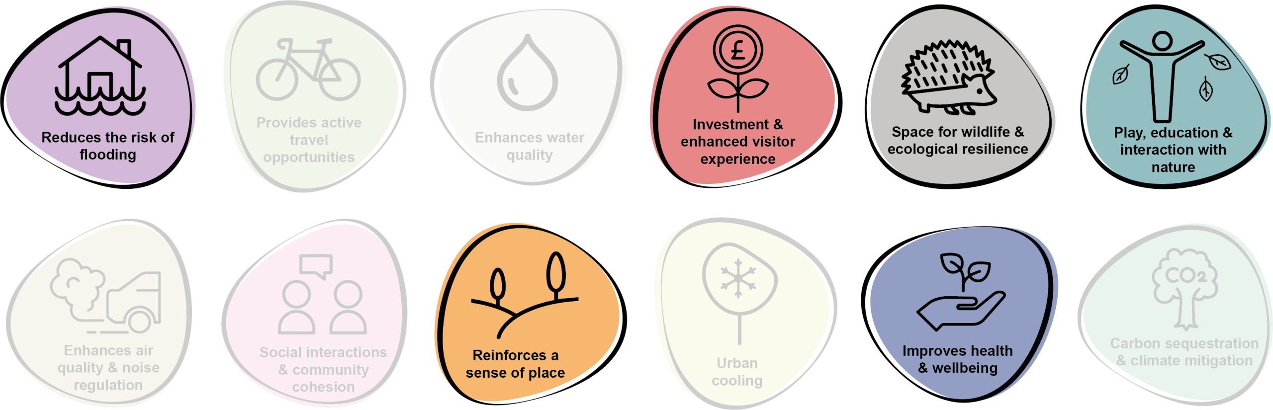
10.20 Benefits of the project, as depicted in Figure 10.7 below, include:
- Reduces the risk of flooding
- Investment & enhanced visitor experience
- Space for wildlife and ecological resilience
- Play, education and interaction with nature
- Reinforces a sense of place
- Improves health and wellbeing
Figure 10.7: Benefits
Delivery mechanisms
10.21 Planters and hanging baskets should be delivered in accordance with the delivery section of the Pollinator Strategy. Local businesses along Saundersfoot Harbour may be interested in sponsoring planters outside their shops in return for advertising or promotion.
Potential partners
- Pembrokeshire County Council (PCC) StreetCare / Amenity Maintenance Team
- Local businesses
Outline cost
Low cost= <£250k
10.22 The capital expenditure required for raised planters is relatively low. However, rain garden planters would be more expensive but provide additional benefits and potential savings in mitigating surface water damage.
Potential funding opportunities
- Local Places for Nature Fund
- Sponsorship from local businesses
Timescale
Quick win = <1 year
10.23 Projects could be implemented on the ground almost immediately.
Potential constraints
10.24 For the planters to successfully establish, maintenance would be required. Without this they may become visually unappealing and lose community support. As the planters would be located in public locations, they may also be disturbed or damaged by antisocial behaviour.
Maintenance and stewardship
10.25 Throughout the spring and summer, planters should be watered daily. When plants are in flower they may benefit from a high potassium liquid feed fortnightly. Containers or pots should have good drainage to prevent waterlogging. To prevent plants getting too wet and cold over winter, they should be raised slightly off the ground and placed against the shelter of a wall. Local businesses or homeowners within closest proximity to the planters could be engaged to assist with this maintenance.
Monitoring for success
10.26 The success of the planters could be recorded by the number of pollinating insects they attract and the diversity of species. The Flower-Insect Timed Counts (FIT Counts) methodology has been developed by the UK Pollinator Monitoring Scheme. This involves counting the insects visiting one of the 14 flower species target flowers within a 50cm by 50cm square patch for 10 minutes in good weather. Local people could partake in this as a citizen science programme.
10.27 Success could also be monitored by recording how many additional planters have been installed by local residents or businesses.
Next steps
10.28 Review the delivery section of the Pollinator Strategy to determine the process and review case studies relating to the installation of planters and hanging baskets.
10.29 Consult with PCC StreetCare / Amenity Maintenance Team.
10.30 Engage with local residents and businesses to establish interest in sponsoring and/or maintaining planters within the town centre.
Figure 10.8: Saundersfoot
SAU12 – Extend areas of riparian woodland, shelterbelt and field margin opportunities to the north
10.31 Saundersfoot has a history of flood events, typically as a result of storm surges that funnel into Carmarthen Bay from the Bristol Channel.
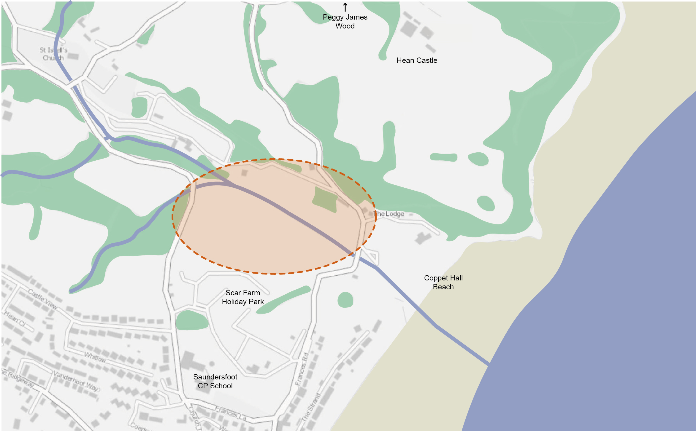
10.32 Land to the north of Saundersfoot CP School and Scar Farm Holiday Park offers the potential for shelterbelt, field margin and riparian woodland opportunities. Currently vacant, this land is bisected by a small watercourse which feeds into Saundersfoot Bay from Coppet Hall Beach. These interventions would help to alleviate surface water flood risk, providing storage for floodwater and helping to connect woodland areas that surround Hean Castle and border Peggy James Wood to the north.
10.33 Whilst the land west of the proposed site has been allocated in the Pembrokeshire Coast National Park Local Development Plan 2 for residential development (HA3 North of Whitlow), design requirements include a woodland buffer to the north of the site which would link riparian woodland planting across the area. A public footpath is also proposed around the perimeter of the site. The opportunity exists to extend this route into the site itself to encourage community engagement with woodland and shelterbelt.
Figure 10.9: SAU12
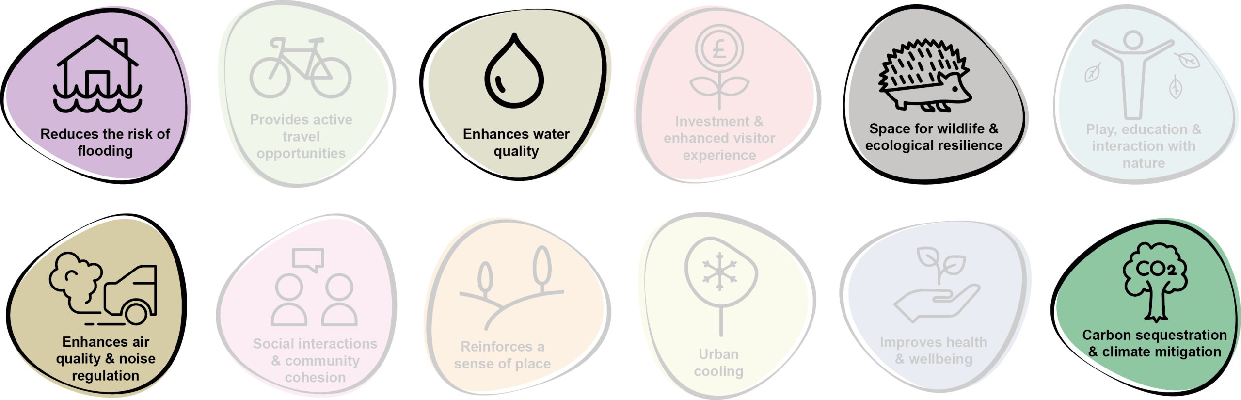
Benefits of the project
10.34 Benefits of the project, as depicted in Figure 10.10 below, include:
- Reduces the risk of flooding
- Enhances water quality
- Space for wildlife and ecological resilience
- Enhances air quality & noise regulation
- Carbon sequestration & climate mitigation
Figure 10.10: Benefits
Delivery of nature-based solutions and ecosystem services
10.35 Land use management for the previous 90 years has involved increased drainage of the land, in a drive to maximise efficiency of farmland. This has led to a reduction in the diversity of habitats, the loss of wetlands, wet-grassland and associated wet terrestrial habitats. It has also increased flood risk, as it increases the speed and volume of water flow down catchments, reducing the buffering effect of the landscape during heavy and prolonged rainfall events. Increased drainage of wet soils also has a detrimental effect on the ability of soil to sequester carbon.
10.36 Through the use of agroforestry techniques such as riparian buffer strips, planting of shelter belts and field margins, the ability of the landscape to absorb and buffer rainfall and surface runoff would be significantly increased. This would have a concomitant beneficial impact on flood risk, water quality and carbon sequestration, as re-wetting of wetland soils would increase their capacity to absorb and lock-in carbon.
Delivery mechanisms
10.37 An initial site survey and scoping should be conducted by trained citizen scientists, Pembrokeshire County Council (PCC) staff or trained consultants. It would be necessary to engage with landowners and land occupiers / graziers in order to present this opportunity and discuss its impacts on current land-use.
10.38 We envisage the proposed physical interventions and amendments to land management could be delivered by the landowners themselves, or by external agricultural contractors.
Potential partners
- PLANED – Pembrokeshire Sustainable Agriculture Network (PSAN)
- Wildlife Trust of South and West Wales
- Natural Resources Wales (NRW)
- Landholders
Outline cost
Low cost = <£250k
10.39 Costs would comprise some limited specialist advice, land agent fees, fencing and tree planting costs.
Potential funding opportunities
- Pembrokeshire Coast National Park Authority (PCNPA)
- Developer contributions (due to the Pembrokeshire Coast National Park Local Development Plan 2 woodland buffer requirements)
- Emerging Welsh Government Sustainable Farming Scheme
- Resilient Communities Grant Programme
- Local Places for Nature Fund
- The Tree Council
- National Forest for Wales – The Woodland Investment Grant (National Lottery Heritage Fund – Round 1)
- NRW grants
- Nature Networks Fund
Timescale
Quick win = <1 year
10.40 Riparian tree planting, shelterbelt and field margin creation could be delivered at a few key locations in the next planting season, with landscape maintenance required across the 60 month establishment phase. A key unknown for the project would be the time taken to gain landowner / occupier / grazier agreements / consents and source funding.
Medium-term = 1-5 years
10.41 The majority of tree planting should be delivered across the next five planting seasons to allow for sufficient planning and engagement.
Potential constraints
10.42 A key constraint for the project would be landowner / occupier / grazier agreements, as there may be a perceived risk to farm viability associated with some loss of land to riparian margins / shelter belts / field margin planting etc. These concerns should be countered with the availability of agricultural payments for environmental goods and services, and hence the delayed launch of the Welsh Government’s Sustainable Farming Scheme is a potential constraint in this regard.
10.43 An ecological assessment of the site would need to be undertaken by an ecologist with all site works potentially supervised by an Ecological Clerk of Works (ECoW).
Maintenance and stewardship
10.44 Maintenance of the softworks and wetland would be required as part of the 60 month establishment phase, including the replacement of failed trees.
Monitoring for success
10.45 Subject to availability of funding, monitoring of the success of the project should be undertaken through simple citizen science, with suitable support. Shelterbelt success is often dependant on initial design but also subsequent care and management using silvicultural techniques to maintain the shelterbelt beyond the life expectancy of the original tree planting.
Next steps
10.46 Engage with landowners / occupiers / graziers and enter into agreements to deliver interventions on their land. Consultation with NRW should also be undertaken to investigate whether the project benefits aligns with the Four Rivers for LIFE project and potential funding opportunities. The potential for nutrient credits to offset project costs should also be explored.
Figure 10.11: Saundersfoot
Project Long List
SAU1 – Enhance wayfinding at The Incline
10.47 Forming part of a wider initiative to provide linkages with Saundersfoot Station, enhance wayfinding, signage, seating and boundary features along The Incline from Brooklands Place, Westfield Road and The Ridgeway. Consideration should be given to the improved interpretation of heritage features at entrances and along the route itself. Re-surfacing works should also be undertaken, particularly focusing on the upper extents where the path is worn and overgrown. This location is an important dormouse corridor. Proposals should therefore aim to strengthen the existing hedgerow structure, whilst providing species-rich edge habitat for pollinators.
SAU2 – Create a network of circular routes
10.48 Refer to Kickstarter Projects.
SAU3 – Introduce urban greening mechanisms along The Strand
10.49 Review parking provisions along The Strand and reclaim some parking bays for urban greening, whilst ensuring retention of adequate space for disabled parking and loading. The opportunity exists to utilise this reclaimed space for the planting of street trees, cycle parking, parklets, seating and cafe spill out areas.
SAU4 – Enhance habitat provision in Saundersfoot Sensory Garden
10.50 The existing sensory garden / pocket park provides an area for ornamental planting and quiet relaxation within Saundersfoot Harbour. The space would benefit from enhanced planting with native, salt-tolerant flowering species, as well as additional habitat features such as log piles and insect hotels to increase the site’s biodiversity benefits.
SAU5 – Promote the greening of existing car parks
10.51 Saundersfoot’s car parks, including Brooklands Close and the Harbour, comprise large expanses of hard landscaping. However, minor reconfiguration works should be explored in order to provide the opportunity for tree planting and interpretative signage within these sites. Additional greening in these locations would also divert stormwater from combined sewers and help reduce fluvial influence in times of flooding.
SAU6 – Enhance the greening of the B4316
10.52 As the primary route through Saundersfoot, greening of the B4316 would help to create a welcoming gateway to the settlement and provide linkages with the proposed shared-user path. The re-purposing of disused planters along the route would provide additional pollinator habitat and commuting corridors. Furthermore, the creation of wildflower meadows on the grass verges at the junction with the A478 at New Hedges would help to create a welcoming gateway which connects with existing verges along Narberth Road.
SAU7 – Introduce and reinstate raised planters at Saundersfoot Harbour
10.53 Refer to Kickstarter Projects.
SAU8 – Develop a management plan for Saundersfoot Plantation
10.54 Encourage the establishment of an interest group / community group and develop a plan for the future management of the site, including the provision of access improvements via Sandyhill Road. Tree and ecological surveys would be beneficial to inform future management practices if not already available.
SAU9 – Enhance vacant land on Milford Street
10.55 The existing area of vacant land at the corner of Milford Street and Brooklands Close could potentially be used to enhance local habitat provision. Landowner engagement would be required to help understand future aspirations for the site and the potential for ‘meanwhile uses’ such as wildflower meadows.
SAU10 – Enrich green verges outside Saundersfoot School
10.56 The current green verges outside Saundersfoot School at the junction of the B4316 and Church Terrace are characterised by short-mown amenity grassland and low maintenance shrub planting. Replacement of these areas with pollinator-friendly rain gardens and small tree species, would provide a more welcoming gateway to the school, whilst providing for pollinators.
SAU11 – Extend riparian buffers along watercourses in the west
10.57 Explore opportunities to extend riparian tree planting along the two watercourses to the west of Saundersfoot, including around Moreton Lane. Additional field margin buffers on agricultural land should be utilised to enhance water quality and control nutrient run-off into adjoining watercourses, as well as slowing the flow of water upstream of Saundersfoot.
SAU12 – Extend areas of riparian woodland, shelterbelt and field margin opportunities in the north
10.58 Refer to Kickstarter Projects.
Previous Chapter:
Pembroke Dock
Next Chapter:
St Davids
Return to homepage:
Homepage