Page Contents:
A Portrait of St David’s Green Infrastructure
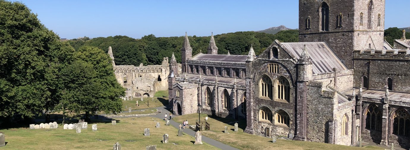
St Davids
Figure 11.1: St Davids
A Portrait of St David’s Green Infrastructure
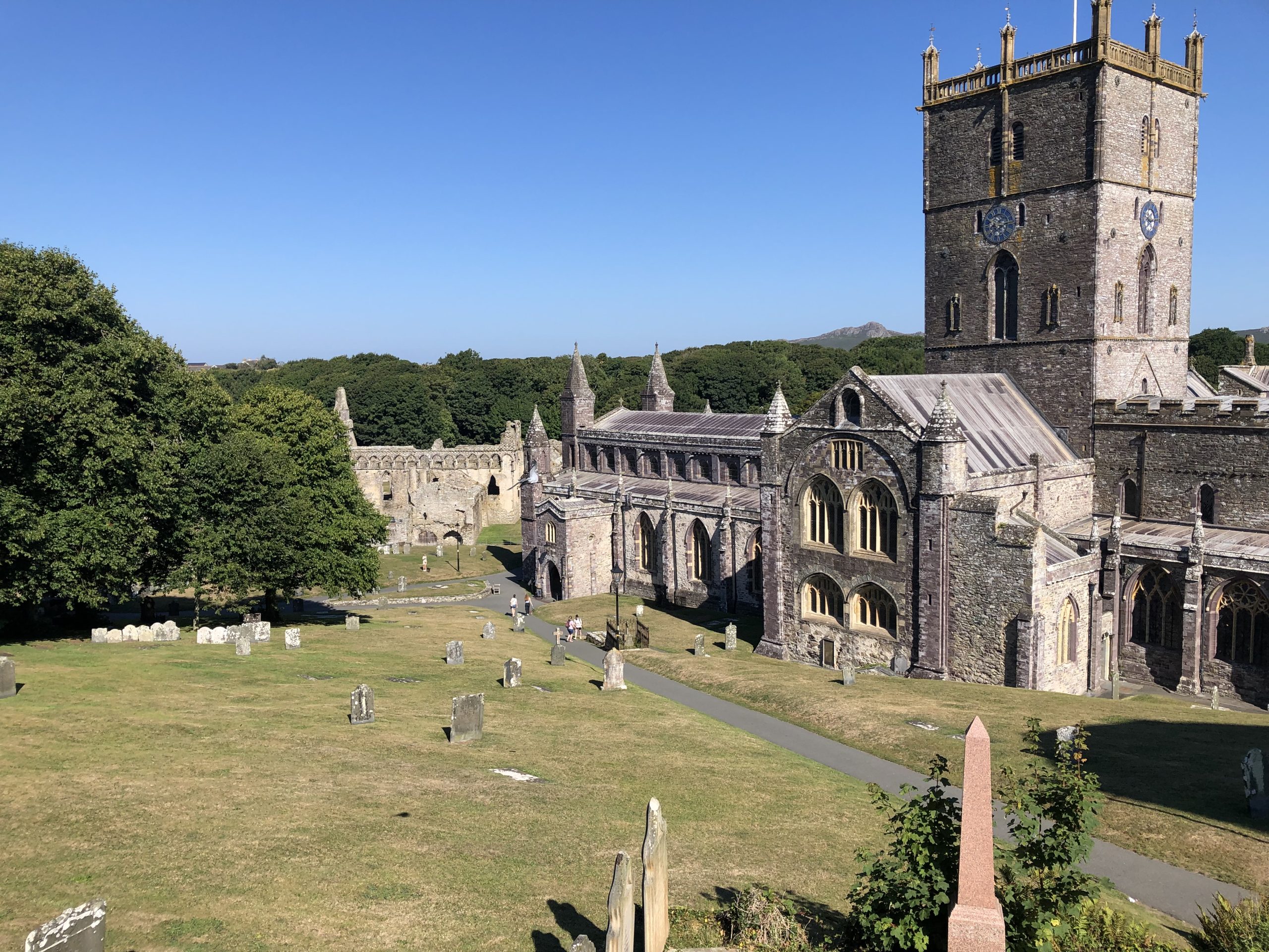
11.1 St Davids is a small, rural city in north west Pembrokeshire, located slightly inland on the St Davids Peninsula and within the Pembrokeshire Coast National Park. The historic core of the city lies within a Conservation Area, which contains numerous Grade I and II listed structures. Multiple Scheduled Monuments associated with the Grade I listed St Davids Cathedral and Bishop’s Palace are concentrated to the west of the settlement’s core.
11.2 The River Alun passes along the western edge of St Davids and provides a wooded wildlife corridor with intermittent Public Rights of Way (PRoW) and open access land along its path. To the north east of the city lies the North West Pembrokeshire Commons Special Area of Conservation (SAC), a National Trust site which hosts biologically important woodland, heathland and grassland, and is also designated as open access land. Within the densely settled core of the city, open space and tree cover are relatively limited.
11.3 Overall connectivity around the city is strengthened by the network of Public Rights of Way (PRoW) concentrated to the north and south of the settlement core. These connect the city down to the Pembrokeshire Coast Path in the south and the Pembrokeshire Commons SAC in the north. A number of recreational cycle routes and National Cycle Network (NCN) route 4 also connect the city with the surrounding coastline and beaches. However, linkages between these existing walking and cycling routes are somewhat disjointed and there are opportunities for improving connectivity for both wildlife and people across the city.
Figure 11.2: GI Opportunities within St Davids
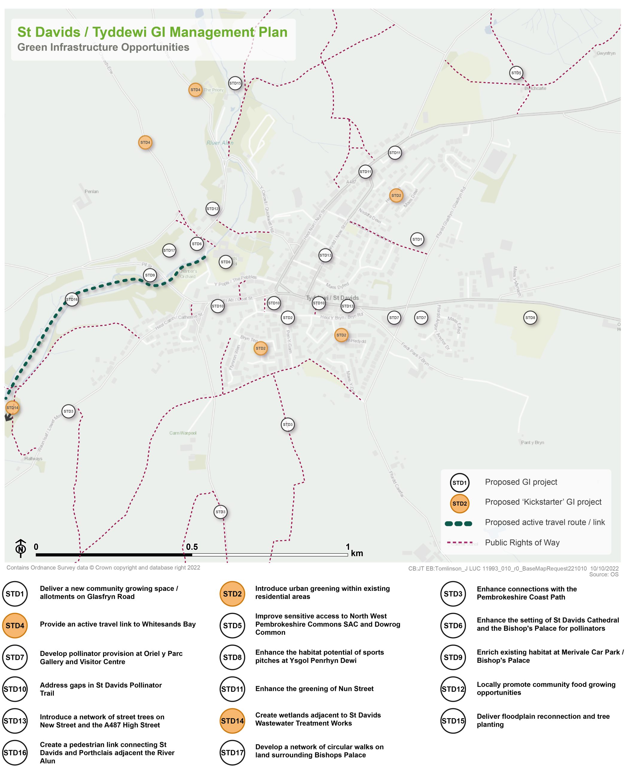
Kickstarter Projects
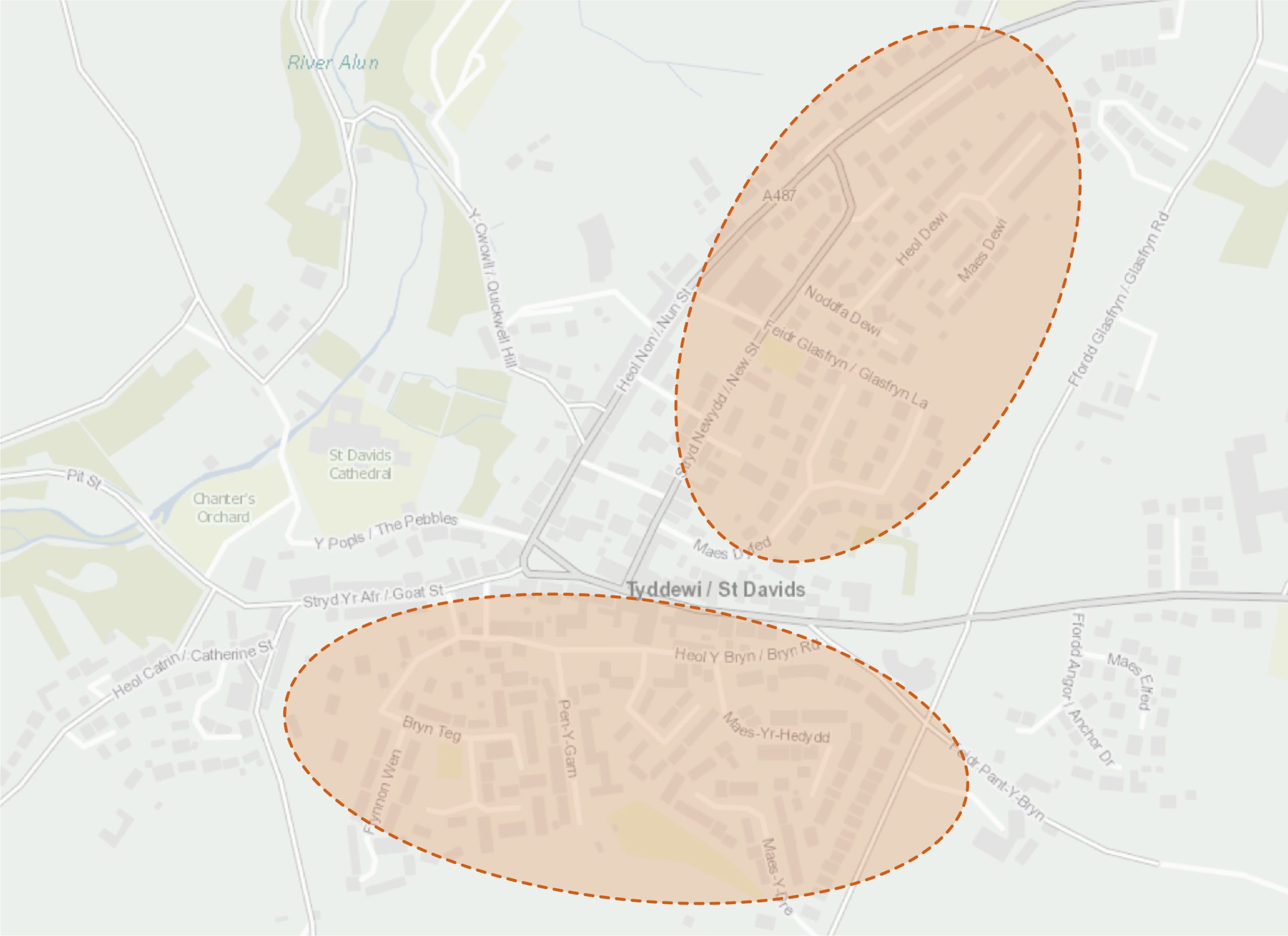
STD2 – Introduce urban greening within existing residential areas
11.4 Streets form an important aspect of public space. The attractiveness of streets can have a significant impact on the wellbeing of residents, with greener and tree-lined streets providing better settings for social interactions, informal play and local pride.
11.5 A number of St Davids’ residential areas host grass verges, wide pavements and redundant carriageway space which offer the opportunity to host a greater diversity of urban greening interventions. Neighbourhoods include around Heol Dewi, Mount Gardens and Maesdyfed within the north of St Davids, and around Bryn Rod, Maes-Y-Hedydd, Pen Y Garn, Brynteg and Ffynnon Wen in the south of the city. Some of these street-facing spaces fall within private ownership and would require engagement with residents to encourage and support them to take on some additional greening activities such as tree, shrub and perennial planting.
11.6 Where spaces are identified, additional street trees, specimen trees, rain gardens and wildflower meadows should be established. Residents could also be empowered to green their own private street-facing spaces, particularly focusing on planting the ‘right tree in the right place’, selecting pollinator-friendly plants and delivering small-scale habitats for wildlife. Residents should be encouraged to view the species recommendations and principles set out within the Urban Tree Planting Strategy and the Pollinator Strategy. Resident interventions could also utilise raised planters, permeable paving and small-scale water features within their own private street-facing spaces. Larger areas of grass verge should be sown with wildflowers to connect with the St Davids pollinator trail, for example along Bryn Road and Brynteg.
Figure 11.3: STD2
Benefits of the project
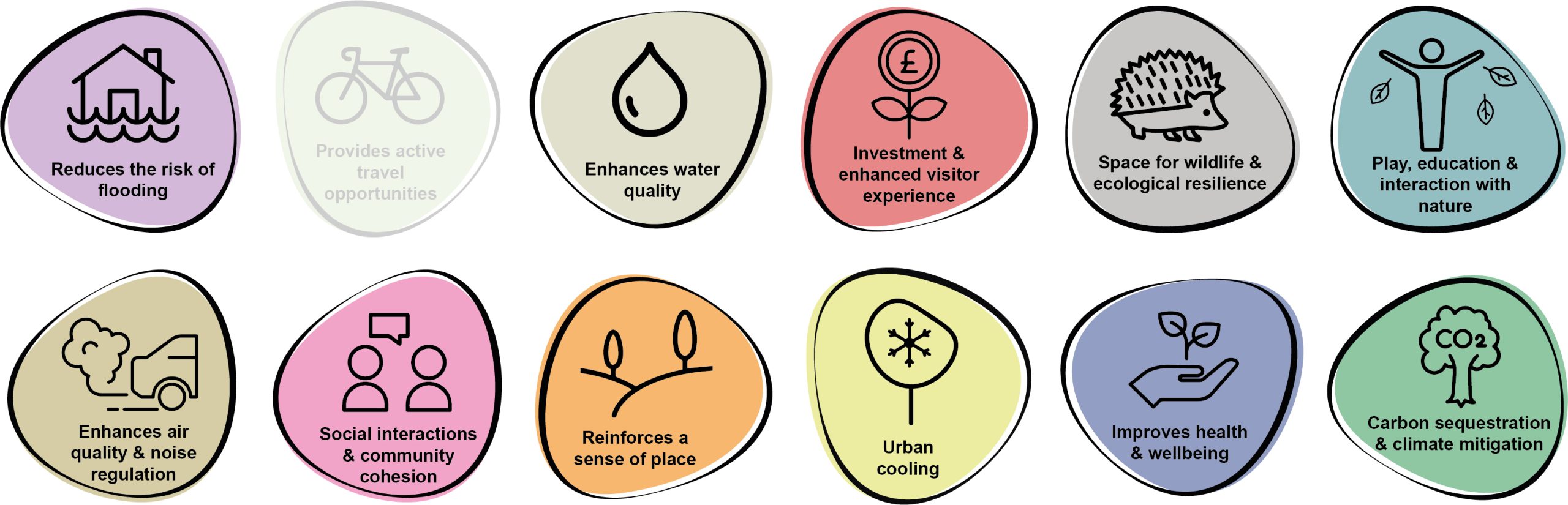
11.7 Benefits of the project, as depicted in Figure 11.4 below, include:
- Reduces the risk of flooding
- Enhances water quality
- Investment & enhanced visitor experience
- Space for wildlife and ecological resilience
- Play, education and interaction with nature
- Enhances air quality & noise regulation
- Social interaction and community cohesion
- Reinforces a sense of place
- Urban cooling
- Improves health and wellbeing
- Carbon sequestration & climate mitigation
Figure 11.4: Benefits
Delivery mechanisms
11.8 The introduction of wildflower meadows, once established, could reduce the time requirements for grass cutting during the growing season. Annual cuts of meadows could be integrated into the existing works programme of the Pembrokeshire County Council (PCC) Street Care / Amenity Maintenance Team.
11.9 The delivery of interventions such as tree planting should be done in collaboration with local residents and could be tied into a community tree planting day. By allowing residents to have a say in what species they would like to see outside their homes, and where they would like them planted, it would encourage greater stewardship of the specimens through and beyond the establishment period. The design of tree pits, the depth and soil used and the on-going watering and maintenance is vital in ensuring successful establishment.
11.10 Where possible, trees and planting material should be sourced locally.
11.11 Planting practices should follow the delivery guidance set out within the Urban Tree Planting Strategy and the Pollinator Strategy.
11.12 Through these community engagement activities, information could be distributed which educates residents on what more they could be doing in their own private spaces, including front and back gardens.
Potential partners
- PCC StreetCare Amenity Maintenance Team
- Tree Wardens Pembrokeshire
- EcoDewi
- The Bug Farm
- St Davids City Council
- Wild About Pembrokeshire
Outline cost
Low cost = <£250k
11.13 Costs would be scalable depending on the number of interventions. Ongoing maintenance and establishment should be factored into costings.
11.14 The cost of creating a meadow depends on the size and scale of the site and the options for seeding available. For small areas, it’s relatively cost effective to establish a small wildflower meadow. The cost of seed (lowland meadow perennial mixes) to cover 50 sq m ranges from £20-£30.
11.15 The cost of trees would vary depending on the size of the tree required and the species, however, planting into soft landscapes would be considerably cheaper than planting into hard surfaces.
Potential funding opportunities
- Community fundraising
- Local Places for Nature Fund
- Pembrokeshire Coast National Park Authority (PCNPA)
- National Lottery Community Fund
- Business sponsorships
Timescale
Quick win = <1 year
11.16 Interventions could be implemented pretty quickly, providing they are carried out at the correct time of the year e.g. bare-root tree planting season runs from October to March. Successful interventions can be replicated and repeated as and when funding comes available, or community appetite grows.
Potential constraints
11.17 There may be local objection to the project if enhancements detract from the tidy and orderly appearance of the street. Signage and interpretation boards could help to mitigate against this, however, interventions must be clearly communicated to local residents prior to installation.
11.18 This project would require the community to get on board to ensure interventions are popular, both on public and private land. Community engagement with the project is essential for the ongoing stewardship of new plantings, particularly new tree planting within the 60 month establishment phase.
11.19 Initial establishment would require additional resources from the PCC StreetCare / Amenity Maintenance Team. However, once meadows are established and trees become independent in the landscape, interventions should reduce management time requirements.
Maintenance and stewardship
11.20 The PCC StreetCare / Amenity Maintenance Team should be ultimately responsible for the establishment of meadows and trees located on public land. However, engaging the community and allowing them to take ownership of the projects would increase the likelihood of long term stewardship, particularly relating to tree watering, inspecting stakes and reporting any issues.
Monitoring for success
11.21 Survival rate of new planting and area of meadow habitats established can be monitoring indicators for success. An annual community BioBlitz could be organised to record the variety of life within areas of intervention. Engaging with citizen science projects such as the UK Pollinator Monitoring Scheme or organising an annual community BioBlitz at certain greenspaces can help involve local communities in monitoring efforts.
Next steps
11.22 Review the delivery section of the Pembrokeshire Pollinator Strategy and Urban Tree Planting Strategy to review options for enhancing the biodiversity value of greenspaces.
11.23 Engage with the PCC StreetCare / Amenity Maintenance Team to determine which sites could be managed differently and how.
11.24 Engage with St Davids City Council and residents.
Figure 11.5: St Davids
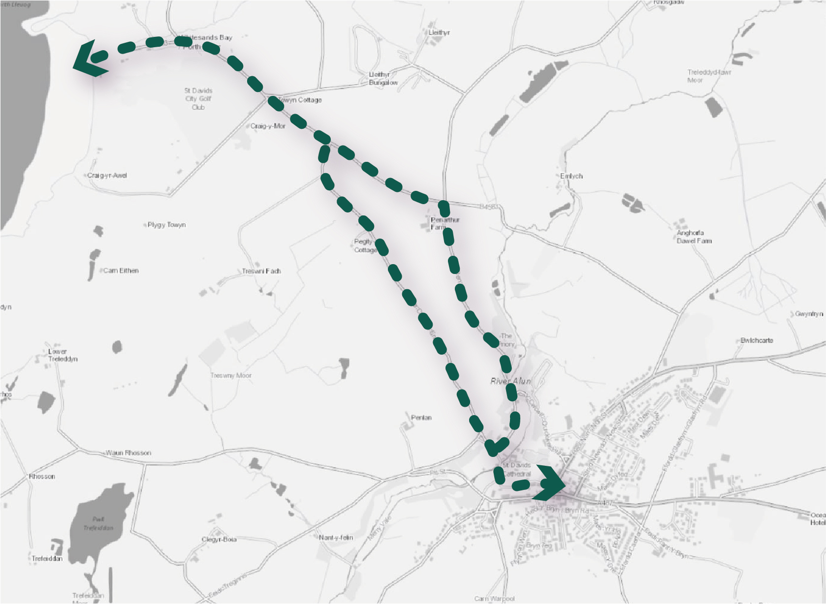
STD4 – Provide an active travel link to Whitesands Bay
11.25 Whitesands Bay is a popular beach with both visitors and residents. As a consequence, the B4583 can form a busy corridor during the busy summer period. Opportunities to create a safe and direct cycle and walking link between St Davids and Whitesands (an approximate 10 minute cycle and 40 minute walk) should be explored. The route could make use of existing minor lanes and prioritise them for pedestrians and cyclists, for example, either Feidr Chwech-Erw or Pen Rhiw (which currently accommodates National Cycle Network (NCN) 4) could be designated as quiet lanes where vehicle speeds are restricted to 20mph or they are used for access only. The creation of an off-road stretch along the B4583 would create a safe route between St Davids and the beach. This would require further exploration and engagement with landowners to determine how the path could be segregated from the road and may require some land take.
11.26 The route to Whitesands would form part of the initial step in making St Davids better connected to the Pembrokeshire Coast Path and creating circular coastal walks for visitors and residents to enjoy to the north, south, east and west of the city. This could be coupled with a new range of signage and street furniture to help people orientate themselves around the St Davids Peninsula on foot and bike, as well as interpreting some of the nationally significant biodiversity and heritage assets.
Figure 1.6: STD4
Benefits of the project
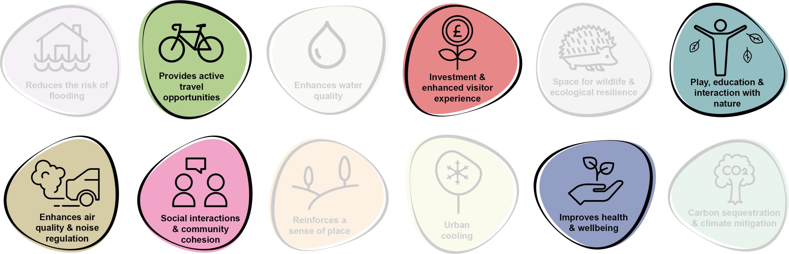
11.27 Benefits of the project, as depicted in Figure 11.7 below, include:
- Provides active travel opportunities
- Investment & enhanced visitor experience
- Play, education and interaction with nature
- Enhances air quality & noise regulation
- Social interaction and community cohesion
- Improves health and wellbeing
Figure 11.7: Benefits
Delivery mechanisms
11.28 A grant application would be required to secure funding for the capital works associated with this project. The route would need to be identified on the Integrated Network Map to be considered eligible for funding.
Potential partners
- Active Travel team, forming part of the Transport Strategy Unit at Pembrokeshire County Council (PCC)
- St Davids City Council
- Pembrokeshire Coast National Park Authority (PCNPA)
- Relevant landowners
Outline cost
High cost = <£1 million
11.29 Costs to transform either Feidr Chwech-Erw or Pen Rhiw into quiet lanes would be relatively small, providing access or speed cameras are not installed. Capital works for a section of off-road path along the B4583 would require a substantial capital investment.
Potential funding opportunities
- Welsh Government Active Travel Fund Grant
- PCC
- Transport for Wales
Timescale
Long term = >5 years
11.30 Timescales would likely be long due to the need to gather traction behind the project, liaise with key stakeholders and landowners, undertake surveys, raise funding and undertake the capital works.
Potential constraints
11.31 The project would likely be complex due to a number of competing demands and constraints. Much of this would come from the issue of requiring significant external funding and buy-in from local landowners. Part of the route would require landowner buy-in if off-road sections are to be delivered, for example along the B4583, or Compulsory Purchase Orders could be explored.
11.32 Should an off-road solution be agreed upon, localised vegetation clearance would be needed, although this should be kept to a minimum and routes should closely hug the existing carriageway as much as possible. The project would require an ecological assessment in order to inform route optioneering. Any construction work would need to be undertaken outside of the bird nesting season and in liaison with an ecologist or an Ecological Clerk of Works (ECoW).
11.33 Sections along the B4583 should ideally be segregated from the road as the route could be unsafe for cyclists and pedestrians during the busy summer peaks. This can be exacerbated by inappropriate parking.
11.34 Some parts of the route are quite steep and therefore it would not be accessible for all users.
11.35 In order to fulfil the criteria of the Welsh Government Active Travel Fund Grant, the scheme design must ensure it is consistent with the principles of the Active Travel (Wales) Act 2013 and the supporting Active Travel Act Guidance. Schemes that include highway improvement, construction, or traffic management must show how they comply in particular with Section 9 of the Act (Provision for walkers and cyclists in the exercise of certain functions).
Maintenance and stewardship
11.36 Ongoing annual maintenance of any hard surfacing along the route would be needed, including any vegetation clearance to keep the route accessible. Sightlines should always be retained across the entire route.
Monitoring for success
11.37 The opportunity exists to install sensors or counters to monitor the usage of the route as part of the wider active travel network within the county. This approach would help measure the success of the substantial investment and inform the long-term strategy and delivery of similar projects in the future.
Next steps
11.38 Undertake a feasibility study and optioneering exercise to determine the proposed route.
11.39 Develop a street furniture and signage strategy for the route which could be rolled out across St Davids and its surrounding area.
11.40 Comprehensive engagement with the community and landowners should be undertaken to gauge appetite for the project.
11.41 Close engagement with specific landowners likely to be affected by the route should take place prior to any public announcements.
11.42 An ecological assessment should be undertaken to examine any likely impacts of vegetation clearance needed to support the route.
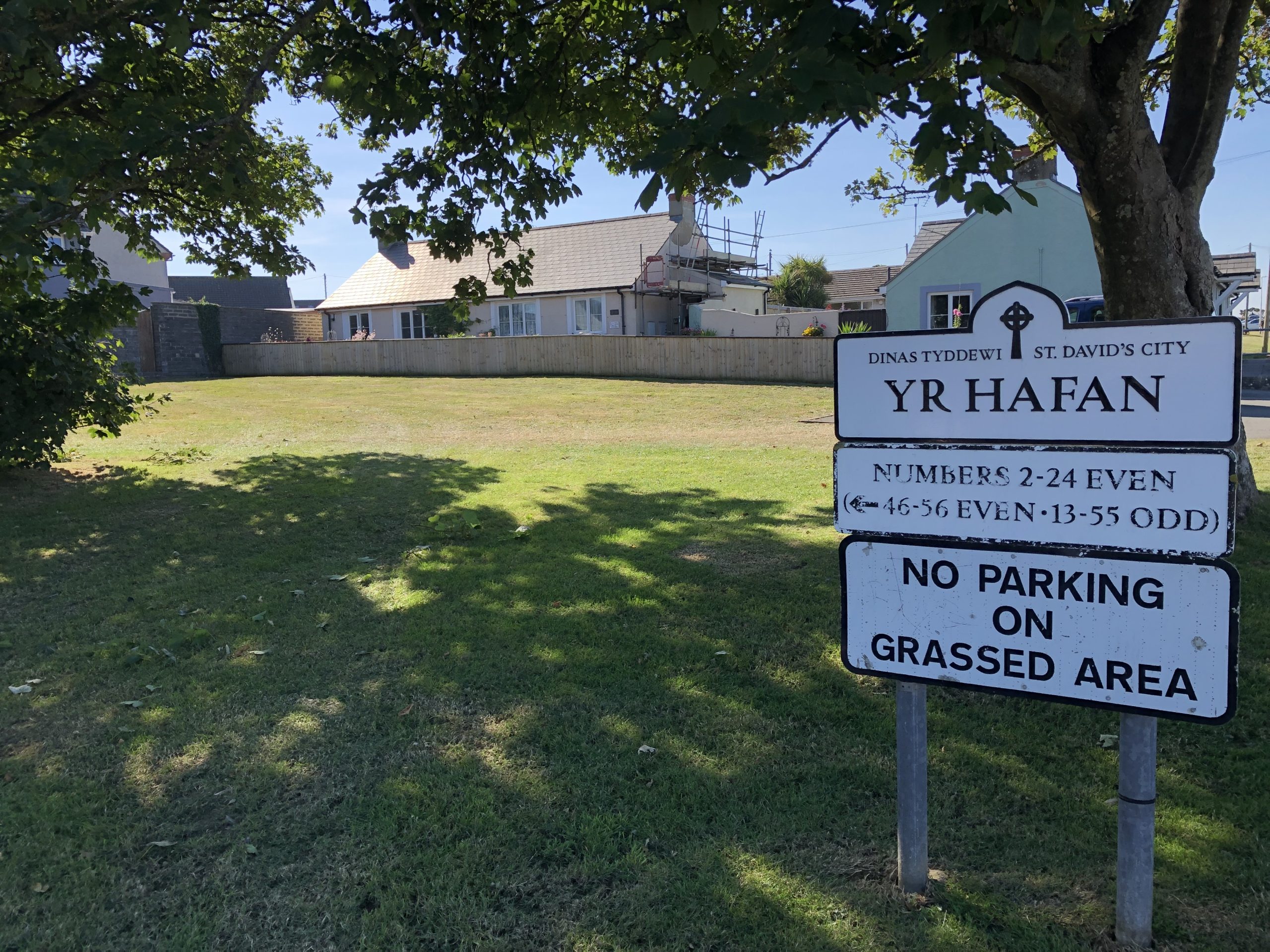
Figure 11.8: St Davids
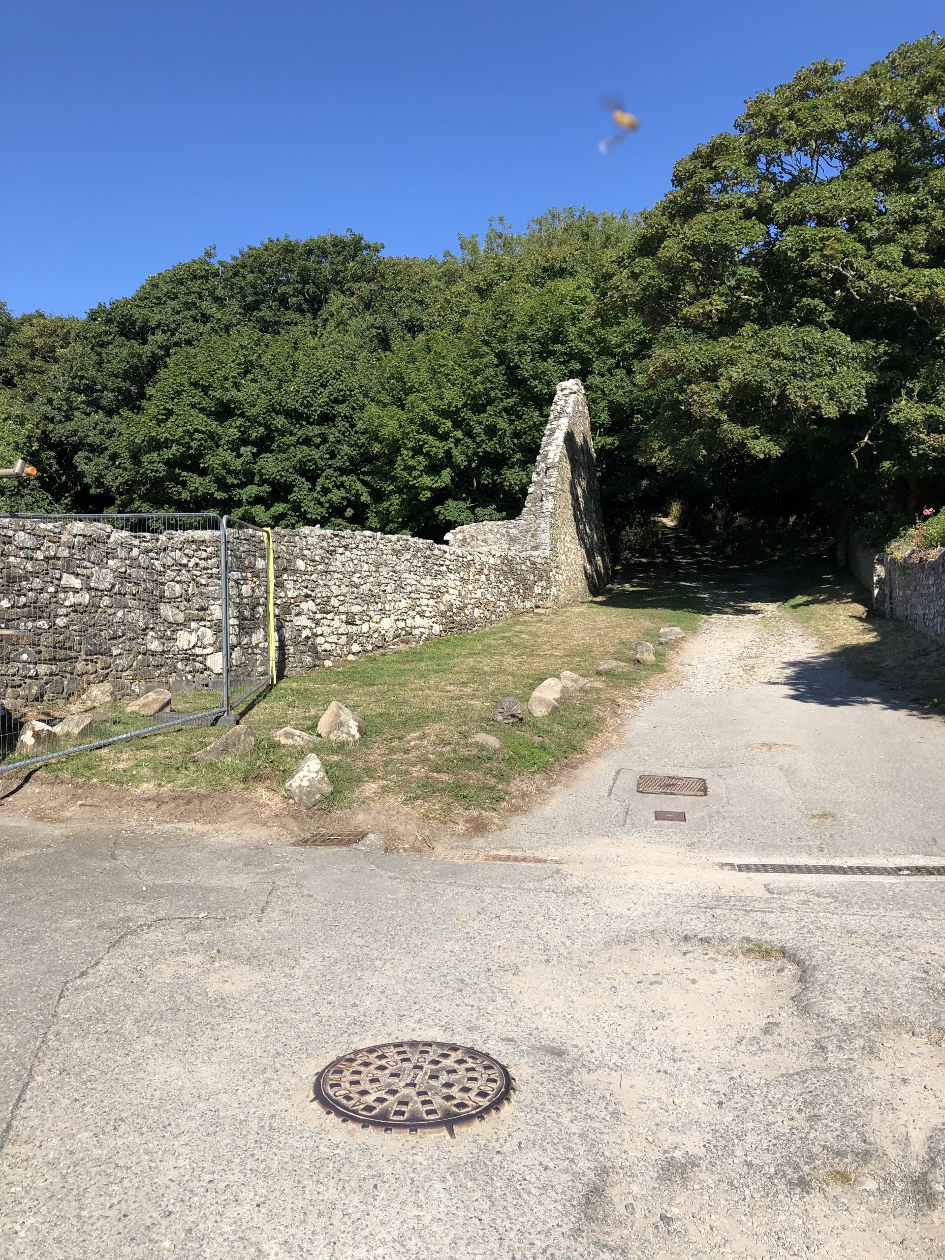
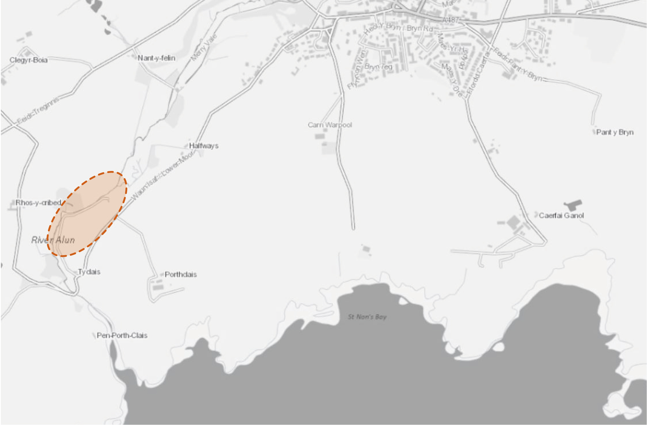
STD15 – Create wetlands adjacent to St Davids Wastewater Treatment Works
11.43 The conversion of vacant land adjacent to St Davids Wastewater Treatment Works to wetland would act as a buffer for sewage outfall in periods of high volume. Wetland habitat would create new habitat for wildlife and aid nutrient stripping of the outfall. This would help to alleviate the nutrient load currently discharged into the Pembroke Marine Special Area of Conservation (SAC) downstream in Porthclais which is an ongoing problem. In 2021, over 1,573 hours of combined storm overflows (where untreated foul effluent is discharged to the river due to the capacity of the infrastructure being exceeded) occurred at the St Davids Sewage Pumping Station. This intervention would help to store floodwater as well as improve water quality, reduce flood risk and decrease the risk of siltation of adjacent waterbodies.
Figure 11.9: STD15
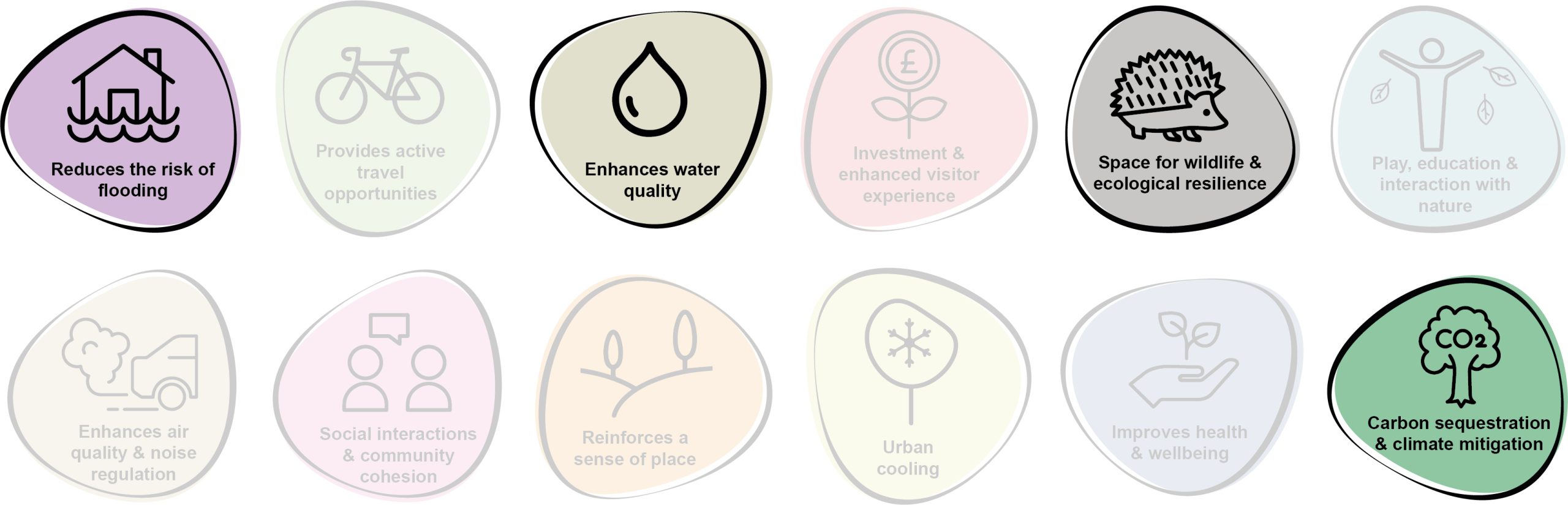
11.44 Benefits of the project, as depicted in Figure 11.10 below, include:
- Reduces the risk of flooding
- Enhances water quality
- Space for wildlife and ecological resilience
- Carbon sequestration & climate mitigation
Figure 11.10: Benefits
Delivery of nature-based solutions and ecosystem services
11.45 Wetlands can aid flood alleviation, acting as a store of excess water in periods of heavy rainfall in addition to their primary function of nutrient stripping and cycling. These habitats also provide multiple biodiversity benefits.
11.46 Constructed wetlands, if designed correctly, can achieve sustainable effluent treatment that provides a reduction in contaminant concentration similar to more complex chemical-based or mechanical mechanisms. The effluent from sewage treatment facilities is typically rich in nutrients and wetlands can be used to help alleviate this issue in sensitive areas such as the Pembrokeshire Marine SAC.
Delivery mechanisms
11.47 The cooperation and involvement of Dwr Cymru Welsh Water would be critical to the success of this project, and hence the first stage would be to engage with them and to draw together a feasibility study, looking at the required throughflow rates, the space available and the options associated with wetland design.
11.48 An appropriate design engineer should be consulted to provide a design of the wetlands. The potential area for the wetlands should be calculated and agreed with relevant landowners. Consultation with the local community should be undertaken to enable engagement with the plans. Contractors required to scope out the topography and excavate selected areas should be employed. Consideration of materials needed to create the wetlands such as substrate materials and vegetation should also be sourced as locally as possible.
11.49 Citizen science and combined storm overflow monitoring should be utilised to help inform and monitor the project. Although scientific studies are outside the scope of this phase of works, any information obtained by citizen science relating to the health of the local marine environment would also be welcomed to support this project. An ecological assessment of potential sites should be undertaken prior to selection.
Potential partners
- Wildlife Trust of South and West Wales
- Natural Resources Wales (NRW)
- West Wales Rivers Trust
- Pembrokeshire Coastal Forum
- Dwr Cymru Welsh Water
- Cardigan Bay Marine Wildlife Group
Outline cost
Low to medium cost = <£250k to £1 million
11.50 Costs would comprise land purchase or rent, specialist engineer design of the wetlands, procurement of planting and costs associated with excavation and installation of the wetlands.
Potential funding opportunities
- Dwr Cymru Welsh Water
- The Four Rivers for LIFE project
- Nutrient credits using Section 106 agreement
- National Lottery Community Fund
- Ofwat Innovation Fund
Timescale
Medium-term = 1-5 years
11.51 This anticipated programme length includes for time to enable the design of the wetland, agreements with landowners, construction and planting of the wetland.
Potential constraints
11.52 A key constraint for the project would be securing landowner agreements. It would also be essential to ensure the wetlands are located adjacent to the sewage treatment infrastructure to avoid re-routing sewage outfalls that would increase time and costs of the project. Antibiotic-resistant bacteria accumulation in wetlands is a concern and should be considered in the design of the wetlands.
11.53 The wetland would need to be sensitively designed due to the spatial constraints of the site.
11.54 An ecological assessment of the site would need to be undertaken by an ecologist with all site works potentially supervised by an Ecological Clerk of Works (ECoW).
Maintenance and stewardship
11.55 Wetlands are fairly low maintenance with little to no running costs as they do not require power and are generally reliable self-adjusting systems. However, maintenance would be required a few times a year to remove debris from any outlets, replace any damaged pipes, remove any invasive plant species that may be outcompeting the wetland plants, reduce sediment accumulation and check the structural integrity of the structural aspects of the design. Ongoing agreements with Dwr Cymru Welsh Water or landholders for access would be crucial.
Monitoring for success
11.56 Subject to availability of funding, monitoring of the success of the project should be undertaken through simple citizen science. Techniques could include monitoring of water quality using simple hand-held equipment or installation of a simple stream-gauge to monitor streamflow. Engagement with Dwr Cymru Welsh Water to create a monitoring system to assess nutrient sequestration and combined storm overflow incidents / spill time should also be explored.
Next steps
11.57 Dwr Cymru Welsh Water’s collaboration would be critical to ensure the success of this project, and so the first step would be to enter into discussion with Dwr Cymru Welsh Water and sign up to a collaboration agreement. This may also enable access to funding for the project, either with Dwr Cymru Welsh Water or as part of the Ofwat Innovation Fund.
11.58 Engage with landowners to enter into agreements to purchase or rent their land. Engage with the local community to create support and ’buy-in’ for the project.
Back to top
Project Long List
STD1 – Deliver a new community growing space / allotments on Glasfryn Road
11.59 In order to meet the high demand for allotments within St Davids, the opportunity exists to utilise the remaining undeveloped field on Glasfryn Road as a community growing space. The site could be managed as a community garden in partnership with Ysgol Penrhyn Dewi School. There are good opportunities for access via active travel routes and additional habitat enhancements, including the introduction of field margins, pollinator corridors, ponds, hedgerows and ditches.
STD2 – Introduce urban greening within existing residential areas
11.60 Refer to Kickstarter Projects.
STD3 – Enhance connections with the Pembrokeshire Coast Path
11.61 The provision of wayfinding and the condition of path surfacing on existing PRoWs between Pen-y-Garn and St Non’s should be improved. The opportunity also exists to enhance wayfinding and the local promotion of the existing cycle route between Bryn Road and Goat Street as a safe cycle link between St Non’s and St Davids (4 minute cycle). Consideration should be given to the installation of electric bicycle charging stations at locations along the route. The use of Fford Porth Clais as a safe and direct cycle route down to Porthclais Harbour (5 minute cycle, 20 minute walk) should also be supported. Wayfinding signage should be clear and include distances and walking / cycling times.
STD4 – Provide an active travel link to Whitesands Bay
11.62 Refer to Kickstarter Projects.
STD5 – Improve sensitive access to North West Pembrokeshire Commons SAC and Dowrog Common
11.63 An off-road cycle route, with wayfinding and signage should be implemented towards the south western arm of Dowrog Common (at Waun Fawr). A circular route around the perimeter of this open access land up to the lane at Mynydd Du should also be established and promoted. As a European protected heathland habitat, the proposals should incorporate sensitive path upgrades and educational signage to ensure dogs are kept on leads and that activities which increase the risk of wildfires are restricted.
STD6 – Enhance the setting of St Davids Cathedral and the Bishop’s Palace for pollinators
11.64 The grounds of both St Davids Cathedral and the Bishop’s Palace are characterised by close mown verges which could be enhanced for pollinators through relaxed mowing regimes and sowing wildflower seeds. Consideration should also be given to the establishment of wildflower meadows on steeply sided slopes which are inaccessible to mowers. Furthermore, quieter areas around the grounds offer the potential for the introduction of undisturbed areas for log piles.
STD7 – Develop pollinator provision at Oriel y Parc Gallery and Visitor Centre
11.65 Existing banks could be enhanced to provide bare earth areas for pollinators and butterfly banks. The enhancement of these areas would create a high value habitat for pollinators at all life stages, including providing larval food sources. A number of banks and vegetation topped dry stone walls within the adjacent car park could also be enhanced to provide a greater variety of flowering plants. This area also forms the start of the pollinator trail and further enhancement would strengthen the bee friendly status of the area.
STD8 – Enhance the habitat potential of sports pitches at Ysgol Penrhyn Dewi
11.66 The potential exists to implement tree planting around the perimeter of the site to enhance habitat connectivity, particularly along the A487. Tree planting at the edges of pitches should also be explored to provide additional shade and structure to the grounds. In addition, the sowing of wildflower seed, appropriate ground preparation and the relaxation of mowing regimes should aim to create ‘wilder’ areas for pollinators at field margins.
STD9 – Enrich existing habitat at Merivale Car Park / Bishop’s Palace
11.67 The existing habitat at this location should be conserved and enhanced for pollinators through the implementation of additional planting, relaxed mowing regimes and woodland edge management. Existing areas of standing water should also be enhanced to incorporate hoverfly lagoons.
STD10 – Address gaps in St Davids Pollinator Trail
11.68 The pollinator trail for which St Davids is granted ‘Bee Friendly’ status has degraded since its accreditation and the opportunity exists to rejuvenate the network of raised planters. In order to re-achieve this status, The Meadow, Quality Cottages and Wild About Pembrokeshire should be enhanced through works to upgrade the planters with flowering, pollinator-friendly perennials.
STD11 – Enhance the greening of Nun Street
11.69 The grass bank at the turning between Nun Street and Mount Gardens offers the opportunity for the establishment of tree groups. Further along Nun Street where the gradient of the grass verge increases, the area should be sown with wildflower meadow to create additional pollinator habitat and increase aesthetic interest. The establishment of additional street trees should also be explored at the hard surfacing separating the carriageway and the parking bays near the junction with New Street.
STD12 – Locally promote community food growing opportunities
11.70 Dewi’s Acre Community Garden provides an exemplar of how wildlife friendly gardening can support biodiversity and deliver opportunities for community food growing. This space should continue to be managed and locally promoted for the benefit of wildlife and the community.
STD13 – Introduce a network of street trees on New Street and the A487 High Street
11.71 Explore the opportunity to introduce a network of robust street trees within the public realm on New Street and the A487 High Street. Due to spatial constraints, options could include the use of trees at the entrance to the street to frame views as well as the use of fastigiate canopy forms to maintain good visibility and ensure sufficient height clearance for pedestrians.
STD14 – Create wetlands adjacent to St Davids Wastewater Treatment Works
11.72 Refer to Kickstarter Projects.
STD15 – Deliver floodplain reconnection and tree planting
11.73 Natural Resources Wales (NRW) has identified multiple areas upstream of St Davids along the River Alun, where there is a potential to connect historical areas of floodplain to the current river channel. These works would aim to provide floodwater storage and reduce flood risk downstream. Furthermore, the potential exists to combine the floodplain reconnection with areas of tree planting to enhance flood alleviation. Tree planting should also be used in areas of un-wooded floodplain as a mechanism to help attenuate rainfall and reduce flood risk, whilst providing valuable habitat for wildlife.
STD16 – Create a pedestrian link connecting St Davids and Porthclais adjacent the River Alun
11.74 Work with local landowners to establish a strategic pedestrian route linking the open access area at Pit Street with Porth Clais, via the corridor of the River Alun. The route offers the potential to link up with existing sections of the Public Rights of Way (PRoW) network, including a bridleway crossing the River Alun at Lower Moor. The corridor would offer recreational value and provide wider linkages with the Pembrokeshire Coast Path.
STD17 – Develop a network of circular walks on land surrounding Bishops Palace
11.75 Explore opportunities for the creation of circular walks which dissect the area of open access land to the south west of Bishop’s Palace, crossing the corridor of the River Alun and form wider linkages with Merry Vale. The potential also exists to utilise the area of woodland to the north of Bishop’s Palace to re-establish woodland paths for local recreational benefits.
Previous Chapter:
Saundersfoot
Next Chapter:
Tenby
Return to homepage:
Homepage