Page Contents:
A Portrait of Pembroke Dock’s Green Infrastructure
Kickstarter Projects
Project Long List
Pembroke Dock
Figure 9.1: Pembroke Dock
A Portrait of Pembroke Dock’s Green Infrastructure
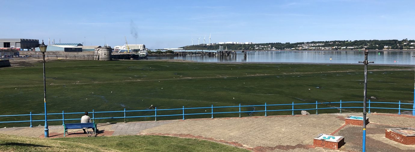
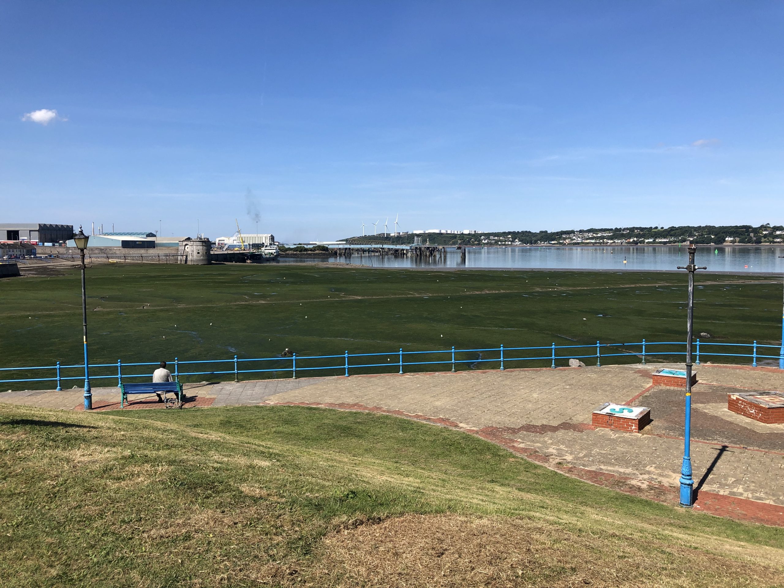
9.1 Pembroke Dock is a relatively large town of just under 10,000 inhabitants. Located on the southern banks of Milford Haven, the town is bounded by the mouths of the River Cleddau to the north and the River Pembroke to the south. Originating as a fishing village, it transitioned into a town with a strong industrial and naval background, tied to its docks and the deep natural harbour of Milford Haven, a designated Site of Special Scientific Interest (SSSI) and Special Area of Conservation (SAC).
9.2 The town has strong transport links to the wider landscape, with a railway, ferries, and multiple long distance recreational routes connecting to and passing through the town centre. The 186-mile Pembrokeshire Coast Path passes along the south-west edge of town and through the centre, connecting across the Cleddau Bridge further north. A National Cycle Network (NCN) route also passes north-south through the town centre, with various other recreational routes linking up and extending east into the wider landscape. A portion of the existing network of Public Rights of Ways (PRoWs) is concentrated within and adjacent to a large golf course at the town’s south western edge, with multiple connections to the Pembrokeshire Coast Path and town centre. Other sections of footpath on the eastern side of the town are more disjointed, and there are opportunities to improve overall connectivity.
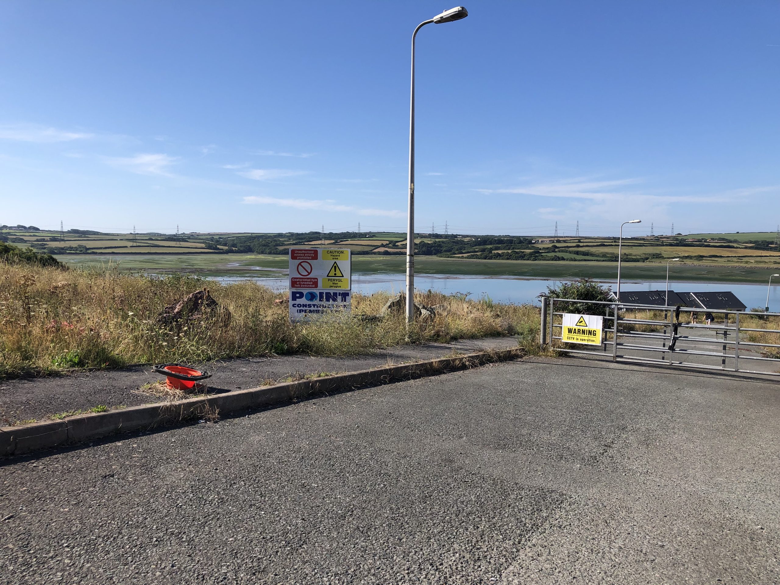
9.3 There is little open space along the estuarine coastline, which is generally built up as part of the docks and port, in addition to areas of dense residential settlement. However, larger open spaces are scattered throughout the town centre, and are linked via cycle and walking routes. Generally, play areas and recreational fields are concentrated in the east of the town, with smaller sections of footpath linking between them. Opportunities exist to enhance public spaces along the coastline, particularly north of the docks, which would enable greater community connections with the estuary and nature. Pembroke Dock’s regular street grid reflects the settlement’s history as a key Royal Navy shipyard and the use of the streets for military parades, the legacy of which has created a town distinctly lacking in trees and urban GI.
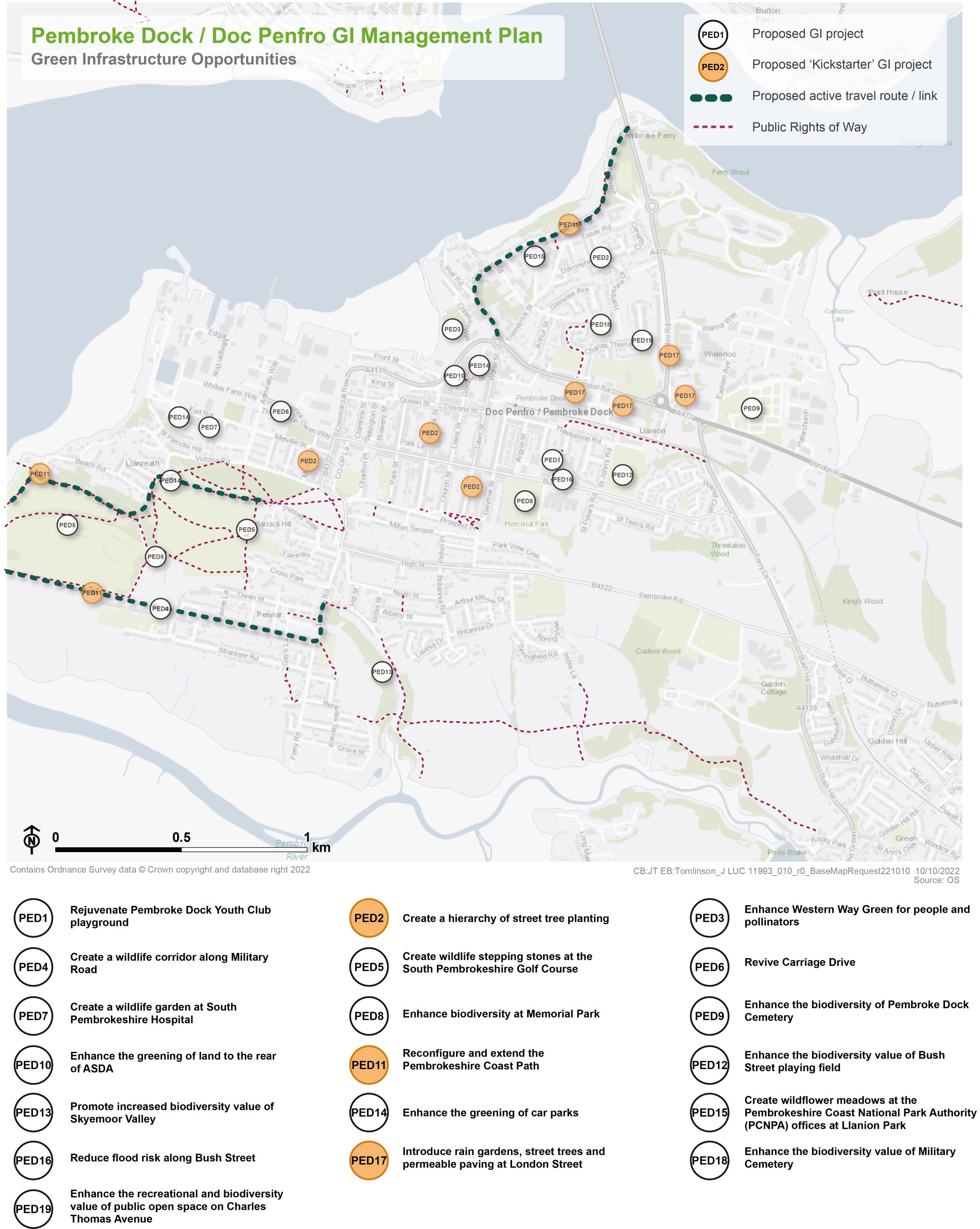
Figure 9.2: GI Opportunities within Pembroke Dock
Kickstarter Projects
PED2 – Create a hierarchy of street tree planting
9.4 Pembroke Dock’s grid street pattern offers the opportunity to implement street tree planting to soften the existing public realm. The grid pattern is a defining characteristic of the Pembroke Dock Conservation Area and therefore new tree planting should reinforce the hierarchy of these streets. This would deliver a positive contribution to townscape character, ensuring heritage assets are celebrated rather than screened. Proposals should also avoid any detrimental impacts on heritage assets.
9.5 Working in conjunction with residents as well as the Historic Building Conservation Officer and Landscape Officer at Pembrokeshire County Council (PCC), locations for new street tree planting should be identified. Proposals should ensure that tree planting proposals enhance the setting of the distinctive historic grid pattern and do not result in detrimental impacts on heritage assets. A hierarchy of trees should be established, for example, principal tree lined streets (e.g. central reservation along Meyrick Street or verges on Devonshire Road), streets with trees incorporated within parking nodes (e.g. Laws Street) and streets with trees to frame views (e.g. Market Street). By working with residents to identify locations and preferred species selection, community ownership of the trees should be encouraged. Where space permits, incidental seating, raised planters and linear rain gardens could also be delivered to create community parklets. Furthermore, consideration should be given to the implementation of a tree replenishment programme to address the diminished tree stock in the town.
9.6 Pembroke Dock’s Urban Tree Strategy must be cross-referenced when delivering this project. Proposals for tree planting must align with the future aspirations for integrated walking and cycling routes along Laws Street, Water Street, Apley Terrace and Gwyther Street as part of the Integrated Network Maps (INMs) produced for the Pembrokeshire County Council’s Active Travel Plan (Opens in new window).
Figure 9.3: PED2
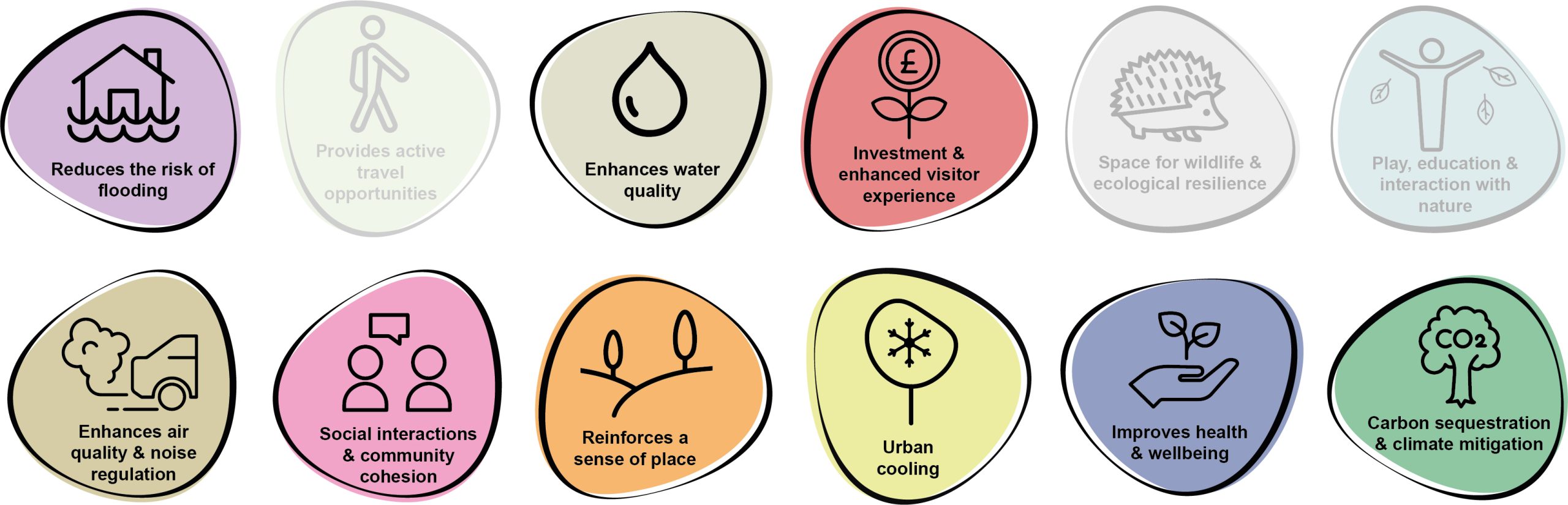
Benefits of the project
9.7 Benefits of the project, as depicted in Figure 9.4 below, include:
- Investment & enhanced visitor experience
- Space for wildlife and ecological resilience
- Play, education and interaction with nature
- Social interaction and community cohesion
- Reinforces a sense of place
- Improves health and wellbeing
Figure 9.4: Benefits
Delivery mechanisms
9.8 An annual planting programme should be established for Pembroke Dock to successfully plan, deliver and manage new tree planting across the town. Proposals should be developed prior to the bare-root planting season (October-March at the latest) to ensure sufficient time for ground checks and the sourcing of nursery stock.
9.9 Residents should have the ability to put forward requests for tree planting locations and species. If the location is appropriate and funding available, the tree should be added to the annual planting programme.
9.10 Trees should be delivered in accordance with the delivery section of the Urban Tree Planting Strategy.
Potential partners
- Residents
- PCC Highways and Transport Department
- Pembroke Dock Town Council
- Local businesses
- Peter Hall Community Trust
- Friends of Pembroke Dock Memorial Park
- Tree Wardens Pembrokeshire
- Pembroke Port
Outline cost
Medium to high cost = £250k – £1 million
9.11 The cost of the project is scalable depending on the number of trees planted. However, a rough estimate of ~£10,000 is required to appropriately establish a tree within hard landscaping (assuming a 60 month establishment period).
Potential funding opportunities
- Developer contributions
- National Lottery Community Fund
- Resilient Communities Grant Programme
- Local Places for Nature Fund
- The Tree Council
Timescale
Quick win = <1 year
9.12 Tree planting could be delivered at a few key locations in the next planting season.
Medium-term = 1-5 years
9.13 The majority of tree planting would be delivered across the next five planting seasons to allow for sufficient planning and engagement.
Potential constraints
9.14 A key issue in the successful establishment of trees within hard landscapes is a lack of suitable soil volume for root growth. Within the urban environment, there are usually competing uses for underground space, including utilities. Assessments to identify underground utility constraints would be needed prior to planting. The cost of excavating tree pits within hard landscapes is also more expensive than within soft landscapes. Therefore, new tree planting must achieve the right balance between cost, space and desired function/design. In some circumstances, fewer trees with a larger rooting volume may be appropriate.
9.15 Proposals must be considerate of their location within Pembroke Dock Conservation Area and therefore all new tree planting should enhance the setting of the distinctive historic grid pattern, maintain key vistas, and must not result in detrimental impacts on heritage assets. Therefore, all planting proposals should be prepared in conjunction with both the Historic Building Conservation Officer and the Landscape Officer.
Maintenance and stewardship
9.16 Establish a resident working group to take ownership of the new tree planting. A training day could provide the community with the tools and knowledge to successfully maintain new trees until establishment, including watering and checking tree stakes.
9.17 Watering and establishment care would be needed as part of a 60 month maintenance period to ensure trees are able to become independent in the landscape.
Monitoring for success
9.18 Utilise the resident working group to monitor the successful establishment of new street trees. Establish a communication channel for reporting issues with street trees.
Next steps
9.19 Review the delivery section of the Urban Tree Planting Strategy to determine the process for planting trees within hard landscapes and to understand the key components for successful tree establishment.
9.20 Engage residents and community groups to identify locations for tree planting and selection of species, using the species selection guide within the Urban Tree Planting Strategy.
Figure 9.5: Pembroke Dock
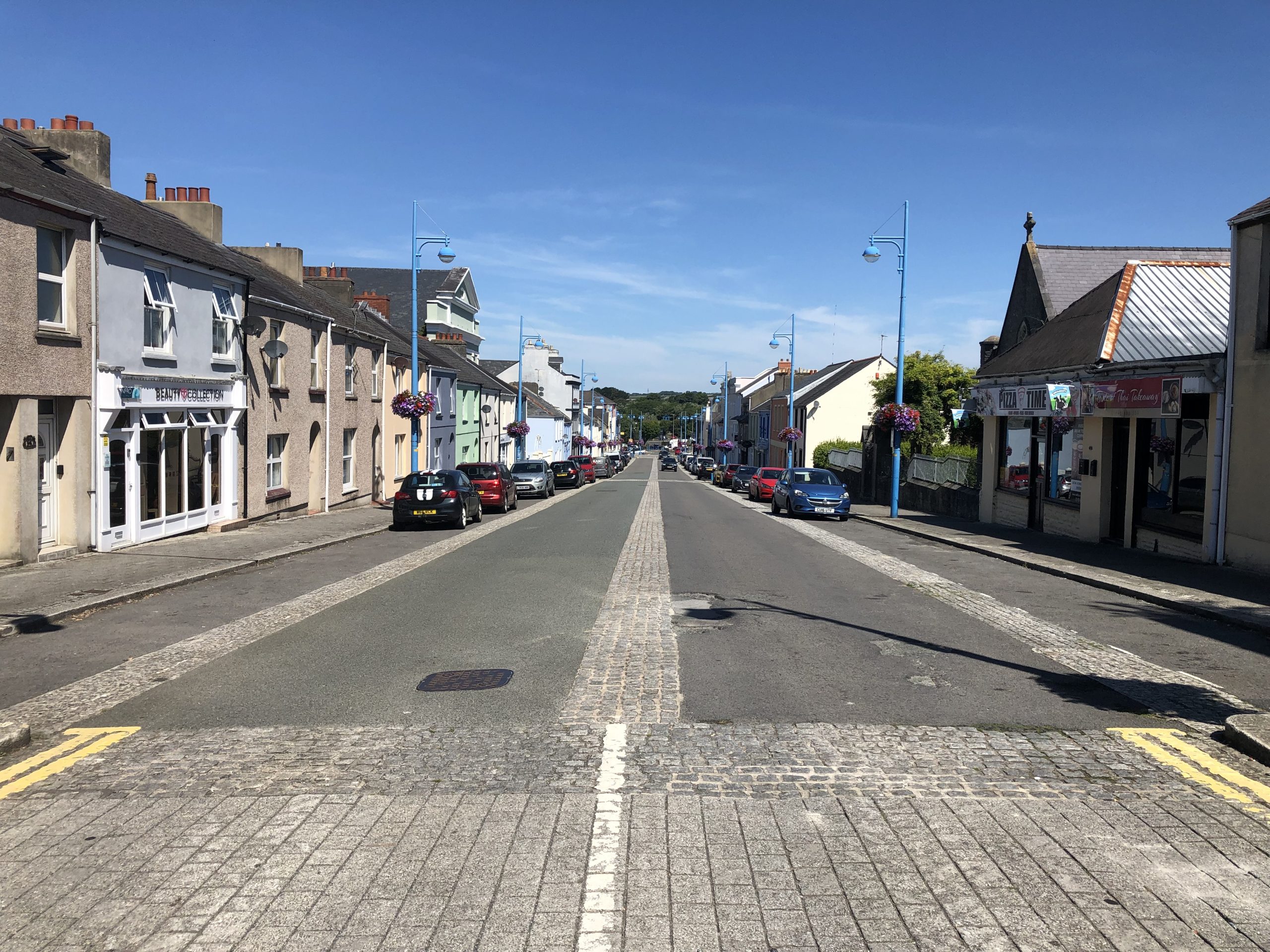
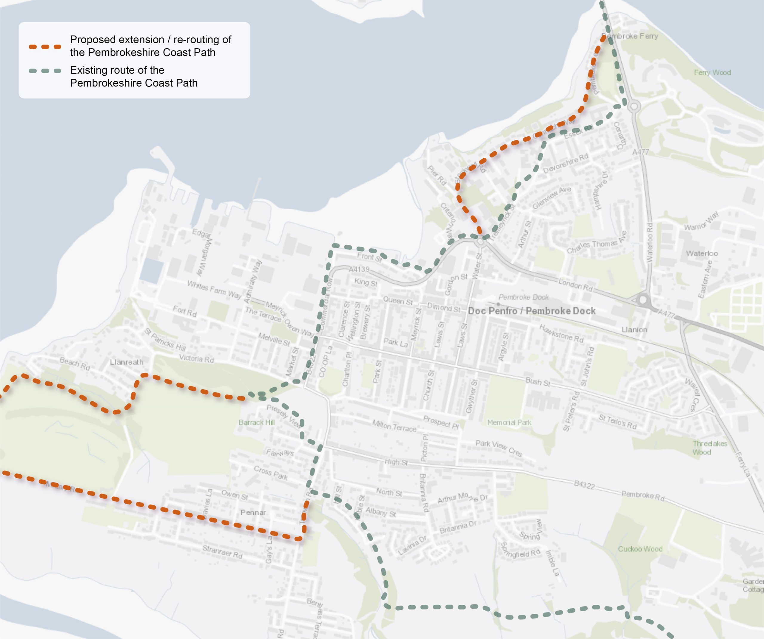
PED11 – Reconfigure and extend the Pembrokeshire Coast Path
9.21 The Pembrokeshire Coast Path at Pembroke Dock bisects the town centre and is not currently accommodated on the coastline. The route forms the eastern boundary of Pembroke Dockyard within a predominantly urban context, following a section of the B4322 Pembroke Street towards Presely View and Treowen Road. The path alignment then moves south to Sykemoor and the low-lying landscape parallel to the Pembroke River. Consideration should be given to re-aligning the route along the waterfront at Llanreath, Pennar Park and Pennar to complement the coastal character of the wider route. The realignment of the route would reduce the need for on-street links, promoting increased segregation of pedestrians and vehicles. Enhanced connectivity could also be achieved by enhancing secondary branching routes from adjacent residential areas.
9.22 The potential exists to utilise sections of existing Public Rights of Way (PRoW) network where possible, including the public footpath at Military Road (connecting Pennar Park and Pennar). However, route realignments would also be required. it would be necessary to engage with landowners and land occupiers in order to present these opportunities and discuss their impacts on current land-use. Any alterations to the existing route would require funding from Natural Resources Wales (NRW) to ensure any reconfigurations are undertaken to national trail standards and appropriately sign-posted. The project would also require amendments to promotional media associated with the Pembrokeshire Coast Path to ensure changes are communicated to both interested stakeholders and the wider public. Due to the ecological sensitivities of the coastline at this location, the project would need to ensure that the delivery of recreational enhancements is balanced with biodiversity pressures.
Figure 9.6: PED11
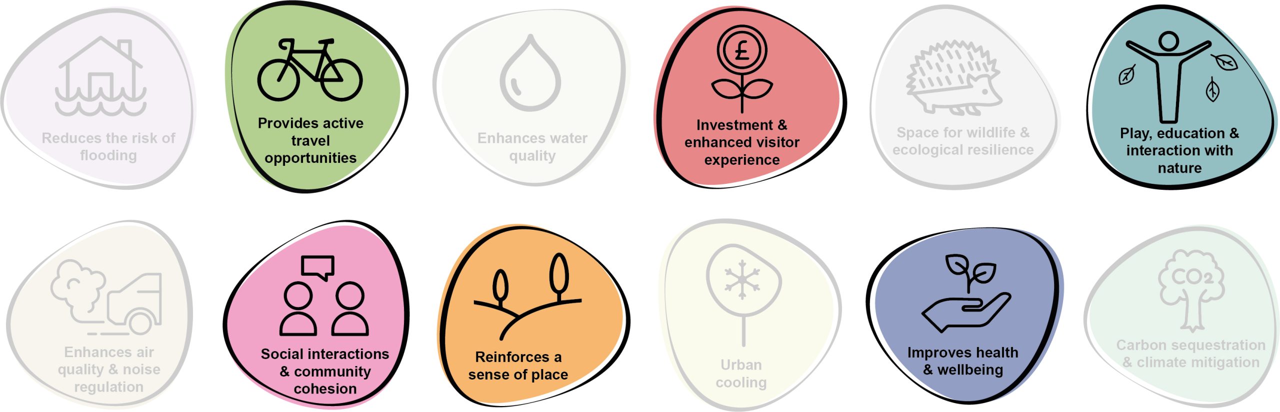
Benefits of the project
9.23 Benefits of the project, as depicted in Figure 9.7 below, include:
- Provides active travel opportunities
- Enhances water quality
- Play, education and interaction with nature
- Social interaction and community cohesion
- Reinforces a sense of place
- Improves health and wellbeing
Figure 9.7: Benefits
Delivery mechanisms
9.24 Delivery of the project would require funding from NRW to undertake the capital works. Support would also be required from the National Trail Steering Group in order to progress the scheme. Additional time resources would be needed as the existing National Trail Officer employed by Pembrokeshire Coast National Park Authority (PCNPA) would not currently have the capacity to deliver a significant reconfiguration of the Pembrokeshire Coast Path.
Potential partners
- Landowners;
- NRW;
- Pembrokeshire County Council (PCC);
- PCNPA; and
- Active Travel Team, forming part of the Transport Strategy Unit at PCC
Outline cost
High cost = >£1 million
9.25 The creation of new paths or path upgrades will be a high cost. Upgrading of signage and street furniture will be a medium cost.
Potential funding opportunities
- NRW
- PCC
- Transport for Wales
Timescale
Long-term = >1 year
9.26 The need for consultation with various stakeholders, engagement with landowners, a collaborative design process and delivery on the ground means the project will likely take around 5 years to deliver in full.
Potential constraints
9.27 The project is likely to be complex, with competing demands to ensure its successful implementation. This includes the requirement for significant external funding and liaison with local landowners. Delivery of the footpath realignment would require co-operation and involvement of NRW as a key stakeholder.
9.28 Due to the complexities of the scheme, the project would require significant staff resource and sustained financial input to reach its full potential. Additional challenges would also involve the need for complex stakeholder and public consultation to ensure local ‘buy-in’. A key unknown for the project would be the time required to gain landowner consents.
9.29 Reconfiguration works would involve localised vegetation clearance along some sections of the route. This would need to be undertaken to avoid the bird nesting season and in liaison with an ecologist or Ecological Clerk of Works (ECoW). The potential for erosion and flooding at this location would also form a key challenge in the establishment of a route at this coastal location.
Maintenance and stewardship
9.30 Ongoing maintenance of the route would be required to ensure access is maintained throughout the year. Landscape management works would also be required to ensure the retention of sightlines across the route.
Monitoring for success
9.31 The opportunity exists to install sensors or counters to monitor the usage of the route as part of the wider active travel network within the county. This approach would help measure the success of the substantial investment and inform the long-term strategy and delivery of similar projects in the future.
Next steps
9.32 Undertake a feasibility study and optioneering exercise to determine the preferred route of the path realignment. Initial conversations with landowners to establish potential route options should also be initiated at this stage.
9.33 An ecological assessment and tree survey to BS5837: 2012 should be commissioned to examine the implications on local biodiversity and existing tree cover. Preliminary consultation with interested stakeholders, community groups and the general public should also be progressed to inform early conceptual development of the project.
Figure 9.8: Pembroke Dock
PED17 – Introduce rain gardens, street trees and permeable paving at London Road
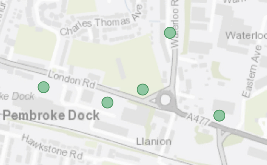
9.34 Sections of London Road within Pembroke Dock are at high risk from surface water flooding, including areas to the north of the large car park complex associated with multiple commercial retailers. A Combined Sewer Overflow (CSO) incident (where untreated foul effluent enters rivers due to the capacity of the sewer infrastructure being exceeded) was also previously recorded at Waterloo Road. Sustainable Drainage Systems (SuDS) interventions which divert storm water from combined sewers would help to reduce fluvial influence in times of flooding.
9.35 There are multiple opportunities for intervention. Consideration should be given to retrofitting the large impermeable car park areas with permeable paving, rain gardens and robust tree planting.
9.36 Introduction of these measures in this area would aid the slowing of surface water run-off, helping to reduce potential surface water flood risk and lessen the fluvial input into the sewer system at times of high rainfall. These proposals would also contribute positively to townscape character and biodiversity.
9.37 Working with residents, commercial partners, Pembrokeshire County Council (PCC) and South Wales Trunk Road Agent (SWTRA), locations for interventions should be identified.
9.38 Pembroke Dock’s Urban Tree Strategy should be cross-referenced when delivering this project. Proposals for tree planting must also align with walking and cycling routes noted along London Road.
Figure 9.9: PED17
Benefits of the project
9.39 Benefits of the project, as depicted in Figure 9.10 below, include:
- Reduces the risk of flooding
- Enhances water quality
- Investment & enhanced visitor experience
- Space for wildlife and ecological resilience
- Enhances air quality & noise regulation
- Reinforces a sense of place
- Urban cooling
- Improves health and wellbeing
Figure 9.10: Benefits

Delivery of nature-based solutions and ecosystem services
9.40 Rain gardens, permeable paving and concurrent tree planting would deliver improvements to the urban setting and contribute towards a sustainable approach to dealing with rainwater. In a natural habitat, precipitation is slowly absorbed into the ground, slowed by vegetation. However, impermeable surfaces in urban environments direct run-off into storm sewers which may contribute towards CSOs and surface water flooding in the local area.
9.41 The creation of tree planting areas and rain gardens would have a beneficial impact on flood risk, water quality and on carbon sequestration. In addition, the potential for CSO incidents is reduced by removing some of the load on the combined sewer network.
Delivery mechanisms
9.42 An initial study should undertake site surveys to identify where the topography, street scene and storm sewer network conditions combine to make interventions both most effective and most deliverable. As part of this, residents should have the ability to put forward requests for rain garden and tree planting. If the location is appropriate and funding available, the tree should be added to the annual planting programme.
9.43 An annual planting programme should be established for Pembroke Dock to successfully plan, deliver and manage the new tree planting, rain gardens and permeable paving areas across the London Road area. Sufficient planning is required prior to the bare-root planting season (October-March at the latest) to ensure ground checks / soil testing is completed.
9.44 Trees should be delivered in accordance with the delivery section of the Urban Tree Planting Strategy.
Potential partners
- Local community
- PCC Highways and Transport Department
- PCC StreetCare / Amenity Maintenance Team
- Local businesses
- Tree Wardens Pembrokeshire
- Dwr Cymru Welsh Water
- South Wales Trunk Road Agent (SWTRA)
Outline cost
Medium to high cost = <£250k – £1 million
9.45 Price is scalable depending on the number of trees planted / rain gardens created/ permeable paving areas installed. However, a rough estimate of ~£10,000 to appropriately establish a tree within hard landscaping should be applied.
Potential funding opportunities
- Developer contributions
- National Lottery Community Fund
- Resilient Communities Grant Programme
- Local Places for Nature Fund
- The Tree Council
Timescale
Quick win = <1 year
9.46 Tree planting and rain garden creation should be delivered at a few key locations in the next planting season.
Medium-term = 1-5 years
9.47 The majority of tree planting, rain garden creation and permeable paving aspects should be delivered across the next five planting seasons to allow for sufficient planning and engagement.
Potential constraints
9.48 There are a considerable number of potential stakeholders to engage with for this project, with various landholders and the engagement process critical to the success of the scheme. London Road (A4139) is a major road, hence PCC Highways and Transport Department and the SWTRA must be involved in the project.
9.49 Although there is a large area for improvements within the car parking areas, space along the carriageway is limited, with competing priorities including cycle lanes and pedestrian walkways. The majority of the surfacing within the potential project area is characterised by hard landscape. The cost of excavating tree pits within hard landscapes is more expensive than within soft landscapes. Therefore, new tree planting must achieve the right balance between cost, space and desired function / design. In some circumstances, fewer trees with a larger rooting volume may be appropriate.
9.50 Within the urban environment the potential for a variety of services and utilities to be located within potential planting areas and avoidance of these must be considered when accounting for the installation of tree planting. Rain gardens typically require shallower depths of installations and would therefore have a lower probability of conflict with services. There may be the potential for substituting tree planting in favour of rain gardens in areas identified to have a high probability of services.
Maintenance and stewardship
9.51 Establish a resident or commercial partner working group alongside PCC Street Care and Highways Department to take ownership of the new tree planting. A training day could provide the community with the tools and knowledge to successfully maintain new trees until establishment, including watering and checking tree stakes.
9.52 Watering and establishment care would be needed for the 60 month establishment phase to ensure trees are able to become independent in the landscape.
9.53 Permeable paving areas would need to be either adopted by PCC or by the relevant landowner.
Monitoring for success
9.54 Subject to the availability of funding, monitoring of the success of the project should be in conjunction with data from Dwr Cymru Welsh Water in terms of sewer capacity and reduction in CSO events.
9.55 Utilise the resident working group to monitor the successful establishment of new street trees and gardens. Establish a communication channel for reporting of any issues or failures.
Next steps
9.56 Immediately identify landholders and commercial partners and engage with potential stakeholders, including SWTRA and the appropriate departments of PCC.
9.57 Survey the area to ascertain areas best suited for intervention.
9.58 Review the delivery section of the Urban Tree Planting Strategy to determine the process for planting trees within soft landscapes and understand the key components for successful tree establishment.
9.59 Engage residents and community groups to identify locations for tree planting and selecting species, using the species selection guide within the Urban Tree Planting Strategy.
Project Long List
PED1 – Rejuvinate Pembroke Dock Youth Club playground
9.60 Work with the Pembroke Dock Youth Club to design a new playful space which is rich in biodiversity. Damaged play equipment should be removed and replaced with robust and adventurous natural play features. New sociable spaces, including swings, seating and climbing bars to appeal to teenage girls, should be introduced. The potential exists to deliver a community garden within the fenced perimeter of the Youth Club, incorporating orchard trees and edible hedges. Additional tree boundary planting and pollinator friendly ‘wild edges’ should also be introduced in conjunction with wider access improvements along Bush Street.
PED2 – Create a hierarchy of street tree planting
9.61 Refer to Kickstarter Projects.
PED3 – Enhance Western Way Green for people and pollinators
9.62 This open space is characterised by an undulating mound of amenity grass. Use of the banks for adventurous climbing and seating could be installed alongside the existing slide, as well as wildflower meadows to create a welcoming and playful space. Additional opportunities for formal and informal seating should be incorporated into the space, helping users (both residents and tourists) take advantage of long range views. Interpretative signage, cycle stands and electric bicycle charging stations should also be installed. Working in partnership with Pembroke Dock Town Council and Pembrokeshire County Council (PCC), consideration should also be given to retrofitting the large car park area with permeable paving, street trees and rain gardens to reduce the run-off entering local combined sewers.
PED4 – Create a wildlife corridor along Military Road
9.63 Establish wildflower meadows and street trees on the wide verges through residential areas to provide opportunities for shading, ensuring proposals do not conflict with proposals for a shared-user path along Military Road. Gaps in the extent of the woodland shelter belt should be filled to buffer any run-off from the adjacent golf course and agricultural land flowing into the River Pembroke. Species diversity of the hedgerow running alongside the carriageway could also be strengthened through the planting of species such as hawthorn (Crataegus monogyna) and blackthorn (Prunus spinosa) to provide further habitat for nesting birds.
PED5 – Create wildlife stepping stones at the South Pembrokeshire Golf Course
9.64 The Golf course creates local habitat severance. Expansion of the current areas of woodland should be considered, alongside tree planting along the PRoW connecting Victoria Road to Cross Park and the perimeter of Pennar School. Consideration should also be given to retaining areas of rough grass between fairways as space for birds and invertebrates to shelter. The use of pesticides, or other chemicals, that are contributing to water quality issues within River Pembroke and the wider catchment should be reduced.
PED6 – Revive Carriage Drive
9.65 Diversify the structure of the existing woodland to allow light to diversify the ground flora, supporting pollinator species. Dead wood should be retained in place to provide additional habitat. Interpretation boards which celebrate the heritage of the area should also be introduced.
PED7 – Create a wildlife garden at South Pembrokeshire Hospital
9.66 Working in conjunction with volunteers, the creation of a wildlife and sensory garden should include native tree planting, dead wood piles, wildflower meadows and bird boxes. The space could be used by patients, staff and visitors to seek a place of peace and tranquillity.
PED8 – Enhance biodiversity at Memorial Park
9.67 Memorial Park is a well-used greenspace, offering key routes from the town centre to the surrounding residential areas. However, interventions should be implemented to improve the biodiversity of the park. Working in conjunction with Pembroke Dock Community School, proposals could include increasing the ground flora beneath large trees through the use of plug planting and the establishment of wildflower meadows. Consideration should also be given to specimen tree planting to plan for tree succession. The Active Travel Network Map includes proposals for additional accessibility improvements at this location.
PED9 – Enhance the bioidversity of Pembroke Dock Cemetery
9.68 Burial grounds offer vitally important habitats for local biodiversity. ‘Messiness’ and increased structural diversity should be encouraged as a mechanism to create feeding, nesting, roosting and hibernating spaces. Existing routes within the site should continue to be maintained and access to tended graves made available throughout the year. Educational signage to promote the changes to the maintenance regime, including relaxed mowing regimes in some areas, should be installed to help visitors understand the rationale for the alterations.
PED10 – Enhance the greening of land to the rear of ASDA
9.69 Land at the rear of ASDA is uninviting and is not currently providing a coherent function for people or wildlife. A network of temporary raised planters with native pollinator friendly plants should be implemented as a measure to provide aesthetic interest and biodiversity value in the short-term. Working in partnership with Pembroke Dock Town Council and ASDA, consideration should also be given to the introduction of greening interventions such as permeable paving, street trees and rain gardens within the car park area.
PED11 – Reconfigure and extend the Pembrokeshire Coast Path
9.70 Refer to Kickstarter Projects.
PED12 – Enhance the biodiversity value of Bush Street playing field
9.71 The playing field on Bush Street is currently home to Pennar Robins Football Club and opportunities could be explored to enhance the biodiversity value of the site. Working with the landowner to maintain the recreational use of the playing fields, the steeply sloping grass verges around the perimeter could be transformed into wildflower meadows through the sowing of wildflower seed and modifications to the mowing regime. Plug plants should also be planted along the wide verge of St Johns Road to increase pollinator food sources. Consideration should also be given to the installation of increased cycle parking to encourage active travel.
PED13 – Promote increased biodiversity value of Skyemoor Valley
9.72 Sykemoor Valley offers core pollinator habitat within the town. Open rides and glades should be created in the woodland to encourage a diverse ground flora and areas of dead wood retained in-situ. The introduction of additional tree planting on Sykemoor Fields would buffer and extend this woodland block. Consideration should also be given to the implementation of Sustainable Drainage Systems (SuDS) interventions to aid with natural flood management.
PED14 – Enhance the greening of car parks
9.73 Introduce raised planters and tree planting within car parks around the town, for example at Llanreath, Hobbs Point, Fort Road and Gordon Street to enhance the setting of these areas and help promote wider pollinator connectivity. Tree planting proposals should be locally appropriate and tolerant of exposure and salt-laden winds.
PED15 – Create wildflower meadows at PCNPA HQ
9.74 Swathes of wildflower meadow should be created to enhance the plots within the curtilage of the Pembrokeshire Coast National Park Authority (PCNPA) offices. This intervention would provide additional habitat and connectivity across Pembroke Dock for pollinators. Additional tree planting should also be provided within the adjacent grassed verges by the car parking, whilst ensuring the retention of views across Milford Haven.
PED16 – Reduce flood risk along Bush Street
9.75 Land within close proximity to Pembroke Dock Youth Club is at risk of surface water flooding. It is recommended that measures should be implemented to provide natural rainwater attenuation. Furthermore, the adjacent car park should be installed with permeable paving, marginal rain gardens and tree planting to reduce the extent of hardstanding and promote infiltration.
PED17 – Introduction of rain gardens, street trees and permeable paving at London Road
9.76 Refer to Kickstarter Projects.
PED18 – Enhance the biodiversity value of Military Cemetery
9.77 Working in conjunction with the Ministry of Defence (MoD) as land-owners, develop a long-term management plan and biodiversity strategy to enhance the biodiversity and landscape value of the site. Consideration should be given to the establishment of a tree replenishment programme and wildflower meadow to improve the value of the site to pollinators. The opportunity also exists to enhance habitat linkages through the provision of wildlife corridors within the surrounding context.
PED19 – Enhance the recreational and biodiversity value of public open space on Charles Thomas Avenue
9.78 Seek to enhance the recreational and biodiversity value of the existing public open space lying to the rear of the electrical sub-station on Charles Thomas Avenue. Currently a under-used resource, the opportunity exists to utilise the site for informal recreation, natural play or for local biodiversity enhancements. Consideration should also be given to the potential of the site as a community growing space given its proximity to adjacent residential properties.
Previous Chapter:
Pembroke
Next Chapter:
Saundersfoot
Return to homepage:
Homepage