Page Contents:
A Portrait of Haverfordwest’s Green Infrastructure
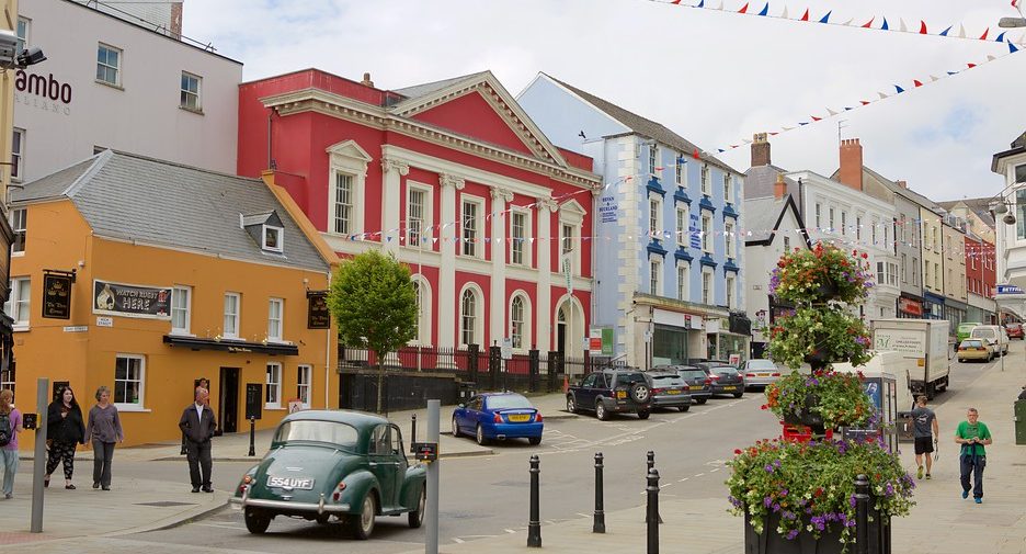
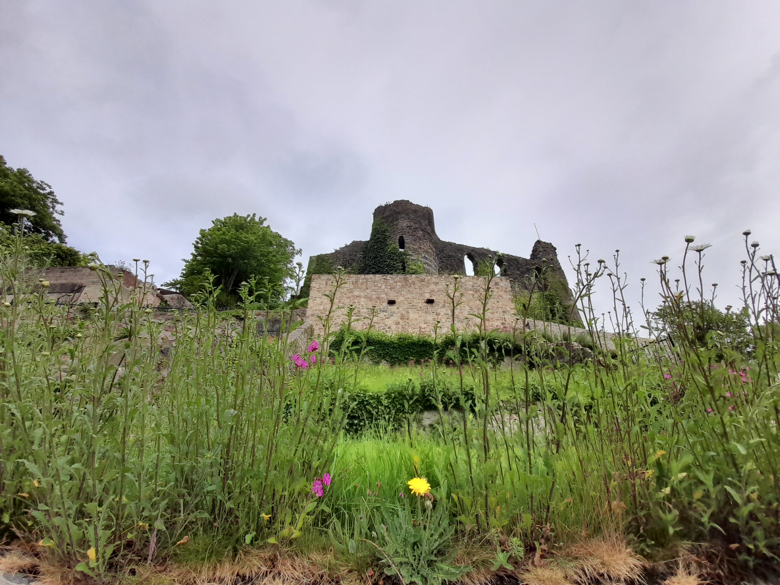
Haverfordwest
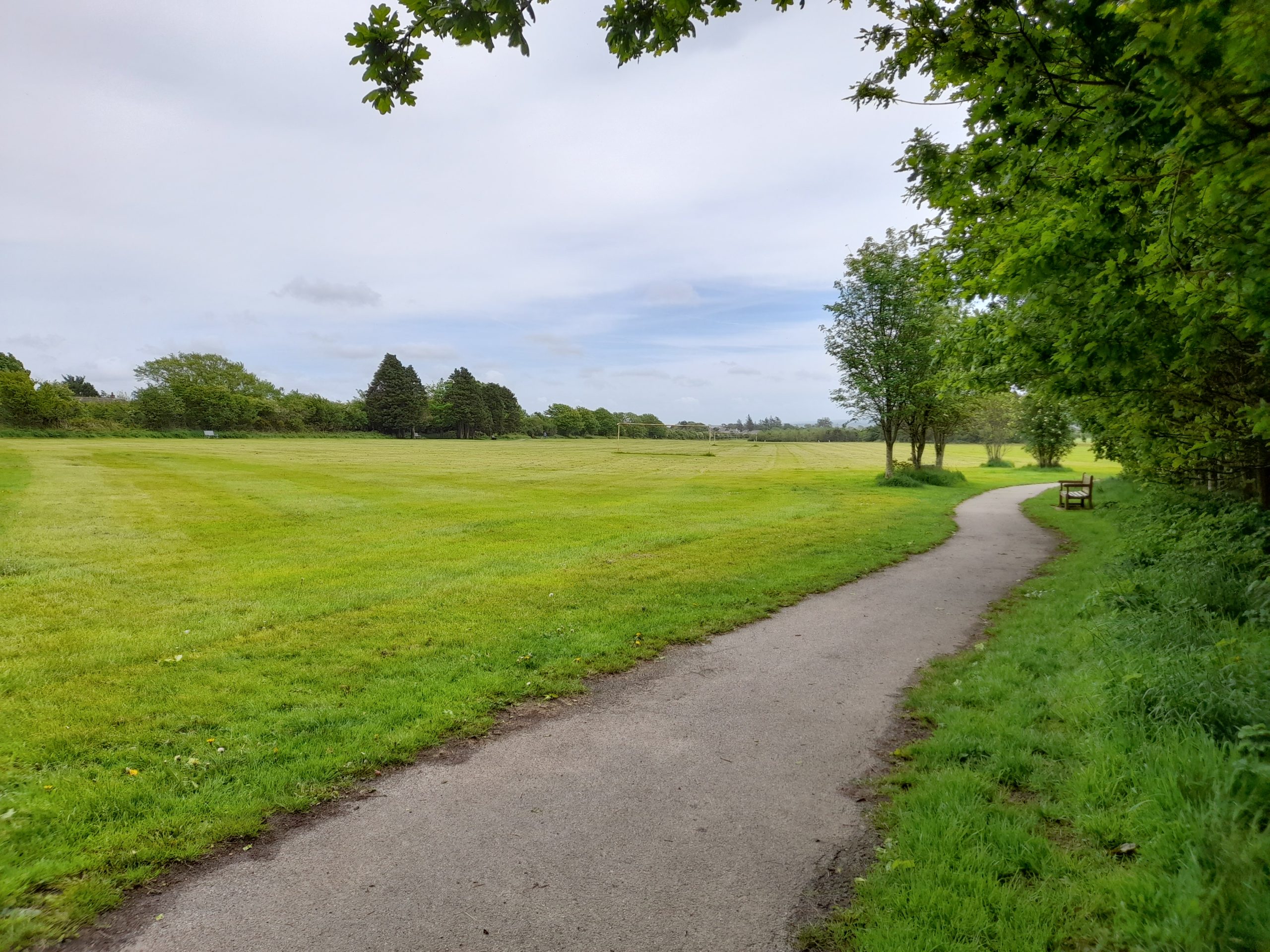
Figure 3.1: Haverfordwest
A Portrait of Haverfordwest’s Green Infrastructure
3.1 Haverfordwest is the largest town within Pembrokeshire with a population of over 15,000. The ancient town is home to numerous historic listed buildings concentrated in the settlement core, contained within the Haverfordwest Conservation Area. Located inland towards the centre of the county, the town’s rural periphery is characterised by hedgerow-bound pastoral fields.
3.2 The Western Cleddau river, which is designated as a Special Area of Conservation (SAC) and Site of Special Scientific Interest (SSSI), bisects the town north-south, and although areas of the river corridor are completely urbanised within the town centre, stretches remain relatively open. These sections provide intermittent walkable connectivity through the town core and out into the surrounding rural landscape, offering opportunities to connect with various nature reserves and Scheduled Monuments along the river corridor. Tributaries of the Western Cleddau include Merlin’s Brook to the south and Fenton Brook to the east of the town. These watercourses provide additional wooded corridors and opportunities for wider access to nature. The river corridor is channelised through the urban centre but opens up into a wider floodplain in the north and south.
3.3 Public Rights of Way (PRoW) within the town centre are limited and generally contained along the river corridor and within wooded open spaces. Areas of public open space are generally located around the town centre and radiate outwards, allowing for some connectivity to the wider countryside. Although the existing PRoW network is somewhat disjointed, there are opportunities for improving overall connectivity. Cycle routes pass through the town along the main roads and join up with National Cycle Network (NCN) route 4 to the south-west of the urban centre. The Brunel Trail, also part of NCN route 4, offers an off-road cycle link between Haverfordwest and Neyland to the south.
Figure 3.2: GI Opportunities within Haverfordwest
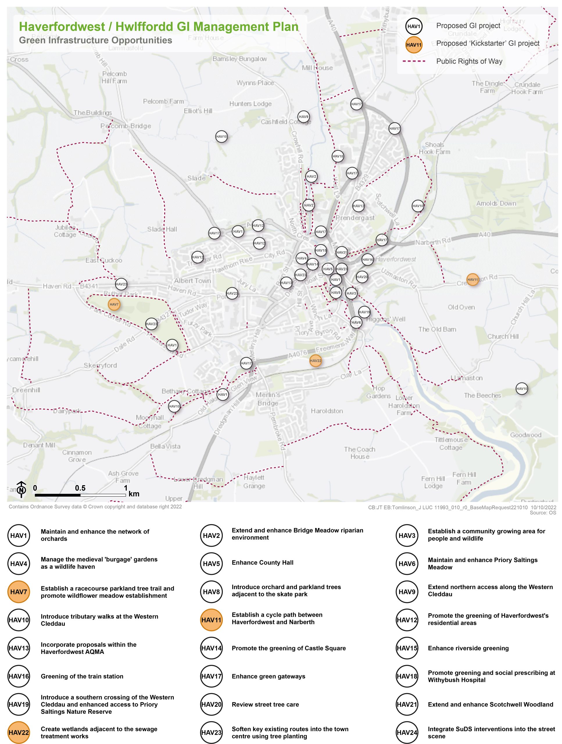
Kickstarter Projects
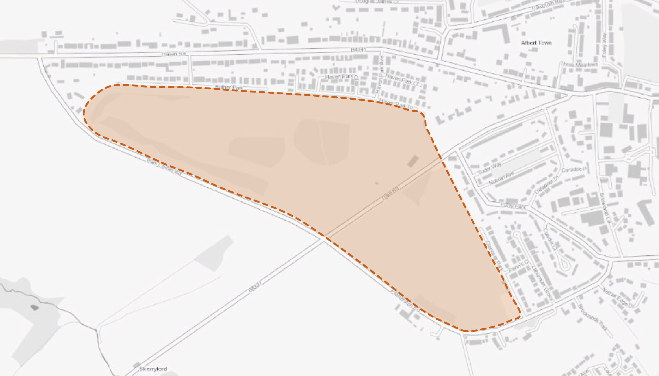
HAV7 – Establish a racecourse parkland tree trail and promote wildflower meadow establishment
3.4 The Haverfordwest Racecourse Public Park is a valued community asset and provides an excellent opportunity to engage the wider public on the value of trees. The site also offers the potential to deliver an educational resource relating to the benefits, diversity and importance of trees within the town. A site-wide tree trail masterplan should be developed which promotes the multi-functional benefits of trees, whilst delivering space for fitness trails and active lifestyles. In addition, a cut and collect tractor and mower should be utilised to remove arisings and promote the establishment of newly sown wildflower meadows on the site.
3.5 Interventions should be delivered in combination with interpretation (potentially including digital interpretation) for all ages. This could include tree labelling as a mechanism to provide information relating to tree species diversity, the importance of trees for climate change mitigation and the promotion of biodiversity.
Figure 3.3: HAV7
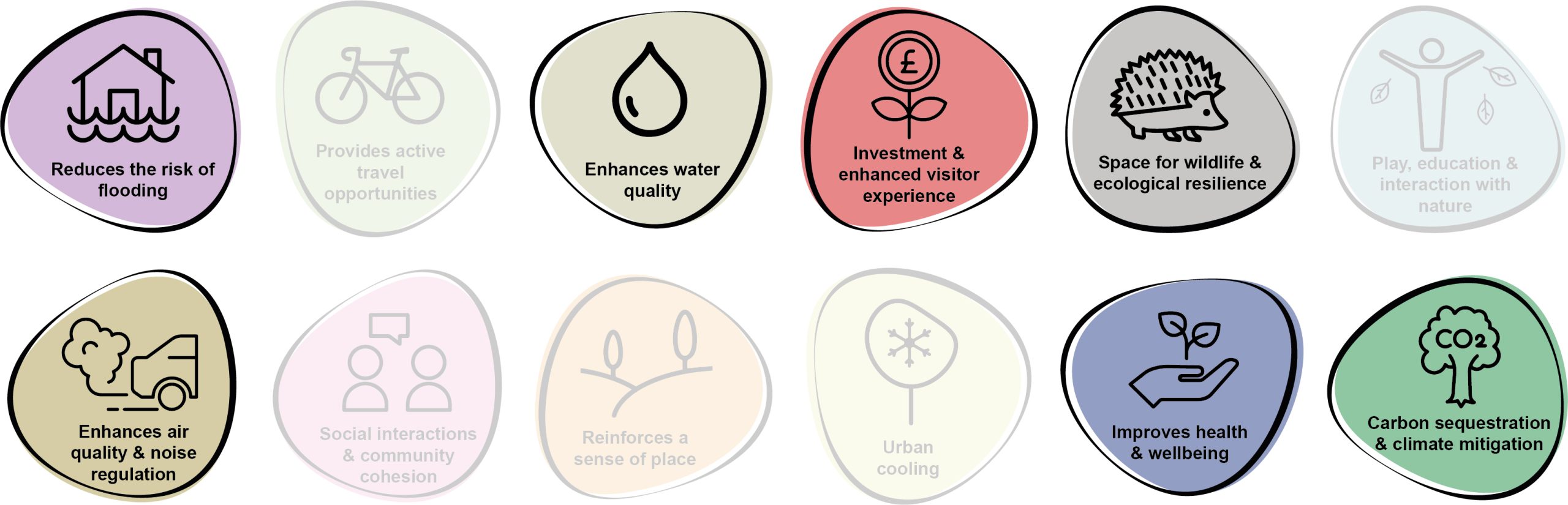
Benefits of the project
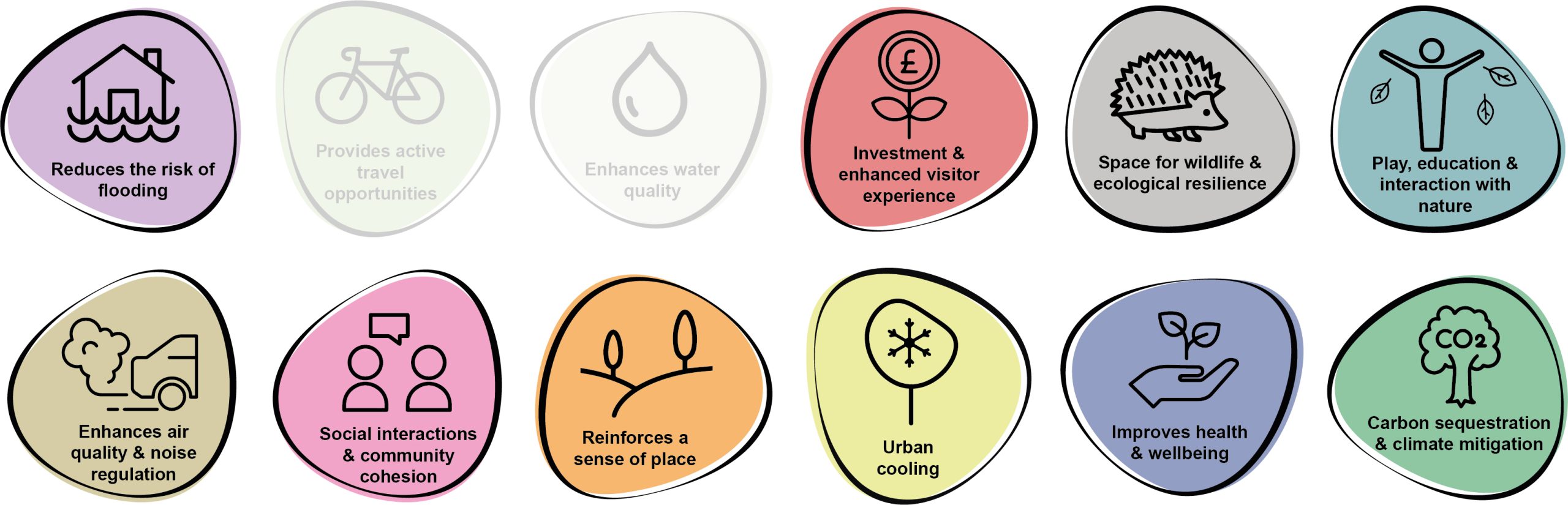
3.6 Benefits of the project, as depicted in Figure 3.4 below, include:
- Reduces the risk of flooding
- Investment & enhanced visitor experience
- Space for wildlife and ecological resilience
- Play, education & interaction with nature
- Enhances air quality & noise regulation
- Social interactions & community cohesion
- Reinforces a sense of place
- Urban cooling
- Improves health and wellbeing
- Carbon sequestration & climate mitigation
Figure 3.4: Benefits
Delivery mechanisms
3.7 An overarching tree planting strategy and masterplan promoting delivery over one season or several planting seasons should be developed. This would need to take account of site conditions, existing tree stock, grassland species, existing site use and access as well as opportunities for enhanced management of existing areas of woodland.
3.8 A preliminary ecological survey should be undertaken to determine the quality of existing grassland at the site and assess suitability for tree planting and the establishment of wildflower meadow. Additional tree planting should not be undertaken in areas identified as exhibiting high floristic diversity. Options for diversifying marginal grassland areas would likely include; cultivating and seeding discrete areas, modifying the existing mowing regime (including annual removal of arisings) and plug planting into existing grass sward (likely only practical over small areas).
3.9 Trees should be delivered in accordance with the delivery section of the Urban Tree Planting Strategy.
Potential partners
- Haverfordwest Racecourse Public Park Trust
- Local community
- Pembrokeshire County Council (PCC) Highways and Transport Department
- PCC StreetCare / Amenity Maintenance Team
- Local businesses
- Tree Wardens Pembrokeshire
Outline cost
Low cost = <£250k
3.10 Costs would comprise some limited specialist advice including development of a masterplan & planting strategy, stakeholder consultation and planting / maintenance costs. Costs of developing interpretation would be dependent on viability and the ambitions of the Haverfordwest Racecourse Public Park Trust.
Potential funding opportunities
- Pembrokeshire County Council (PCC)
- National Lottery Community Fund
- Local Places for Nature Fund
- The Tree Council
- Natural Resources Wales (NRW) grants
Timescale
Quick win = <1 year
3.11 Some initial tree planting could be undertaken during the next planting season.
Medium-term = 1-5 years
3.12 The majority of tree planting, development of interpretation and community engagement should be undertaken over several planting seasons.
3.13 Subsequent carbon sequestration of the trees and associated vegetation would be limited initially, but would increase within the next decade as the trees reach maturity. Depending on the techniques employed and site conditions, the diversification of grassland areas would likely be undertaken over several seasons.
Potential constraints
3.14 A range of stakeholders would need to be engaged to inform an appropriate masterplan and planting strategy for the site. This should include existing users, including sports groups using the grass pitches.
3.15 Whilst tree planting would likely be small scale, advice should be sought as to whether any permissions or consents would be required.
3.16 As there are already notable areas of woodland present on the site, it is reasonable to assume that all areas would generally be suitable for tree planting. However, ecological and feasibility surveys should inform the location of trees and any grassland seeding.
Maintenance and stewardship
3.17 The project presents a notable opportunity for promoting community stewardship and management of trees / grassland areas. The project would ideally involve community training on tree identification, planting and maintenance. Depending on the scale of tree planting, some contractor support for establishment of trees, such as watering, checking stakes etc. may be appropriate and could be built into any funding applications.
3.18 Watering and establishment care would be needed for the 60 month establishment phase to ensure trees are able to become independent in the landscape. A high level management plan for the new planting would ideally be adopted and include removal of tree protection (tree guards / stakes) once trees are fully independent in the landscape (after approximately five years). Allowance should be made for some losses of new trees and provision for replacement planting. Grassland mowing regimes would need to be adjusted to account for areas that are being diversified. Arisings should be removed and disposed of, either offsite, or at a suitable area onsite for composting.
Monitoring for success
3.19 Success could be monitored through early stage and follow up species surveys for grassland areas, the number of trees planted and successful establishment. Monitoring of community engagement should involve a review of volunteer participation, attendance at training days and use of the site through simple visitor surveys.
Next steps
3.20 Undertake feasibility and ecological surveys of the area to ascertain areas best suited for the various interventions. This should include site conditions, existing tree and grassland species.
3.21 Review the delivery section of the Urban Tree Planting Strategy to determine the process for planting trees within soft landscapes and understand the key components for successful tree establishment.
3.22 Engage residents and community groups to identify locations for tree planting and the selection of species, using the species selection guide within the Urban Tree Planting Strategy. Consultant support should be commissioned, where required, for the development of the masterplan / planting strategy and interpretation.
Figure 3.5: Haverfordwest
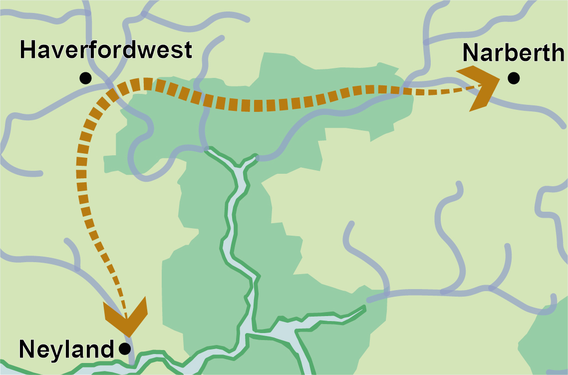
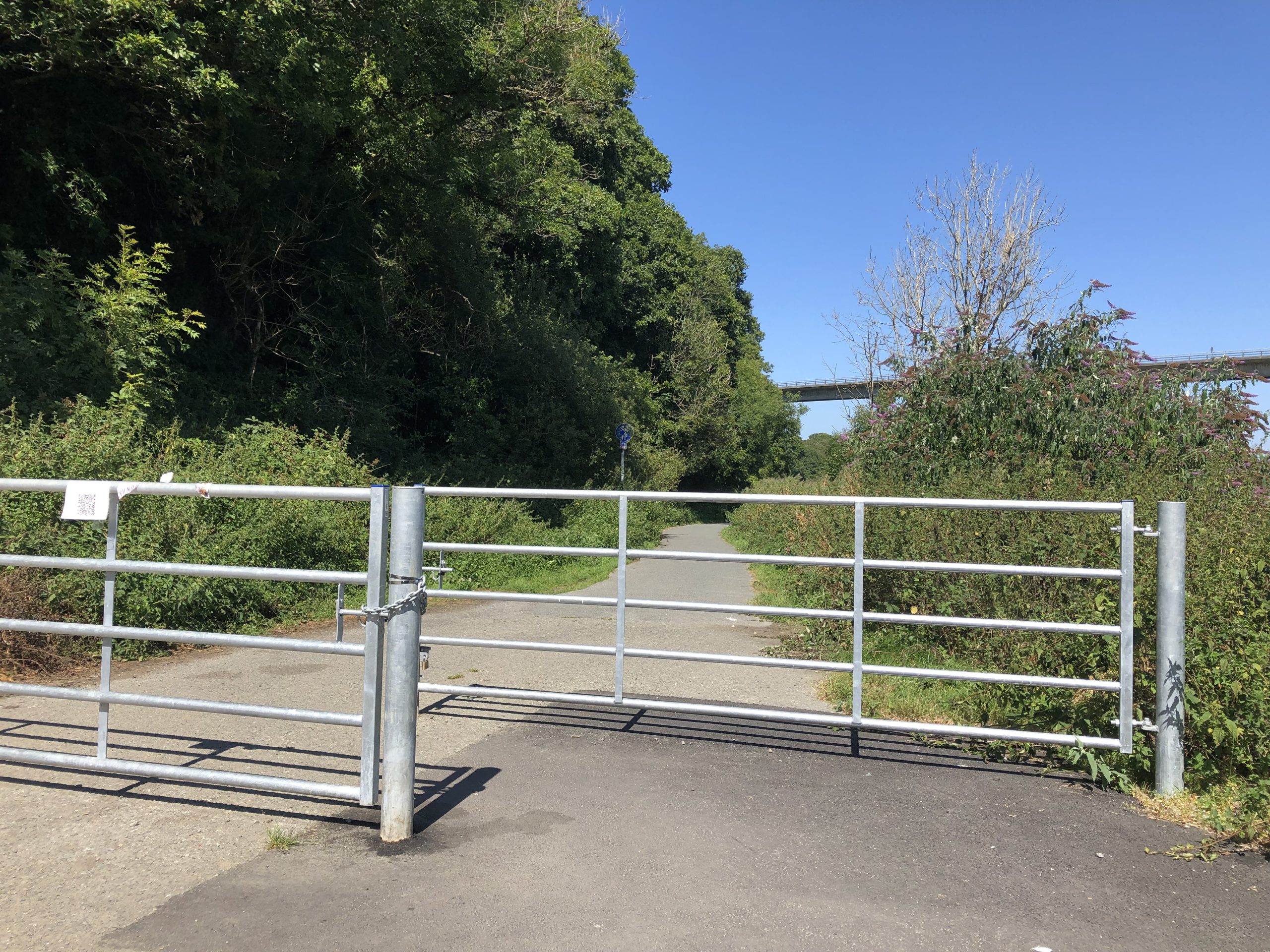
HAV11 – Establish an integrated cycle path between Narberth, Haverfordwest, and Neyland
3.23 The opportunity exists to extend the existing route of the Brunel Trail, linking Neyland to Haverfordwest, to provide a predominantly off-road cycle route connecting eastwards towards Narberth. Recently upgraded multi-user paths emerging from Town Moor car park in Narberth currently provide a connection to Blackpool Mill, via the lowland landscape parallel to the Cleddau River. However, an optioneering exercise and feasibility study should be undertaken to determine a preferred route to deliver the ‘missing link’ in the route between Blackpool Mill and Haverfordwest. Working in conjunction with Pembrokeshire County Council (PCC), proposals would need to resolve access issues across privately owned land at Slebech Park, where existing Public Rights of Way (PRoW) are currently absent.
3.24 Consideration should be given to the incorporation of a range of street furniture, interpretation, signage and incidental natural play features along the route to enhance the corridor as a recreational asset. However, the implementation of any lighting proposals would need to be undertaken in liaison with an ecologist to ensure the correct balance is reached between the perception of safety and biodiversity considerations. This would be carried out as part of a wider ecological assessment to determine specific ecological sensitivities of the proposed site and any requirements for mitigation. Working in conjunction with conservation groups and local voluntary groups, conservation activities would not only enhance the nature value of the route, but also promote active lives and positive mental wellbeing through community cohesion.
Figure 3.6: Route between Narberth, Haverfordwest, and Neyland
Benefits of the project
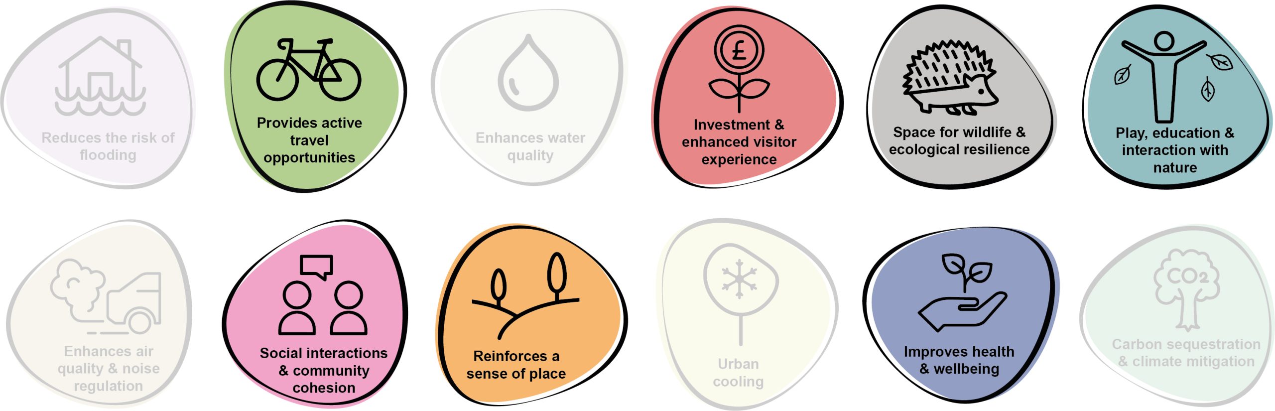
3.25 Benefits of the project, as depicted in Figure 3.7 below, include:
- Provides active travel opportunities
- Investment and enhanced visitor experience
- Space for wildlife and ecological resilience
- Play, education and interaction with nature
- Social interaction and community cohesion
- Reinforces a sense of place
- Improves health and wellbeing
Figure 3.7: Benefits
Delivery mechanisms
3.26 A grant application would be required to secure funding for the capital works associated with this project. The route would need to be identified on the Integrated Network Map to be considered eligible for funding.
Potential partners
- Active Travel team, forming part of the Transport Strategy Unit at PCC
Outline cost
High cost = <£1 million
Potential funding opportunities
- Welsh Government Active Travel Fund Grant
- PCC
- Transport for Wales
Timescale
Medium-term = >5 years
3.27 To complete the route in full, it will likely take over 5 years to deliver.
Potential constraints
3.28 The project is likely to be complex, with competing demands including the requirement for significant external funding and liaison with local landowners. It would be necessary to engage with landowners and land occupiers in order to present the project and discuss any impacts on current land-use. However, a key unknown for the project would be the time needed to gain these landowner consents.
3.29 The upgrading of existing routes to provide a multi-user route for cyclists would also require localised vegetation clearance along some sections of the route. This would need to be undertaken to avoid the bird nesting season and in liaison with an ecologist or Ecological Clerk of Works (ECoW).
3.30 In order to fulfil the criteria of the Welsh Government Active Travel Fund Grant, the scheme design would need to ensure it is consistent with the principles of the Active Travel (Wales) Act 2013 and the supporting Active Travel Act Guidance. Schemes that include highway improvement, construction, or traffic management must show how they comply in particular with Section 9 of the Act (Provision for walkers and cyclists in the exercise of certain functions).
Maintenance and stewardship
3.31 Ongoing annual maintenance of the hard surfacing of the route would be required to ensure access is maintained throughout the year. Landscape management works would also be required to ensure the retention of sightlines across the route.
Monitoring for success
3.32 The opportunity exists to install sensors or counters to monitor the usage of the route as part of the wider active travel network within the county. This approach would help measure the success of the substantial investment and inform the long-term strategy and delivery of similar projects in the future.
Next steps
3.33 Undertake a feasibility study and optioneering exercise to determine a proposed route. This exercise should incorporate an ecological assessment and tree survey to BS5837: 2012 to examine the implications on local biodiversity and existing tree cover. A street furniture and signage strategy for the route should also be developed. Furthermore, a comprehensive process of consultation and engagement would be required to determine the appetite for conservation days along the route.
Figure 3.8: Haverfordwest
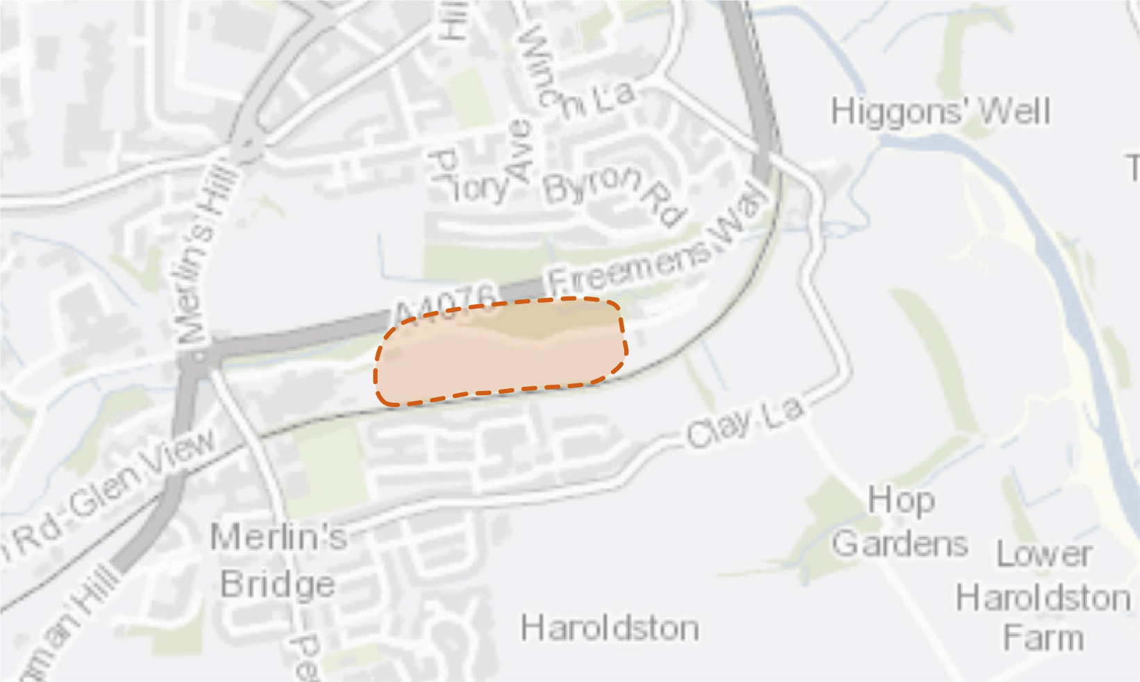
HAV22 – Create wetlands adjacent to the sewage treatment works
3.34 South of Haverfordwest lies a Dwr Cymru Welsh Water sewage treatment works adjacent to Merlin’s Brook. This site lies within Flood Zone 2 and 3, with several historic combined storm overflow events (where foul effluent, mixed with rainwater is released into the river due to the capacity of infrastructure being exceeded). Dwr Cymru Welsh Water recorded a total of 847.25 total hours of spills in 2021 alone. These spills feed into Merlin’s Brook which drains into the Western Cleddau River, a designated Special Area of Conservation that is currently failing the new phosphate criteria. Phosphate, whilst naturally occurring, can also result from human activity such as sewage effluent. Elevated levels of phosphate lead to eutrophication of rivers which can cause significant ecological damage. The Western Cleddau supports populations of brook lamprey, river lamprey, bullhead and otters, all of which decline with decreasing water quality.
3.35 The creation of new wetlands on vacant land next to the sewage treatment works would provide increased treatment capacity to help remove phosphates from the treated sewage effluent as it exits the site. This intervention would also provide a buffer for both flood alleviation and combined storm overflow events, reducing the degree to which raw untreated sewage flows directly into the brook. The wetlands would aid nutrient stripping of the outfall and this in turn would help reduce phosphate levels in the Western Cleddau River.
Figure 3.9: HAV22 project
Benefits of the project
3.36 Benefits of the project, as depicted in Figure 3.10 below, include:
- Reduces the risk of flooding
- Enhances water quality
- Investment & enhances visitor experience
- Spaces for wildlife & ecological resilience
- Enhances air quality & noise regulation
- Improves health & wellbeing
- Carbon sequestration & climate change.
Figure 3.10: Benefits
Delivery of nature-based solutions and ecosystem services
3.37 Wetlands can aid flood alleviation, acting as a store of excess water in periods of heavy rainfall in addition to their primary function of nutrient stripping and cycling. These habitats also provide multiple biodiversity benefits.
3.38 Constructed wetlands, if designed correctly, can achieve sustainable effluent treatment that provides a reduction in contaminant concentration similar to more complex chemical-based or mechanical mechanisms. The effluent from sewage treatment facilities is typically rich in nutrients and wetlands can be used to help alleviate this issue in a sensitive areas such as the Western Cleaddau River SAC.
Delivery mechanisms
3.39 An appropriate design engineer should be consulted to provide a design of the wetlands. The potential area for the wetlands should be calculated and agreed with relevant landowners. Consultation with the local community should be undertaken to enable engagement with the plans. Contractors required to scope out the topography and excavate selected areas should be employed. Consideration of materials needed to create the wetlands such as substrate materials and vegetation should also be sourced as locally as possible.
3.40 It may be possible to incorporate solutions such as this into developer contributions (e.g. under Section 106 agreements) that enable developers to offset the increased nutrient loading associated with new developments, thus providing a funding mechanism for the wetland’s construction and maintenance.
Potential partners
- Natural Resources Wales (NRW) Projects for Cleddau Rivers – Natural Flood Alleviation
- The Four Rivers for LIFE project
- Wildlife Trust of South & West Wales
- Cleddau SAC Nutrient Management Plan Board
- West Wales Rivers Trust
Outline cost
Low cost = <£250k
3.41 Costs would comprise land purchase or rent, specialist engineer design of the wetlands, procurement of planting and costs associated with excavation and installation of the wetlands.
Potential funding opportunities
- Dwr Cymru Welsh Water
- The Four Rivers for LIFE project
- Nutrient credits using Section 106 agreement
- Ofwat Innovation Fun
Timescale
Medium-term = <1-5 years
3.42 This anticipated programme length includes for time to enable design of the wetland, agreements with landowners, construction and planting of the wetland.
Potential constraints
3.43 A key constraint for the project would be securing landowner agreements. It would also be essential to ensure the wetlands are located adjacent to the sewage treatment infrastructure to avoid re-routing sewage outfalls that would increase time and costs of the project. Antibiotic-resistant bacteria accumulation in wetlands is a concern and should be considered in the design of the wetlands.
3.44 An ecological assessment of the site would need to be undertaken by an ecologist with all site works potentially supervised by an Ecological Clerk of Works (ECoW).
Maintenance and stewardship
3.45 Wetlands are fairly low maintenance with little to no running costs as they do not require power and are generally reliable self-adjusting systems. However, maintenance would be required a few times a year to remove debris from any outlets, replace any damaged pipes, remove any invasive plant species that may be outcompeting the wetland plants, reduce sediment accumulation and check the structural integrity of the structural aspects of the design. Ongoing agreements with Dwr Cymru Welsh Water or landholders for access would be crucial.
Monitoring for success
3.46 Subject to availability of funding, monitoring of the success of the project should be undertaken through simple citizen science. Techniques could include monitoring of water quality using simple hand-held equipment.
Next steps
3.47 This project would require collaboration with Dwr Cymru Welsh Water and so the first step would be to explore and set in place a collaboration agreement. This may help unlock funding from Dwr Cymru Welsh Water themselves, or from Offwat Innovation Fund or similar. Thereafter, a scoping exercise should be undertaken to define the requirements of the scheme in terms of the range of outflows from the sewage works, the space available for construction and landowner considerations.
Project Long List
HAV1 – Maintain and enhance the network of orchards
3.48 Continue the legacy of Transition Haverfordwest’s Orchard Mawr project through ongoing management of Merlins Bridge Orchards, Fleming Crescent Orchards and Racecourse Orchards. The establishment of fruit trees by the skate park and the extension of planting along the grassy verges of the Parade / tennis courts should also be explored.
HAV2 – Extend and enhance Bridge Meadow riparian environment
3.49 Complement wildflower areas along the extent of the Western Cleddau reaches by extending areas of wet meadow along the floodplain. This would support wider biodiversity objectives through the inclusion of wader scrapes and areas of wet woodland, reinforcing the habitat corridor. The area has been identified by Natural Resources Wales (NRW) as an area for floodplain reconnection potential and would help provide a natural flood attenuation area upstream of the town.
HAV3 – Establish a community growing area for people and wildlife
3.50 The opportunity exists to create an area of community allotments, fulfilling a vital role in connecting people to the process of food production. Where possible, planting margins should be left uncut, sheds fitted with living roofs and bird feeders added to attract wildlife. The intervention should encourage plot owners to reduce the use of pesticides and herbicides, instead choosing to work the land organically. Additional tree and orchard planting opportunities should also be explored.
HAV4 – Manage the medieval ‘burgage’ gardens as a wildlife haven
3.51 The Haverfordwest Castle burgage plots are currently managed as a wildlife haven, with more than 18 different types of wildflower plants, hedgehog hideaways, bird and bat boxes. By supporting a variety of species, the burgage plots not only are an attractive visitor destination, but they also help demonstrate the importance of interconnected food webs. Continued management is recommended to ensure that the site continues to be a place for people and wildlife to enjoy.
HAV5 – Enhance County Hall
3.52 The opportunity exists to re-plant the redundant window boxes at County Hall with native flowers to enhance biodiversity. Wildflower seeds should also be sown and plug plants introduced in the verges at ground level to provide additional value to pollinators. Planting proposals which aim to enhance biodiversity should also be integrated within proposals to improve the link between Picton Place and the Clock Tower.
HAV6 – Maintain and enhance Priory Saltings Meadow
3.53 Formerly a household waste recycling centre, Priory Saltings is now a thriving nature reserve. The meadow grassland should continue to be managed through mowing and gathering seed rich hay between late August and September. This operation encourages a traditional hay meadow to establish that is rich in flowering perennials. The site should also continue to promote events such as Pembrokeshire Meadows Open Day to encourage local awareness and engagement. Areas of bare ground and wetter areas should be enhanced to provide for pollinators throughout their life cycle. Consideration should also be given to improved wayfinding and interpretation signage, including the potential to provide an all-weather accessible link between the site and The Priory.
HAV7 – Establish a racecourse parkland tree trail and promote wildflower meadow establishment
3.54 Refer to Kickstarter Projects.
HAV8 – Introduce orchard and parkland trees adjacent to the skate park
3.55 Explore the opportunity to introduce tree planting adjacent to the skatepark to complement the network of existing fruit trees. Planting parkland trees would also help to reinforce the townscape and landscape character of the area, whilst delivering a range of multi-functional benefits. Working in conjunction with Haverfordwest Skatepark Association, the opportunity exists to deliver a community tree planting event to encourage local buy-in of the proposals and promote community ownership.
HAV9 – Extend northern access along the Western Cleddau
3.56 Extend and connect Old Mill Ground Nature Reserve to facilitate sensitive access to nature. Building on the recent footbridge which crosses the Western Cleddau at this location, the installation of additional access northwards (subject to landowner approval) should be explored. This should be coupled with direct access towards communities at Cashfield where the opportunity exists to create a circular recreational route. Additional tree planting to increase strategic canopy cover, whilst delivering nature-based solutions to flooding, should also be incorporated into future landscape proposals.
HAV10 – Introduce tributary walks at the Western Cleddau
3.57 Explore opportunities for circular walks which connect the centre of Haverfordwest with the surrounding countryside and Pembrokeshire Coast National Park. The routes should utilise some of the Western Cleddau’s tributaries (including Merlin’s Brook, Cartlett Brook and Pelcomb Brook).
HAV11 – Establish an integrated cycle path between Narberth, Haverfordwest and Neyland
3.58 Refer to Kickstarter Projects.
HAV12 – Promote the greening of Haverfordwest’s residential areas
3.59 Supplement and enhance existing woodland buffers within the north west of Haverfordwest, utilising large areas of amenity grassland adjacent to residential areas. Additional habitat creation interventions, including wildflower meadows, should also be explored within locations such as Thomas Parry Way, Fleming Crescent, Trafalgar Road and the estate at Scotchwell View. In addition, the integration of greening initiatives within the green space at Tan Bank should be delivered in conjunction with proposals to introduce a footway to connect Cardigan Road with Prendergast School. An opportunity to review the landscape management of Fleming Crescent Woodland should also be explored.
HAV13 – Incorporate proposals within the Haverfordwest AQMA
3.60 Review parking provisions to accommodate space for raised planters and street tree planting. This intervention should be coupled with the potential for planting on grass verges, for example at Milford Road. Trees should also be used to define key routes between key destinations and visitor attractions within the town.
HAV14 – Promote the greening of Castle Square
3.61 Introduce soft landscape interventions within Castle Square to provide an attractive public space. Street trees with incorporated seating should be used to provide shade, alongside raised planters with incorporated bike parking, electric bike charging and sociable seating arrangements. Features utilised within Castle Square should form part of a repetitive set of street furniture across the town. Urban greening and signage should also be used to create a more welcoming route to the car park. Consideration should also be given to the installation of additional cycling and electric bike facilities.
HAV15 – Enhance riverside greening
3.62 A concentration of Combined Sewer Overflow (CSO) events are located within close proximity to Riverside Shopping Centre. Bridge Meadow Retail Estate has also previously recorded flood events. Therefore, the implementation of trees, permeable paving, raised planters, seating and rain gardens within the public realm and car parks should be explored. Supported by appropriate maintenance and management programmes, floating reedbeds should also be used to soften the channelised edge of the river with the aim of enhancing water quality and provide riparian habitats. Green walls, green bus stops and greening features should be delivered along the multi storey car park to the north east of the shopping centre.
HAV16 – Greening of the train station
3.63 Enhance the sense of arrival within the town through small scale street tree planting and urban greening features; including raised planters, green cycle parking and green bus stops. This should be complemented with enhanced wayfinding to promote the town’s key attractions as well as seating provision and electric bicycle charging stations.
HAV17 – Enhance green gateways
3.64 Deliver attractive and pollinator-friendly green gateways to Haverfordwest at key entrance points, car parks and roundabouts. Potential locations include Withybush Roundabout, Cardigan Road Roundabout, Brigend Square Roundabout, Salutation Square Roundabout, Merlins Bridge Roundabout, Slade Roundabout, and Scotchwell Roundabout as well as both public and private car parks. Alongside planting improvements, consideration should be given to junction approaches and how these can be improved to promote increased usage by pedestrians and cyclists (whilst allowing for appropriate visibility splays).
HAV18 – Promote greening and social prescribing
3.65 Work in partnership with Withybush Hospital, South Pembrokeshire Hospital, Tree Wardens Pembrokeshire and Local Places for Nature to progress landscape design proposals for therapeutic gardens. These spaces should aim to deliver gardens for quiet relaxation and promote a greater connection with nature for patients and staff. Opportunities for gardening and small-scale food growth should also be explored. The potential also exists to support Pembrokeshire College in the development of proposals for a food growing area for life skills learners as well as a well-being garden at its site at Withybush. Long-term aspirations should involve a direct active travel connection between the Withybush Hospital and Crowhill Road via the Western Cleddau footbridge.
HAV19 – Introduce access improvements to improve connections between the Western Cleddau and Priory Saltings Nature Reserve
3.66 Explore future options for access enhancements to Priory Saltings Nature Reserve from the Western Cleddau. Options include improvements to the existing road bridge from Picton Fields or a new southerly crossing of the Western Cleddau. These links would aim to connect Priory Saltings Nature Reserve, Fortune’s Frolic footpath as well as the wider Public Rights of Way (PRoW) network. Links from the A4076 to Priory Saltings Nature Reserve, including the provision of circular route options in the south of Haverfordwest, should also be explored. In addition, the opportunity exists to explore new shared-user path proposals connecting Merlin’s Bridge along Clay Lane to Union Hill.
HAV20 – Review street tree care
3.67 Review the setting of existing street trees and their ongoing care. To promote their long term establishment, existing areas of asphalt concrete should be broken-out at the base of the street tree to allow for the passage of air and water. Installation of new street trees should follow best practice use of tree pits, guards and grilles (where appropriate).
HAV21 – Extend and enhance Scotchwell Woodland
3.68 Review the management of Scotchwell Woodland to promote positive management practices; ensuring appropriate thinning, coppicing and invasive species removal. Consideration should also be given to the introduction of new trees at the amenity greenspace at Cherry Grove and Mill Bank to expand connectivity of the woodland and enhance the structured woodland edge hierarchy. Proposed access improvements, in accordance with the Active Travel Network Map, should also be delivered.
HAV22 – Create wetlands adjacent to the sewage treatment works
3.69 Refer to Kickstarter Projects.
HAV23 – Soften key existing routes into the town centre using tree planting
3.70 Introduce tree planting along key routes to soften the approach into the town centre and address the gaps in strategic canopy cover, whilst also softening urban edges. Potential locations include the A4076 corridor, B4341 Haven Road, B4327 Dale Road and High Street. The management of existing street trees should also be re-examined, ensuring tree stakes, grilles and guards are removed or re-tied to accommodate growth.
HAV24 – Integrate Sustainable Drainage Systems (SuDS) interventions into the street scene
3.71 The urban street scene offers the opportunity to integrate various Sustainable Drainage Systems (SuDS) interventions and tree planting as a mechanism to help reduce the volume of surface water which is directly channelled through a network of pipes. The potential also exists to work in conjunction with Haverfordwest Town Council to explore locations for SuDS interventions within the townscape.
Previous Chapter:
Fishguard and Goodwick
Next Chapter:
Milford Haven
Return to homepage:
Homepage