
Page Contents:
A Portrait of Milford Haven’s Green Infrastructure
Milford Haven
Figure 4.1: Milford Haven
A Portrait of Milford Haven’s Green Infrastructure
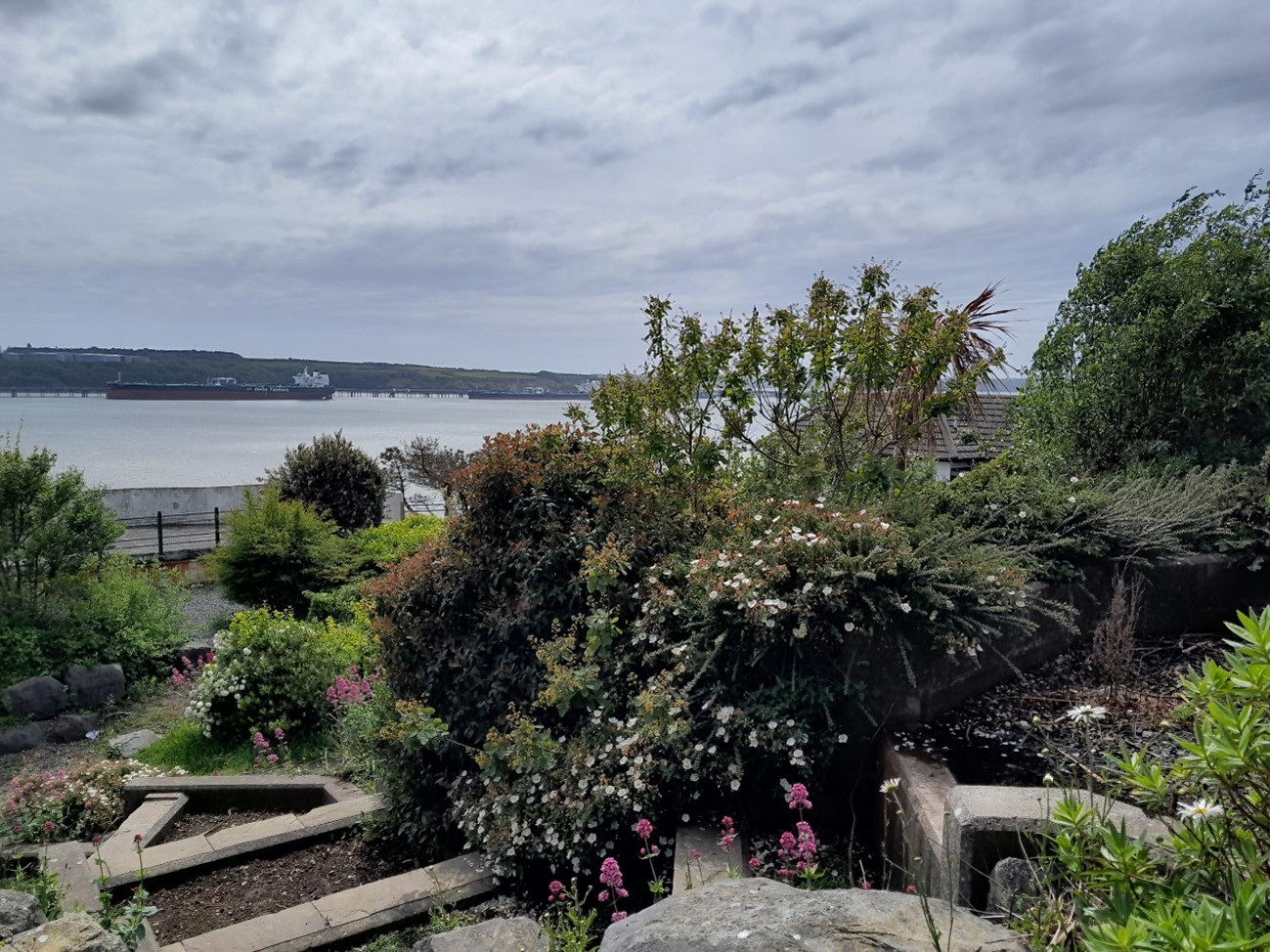
4.1 Milford Haven is a historic industrial town in the south of Pembrokeshire. The settlement is located on the northern shore of Milford Haven, one of the deepest natural harbours in the world and which forms part of the Pembrokeshire Marine Special Area of Conservation (SAC). Significant stretches of the estuary’s coastline are also designated under the Milford Haven Waterway Site of Special Scientific Interest (SSSI). Originating as a whaling port, Milford Haven and the wider estuary have since developed into a nationally important shipping hub for oil and gas, with large infrastructure to the west, north, and east of the town boundaries. The growth of the oil and gas industry in the 20th century gave rise to modern housing developments, which now occupy the clifftops to the north and west of the old town centre. Much of the townscape has views across the waterway, with chimney stacks from the oil refinery breaking the skyline on the southern shore.
4.2 Hubberston Pill and Castle Pill are two tidal inlets that branch off Scotch Bay and are located on either side of the town centre. Corridors of green space and Public Rights of Way (PRoW) stretch along the coastline and follow these watercourses inland. Castle Pill, to the east of the town centre, is set within a meandering stream valley and connects with Deadman’s Lake in the north. Hubberston Pill and its wooded valley divide the town centre from the modern residential development to the west. Dense woodland, some of it ancient, and cycling and walking paths along the watercourses provide opportunities for connectivity between the coast and surrounding countryside for both people and wildlife. The Pembrokeshire Coast Path passes along the coastline and through sections of the town, before being diverted up to Black Bridge at Castle Pill.
4.3 Beyond the green spaces along the water, larger public open spaces are located throughout the town, largely concentrated in residential areas. The open space network generally comprises playing fields and other recreational uses but is somewhat disconnected from the network of PRoW.
Figure 4.2: GI Opportunities within Milford Haven
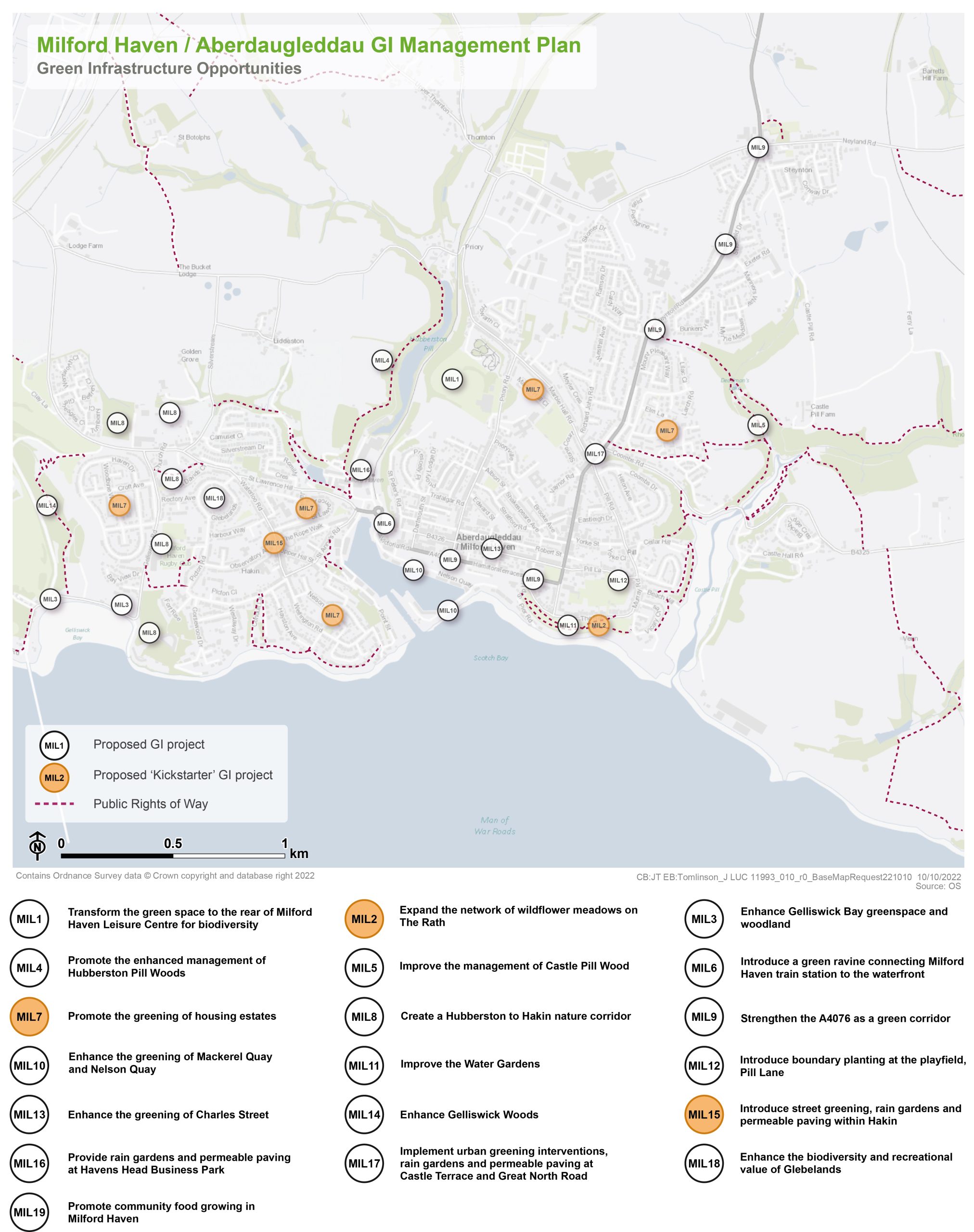
Kickstarter Projects
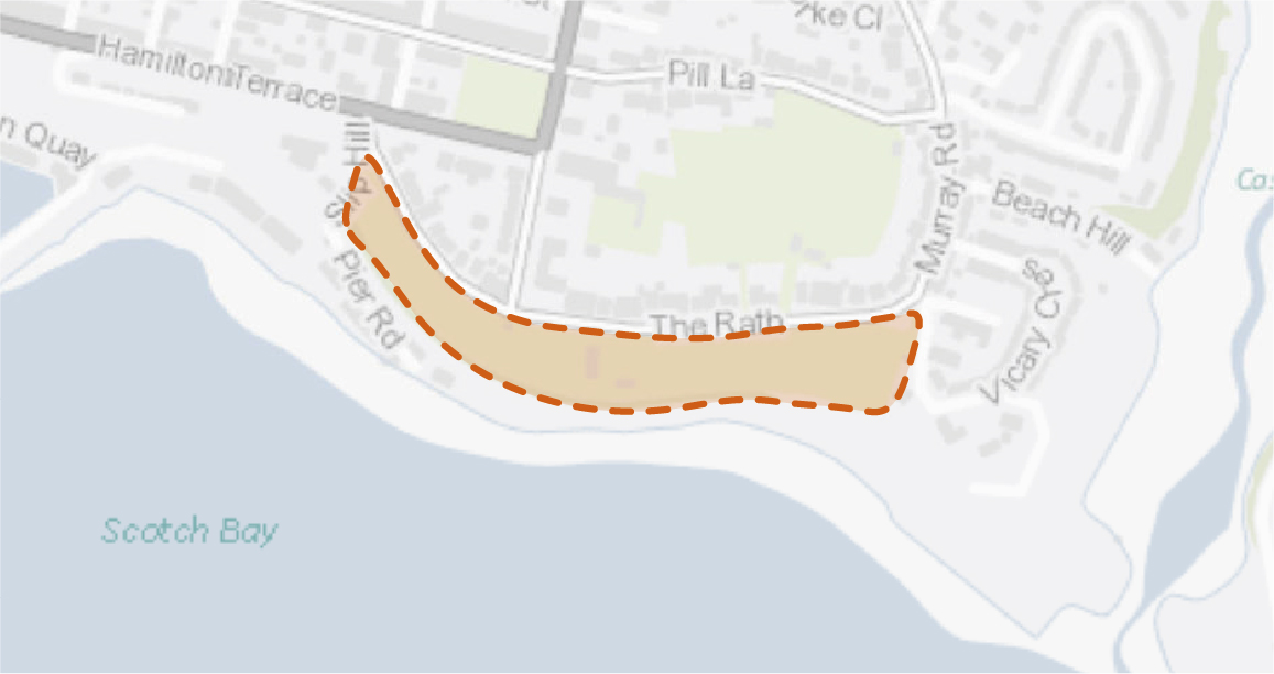
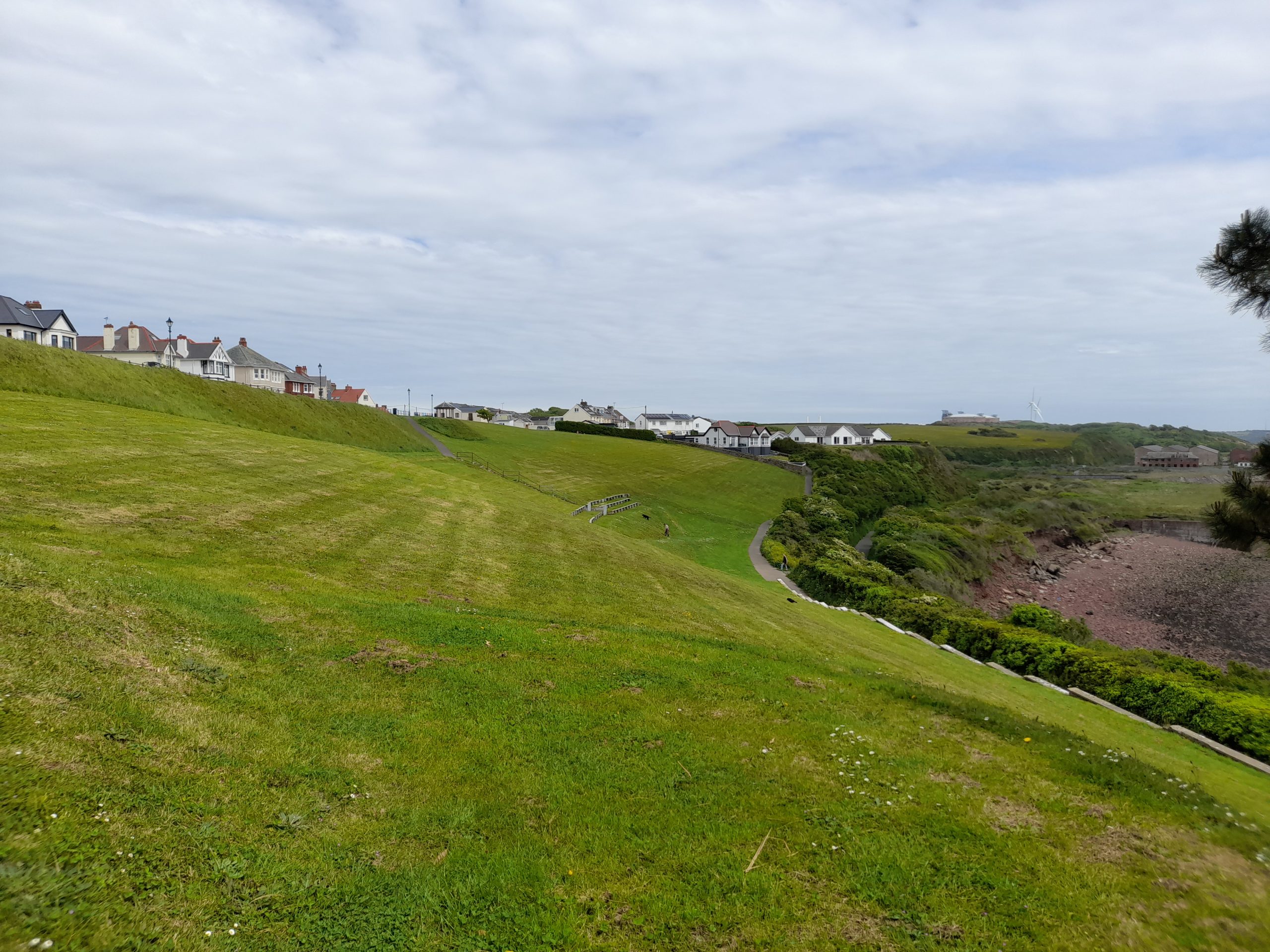
MIL2 – Expand the network of wildflower meadows on The Rath
4.4 The greenspace forming the frontage of The Rath was transformed into a wildflower meadow following the introduction of relaxed mowing regimes as part of ‘No Mow May’. This intervention demonstrated what could be achieved through targeted maintenance.
4.5 As this area is characterised by a sloped embankment, much of the land is an unsuitable gradient for recreation and paved paths and benches are provided for people to walk and rest. Much of this area is therefore providing little function and offers the opportunity to be enhanced for biodiversity benefits.
4.6 Continuation of these mowing practices to the sloped edge of The Rath would provide much needed pollinator habitat in the centre of the town. To increase species diversity, native wildflower seed should be sown, or wildflower turf laid. Consideration should also be given to mechanisms to reduce topsoil fertility to increase the likelihood of wildflower establishment. The use of salt-tolerant wildflower species should be explored due to the proximity of the site to the coast.
4.7 Signage can play an important role in communicating to the public why the wildflower meadow is being established. This can help overcome perceptions of ‘messiness’ by conveying that the area is being prioritised for nature.
4.8 On the lower slopes, additional small-scale tree planting would be appropriate. However, views across Milford Haven should be retained.
Figure 4.3: MIL2
Benefits of the project
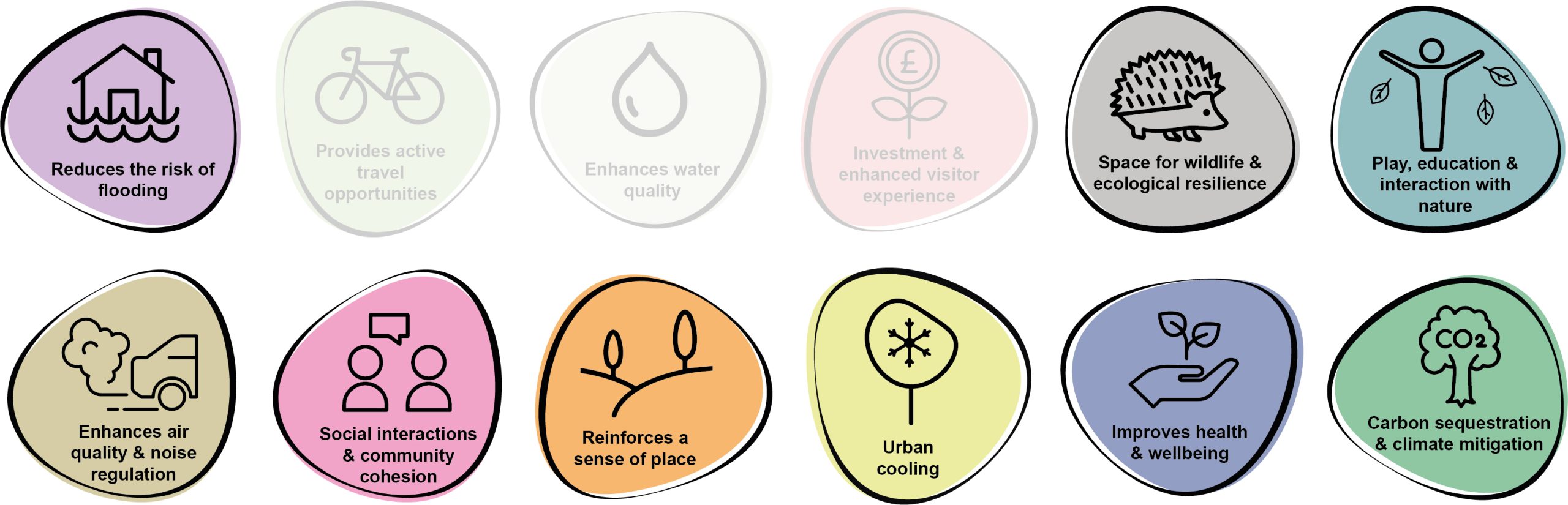
4.9 Benefits of the project, as depicted in Figure 4.4 below, include:
- Investment & enhanced visitor experience
- Space for wildlife and ecological resilience
- Play, education & interaction with nature
- Reinforces a sense of place
- Improves health and wellbeing
Figure 4.4: Benefits

Delivery mechanisms
4.10 Annual cuts of wildflower meadow should be integrated into the work programme of the Pembrokeshire County Council (PCC) StreetCare / Amenity Maintenance Team.
4.11 Wildflower meadows and the community orchard should be delivered in accordance with the delivery section of the Pollinator Strategy.
4.12 There may be a requirement to reduce soil fertility to promote the successful establishment of wildflower meadows. This could be achieved by stripping away the top 5-10 cm of soil in the area where the wet meadow would be created. Autumn is the optimum time to sow wildflower seeds to provide the earliest display of wildflowers the following year. However, wildflower seeds can be planted throughout the year and would begin to bloom after approximately 60-80 days.
Potential partners
- PCC StreetCare / Amenity Maintenance Team
- Tree Wardens Pembrokeshire
- Milford Haven Town Council
- Pembrokeshire Nature Partnership
- Pembrokeshire Meadows Group
Outline cost
Low cost = <£250k
4.13 As described in the delivery section of the Pollinator Strategy, wildflower meadows can in fact save money from reduced mowing. Investment in a cut and collect machine may also aid overall savings on labour costs from gathering cuttings. Cost of wildflower seed is likely to be low, although this figure would be higher if plug plants or wildflower turf are utilised instead.
Potential funding opportunities
- Local Places for Nature Fund
- National Lottery Community Fund
Timescale
Quick win = <1 year
4.14 Depending on soil fertility and if wildflowers are sown after Autumn, it may be the case that the seeds do not bloom until after their first winter season.
Potential constraints
4.15 Consideration should be given to how to gather the cuttings and remove them from the wildflower meadow to prevent enrichment of the soil. The most efficient way to do so is with a cut and collect mower but this requires capital investment. Otherwise, arisings should first be gathered into rows which are then gathered into individual stacks. This can be labour intensive.
4.16 There can be a perception that wildflower meadows are untidy or messy, especially before and after flowers have bloomed. This could result in complaints from the public. Signage to communicate the benefits of growing wildflower meadows can help increase understanding and education regarding the importance of pollinators.
Maintenance and stewardship
4.17 A wildflower meadow requires a cut and lift at the end of the season. This is typically in September. The arisings should ideally be left for seven days to shed seed before removing. A second cut and lift may be required in early spring to remove winter growth. Care is required when mowing as small mammals, amphibians and reptiles may be hiding in the grass. Some birds nest in larger meadows, so mowing should not be undertaken until after the beginning of August. Dominant species such as nettle and dock should be managed through selective scything or hoeing.
4.18 Use of fertilisers, pesticides and insecticides should be avoided.
Monitoring for success
4.19 Monitoring should align with national schemes. The UK Pollinator Monitoring Scheme runs Flower-Insect Timed Counts (FIT Counts). This involves counting the insects visiting one of the 14 flower species target flowers within a 50cm by 50cm square patch for 10 minutes. Local residents and schools could be encouraged to participate in this as a citizen science initiative. Alternatively, plant ‘indicator species’ can be recorded within a 1km square to monitor species diversity.
Next steps
4.20 Review the delivery section of the Pollinator Strategy to determine the process and review case studies relating to the creation of wildflower meadows. Engage with the PCC StreetCare / Amenity Maintenance Team to communicate the proposed mowing regime.
Figure 4.5: Milford Haven
MIL7 – Promote the greening of housing estates
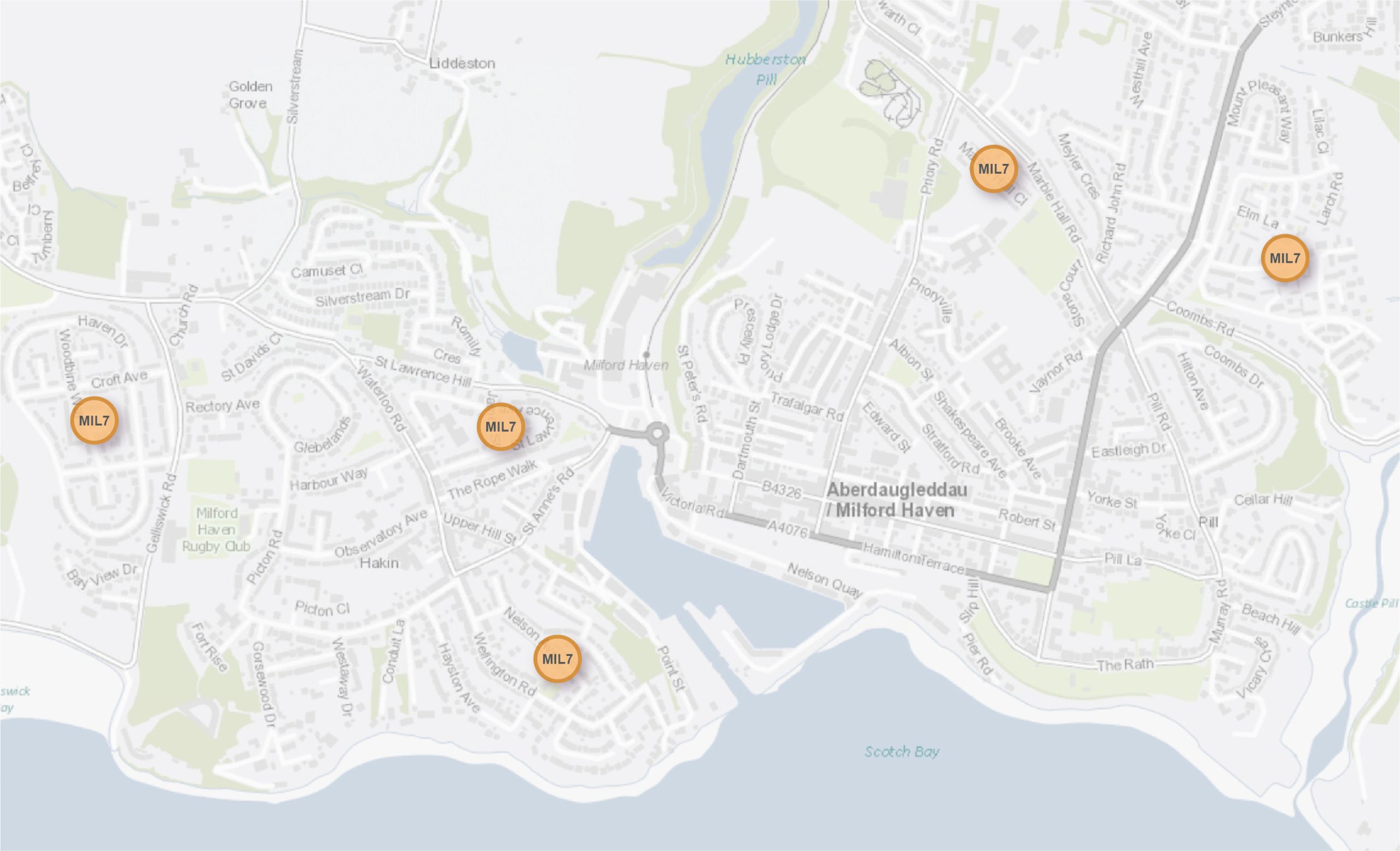
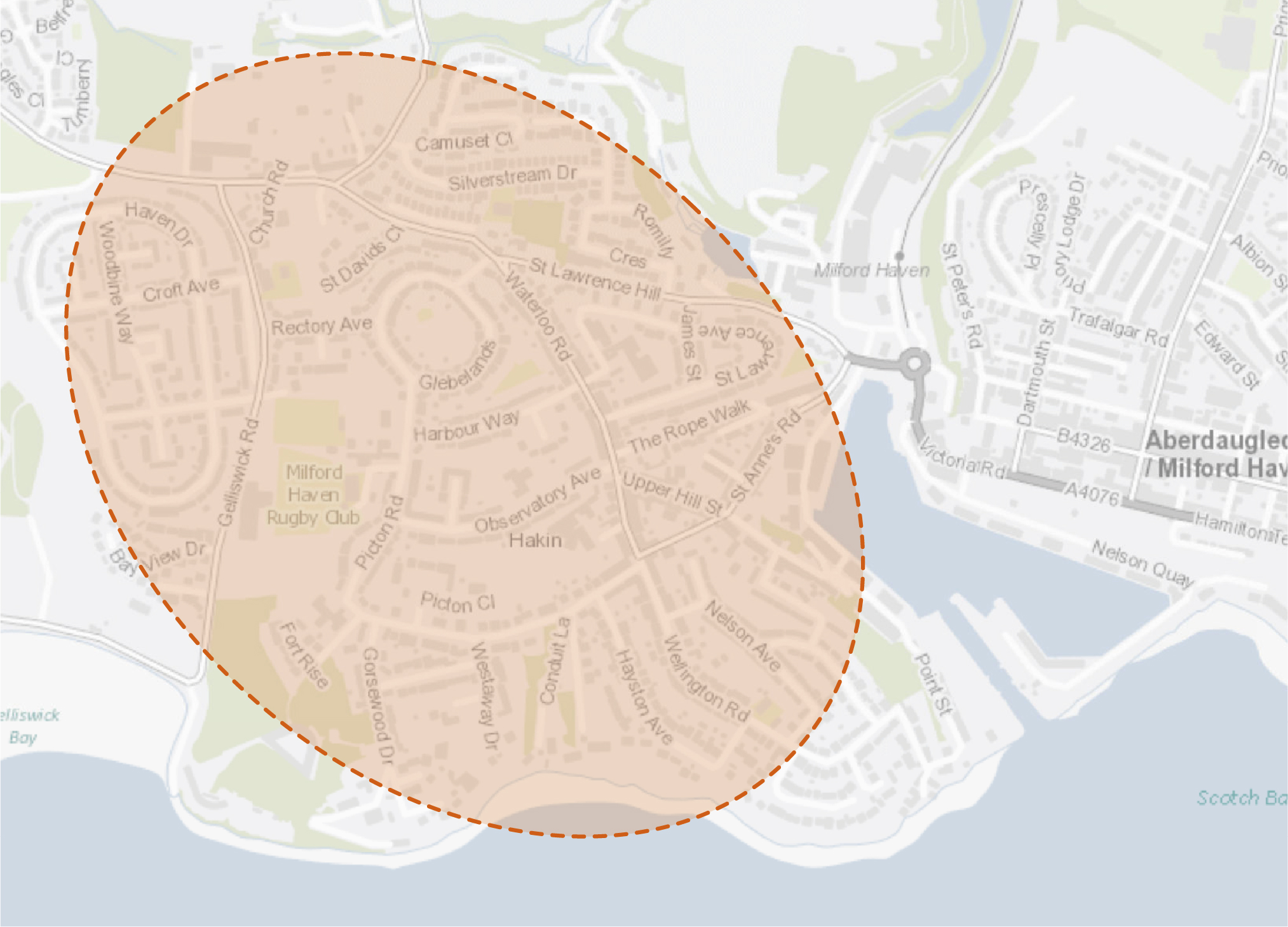
4.21 Several residential areas and housing estates within Milford Haven contain numerous small areas of publicly accessible greenspace. These areas generally comprise short mown amenity grassland that offer limited biodiversity value. Working in conjunction with the local community and wider stakeholders, tree planting, small-scale food growing, wildflower meadows and other habitat interventions should be implemented to enhance the recreational and biodiversity value of these sites. This should involve the inclusion of log piles, insect hotels and bird / bat boxes within housing estates which at present host large swathes of close-mown amenity grassland, (e.g. Marble Hall, The Mount Estate, St Lawrence, around Nelson Avenue, and around Woodbine Way and Haven Drive).
Figure 4.6: MIL7 Locations
Benefits of the project
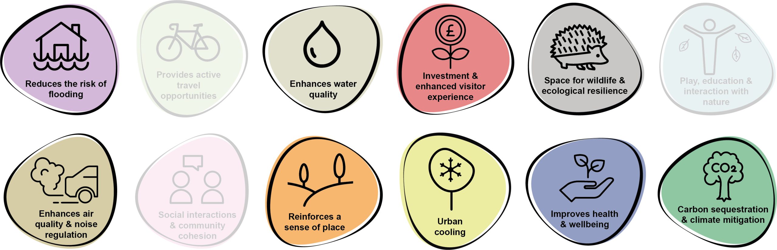
4.22 Benefits of the project, as depicted in Figure 4.7 below, include:
- Reduces the risk of flooding
- Space for wildlife and ecological resilience
- Play, education and interaction with nature
- Enhances air quality & noise regulation
- Social interaction and community cohesion
- Reinforces a sense of place
- Urban cooling
- Improves health and wellbeing
- Carbon sequestration & climate mitigation
Figure 4.7: Benefits
Delivery mechanisms
4.23 A comprehensive programme of public engagement would be required across one or two small scale pilot sites to gauge community appetite for the project. This could involve a free community event to promote the concept and gather community support (i.e. a survey or similar). A funded project officer role would likely be needed to develop a programme of rolling projects with community engagement over several years. This could be based on a similar format as adopted by the Wildlife Trust of West Wales as part of their ‘Nextdoor Nature’ project https://www.welshwildlife.org/about-us/what-we-do/wildlife-conservation/our-projects/nextdoor-nature.
4.24 It would be beneficial if initial small scale tree planting was undertaken by Pembrokeshire County Council (PCC) to provide examples of what could be achieved and develop community interest in a long term project.
4.25 Individual sites identified for potential inclusion within the project would need to be assessed on an individual basis. All sites should be subject to a site survey to identify existing services, suitability of soil / ground conditions and visibility considerations (including views from residential dwellings etc.).
4.26 Trees should be delivered in accordance with the delivery section of the Urban Tree Planting Strategy.
Potential partners
- Local community;
- PCC Highways and Transport Department;
- PCC StreetCare / Amenity Maintenance Team;
- Local businesses;
- Local schools; and
- Tree Wardens Pembrokeshire
Outline cost
Low cost = <£250k
4.27 Costs would be dependent on community uptake, engagement with proposals and capacity for tree planting. Costs for individual interventions would potentially be quite low, with the main cost likely arising from resourcing from the project officer to deliver community engagement. The scheme could also include the provision of resources (such as trees) to residents to enhance private gardens for nature in the project areas.
Potential funding opportunities
- Pembrokeshire County Council (PCC);
- National Lottery Community Fund;
- Local Places for Nature Fund; and
- The Tree Council
Timescale
Medium-term = 1-5 years
4.28 The majority of community engagement, tree planting and habitat interventions should be undertaken over several planting seasons. The success of the scheme would be dependent on effective community engagement within several localities, delivered through a funded officer role.
4.29 Subsequent carbon sequestration of the trees and associated vegetation would be limited initially but would increase within the next decade as the trees reach maturity.
Potential constraints
4.30 Due to the urban context of potential project areas, underground / overhead services and utilities would present a notable constraint for tree planting. This type of intervention would therefore need to be adapted to suit the local constraints (i.e. focussing wildflower areas where there are notable service constraints that limit tree planting options). Any sites identified for small scale food growing would need to be subject to more detailed soil testing to confirm suitability, including any potential issues associated with soil contamination.
4.31 Land searches would be required to determine land ownership of individual parcels of greenspace that are considered as part of the scheme.
4.32 Whilst tree planting would likely be small scale, advice should be sought as to whether any permissions or consents would be required. Engagement with the PCC Highways and Transport Department would likely be required to identify any highways constraints, including the maintenance of appropriate visibility splays.
Maintenance and stewardship
4.33 Due to the urban context of potential project areas, underground / overhead services and utilities would present a notable constraint for tree planting. This type of intervention would therefore need to be adapted to suit the local constraints (i.e. focussing wildflower areas where there are notable service constraints that limit tree planting options). Any sites identified for small scale food growing would need to be subject to more detailed soil testing to confirm suitability, including any potential issues associated with soil contamination.
4.34 Land searches would be required to determine land ownership of individual parcels of greenspace that are considered as part of the scheme.
4.35 Whilst tree planting would likely be small scale, advice should be sought as to whether any permissions or consents would be required. Engagement with the PCC Highways and Transport Department would likely be required to identify any highways constraints, including the maintenance of appropriate visibility splays.
Monitoring for success
4.36 Success would be monitored through the number of residents engaged, number of trees established and the range of habitat features created. The establishment of an independent community group would also indicate project success.
Next steps
4.37 Develop a more detailed project proposal to include proposed project governance and a programme. Scoping of funding options should be suitable for a project officer role, or alternatively through the identification of potential delivery partners.
4.38 Individual parcels of greenspace should be subject to an ecological survey to ascertain sites best suited to the various interventions. Plans for an initial community engagement event to gauge community / resident interest within the project areas should also be developed. Areas for a pilot tree planting project following initial community engagement should also be identified.
4.39 The delivery section of the Urban Tree Planting Strategy should be reviewed to determine the process for planting trees within soft landscapes and understand the key components for successful tree establishment.
MIL16 – Introduce street greening, rain gardens, and permeable paving within Hakin
4.40 Hakin is located to the west of Milford Haven town centre, characterised by predominantly residential properties. The south and south eastern areas of Hakin have suffered from multiple Combined Storm Overflows (CSOs) incidents (where foul effluent is released into rivers due to the capacity of the infrastructure being exceeded).
4.41 The area is typified by large grassed verges which offer the opportunity for tree planting within the soft estate. Introduction of permeable paving, rain gardens and tree planting in this area would aid the slowing of surface water run-off, helping to reduce potential surface water flood risk and reduce the fluvial input into the sewer system at times of high rainfall. This is in addition to the positive contribution of these interventions to townscape character.
4.42 Working with the local community, locations for street tree planting should be identified. Harbour Way offers the potential for planting of trees, potentially in combination with linear rain gardens and community parklets. The play area at Glebelands Road is currently devoid of tree cover and would also form a potential target for intervention.
4.43 By working with local residents to identify locations and preferred species selection, community ownership of the trees would be promoted. Furthermore, consideration should be given to the implementation of a tree replenishment programme to address the diminished tree stock in the town. Canopy cover within Milford Haven is currently just under 10%.
Figure 4.8: MIL16 Project
Benefits of the project
4.44 Benefits of the project, as depicted in Figure 4.9 below, include:
- Reduces the risk of flooding
- Enhances water quality
- Investment & enhances visitor experience
- Spaces for wildlife & ecological resilience
- Enhances air quality & noise regulation
- Reinforces a sense of place
- Urban cooling
- Improves health & wellbeing
- Carbon sequestration & climate change.
Figure 4.9: Benefits
Delivery of nature-based solutions and ecosystem services
4.45 The implementation of rain gardens, tree planting and permeable paving within these areas would improve the character of the townscape and introduce a sustainable approach of dealing with rainwater run-off.
4.46 SuDS interventions mimic drainage in nature where precipitation is absorbed into the ground, slowed by vegetation. The quantity and quality of water that ends of up in local watercourses is therefore improved, helping to alleviate flooding and reduce CSOs. Sustainable management of water in urban areas also ensures towns are more resilient to the pressures of climate change and population growth.
Delivery mechanisms
4.47 An initial study should be undertaken to identify where the topography, street scene and storm sewer network conditions combine to result in the most effective and deliverable interventions. The local community should also have the ability to put forward requests for rain garden and tree planting. If the location is appropriate and funding available, the tree should be added to the annual planting programme.
4.48 An annual planting programme should be established to successfully plan, deliver and manage the new tree planting, rain gardens and permeable paving areas. Sufficient planning is required prior to the bare-root planting season (October-March at the latest) to ensure ground checks / soil testing is completed.
4.49 Trees should be delivered in accordance with the delivery section of the Urban Tree Planting Strategy.
4.50 New tree pits, rain gardens and other features should be positioned and designed such that they are able to accept overland flow routes, thus rediverting flows that would otherwise enter storm gullies and the wider sewer network.
Potential partners
- Local community
- Pembrokeshire County Council (PCC) Highways and Transport Department
- PCC StreetCare / Amenity Maintenance Team
- Local businesses
- Tree Wardens Pembrokeshire
- Dwr Cymru Welsh Water
- South Wales Trunk Road Agent (SWTRA)
Outline cost
Low cost = <£250k
4.51 Price is scalable depending on the number of trees planted / rain gardens created / permeable paving areas installed. However, a rough estimate of ~£10,000 to appropriately establish a tree within hard landscaping should be applied.
4.52 Costs would comprise some limited specialist advice including utility searches, stakeholder consultation and planting / maintenance costs.
4.53 More technically challenging / construction orientated solutions such as permeable paving and the interception and redirection of existing surface water sewers would be more expensive (Medium Cost £250k – £1m).
Potential funding opportunities
- Developer contributions
- PCC
- National Lottery Community Fund
- Resilient Communities Grant Programme
- Local Places for Nature Fund
- The Tree Council
- Nature Networks Fund
- Transforming Town Fund
- NRW grants
- Dwr Cymru Welsh Water
Timescale
Quick win = <1 year
4.54 Tree planting and rain garden creation should be delivered at a few key locations in the next planting season.
Medium-term = <1-5 years
4.55 The majority of tree planting, rain garden creation and permeable paving aspects should be delivered across the next five planting seasons to allow for sufficient planning and engagement. Permeable paving should be installed where opportunities for tree planting and rain garden installation are limited. Opportunities to intercept and redirect surface water flows in sewers is also anticipated to require a medium term timeline of 1 – 5 years.
Potential constraints
4.56 There are a considerable number of potential stakeholders to engage with for this project, with various landholders and the engagement process critical to the success of the scheme. PCC Highways and Transport Department and the SWTRA must be involved in the project.
4.57 The majority of the surfacing within the potential project area is characterised by hard landscape. The cost of excavating tree pits within hard landscapes is more expensive than within soft landscapes. Therefore, new tree planting must achieve the right balance between cost, space and desired function / design. In some circumstances, fewer trees with a larger rooting volume may be appropriate.
4.58 Within the urban environment the potential for a variety of services and utilities to be located within potential planting areas and avoidance of these must be considered when accounting for the installation of tree planting. Rain gardens typically require shallower depths of installations and would therefore have a lower probability of conflict with services. There may be the potential for substituting tree planting in favour of rain gardens in areas identified to have a high probability of services.
4.59 New tree planting must also maintain key vistas. Therefore, all planting proposals should be prepared in conjunction with PCC.
Maintenance and stewardship
4.60 Establish a resident or commercial partner working group alongside PCC Street Care and Highways Department to take ownership of the new tree planting. A training day could provide the community with the tools and knowledge to successfully maintain new trees until establishment, including watering and checking tree stakes.
4.61 Watering and establishment care would be needed for the 60 month establishment phase to ensure trees are able to become independent in the landscape.
4.62 Permeable paving areas would need to be either adopted by PCC or by the relevant landowner.
Monitoring for success
4.63 Subject to the availability of funding, monitoring of the success of the project should be in conjunction with data from Dwr Cymru Welsh Water in terms of sewer capacity and reduction in CSO events.
4.64 Utilise the resident working group to monitor the successful establishment of new street trees and gardens. Establish a communication channel for reporting of any issues or failures.
Next steps
4.65 Undertake a feasibility survey of the Hakin area, to determine where new trees, tree pits and rain gardens might be best positioned to accept flow from areas of hardstanding and therefore help divert water away from the storm sewer network.
4.66 Immediately identify landholders and commercial partners and engage with potential stakeholders, including SWTRA and the appropriate departments of PCC.
4.67 Review the delivery section of the Urban Tree Planting Strategy to determine the process for planting trees within soft landscapes and understand the key components for successful tree establishment.
4.68 Engage residents and community groups to identify locations for tree planting and selecting species, using the species selection guide within the Urban Tree Planting Strategy.
Project Long List
MIL1 – Transform the green space to the rear of Milford Haven Leisure Centre for biodiversity
4.69 This land currently serves little function for people or wildlife. Opportunities should therefore be sought to introduce wildflower meadows as well as a butterfly bank on the central ridge. Consideration should also be given to the adjacent area of woodland to encourage ground flora, with Japanese knotweed removal required on the northern edge. Working with Milford Haven Youth Centre and the Milford Haven Leisure Centre, opportunities to deliver sensitive access to nature through trim trails / fitness trails should also be explored to complement the existing shared-user path which crosses the area.
MIL2 – Expand the network of wildflower meadows on The Rath
4.70 Refer to Kickstarter Projects.
MIL3 – Enhance Gelliswick Bay greenspace and woodland
4.71 Working with local schools and community groups to promote local buy-in, promote the biodiversity value of the greenspace in front of Gelliswick Road and Gelliswick Beach by sowing with salt-tolerant wildflower meadow seed. The adjacent woodland should also be opened up to allow light to reach the understorey and encourage the establishment of a diverse ground flora.
MIL4 – Promote the enhanced management of Hubberston Pill Woods
4.72 Create a woodland management plan to help transform Hubberston Pill Woods into a state of positive and active management. Improve the range of habitats and shelter for wildlife using thinning to allow ground flora to thrive. Promote the use of dead wood as a vital habitat for pollinator nesting and larval development. Consideration should also be given to improving wayfinding to connect to Priory Inn and implementing a volunteer scheme to tackle the spread of Himalayan balsam.
MIL5 – Improve the management of Castle Pill Wood
4.73 Create a management plan which promotes positive management practices, including coppicing and the implementation of a planting strategy to reduce invasive species and mitigate the effects of ash dieback (Hymenoscyphus fraxineus). Selective thinning should also be considered to provide a greater diversity of ground flora. The opportunity exists to enhance access and wayfinding, making connections with the Wales Coast Path and local communities, as well as interpretation at structures such as Dead Man’s Lake Dam. Wider proposals to deliver a footpath connecting Coombs Road to Vicary Crescent should also be supported.
MIL6 – Introduce a green ravine connecting Milford Haven train station to the waterfront
4.74 Landscape architects have been engaged and design proposals progressed for the creation of a green ravine at this location. The link would run to the rear of commercial shops and cafes off Victoria Road. The proposals provide the opportunity for improved active travel corridors, alongside enhanced habitat provision. The opportunity also exists to review landscape management interventions and refurbish areas of ornamental planting along this route.
MIL7 – Promote the greening of housing estates MIL8 – Create a Hubberston to Hakin nature corridor
4.75 Seek to connect areas of woodland to the north of Hubberston towards Milford Haven estuary using existing greenspaces and corridors. The potential to establish additional tree planting and wildflower meadows along Gelliswick Road, including the route of the existing shared-user path, should also be explored. Amenity greenspace between Dale Road and Rectory Avenue could also accommodate several large parkland trees, orchard trees and boundary planting. The boundaries of greenspaces at Hakin United AFC and Gelliswick Primary School should be reviewed for habitat improvements to provide a direct link to woodland at Fort Hubberston.
MIL9 – Strengthen the A4076 as a green corridor
4.76 The A4076 is a key gateway and entry point for Milford Haven and hosts large stretches of amenity green space and close mown grass verges. Wildflower verges and additional planting, particularly along the Steynton Road and Hamilton Terrace stretches of the A4076 would improve user experience as well as provide direct green corridors into the heart of Milford Haven. Where space is more limited, raised planters with native pollinator plants should be implemented. Proposals should be developed in conjunction with plans to deliver a shared-user path between Johnston and Steynton (following the corridor of the A4076).
MIL10 – Enhance the greening of Mackerel Quay and Nelson Quay
4.77 Mackerel Quay at Milford Haven’s waterside currently serves as a car park with large expanses of hard surfacing. Raised planters incorporated within seating areas, restaurant spill out areas, cycle parking and electric bicycle charging stations should be included to provide a more welcoming and pleasant experience for visitors to the harbour, whilst taking advantage of expansive views across Milford Haven. Tree planting should also be extended along Nelson Quay to delineate a route between the station and the waterfront.
MIL11 – Improve the Water Gardens
4.78 Introduce further improvements to the landscape management of the Water Gardens, including the future repair of the water basins. The reintroduction of water features should be considered as a mechanism to improve the site’s visitor appeal whilst providing biodiversity benefits.
MIL12 – Introduce boundary planting at the playfield, Pill Lane
4.79 Improve the character of the site and the adjacent street scene through the introduction of tree planting along the boundary fences and delivery of the Pill Lane shared-user path. Specimen tree planting should be considered for the delineation and definition of entrances and gateway features.
MIL13 – Enhance the greening of Charles Street
4.80 Charles Street forms a semi-pedestrianised commercial street with parallel parking bays along both sides with some existing established street trees. The reclaiming of some parking spaces for urban greening features; including street trees, parklets, cycle parking, electric bike hire, pollinator-friendly raised planters and seating would create a more attractive and well-used public realm, whilst also enhancing the townscape character of this key shopping area. Longer term aspirations should include the installation of linear rain gardens to enhance water alleviation.
MIL14 – Enhance Gelliswick Woods
4.81 Proposals should seek to enhance access to the woods above Gelliswick and create a circular route utilising the existing PRoW. Wayfinding provision from Hubberston Drive, Gelliswick Beach and Hubberston & Hakin Play Area should also be improved. The creation of a management plan for the woodland to restore the site into a state of positive management would help to create a more diverse mosaic of habitats; including selective thinning to allow ground flora to thrive as well as the establishment of riparian habitats within the valley bottom.
MIL15 – Introduce street greening, rain gardens and permeable paving within Hakin
4.82 Refer to Kickstarter Projects.
MIL16 – Provide rain gardens and permeable paving at Havens Head Business Park
4.83 Havens Head has previously been impacted by floods, notably in 2018, with the surrounding vicinity also impacted by a number of combined sewer overflow incidents. The opportunity exists to retrofit Sustainable Drainage Systems (SuDS) interventions within large areas of hardstanding in order to divert storm water from combined sewers and slow surface water run-off. These measures would reduce pressure on infrastructure and help to reduce fluvial influence in times of flooding.
MIL17 – Implement urban greening interventions, rain gardens and permeable paving at Castle Terrace and Great North Road
4.84 The area of Castle Terrace towards Coombs Road is recorded as at risk from surface water flooding. A Combined Sewer Overflow (CSO) incident has also been recorded on Great North Road. Castle Terrace, Coombs Road and Steynton Road are typified by grass verges which offer the potential for the creation of various SuDS interventions and tree planting. The use of permeable paving and rain gardens should also be explored on gradients; including Lidl car park on Great North Road. The delivery of these interventions offers the opportunity to link with wider active travel initiatives, including a proposed shared-user path along Coombs Road to Black Bridge.
MIL18 – Enhance the biodiversity and recreational value of Glebelands
4.85 Explore opportunities to enhance the quality and value of recreational provision at The Dome, Glebelands. Overlooked by residential properties, the site provides informal surveillance with the potential for urban greening interventions, including tree planting, to soften the urban setting. Consideration should also be given to biodiversity enhancements within existing areas of close mown amenity grass.
MIL19 – Promote community food growing in Milford Haven
4.86 The opportunity exists to work with Pembrokeshire County Council (PCC) to select an appropriate site to increase allotment provision within the town. The intervention should encourage plot owners to reduce the use of pesticides and herbicides, instead choosing to work the land organically. Additional tree and orchard planting opportunities should also be explored. Where possible, planting margins should be left uncut, sheds fitted with living roofs and bird feeders added to attract wildlife.
Previous Chapter:
Haverfordwest
Next Chapter:
Narberth
Return to homepage:
Homepage