Page Contents:
A Portrait of Narberth’s Green Infrastructure
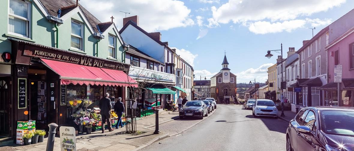
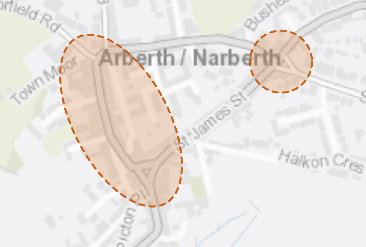
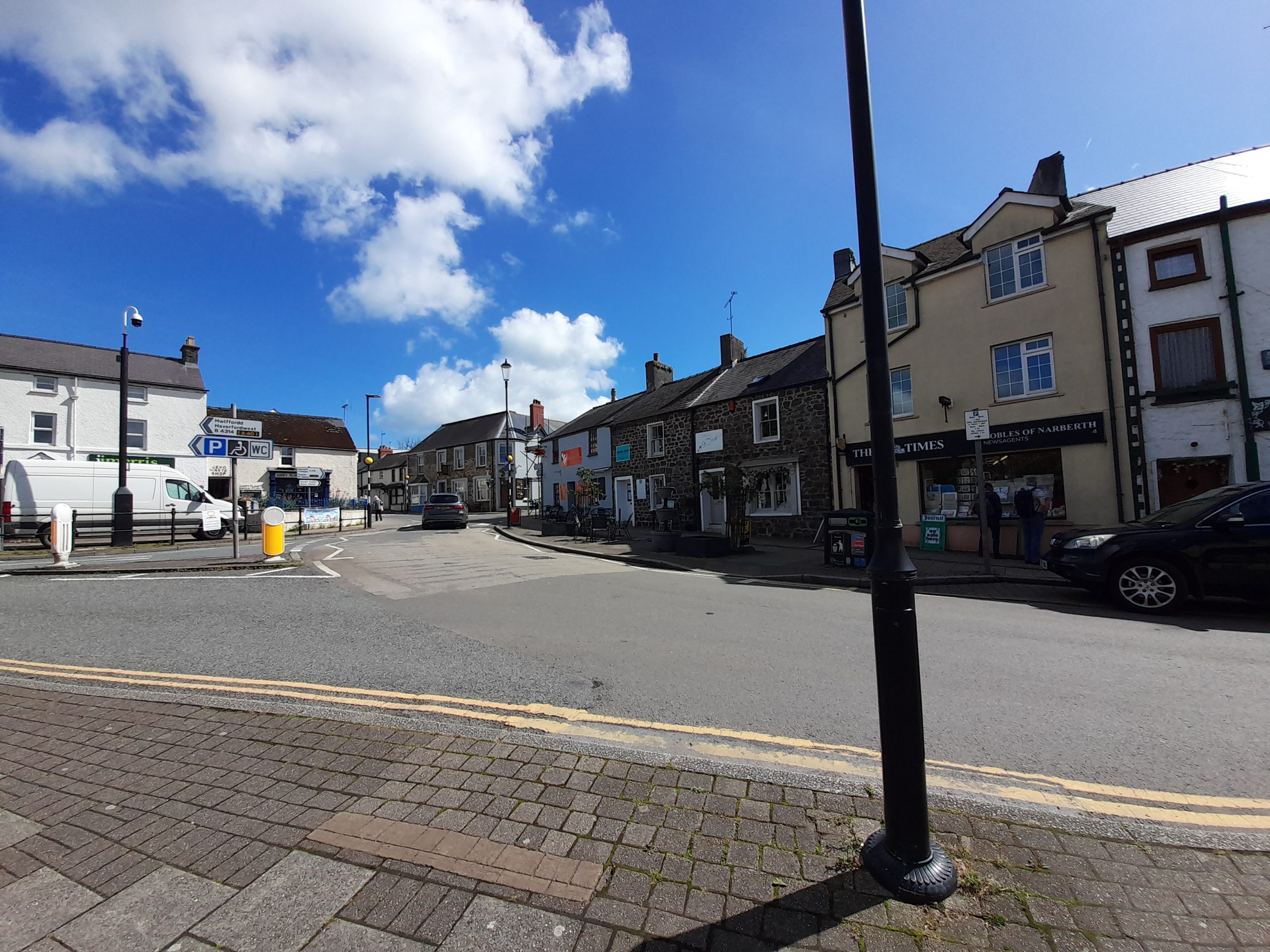
Narberth
Figure 5.1: Narberth
A Portrait of Narberth’s Green Infrastructure
5.1 Narberth is a small market town of just over 2,000 residents located in the south east of Pembrokeshire. With origins dating back to the Middle Ages, the town centre is designated as a Conservation Area and contains numerous listed buildings located along the High Street. The 13th century Narbeth Castle, designated as a Scheduled Monument, is situated just south of the town centre within a wooded public space. The south-eastern extent of the Cleddau Rivers Special Area of Conservation (SAC) originates to the south of the town centre at Narberth Bridge. This small meandering watercourse passes through pastoral fields and wooded river valleys before feeding into the Eastern Cleddau river at Canaston Bridge. This in turn merges with the Pembrokeshire Marine SAC at Blackpool Bridge.
5.2 Large open spaces sit towards the edge of the town centre and consist primarily of open recreational fields with few pedestrian links. Public footpaths instead extend south of the town centre, joining up with the wooded areas along the Eastern Cleddau. Links into the wider landscape within the north of the town are distinctly lacking. Although no National Cycle Network (NCN) routes connect directly with the town, plans for an off-road route between Narberth and Haverfordwest will connect the town with NCN route 4. An initial stretch which connects the west of Narberth at Town Moor with Canaston Bridge has been recently opened.
5.3 Larger woodland blocks are concentrated to the south of the town, at the edges of open spaces and connecting to linear woodland belts along the river corridor. These woodland areas provide opportunities to further strengthen the Public Right of Way (PRoW) network on the outskirts of the town.
Figure 5.2: GI Opportunities within Narberth
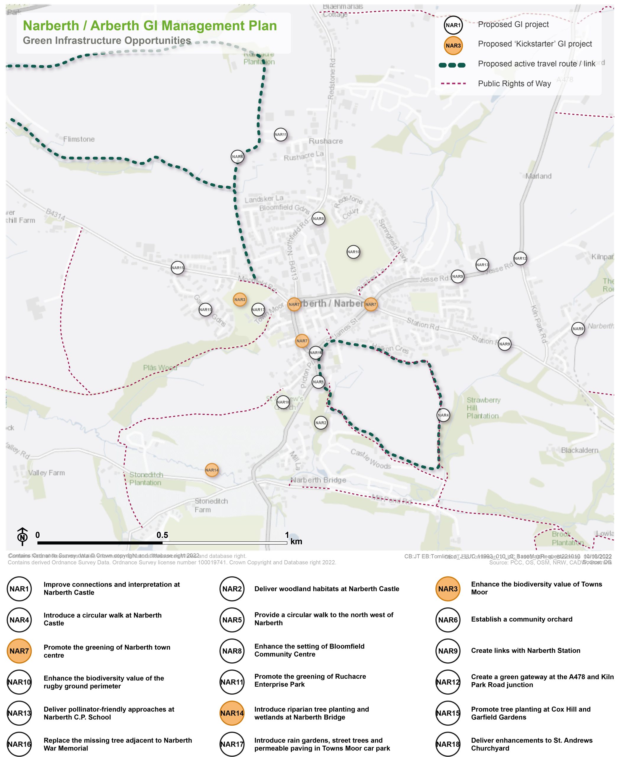
Kickstarter Projects
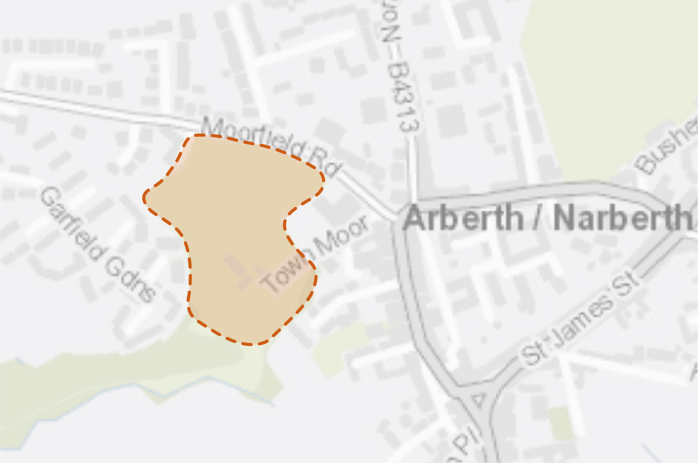
NAR 3 – Enhance the biodiversity value of Towns Moor
5.4 Towns Moor is a registered village green and well-used recreational space, providing play equipment, active travel routes and publicly accessible greenspace.
5.5 Steeper embankments to the south, which are of little recreational value, are currently characterised by long grass. However, the species diversity of the sward is limited. This could be improved by sowing wildflower seed or plug planting with native nectar rich plants to support pollinators, whilst continuing with a wildflower meadow mowing regime. Native flowering plants, such as Tenby daffodil, could also be planted around the base of large mature trees to further increase the pollinator resource. Consideration should be given to the introduction of a relaxed cutting regime within the perimeter of the car park as well as the use of deadwood, occasional mown paths and glades for informal seating and play. The provision of a range of habitats for food and shelter should be focussed to the south of the site due to reduced recreational pressure. Biodiverse rain gardens could also be installed in the waterlogged parts of the village green to provide additional habitats and contribute to flood management.
5.6 Additional tree planting using varied typologies; including avenue planting, specimen trees, fruit and nut trees, hedgerows, edible hedges and shrubs should be implemented, for example along active travel routes. Hedgerows and shrubs should also be planted along the informal areas adjacent to residential properties to the north west of Towns Moor. This would define the boundary of Towns Moor, enhancing its appearance and contribute to habitat connectivity. Connections to the belt of woodland to the south west would also be improved, strengthening its role as a foraging and commuting corridor for bats.
5.7 These interventions would complement proposals to upgrade existing footways to shared-user paths within the Towns Moor area.
Figure 5.3: NAR3
Benefits of the project
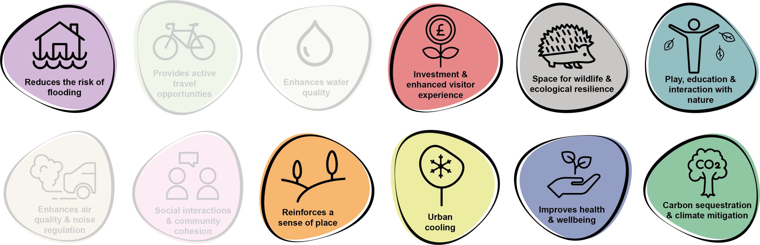
5.8 Benefits of the project, as depicted in Figure 5.4 below, include:
- Reduces the risk of flooding
- Investment & enhanced visitor experience
- Space for wildlife and ecological resilience
- Play, education and interaction with nature
- Reinforces a sense of place
- Urban cooling
- Improves health and wellbeing
- Carbon sequestration & climate mitigation
Figure 5.4: Benefits
Delivery mechanisms
5.9 Wildflower meadows, community orchards and species rich hedgerows should be delivered in accordance with the delivery section of the Pollinator Strategy.
5.10 Trees should be planted in accordance with the delivery section of the Urban Tree Planting Strategy.
5.11 Annual cuts of wildflower meadow should be integrated into the work programme of the Pembrokeshire County Council (PCC) StreetCare / Amenity Maintenance Team.
Potential partners
- PCC StreetCare / Amenity Maintenance Team
- Pembrokeshire Nature Partnership
- Arberth gwyllt / Wild Narberth
Outline cost
Low cost = <£250k
5.12 Wildflower seeds are relatively inexpensive and savings would be made due to reduced mowing operations. The number of trees planted with have an influence on the overall cost.
Potential funding opportunities
- Local Places for Nature Fund
- National Lottery Community Fund.
Timescale
Medium-term = 1-5 years
5.13 The various interventions may be staggered over planting seasons to align with available capacity and resource. Wildflowers would be quick to establish if soil fertility is low.
Potential constraints
5.14 The design of the enhancements would need to balance the need for nature recovery and provision of wildlife habitat with the requirement for access and enjoyment of the site. This should be achieved through the sensitive design of the space to provide distinct routes for active access, opportunities to explore nature as well as areas for biodiversity.
5.15 The extent of the wildflower planting would have to ensure that it does not impede on community events within the existing greenspace.
5.16 Wildflower meadow can occasionally draw complaints from members of the public who view the areas as messy or unmanaged. Signage and interpretation can help communicate the deliberate intention of the meadow and raise awareness of pollinators.
5.17 Consideration needs to be given to how to gather the cuttings and remove them from the meadow area to prevent enrichment of the soil. The most efficient way to do so is with a cut and collect mower but this requires capital investment.
5.18 Trees along active travel routes would need to be regularly checked to ensure they don’t impede access or cause any health and safety concerns.
Maintenance and stewardship
5.19 A wildflower meadow requires a cut and lift at the end of the season. This is typically in September. The arisings should ideally be left for seven days to shed seed before removing. A second cut and lift may be required in early spring to remove winter growth.
5.20 Watering and establishment care would be required as part of a 60 month maintenance period to ensure trees are able to become independent in the landscape.
5.21 Tree guards would need to be checked and removed when there is no longer a risk of damage.
Monitoring for success
5.22 The survival rate of new planting and wildflower meadow establishment should be monitored for indicators of success. Once all biodiversity enhancements have been implemented, an annual community BioBlitz could be organised to record the variety of life at the site.
Next steps
5.23 Review the delivery section of the Urban Tree Planting Strategies to determine the process for planting trees and to understand the key components for successful tree establishment.
5.24 Review the delivery section of the Pollinator Strategy to determine the process and review case studies relating to the creation of wildflower meadows.
5.25 Establish willingness of Wild Narberth or another community group to be involved in the management and maintenance of new tree planting.
Figure 5.5: Narberth
NAR 7 – Promote the greening of Narberth town centre
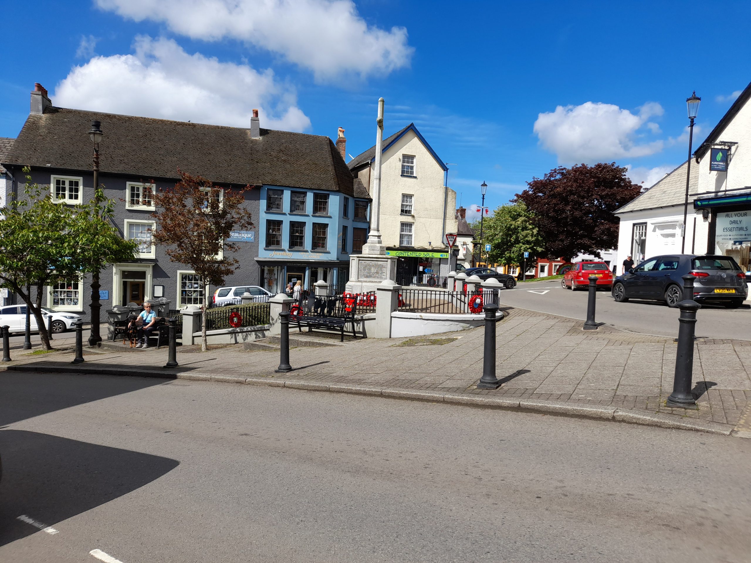
5.26 Narberth town centre is characterised by an attractive mix of shops, buildings and heritage assets, including the distinctive Narberth Town Hall and the Narberth War Memorial. At present, the High Street is dominated by vehicles, with on street parking regularly provided on both sides of the one-way street. There is the opportunity to reclaim some of this space from vehicles and provide a safer, more attractive pedestrian environment.
5.27 Existing raised planters should be re-purposed or upgraded to create larger and more impactful areas of pollinator-friendly planting with incorporated spaces for seating and cycle parking. Where spaces and underground services are not a constraint, the removal of some hard landscape should be undertaken to create larger areas of planting and rain gardens. The removal of occasional parking spaces could be used to accommodate additional street tree planting or parklets. This should be focussed on one side of the street to create a larger space for pedestrians and spill out space for businesses. Where space and underground services permit, the introduction of additional street trees should be explored.
5.28 These opportunities also apply to the junction of Station Road and the A478 where there is a large amount of hard landscaping with existing planters. Market Street and around the War Memorial also have the potential to reclaim space from car parking and integrate areas of greenspace within existing public realm. The rolling out of green bus stops across Narberth through the use of green roofs, climbers and raised planters should also be explored.
5.29 The High Street should be investigated as a possible location for a shared-user path. This could link with the recently delivered cycle link towards Canaston Woods and Haverfordwest.
Figure 5.6: NAR7
Benefits of the project
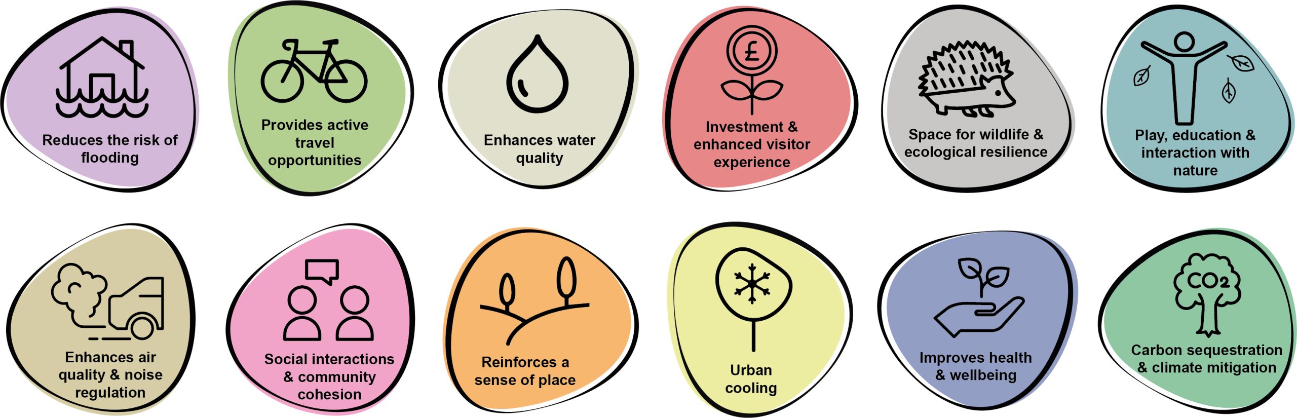
5.30 Benefits of the project, as depicted in Figure 5.7 below, include:
- Reduces the risk of flooding
- Provides active travel opportunities
- Enhances water quality
- Investment & enhanced visitor experience
- Space for wildlife and ecological resilience
- Play, education and interaction with nature
- Enhances air quality & noise regulation
- Social interaction and community cohesion
- Reinforces a sense of place
- Urban cooling
- Improves health and wellbeing
- Carbon sequestration & climate mitigation
Figure 5.7: Benefits
Delivery mechanisms
5.31 The delivery of interventions such as tree planting should be achieved in collaboration with local residents and businesses. By allowing residents to have a say in what species they would like to see outside their homes / businesses, and where they would like them planted, it would encourage greater stewardship of the specimens through and beyond the establishment period. The design of tree pits, the depth and soil used and the on-going watering and maintenance is vital in ensuring successful establishment.
5.32 Where possible, trees and planting material should be sourced locally.
5.33 Planting practices should follow the delivery guidance set out within the Urban Tree Planting Strategy and the Pollinator Strategy.
Potential partners
- Pembrokeshire County Council (PCC) StreetCare / Amenity Maintenance Team;
- Local businesses;
- Local community;
- Tree wardens Pembrokeshire; and
- Narberth Town Council
Outline cost
Medium cost = <£250k – £1 million
5.34 This project is very scalable and improvements could be made for <£250k. However, it is recommended that the High Street, Market Street and the junction with Station Road are reviewed and designed as a whole to help create a more functional and cohesive town centre.
High cost = >£1 million
5.35 Should a shared user path be implemented along the High Street, then this would increase costs.
Potential funding opportunities
- Local Places for Nature Fund
- Business sponsorships
- Pembrokeshire County Council
- Shared Prosperity Fund
Timescale
Medium-term = 1-5 years
5.36 This project is scalable, and interventions could be implemented on the ground relatively quickly. However, if a cohesive approach is taken which looks at Narberth town centre as a whole, the project could take a number of years to deliver.
Potential constraints
5.37 Businesses may object to the proposals if they believe footfall would reduce due to limited parking. The design process would therefore need to be collaborative, with precedent examples provided of where greening interventions have resulted in positive impacts in other village / town centres. Similar engagement would be needed with accessibility groups, and it should be made clear from the outset that blue badge parking would remain.
5.38 Underground services and utilities could limit the amount of ‘in the ground’ interventions, including rain gardens and trees in hard landscapes.
5.39 Establishing vegetation, particularly trees, within hard landscapes is much more difficult than in soft landscapes and continued maintenance during the establishment period (60 months) would be needed to ensure the trees can be independent in the landscape. The Urban Tree Strategy delivery section should be used to guide appropriate planting and maintenance.
Maintenance and stewardship
5.40 The PCC StreetCare / Amenity Maintenance Team should be ultimately responsible for the establishment of trees and any planting material. However, collaboration and engagement with the community and businesses from the outset of the project would help to deliver greater long-term stewardship of the scheme. Businesses should be able to sponsor trees, planters or parklets and they could also contribute towards their ongoing maintenance. This could include watering during dry periods or reporting any failures to PCC.
5.41 Review the Urban Tree Strategy and Pollinator Strategy ‘delivery’ sections.
Monitoring for success
5.42 Understanding the impact of this greening project on footfall and business prosperity would be a useful tool for encouraging investment elsewhere and to determine whether schemes like this should be replicated. Regular surveys with local businesses, traffic surveys and pedestrian counts should be used to understand how the use of the town centre changes before and after the implementation of the project.
Next steps
5.43 Consult with the PCC StreetCare / Amenity Maintenance Team.
5.44 Consult with local businesses, particularly where car parking spaces would be reduced, to understand the appetite for the scheme and to ensure any concerns are addressed prior to the design process.
5.45 Consult with accessibility groups.
5.46 Instruct a landscape architect to develop conceptual designs for the town centre.
Figure 5.8: Narberth
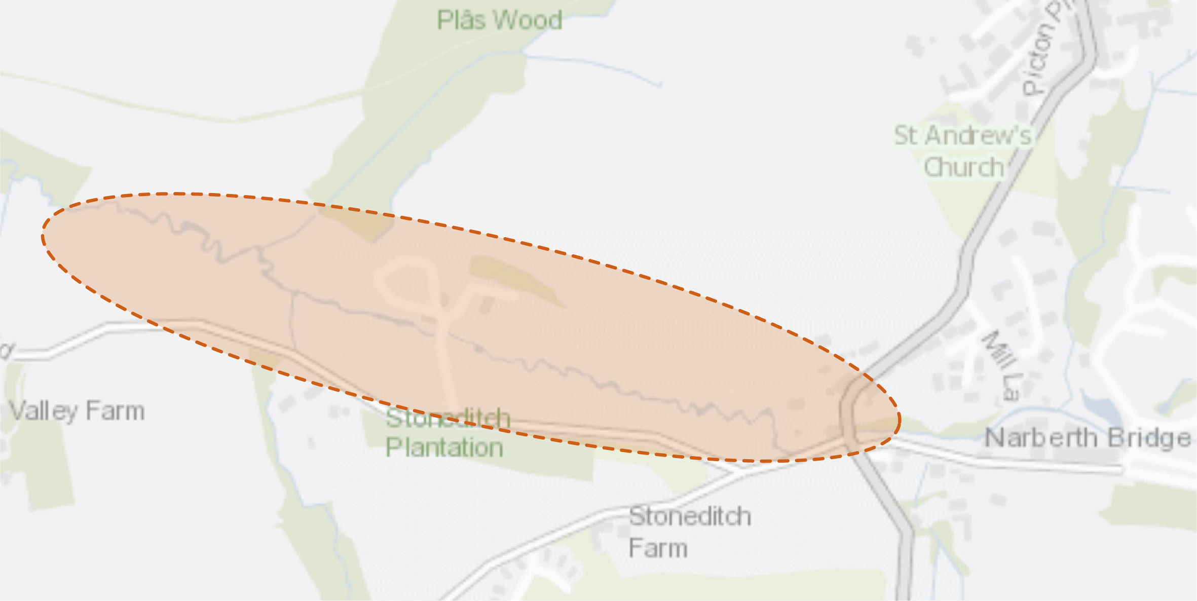
NAR14 – Introduce riparian tree planting and wetlands at Narberth Bridge
5.47 An area of grazing land between Narberth Bridge and Narberth West Wastewater Treatment Works offers the opportunity to host additional riparian tree planting and wetland scrapes. This intervention would provide enhanced habitat connectivity within the wider Cleddau Rivers Special Area of Conservation (SAC). Additional benefits of the project would include the storage of floodwater and the provision of a buffer for sewage outfall in periods of high rainfall. The proposal would also result in improved water quality, reduced flood risk as well as decreased risk of siltation of adjacent waterbodies.
5.48 The creation of wetland habitat would aid nutrient stripping of the outfall, helping to alleviate the discharge of the nutrient load and reducing the impact on the wider Cleddau Rivers SAC. The Cleddau River itself is the subject of an ongoing Natural Resources Wales (NRW) led ‘Four Rivers for LIFE’ project to protect, enhance and help restore the watercourse. Proposed wetland and riparian tree planting, therefore, aligns strongly with the aims of the project.
Figure 5.9: NAR14
Benefits of the project
5.49 Benefits of the project, as depicted in Figure 5.10 below, include:
- Reduces the risk of flooding
- Enhances water quality
- Space for wildlife and ecological resilience
- Reinforces a sense of place
- Carbon sequestration & climate mitigation
Figure 5.10: Benefits

Delivery of nature-based solutions and ecosystem services
5.50 Land use management for the previous 90 years has involved increased drainage of the land, in a drive to maximise efficiency of farmland. This has led to the reduction in the diversity of habitats, and the loss of wetlands, wet-grassland and associated wet terrestrial habitats. It has also exacerbated flood risk, as it increases the speed and volume of water flow down catchments, reducing the buffering effect of the landscape during heavy and prolonged rainfall events. Increased drainage of wet soils also has a detrimental effect on the ability of that soil to sequester carbon.
5.51 Through the use of techniques such as riparian buffer strips, which reduces bank erosion and poaching by livestock, planting of shelter belts and field margins, the ability of the landscape to absorb and buffer rainfall could be significantly increased. This would have a beneficial impact on flood risk, water quality and carbon sequestration. Re-wetting of wetland soils would also increase their capacity to absorb and lock-in carbon.
5.52 The creation of wetlands could be used to limit the quantity of phosphorus and nitrogen entering the river, by absorbing and sequestering nutrients as water passes through the system, essentially filtering the water. The run-off from sewage treatment facilities is typically rich in nutrients and wetlands can be used to help alleviate this issue, as well as contribute to other ecosystem services
Delivery mechanisms
5.53 An initial site survey and scoping should be conducted by trained citizen scientists, Pembrokeshire County Council (PCC) staff or trained consultants. It would be necessary to engage with landowners and land occupiers / graziers in order to present this opportunity and discuss its impacts on current land-use. In addition, discussion with Dwr Cymru Welsh Water (as operator of the sewage treatment plant), West Wales Rivers Trust and NRW would also be beneficial. This discussion with potential partners would shape the nature of the project, with the potential balance between wetland creation and tree planting to be determined by costs, stakeholder preferences and potential benefits.
5.54 We envisage the proposed physical interventions and amendments to land management could be delivered by the landowners themselves, or by external agricultural contractors.
5.55 The potential exists for the project to be used to create nutrient trading credits as a mechanism to wholly or partially fund the intervention, with a pilot scheme run by EEP-Ecobank for nutrient credits operating within the Milford Haven catchment (although the status of this project is currently unclear).
Potential partners
- Wildlife Trust of South and West Wales;
- NRW;
- West Wales Rivers Trust;
- Landholders; and
- Dwr Cymru Welsh Water
Outline cost
Low cost = <£250k
5.56 Costs would comprise some limited specialist advice, land agent fees, fencing, tree planting costs and potential machinery for the creation of wetland scrapes. If a more engineered wetland solution to help improve sewage effluent is preferred following consultation, the costs would increase.
Potential funding opportunities
- Emerging Welsh Government Sustainable Farming Scheme
- National Forest for Wales – The Woodland Investment Grant (National Lottery Heritage Fund – Round 1)
- Dwr Cymru Welsh Water
- NRW
- Nutrient credits in partnership with EEP Ecobank, Pembrokeshire Coastal Forum or potentially PCC
Timescale
Quick win (<1 year)
5.57 Riparian tree planting, shelterbelt and field margin creation could be delivered at a few key locations in the next planting season, with landscape maintenance required across the 60 month establishment phase. A key unknown for the project would be the time taken to gain landowner / occupier / grazier agreements / consents and source funding.
Medium-term (1-5 years)
5.58 The majority of tree planting should be delivered across the next five planting seasons to allow for sufficient planning and engagement.
Potential constraints
5.59 A key constraint for the project would be landowner / occupier / grazier agreements, as there may be a perceived risk to farm viability associated with some loss of land to riparian margins / shelter belts / field margin planting etc. These concerns should be countered with the availability of agricultural payments for environmental goods and services, and hence the delayed launch of the Welsh Government’s Sustainable Farming Scheme is a potential constraint in this regard.
5.60 An ecological assessment of the site would need to be undertaken by an ecologist with all site works potentially supervised by an Ecological Clerk of Works (ECoW).
Maintenance and stewardship
5.61 Maintenance of the softworks and wetland would be required as part of the 60 month establishment phase, including the replacement of failed trees.
5.62 If an engineered wetland is introduced as part of the project, this would entail increased maintenance requirements, which would be the responsibility of Dwr Cymru Welsh Water.
Monitoring for success
5.63 Subject to availability of funding, monitoring of the success of the project should be undertaken through simple citizen science, with suitable support. Shelterbelt success is often dependent on initial design but also subsequent care and management using silvicultural techniques to maintain the shelterbelt beyond the life expectancy of the original tree planting.
Next steps
5.64 Engage with landowners / occupiers / graziers and enter into agreements to deliver interventions on their land. Consultation with NRW should also be undertaken to investigate whether the project benefits align with the Four Rivers for LIFE project and potential funding opportunities. The potential for nutrient credits to offset project costs should also be explored.
Project Long List
NAR1 – Improve connections and interpretation at Narberth Castle
5.65 The current entrance to Narberth Castle is concealed, indistinct and used predominantly for vehicle parking. The opportunity exists to improve the gateway to the site through improved signage and controlled access points. Enhancements to wayfinding from Market Street would increase awareness of the site and should encompass signage on the widened pavement at the junction of Market Street and Castle Terrace. Improved interpretation boards within the grounds of Narberth Castle should also be considered.
NAR2 – Deliver woodland habitats at Narberth Castle
5.66 Narberth Castle’s boundary should be enhanced through the provision of access to the adjacent Pembrokeshire County Council (PCC) owned woodland to the east of the site. Enhanced woodland management should provide space for a diverse range of habitats, as well as areas for shaded seating, natural play and recreation. Links with the adjacent Brookside and Castlewood Caravan Site should also be accommodated. Relaxed mowing regimes and the retention of deadwood across other parts of Narberth Castle would provide additional habitats for pollinators.
NAR3 – Enhance the biodiversity value of Towns Moor
5.67 Refer to Kickstarter Projects.
NAR4 – Introduce a circular walk at Narberth Castle
5.68 Utilise existing PRoWs to create a circular walk to the south east of Narberth from Tabernacle Lane. The route would move south across the fields towards Brookside & Castlewood Caravan Site before connecting back up through Narberth Castle towards Market Street. Enhanced wayfinding and improved surfacing provision should be incorporated as part of a recreational route, providing a connection from Brookside & Castlewood Caravan Site to the town centre.
NAR5 – Provide a circular walk to the north west of Narberth
5.69 Land to the north west of the settlement is devoid of PRoW connections to the wider countryside. The opportunity therefore exists to create a new circular route following the alignment of existing wooded ditches and tracts of plantation between Ruchacre, Flimstone and back towards Jacob’s Park and Rushacre Plantation. This proposals should support proposals to deliver a shared-user path along Redstone Road into Narberth.
NAR6 – Establish a community orchard
5.70 Working in partnership with a range of stakeholders, identify a location for a community orchard within the town. Proposals should seek to deliver a community allotment / orchard which would perform a vital role in connecting local people to the process of food production. Where possible, planting margins should be left as uncut, green roofs introduced in sheds and bird feeders added to attract wildlife. Pesticide and herbicide use would be discouraged.
NAR7 – Promote the greening of Narberth town centre
5.71 Refer to Kickstarter Projects.
NAR8 – Enhance the setting of Bloomfield Community Centre
5.72 Swathes of wildflower meadow should be created to enhance the green banks and plots within the curtilage of Bloomfield Community Centre. This intervention would provide additional habitat and connectivity across Narberth for pollinators. Additional tree planting should also be provided within the adjacent green verges within the car park.
NAR9 – Create links with Narberth Station
5.73 Create an enhanced pedestrian link between Narberth town centre and Narberth Station. This should include options for road widening, footpath extensions and traffic calming along Station Road (such as a continuation of the 30mph speed limit past the junction with Kiln Park Road). Green traffic calming options along the A478 and Kiln Park Road should also be considered, with the aim to provide an additional route to the station and Narberth School. Urban greening and small-scale street tree planting at Narberth Station should be used to promote a more welcoming gateway.
NAR10 – Enhance the biodiversity value of the rugby ground perimeter
5.74 Prepare the ground for wildflower seeding and adopt a relaxed mowing regime around the periphery of the rugby fields. This would provide additional habitat for pollinators through the creation of wildflower meadow, whilst having no impact on sporting and spectator activities.
NAR11 – Promote the greening of Ruchacre Enterprise Park
5.75 Work with tenants and business owners at Ruchacre Enterprise Park to identify areas for additional tree planting and greening opportunities. Deliver tree planting within areas of close mown grass and encourage relaxed mowing regimes. Explore opportunities to diversify hedges by introducing additional species and hedgerow trees where space permits. Explore ‘meanwhile’ uses for vacant land, for example, wildflower meadows.
NAR12 – Create a green gateway at the A478 and Kiln Park Road junction
5.76 Develop wildflower-rich verges at the junction of the A478 and Kiln Park Road to promote benefits to pollinators whilst also creating a welcoming gateway into Narberth.
NAR13 – Deliver pollinator-friendly approaches at Narberth C.P. School
5.77 Working in conjunction with Narberth School, build on their existing Eco Code and allotment to provide additional habitat for pollinators. This should include making and planting seed bombs, creating log piles and building bug hotels. The introduction of wildflower meadows and relaxed mowing regimes should be implemented within the areas of close-mown grass at the entrance and within the car park of the school.
NAR14 – Introduce riparian tree planting and wetlands at Narberth Bridge
5.78 Refer to Kickstarter Projects.
NAR15 – Promote tree planting at Cox Hill and Garfield Gardens
5.79 Additional options for tree planting within grass verges and adjacent shared-user paths on Cox Hill and Garfield Gardens should be explored. Ensure suitable species are selected if adjacent to road carriageways e.g. small to medium height with upright crowns. This should be accompanied with bulb and plug planting beneath the trees to provide additional pollinator and visual interest.
NAR16 – Replace the missing tree adjacent to Narberth War Memorial
5.80 A tree pit currently lies vacant adjacent to the Narberth War Memorial. This should be filled with a replacement specimen tree which is appropriate to the constrained urban setting e.g. whitebeam (Sorbus aria), field maple (Acer campestre) and silver birch (Betula pendula).
NAR17 – Introduce rain gardens, street trees and permeable paving in Townsmoor Car Park
5.81 The large car park within Townsmoor is dominated by hardstanding and devoid of trees and other urban greening interventions. Limited tree planting is also evident on the green itself and is located in an area prone to waterlogging. These areas should be targeted with attenuation ponds that would form water features for the local community as well as other urban greening interventions. Sustainable Drainage Systems (SuDS) interventions which act to divert storm water from combined sewers would also help to reduce pressure on infrastructure within Narberth in times of flooding. Proposals should ensure the integration of the proposed shared-user path connecting Moorfield Road with the Narberth to Blackpool Mill route.
NAR18 – Deliver enhancements to St. Andrews Churchyard
5.82 Working in conjunction with St. Andrew’s Church, Narberth Town Council and the Friends of Narberth Churchyard, proposals should be developed to enhance the site for recreational and biodiversity benefits. The opportunity exists to increase site accessibility through the implementation of path network improvements and the introduction of additional seating. Proposals should also seek to maximise the biodiversity of the site through softworks improvements and the establishment of wildflower habitat.
Previous Chapter:
Milford Haven
Next Chapter:
Newport
Return to homepage:
Homepage