Fairly easy walking on the mainly level wave cut Marloes - Dale plateau with the occasional short climb out of steepish valleys cut by glacial meltwater at the end of the last Ice Age. A walk of contrasts starting on the wild and treeless Atlantic coast with spectacular views of the rugged offshore islands of Skomer, Skokholm and Grassholm, and ending in the gentle, pastoral and in places wooded shelter of the Milford Haven waterway. This section is close to accommodation and the village shops, pubs and cafes of Marloes and Dale. The many access points and excellent coastal bus service makes this a popular area for short and circular walks. There are now no stiles on this section.
1. Martin’s Haven to Watery Bay 1 Mile (1.61km)
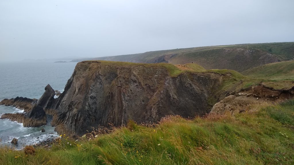
Open to the full rage of the Atlantic storms, this section has some very sheer cliffs and active erosion threatens the National Trail. The Trail cuts across the neck of the western peninsula (the Deer Park), although there is an alternative footpath that provides this worthwhile extra loop. New views open up, with the islands of Skomer and Skokholm interrupting the expanse of ocean. Two kissing gates and a wicket gate through the Deer Park (grade 3) or three wicket gates accessed from Martin’s Haven Car Park (grade 2).
Walk Difficulty: No man made obstructions to wheelchairs, ground conditions vary.
Car Park / Public Transport Access
Martin’s Haven Car Park (Grid ref: SM76110898)
Bus stop (Puffin Shuttle – thrice daily return – St David’s to Milford Haven). Large National Trust car park, charge in season – about 100m inland of the Coast Path. WC near Martin’s Haven beach.
Worth a look
The Deer Park (Grid ref: SM75810900)
The western headland is known as the Deer Park. It was walled in the late 18th century when it belonged to the Kensington estate, but deer were probably never kept here. There are wonderful views from the Deer Park across to the islands. In early autumn it’s a favourite breeding place for grey seals. If you’re watching seals and their pups, please keep quiet and still, as they’re easily upset by noise and movement. And for your own safety, avoid the cliff edge. The earthwork across the neck of the peninsula is another Iron Age Promontory fort, one of over 50 Neolithic settlement sites to be found along the Pembrokeshire Coast Path National Trail.
Walking Access Point
Deer Park Footpath (Grid ref: SM75810900)
The Deer Park was not designated as part of the National Trail. This route offers a public footpath and permissive circuit of the peninsula.
Caution
Deer Park to Marloes Sands Cliffs (Grid ref: SM76010880)
Unguarded and eroding cliff edges. Keep to the Path. Take care in windy weather. Long sections of Path fairly close to the cliff edge. In bad weather it is best to keep to the field edge.
Walking Access Point
Martin’s Haven towards Gateholm Easy Acess Path (Grid ref: SM76110874)
Turn left through wicket gate at west end of National Trust car park (charge to park in season). Field edge path. Gradients less than 1 in 20; no discernible side slope, no seats, three gates with accessible catches. (Has been tackled by a ‘Sterling EX3 (Classic)’ with no problems). Connects to rolled stone path from Marloes Mere car park. The easterly paths lead to accessible viewpoints across the sands. Fine views of Skomer and Skokholm Islands. WC in Marloes. Easy Access Path 2.8 km.
2. Watery Bay to Raggle Rocks 0.9 Miles (1.61km)
The path passes through the grand Iron Age fort at Watery Bay and the fairly level cliff top plateau continues. Views of storm-sculptured rock formations give way to those along the magnificent Marloes Beach as one turns the corner above Gateholm. One kissing gate, one flight of 15 steps, slight gradients.
Walk Difficulty: Stiles or flights of steps or steep hills.
Worth a look
Watery Bay Iron Age Fort (Grid ref: SM76870798)
An Iron Age promontory fort, one of over 50 Neolithic settlement sites to be found along the Pembrokeshire Coast Path National Trail. Note the impressive triple ditches and banks. Scheduled Ancient Monument.
Walking Access Point
Watery Bay Footpath (Grid ref: SM76930790)
National Trust permissive path, return to Marloes Mere Car Park (and Youth Hostel). Offers a number of options for circular walks of the peninsula.
Caution
Marloes Bay Cliffs (Grid ref: SM76930790)
Unguarded and eroding cliff edges. Keep to Path. Take care in windy weather. Quite long sections of Path fairly close to the cliff edge.
Caution
Albion Sands Footpath (Grid ref: SM77200764)
The footpath shown on some maps to seaward of the Coast Path, to Albion Sands is an energetic scramble.
Walking Access Point
Gateholm to Mere Footpath (Grid ref: SM77340773)
Return to Marloes Mere Car Park (and Youth Hostel). Offers a number of options for circular walks of the peninsula.
Walking Access Point
Raggle Rocks to Mere Footpath (Grid ref: SM77840770)
National Trust permissive path, return to Marloes Mere Car Park (and Youth Hostel). Offers a number of options for circular walks of the peninsula.
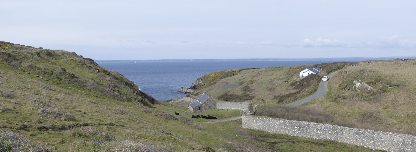
3. Raggle Rocks, Marloes to Hayguard Hay, Westdale 2.5 Miles (3.22km)
At each end of this walk steep descents and ascents take the walker from 150 feet to sea level and back again on steep, stepped slopes. In between the cliff path is fairly flat. Approached from Dale airfield gives access to a gentle walk. Six wicket gates, 130 steps, six hills (Grade 2 using the access footpath along the airfield).
Walk Difficulty: Stiles, long flights of steps, gradients up to 1:1
Car Park / Public Transport Access
Marloes Mere Car Park (Grid ref: SM77920822)
The Puffin Shuttle picks up (hail and ride) from the north access to the car park (SM77800858). Large National Trust car park, charge in season. Accessible WC at the Youth Hostel (SM77880804).
Facilities
Marloes Youth Hostel (Grid ref: SM77880804)
Runwayskiln
Walking Access Point
Marloes Sands to Mere Bridleway (Grid ref: SM78120767)
This bridleway is the main beach access from Marloes Mere Car Park and minor road.
Beach
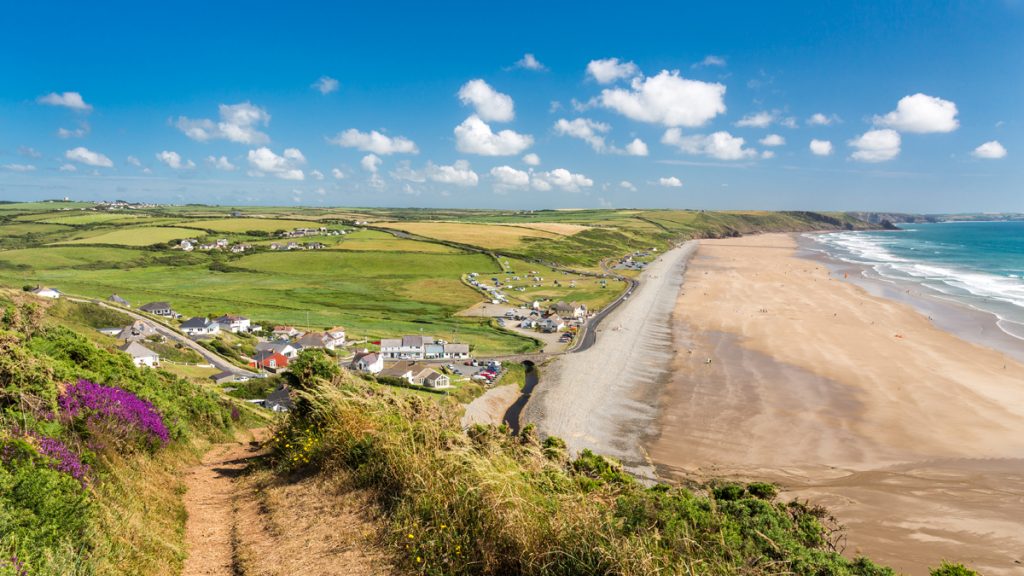
Marloes Sands (Grid ref: SM78040755)
Long sandy beach with scattered rocks. Marloes is an interesting beach to walk along, but there is no safe ascent at the east end. It is a lovely, refreshing beach to swim from, often with exciting surf, but watch out for the rip and drift currents.
Information
Marloes Sands Cliffs (Grid ref: SM78040755)
The cliffs behind this magnificent beach contain a range of sedimentary rocks formed in the Silurian period, about 410 million years ago. They include the dramatic ‘Three Chimneys’ formation, composed of alternating layers of mudstone and sandstone and upended to a vertical position by a collision of continents around 290 million years ago. The soft mudstone has weathered more, so that the harder sandstone layers stick out from the cliff face like buttresses.
Caution
Marloes sands Cliffs (Grid ref: SM78160760)
Unguarded and eroding cliff edges. Keep to Path. Take care in windy weather. Quite long sections of Path fairly close to the cliff edge.
Walking Access Point
Mathew’s Slade Footpath (Grid ref: SM78460750)
Steep, stepped descent to Marloes beach.
Walking Access Point
Dale Airfield Footpath (Grid ref: SM79090671)
This footpath presents the opportunity for a longer circuit of the peninsula.
Information
Dale Airfield (Grid ref: SM79460676)
Dale, one of eight World War II airfields in Pembrokeshire, was linked to nearby Talbenny. It opened in June 1942 and for a year operated Wellington bombers on maritime patrols flown by Polish airmen in the RAF. Later the Royal Navy took over Dale until the station closed in 1947.
Walking Access Point
Dale Airfield Wheelchair Access (Grid ref: SM79810623)
World War II airfield. Concrete and asphalt flat surface (1.3km) with some bumps on the joins. Splendid views. Further 1.4km may suit some chairs on short grass section of Coast Path. WC in Dale. Wheelchair 1.3km; Adventure 1.4km.
Caution
Westdale Cliffs (Grid ref: SM79880601)
Unguarded and eroding cliff edges. Keep to Path. Take care in windy weather. Quite long sections of Path fairly close to the cliff edge.
Walking Access Point
Westdale Bay Footpaths (Grid ref: SM79980580)
Two footpaths join here. The higher is a short footpath link to a very minor road (roadside parking for about three cars and no safe place to turn round!). The lower path offers a short cut to Dale (0.7 miles) (shop, pub and cafe) and the first of a number of shorter or longer circuits of the Dale peninsula.
Beach
Westdale Bay (Grid ref: SM79860586)
Small sandy beach with rocks to each side. Westdale Bay is another exciting swim when the surf is up, but watch out for the rip, which is strongest on the south side of the beach.
Information
Great Castle Head (Grid ref: SM79930566)
Another imposing Iron Age promontory fort, this one being rapidly eroded by the sea.
4. Hayguard Hay to St. Ann’s Head 2.5 Miles (3.22km)
The Coast Path route is again on a nearly flat cliff top plateau with no steep hills. No stiles, no steps, two kissing gates, one wicket gate. The southern 250m at St. Ann’s Head is on a very quiet private road.
Walk Difficulty: Road
Information
Kete Airfield (Grid ref: SM79830480)
Kete was, for 16 active years, a naval station. Work began in 1944 on what became an extensive site and the station was commissioned as HMS Harrier in 1948. It was home to the Royal Naval Aircraft Direction Centre and the Navy’s School of Meteorology. After closure in 1960 many of the buildings were removed under Operation Neptune. Little remains as a reminder of its Navy past. A recent addition is the commemorative plaque by the Coast Path. The bank on the inland side of the Coast Path is composed of some of the concrete and brick remains of the runway, recently reclaimed as farmland again.
Car Park / Public Transport Access
Kete Car Park (Grid ref: SM80290427)
Use this free, National Trust car park for St Ann’s Head. Bus stops in the village of Dale.
Walking Access Point
Kete North Footpath (Grid ref: SM79950420)
National Trust permissive path. Link to minor coast road, and car park. Use this free, National Trust car park for St Ann’s Head.
Walking Access Point
Kete Easy Access Route (Grid ref: SM79950420)
Park at Kete car park (near St Ann’s Head) and go back along the road towards Dale for one field and turn through the gate on the footpath. First section is old concrete runway, often with cattle dung, then across a fairly firm field and through a third gate onto the Coast Path. Great views of Skokholm and the coast. About 0.5km of Coast Path is barrier-free. WC in Dale. Adventure 1.1 km.
Walking Access Point
Kete South Footpath (Grid ref: SM80080383)
National Trust permissive path. Link to minor coast road, and car park. Use the free, National Trust car park for St Ann’s Head.
Caution
Kete Cliffs (Grid ref: SM80480315)
Unguarded and eroding cliff edges. Keep to Path. Take care in windy weather. Quite long sections of Path fairly close to the cliff edge.
Caution
St Ann’s Head (Grid ref: SM80530312)
Private road, private land – no parking – use Kete car park for access to St Ann’s Head.
Information
St Ann’s Head Lighthouse (Grid ref: SM80570295)
A chapel dedicated to St Ann was built here by Henry VII and included a beacon-fire burning at night. A lighthouse, lit by coal fires, was first erected in 1713. Passing ships paid a toll of 1 penny per ton of cargo if they were British, 2 pence per ton if foreign. The present buildings date from the mid-19th century. The lighthouse is now fully automatic. The beam is visible for 20 miles and flashes every 5 seconds.
Worth a look
The Cobbler’s Hole (Grid ref: SM80550286)
Danger unguarded cliff edge. When walking south the last 250m to St. Ann’s Head is on a very quiet road. At the point where the Coast Path turns into the field, a path on the other side of the road leads to The Cobblers Hole where contorted folding of Old Red Sandstone can be seen.
5. St. Ann’s Head to Watwick 1.5 Miles (3.22km)
A fairly flat section apart from the steep hill down to Mill Bay and up again. No stiles, two wicket gates, one kissing gate, 50 steps. Good views across the Milford Haven Waterway of Angle Peninsula, oil tankers and the ferry to Ireland pass frequently.
Walk Difficulty: Stiles, long flights of steps, gradients up to 1:1.
Information
Mill Bay (Grid ref: SM80920347)
On 7 August 1485, Henry Tudor landed here after sailing from France with an army of 2,000 men. Born in Pembroke, Henry was the House of Lancaster’s claimant to the English throne. Gathering support, he marched through Wales and eventually defeated Richard III at the Battle of Bosworth, taking the throne as Henry VII.
Beach
Mill Bay (Grid ref: SM80920347)
Small Sandy cove. Take care of the sharp metal from a shipwreck.
Caution
West Blockhouse (west) (Grid ref: SM81560352)
The footpath shown on most maps is not available, being an earlier route of the Pembrokeshire Coast Path which now follows closer to the coast.
Information
West Blockhouse (Grid ref: SM81690359)
At West Blockhouse there is the former site of modern gun batteries on the inland side of the Path. To seaward is West Blockhouse itself, which dates from earlier times.
Walking Access Point
West Blockhouse (east) (Grid ref: SM81760379)
A link to a ‘white road’ which is a public footpath offering an inland return to Dale. One mile to the road.
Walking Access Point
Watwick Bay (Grid ref: SM81490409)
A beach access footpath crosses the Coast Path, linking to a ‘white road’ which is a public footpath offering an inland return to Dale. 200m steep stepped descent to beach, 0.7 miles to the road.
Beach
Watwick Bay (Grid ref: SM81690404)
Small to medium sandy cove. Watwick Bay is another delightful beach that has an almost Caribbean appearance at times, usually with calm water that feels cold.
6. Watwick to Dale Fort 1.3 Miles (1.61km)
Accessed from West Blockhouse this is a fairly level section but near Dale Fort there are few moderate hills. Nine wicket gates, 35 steps. The route passes through some woodlands, there are some irrigation ponds (for early potatoes) close to the Path – dragon and damsel flies abound in their season.
Walk Difficulty: Stiles, long flights of steps, gradients up to 1:1
Information
Watwick Leading Light (Grid ref: SM82130443)
Watwick Light is one of a series of beacons of different patterns that lead ships into the Haven safely.
Beach
Castle Beach (Grid ref: SM81920501)
Small sandy beach often with drifts of seaweed.
Information
Dale Forts (Grid ref: SM82300517)
Dale Fort boasts both an Iron Age fort and a Victorian fort. The series of defensive structures between West Blockhouse and East Blockhouse, all around the Estuary, span millennia – these are one of the added features of interest along the Trail.
7. Dale Fort to Dale Village 0.8 Miles (1.61km)
A long steady hill along a narrow road. The paths off through the woods are not an alternative route. Watch out for the nettles if a car comes. Glimpses of windsurfers between the trees give early indications of Dale’s importance as a watersports centre.
Walk Difficulty: Road.
Walking Access Point
Farmland footpath (Grid ref: SM81270558)
Footpath joins close to Dale, offers a circuit via Maryborough Farm and Watwick, or a route avoiding most of the road section. 1.4 miles to Watwick Bay.
Facilities
The Griffin Pub (Grid ref: SM81150568)
Food and drink.
Facilities
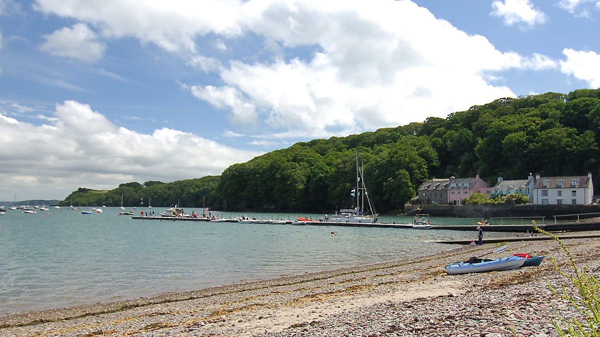
Dale Village (Grid ref: SM81150568)
Pub, shop, cafe etc.
Information
Dale (Grid ref: SM81090569)
The Dale valley marks the line of a major geological fault which extends eastwards as far as Tenby. When the sea level was higher, the valley was a narrow sound between the Dale peninsula and the mainland. The valley’s western end is now plugged by glacial debris. Dale has a long seafaring tradition. In the 16th century it was one of the most important ports in Pembrokeshire, and ships were still being built here in the 1850s.
Beach
Dale Roads (Grid ref: SM81340577)
This large sheltered bay makes Dale a very popular watersports centre.
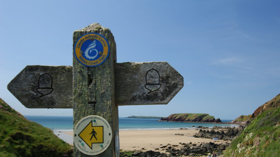
VIEW THIS SECTION ON STREET VIEW
Martin's Haven (Grid ref: SM760091)
Follow the Coast Path Safety Code
- Take care on the Coast Path - it's rugged, natural terrain.
- Keep to the path, away from cliff edges and overhangs.
- Always supervise children, especially near cliff edges.
- Walking surfaces can vary considerably with the weather. Always wear strong footwear with a good grip and ankle support.
- Wear or carry warm and waterproof clothing.
- Cliff-top walking can be dangerous in high winds.
- Beware of taking shortcuts across beaches - you may be cut off by the tide. Swimming can also be dangerous.
- Do not sit under cliffs or climb them.
- Keep dogs under close control.
- The Coast Path is for walkers. It is not safe or lawful to ride horses or cycle along most of the Coast Path.
- Leave gates and property as you find them.
- Note that mobile phone coverage is unreliable on the coast.