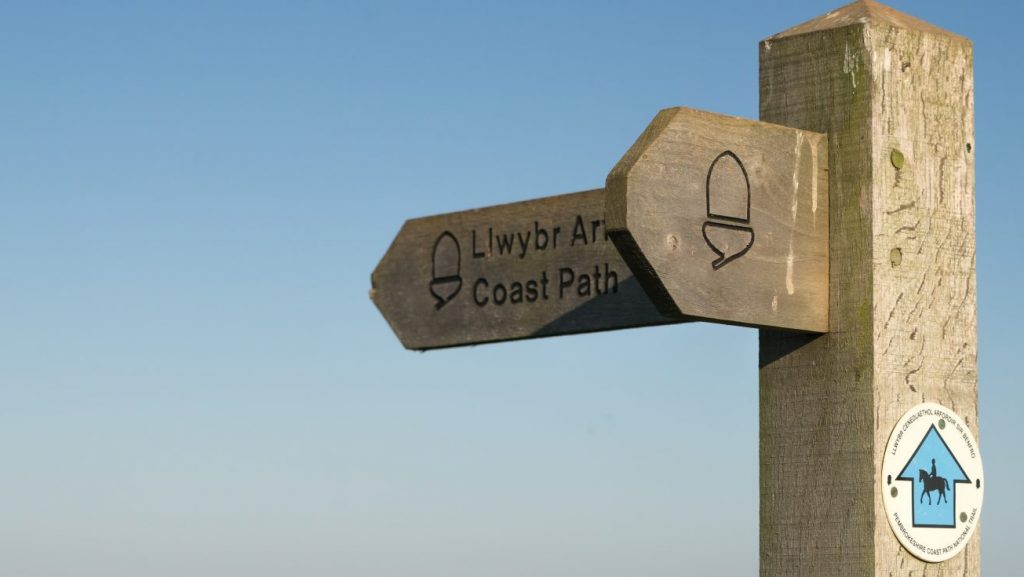
Due to the beautiful beaches in the area and the tourist attractions and facilities around Tenby, this is probably the busiest section of the whole route with superb views of Caldey Island, and the coasts of the Gower and Exmoor.
1. Skrinkle to Lydstep Beach. 1.3 Miles (1.61km)
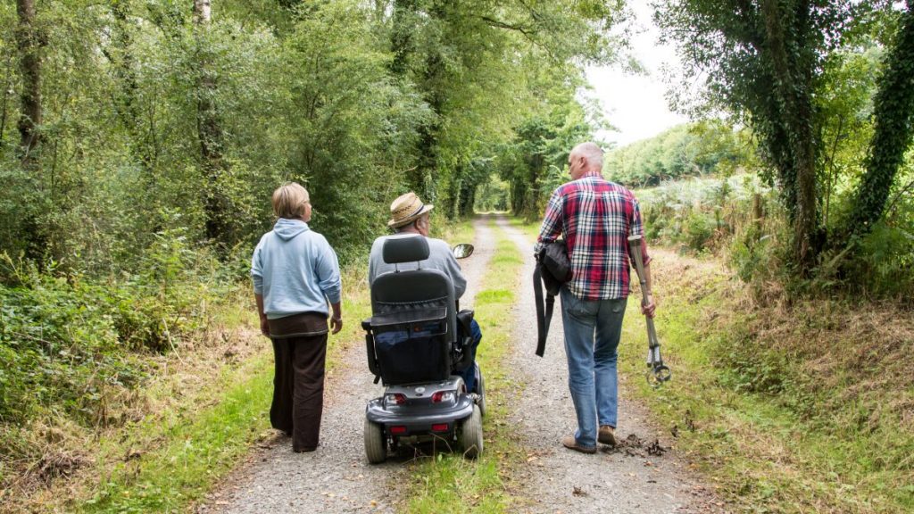
There is level walking on the two headlands, with opportunities for wheelchair users, split by a very steep valley in between. Also a hill between Lydstep Beach and Head – a short section of surfaced byway. No stiles, one kissing gate, four wicket gates, 115 steps. There are some fine examples of limestone features from here to Tenby.
Walk Difficulty: Stiles, long flights of steps, gradients up to 1:1
Information
Skrinkle Haven (Grid ref: SS08029764)
For many years this part of the coast was a military area and closed to the public. Old Castle Head is still in use as a firing range, so you may hear loud bangs as you walk past, but the Coast Path is permanently open. The National Park Authority bought some 18 hectares (45 acres) of former army land in 1982. The strikingly designed Youth Hostel was converted from a military building. The bay contains a sandy beach and a rocky cove, separated by a narrow rib of limestone known as the Church Doors, because of its great arched cave entrances. Skrinkle Haven marks the reappearance of the boundary between the Old Red Sandstone and the Carboniferous Limestone. The cliffs here are very unstable and access to the beach is restricted.
Facilities
Skrinkle Haven Youth Hostel (Grid ref: SS08029764)
The strange design of the Youth Hostel was to disguise its former incarnation as a military building.
Car Park / Public Transport Access
Skrinkle Parking (Grid ref: SS08349749)
Service bus stop at the end of the road 0.5 miles inland, railway station two miles inland. Large, free National Park parking areas.
Caution
Skrinkle and Lydstep Cliffs (Grid ref: SS08349749)
Unguarded cliff edges. Very steep coastal slope. Keep to Path. Take care in windy weather. Short sections of Path close to the cliff edge.
Walking Access Point
Skrinkle Haven Wheelchair route (Grid ref: SS08349749)
Once part of a MOD missile testing range, now owned by National Park Authority. Route follows Tarmac roads and concrete test sites. The first 500m is 1:20 or less, the last 100m 1:12 or less. Approach to second viewpoint is steeper, over grass, and may not be useable by all (public footpath to beach shown on OS map is closed due to a collapsing cliff). Further length may be possible for adventure chairs. No seats. Toilets at Manorbier beach car park. Wheelchair 0.6 km.
Beach
Skrinkle and Church Doors Beaches (Grid ref: SS08079741)
Skrinkle is a medium sandy beach, Church Doors is a boulder beach. Danger of being cut off. Steep descent.
Caution
Skrinkle Beach Footpath Closed (Grid ref: SS08079741)
The beach access path is shown on many maps as part of the National Trail, although it has never been included. This path is now closed by Order as it crosses a collapsing cliff. To access the beach use the next path, down very steep steps, to Church Doors beach, then through a natural tunnel to the main beach. Take great care, apart from being slippery, it is not obvious when the tunnel is cut off by the incoming tide. Danger of being cut off by the tide.
Beach
The Caverns Beach (Grid ref: SS08709758)
Medium sandy beach. This beach is accessible only at low tide. Huge limestone caves.
Car Park / Public Transport Access
Lydstep Head Car Park (Grid ref: SS08789777)
Service bus stop in Lydstep Village (0.25 Miles). Medium, free, National Trust car park on the Head.
Walking Access Point
Lydstep Head Wheelchair Access (Grid ref: SS08789777)
The vehicle access track to National Trust car park is rough. Head south from the car park – mostly a grass path. No discernible gradient, no cross fall, but rough in places. Easy Access path (400m+) to the east, basically flat, muddy in places when wet, part under trees, with views of Lydstep Bay and Giltar Cliffs. One seat at cliff. Toilets at Manorbier beach car park and Penally Station car park. Wheelchair 400m; Easy Access Path 400m.
Walking Access Point
Lydstep Village Byway (Grid ref: SS08749784)
A byway joins along an access track link to the main road and Lydstep Village. Offers a large circular walk via St. Florence and Tenby.
Facilities
Lydstep Village (Grid ref: SS0865832)
Lydstep Tavern
Information
Lydstep Head (Grid ref: SS08979767)
The official route cuts across the neck of this headland, but a well-defined path follows the cliff tops and makes an interesting detour. The headland has been owned by the National Trust since 1936. The imposing cliffs on the southern side show limestone beds up-ended to a vertical position. This happened when drifting continents collided about 290 million years ago. Some of the beds have resisted erosion and stand out as rocky pinnacles, separated by inlets which have formed along fault lines. On the north side of the headland is a platform where sailing ships moored to take on limestone from the nearby quarry. The stone was shipped to ports along the Bristol Channel.
2. Lydstep to South Cliff, Tenby. 3.8 Miles (6.44km)
A beach, then steep hills at each end with gently rolling limestone cliff top. Gentlest access is via the western range alternative route. Because of the Blue Flag status of Lydstep Beach, walkers with dogs must follow the caravan site route, which is signed. No stiles, 100 steps, eight wicket gates. Away from the cliff edge most of the way, blowholes close to the path in places. Views of Lydstep, Caldey and along South Beach to Tenby.
Walk Difficulty: Stiles, long flights of steps, gradients up to 1:1
Beach
Lydstep Haven (Grid ref: SS09119805)
A large sand and gravel beach dominated by a large holiday park. Power boats often operate here.
Walking Access Point
Lydstep Caravan Site Footpath (Grid ref: SS09339858)
A footpath links, through the caravans, to the main road. No parking available, vehicular access to Lydstep is via a private road.
Caution
Proud Giltar Blowhole (Grid ref: SS09939860)
Collapsed sea cave close to the path. Sheer cliff. Beware.
Caution
Frank’s Shore Cliff (Grid ref: SS10529860)
Collapsing cliff edge close to Path. Keep to Path.
Walking Access Point
Proud Giltar to Bubbleton Footpath (Grid ref: SS10039854)
A footpath links to the main road. No parking.
Walking Access Point
MOD Range Alternative West Path (Grid ref: SS10959843)
A footpath links to the main road and Penally. This is an alternative route for the Coast Path when the rifle range is in use – if the red flags are flying, the cliff route must not be used.
Caution
Penally Rifle Range (Grid ref: SS11679839)
If the small arms range at Penally is in use, the eastern part of the cliffs are out of bounds, red flags fly to warn walkers (the sentries enforce this), an alternative route is way-marked.
Beach
Tenby South Beach (Grid ref: SS12709928)
South Beach is a 1.5 mile long sandy beach backed by extensive sand dunes. Mobile ice cream vans and a cafe at the Tenby end. An alternative route is waymarked for times of very high tide or storm.
Caution
Beware of Sandbanks at Low Tide (Grid ref: SS12469888)
Coastguard Report reads: Tenby RNLI Inshore Lifeboat went to the rescue of a couple and their dog, who appeared to be stranded on the ‘Whiteback’ sandbank at the south end of South Beach, Tenby. Fortunately the couple managed to leave the bank before the tide rose too high around it. Words of advice were given. This sandbank, and ones like it, appear at very low tides and when on them it is very difficult to see the incoming tide racing around the banks, meaning escape from the area is almost impossible because of the sudden depth of surrounding water. Those unaware of tidal movements are the most vulnerable. It is therefore very advisable to seek information on the state of tides when visiting any local beaches. You can download a timetable or search for tide times online at www.mhpa.co.uk or pick up a tide table booklet from a newsagent, local Tourist Information Centre, or call the Coastguard station in Milford Haven on 01646 690909, 24hours a day. DON’T BE SHY, SEEK ADVICE AND STAY SAFE.
Walking Access Point
MOD Range Alternative East Path (Grid ref: SS12269887)
A surfaced footpath links South Beach to Penally and the main road. Parking and WC at Penally railway station. This is an alternative route for the Coast Path when the rifle range is in use – if the red flags are flying, the cliff route must not be used.
Walking Access Point
Kiln Park Footpath (Grid ref: SS12759959)
A permissive footpath links, through the dunes, across the golf course via Kiln Park Caravans to the main road or Penally, no parking.
3. Valleyfield Top to South Cliff Tenby 2.4 Miles (3.22km)
Penally Range South Beach alternative routes. No access across Giltar Cliffs when red flags fly. Some minor roads. Main road section with pavement. Sheltered footpaths. Slight gradients, five kissing gates, two wicket gates, no stiles, no steps.
Walk Difficulty: No stiles or flights of steps, gradients less than 1:6
Information
Penally Range (Grid ref: SS11419865)
Used for training troops in trench warfare 100 years ago, the trench system on the west of the site is of historic importance.
Facilities
Penally Village (Grid ref: SS11799958)
Small shop and PO. B&Bs. Pubs.
Facilities
New Overland Inn (Grid ref: SS11759902)
Accommodation/food and drink.
Walking Access Point
South Beach Wheelchair Path (Grid ref: SS11859914)
Penally Station to South Beach SS 118990. Tarmac strip terminates at oak viewpoint. Descent to beach would require much help, a drop down and then 20m soft sand; the ramp has been replaced with steps! No discernible gradient except at east end – 20m at 1:12 approx. No cross fall. First part of the Path crosses the rifle range. Toilets in car park. Wheelchair 550m.
Car Park / Public Transport Access
Penally Railway Station (Grid ref: SS11819908)
Medium-size National Park car park. WC.
4. Through or around Tenby 1.2 Miles (1.61km)
Many walkers choose to use the beaches when the tide is out. However, the recommended route, which is not waymarked, follows the cliff edge promenades and linking lanes that provide a good introduction to this charming walled town.
Walk Difficulty: Road
Facilities
Tenby (Grid ref: SN13390044)
Modest sized holiday town with all services including pubs, hotels, some very good restaurants, banks, supermarket, railway station etc. The town is built on a peninsula with good beaches on three sides!
Information
Tenby (Grid ref: SN13390044)
This ancient walled town is famous for its wonderful beaches and picturesque harbour. Its name in Welsh, Dinbych-y-pysgod, means ‘the little fort of the fishes’ and is first mentioned in a poem written in the 9th century. The Norman fortifications on Castle Hill date from the 12th century and the town walls were built a century later. Many houses in High Street and Tudor Square date back to the 16th century or earlier. Tenby was a major port at this time, its ships trading across the Bristol Channel and to the European continent. The first oranges seen in Wales were imported here in 1556. The town declined after the Civil War and the plague of 1650-51, but its fortunes improved in the 18th century when it became a popular holiday resort. For more information about Tenby, visit the Tourist Information Centre at Ruabon House, South Parade.
Car Park / Public Transport Access
Tenby Railway Station (Grid ref: SN12930057)
Links to the east to Swansea, Cardiff, London etc. Also can connect to Fishguard, Haverfordwest and Milford Haven via Whitland. Trains continue to the west to Penally, Manorbier, Lamphey, Pembroke and Pembroke Dock. This makes a range of linear walks based on the train possible.
Beach
Castle Sands (Grid ref: SN13720044)
Medium sandy beach with a cafe.
Worth a look
Caldey Island (Grid ref: SN13750043)
Regular boat service to Caldey Island from the Harbour or Castle Beach.
Beach
North Beach (Grid ref: SN13390089)
Large sandy beach with cafe and harbour.
5. Tenby to Saundersfoot 3.5 Miles (6.44km)
A very rugged section of mixed woodland and open countryside. Repeated descents to sea level and back to 60m high cliff top! No stiles, 342 steps, one kissing gate, 11 wicket gates.
Walk Difficulty: Stiles, long flights of steps, gradients up to 1:1
Caution
Tides (Grid ref: SN13770196)
The tides rise and fall by different depths each day. On the days with the biggest tidal range, at low tide, it is possible to walk on the beach from Waterwynch to Tenby. At high tide beaches disappear and in places one can be trapped up against high unstable cliffs.
Beach
Waterwynch Beach (Grid ref: SN13770196)
A small sandy beach with pebble bank, backed by a high wall. When the tide is out, it opens onto a large beach with lovely sandy bays to left and right. Beware of being cut off by the tide. Resist the temptation to sunbathe under the cliffs – falling rock.
Walking Access Point
Waterwynch footpath (Grid ref: SN13380220)
A public footpath crosses from the main road to the beach. The west part is a private road, with no place to park.
Caution
Waterwynch to Saundersfoot Cliffs (Grid ref: SN14320292)
Unguarded cliff edges. Keep to Path. Take care in windy weather. Short sections of Path fairly close to the cliff edge.
Walking Access Point
Trevayne Path (Grid ref: SN14460324)
A permissive footpath links to the end of the minor road to Trevayne Farm. Very limited roadside parking.
Walking Access Point
Monkstone Point Path (Grid ref: SN14700329)
The Coast Path has two routes at Monkstone, a short route and a peninsula route that gives a great view of Tenby and across to the Gower. Carboniferous coal measures; some of the most obvious coastal landslides affecting the Coast Path are to be seen on this section, requiring frequent realignment of the Path further inland.
Walking Access Point
Swallowtree/Rhode Wood Path (Grid ref: SN14130380)
A public footpath link, from housing estate to beach, along an often muddy track to the road.
Beach
Swallowtree Beach (Grid ref: SN14180385)
Large sandy beach. A cove when the tide is high – joins to Saundersfoot when the tide is out.
Information
Swallowtree Woodland (Grid ref: SN14190374)
Between Tenby and Amroth the Coast Path is often in woodland. The woodland is part of the remains of an ancient forest. The remains of coal mines can be seen at the sides of the Path.
Walking Access Point
Glen Beach Alternative (Grid ref: SN139800431)
It is possible to walk along the beach between The Glen and Saundersfoot Harbour, except at high tide. Be careful crossing the slippery rocks. The recommended route follows roads for 600m but about 250m of this has no pavement.
Caution
Tidal Alternatives (Grid ref: SN13830454)
It is possible to walk from Saundersfoot Harbour beach to Swallowtree on a low tide. Beware of being cut off. Thorough understanding of tide tables and knowledge of access points is needed.
6. Saundersfoot to Amroth 3.5 Miles (6.44km)
This section is mostly either on road or cycle track. Gradients are fairly modest except for the road section east of Wisemans Bridge and to the west of Amroth. The section west of Amroth is a steep stepped hill but there is a road alternative (follow cycleway signs). One wicket gate and on the west of Amroth section – one kissing gate, one wicket gate, 60 steps, no stiles.
Walk Difficulty: Purpose-built path to BT’ Standard for pavement wheelchairs
Facilities
Saundersfoot (Grid ref: SN13590471)
Busy seaside town with a full range of services.
Information
Saundersfoot (Grid ref: SN13590471)
The village owes its development to the coal industry. In the 19th century it was the export point for coal brought by tramway from the mines around Kilgetty. The harbour was completed by 1834. By 1864, more than 30,000 tons of coal were exported from here annually, and by the 1880s the figure was approaching 100,000 tons. Firebricks and iron castings from the Stepaside ironworks near Wisemans Bridge were also exported from here, mostly to Bristol, France and Ireland, though some went as far as Hong Kong. By 1939 the last cargo had sailed from Saundersfoot and the last of the local collieries had closed. The village is now a popular holiday centre and the harbour provides a safe anchorage for sailing boats.
Caution
Tidal Routes (Grid ref: SN13830468)
The tides rise and fall by different depths each day. On the days with the biggest tidal range, at low tide, it is possible to walk on the beach from part of the way towards Tenby. Also towards Amroth. At high tide beaches disappear and in places one can be trapped up against high unstable cliffs.
Car Park / Public Transport Access
Coppet Hall Car Park (Grid ref: SN13930537)
Link to coast road. Large, privately managed car park, charge in season. WC. If Saundersfoot car parks are full, it is a 0.4 mile walk along the Coast Path or beach to Saundersfoot.
Beach
Saundersfoot Beach (Grid ref: SN13760482)
Long flat sandy beach. Very popular in summer. On low tides the length of unbroken sandy beach can reach five miles.
Beach
Coppet Hall Beach (Grid ref: SN14040533)
Medium flat sandy beach. Joins to Saundersfoot and Wisemans Bridge beaches on low tides.
Walking Access Point
Dramway Wheelchair Route (Grid ref: SN14040533)
Dramway – Wiseman’s Bridge SN 144059 Towards Saundersfoot Harbour SN139053. Surfaced path as cycleway. Route is occasionally closed for cliff stabilisation work. Cross fall is negligible. This was a railway line initially horse-powered, so no obvious gradient. With exception of tunnels the section from Coppit Hall to Wiseman’s Bridge has uninterrupted views. Seats
300m east of Coppit Hall. Toilets at Saundersfoot Harbour SN136046, Coppit Hall (car park charge in season) SN138053, and at Wiseman’s Bridge. Information Centre at Saundersfoot Harbour (car park charge) SN136048. Wheelchair 1.225 km.
Information
Tunnels and Landslides (Grid ref: SN14120544)
On this stretch the Coast Path runs through tunnels, built to carry the rail link from the Kilgetty coal mines and the Stepaside ironworks to Saundersfoot harbour. In 1980, a massive landslide covered the old route with fallen rock. The debris has been removed and the cliffs stabilised with netting, but there is still a danger of rock falls. There is an alternative route along the cliff top. North of the tunnels, at low tide, you can see a semi-circular pattern in the rocks along the foreshore. This where the top of an anticline (upfold) has been sliced through by marine erosion to form a wave-cut platform. In the adjacent cliffs there are old mine tunnels, now fenced off.
Car Park / Public Transport Access
Wisemans Bridge Parking (Grid ref: SN14530610)
Service bus stop. Very limited, informal parking by pebble bank. If the weather is stormy, do not park here at high tide – the stones can be flung across the road by the angry sea. WC. Phone box. Inland footpaths link to Stepaside.
Information
Wisemans Bridge (Grid ref: SN14710610)
This beach was the scene, in August 1943, of full-scale rehearsals for the D-Day landings. Churchill and Eisenhower are both said to have been present to watch the event. In the early 19th century, coal and ironstone were exported from here.
Beach
Wisemans Bridge Beach (Grid ref: SN14710610)
Medium sand and rock beach. Joins to Saundersfoot and Amroth beaches at low tide.
Facilities
Wisemans Bridge Inn (Grid ref: SN14750622)
B&B. Food and beer with a view.
Caution
Wisemans Bridge Road (Grid ref: SN14730632)
Danger, 250m section on narrow busy road with no pavement.
Walking Access Point
Wisemans Bridge to Amroth Wheelchair (Grid ref: SN15060653)
Wisemans Bridge to Amroth (Old Coast Road) SN 160070. Sealed surface cycle track about 3m wide; no cross falls. First section from car parking above Wisemans Bridge rises gently 1:12. At east end path descends more steeply approx 1:8 for 60m. Gate at each end. After help to get over the steep section, one would face long downgrade of about 1km travelling from east to west. One seat. Toilets at Wisemans Bridge and Amroth. Wheelchair 0.75 km; Adventure 250m.
Walking Access Point
Wisemans Bridge to Amroth (Grid ref: SN15240668)
SN 15460679. Two short footpaths link to the coast road.
Walking Access Point
Celtic Cycleway Junction (Grid ref: SN15890694)
White road (bridleway) (Celtic Cycleway) joins to coast road.
Facilities
Amroth Village (Grid ref: SN16170700)
Seaside village with limited services. B&B, pubs, shop, cafe, restaurant. Service bus stop. WC.
Beach
Amroth Beach (Grid ref: SN16260697)
Big sandy beach with massive defences. Joins to Sandersfoot and Telpyn beaches on low tide.
Information
Amroth (Grid ref: SN16170700)
Amroth developed as a mining village. Amroth Castle is an 18th century house built on the site of a medieval fortification. A row of cottages once stood on the seaward side of the road, but they were washed away by storms in the 1930s. At low tide, you can see peat and tree stumps just offshore. These are the remains of an ancient woodland, drowned by rising sea levels at the end of the Ice Age, between 10,000 and 5,000 years ago.
Facilities
Thet Temple Bar (Grid ref: SN16190702)
Food and beer.
Car Park / Public Transport Access
Amroth Car Park (Grid ref: SN16270707)
Limited seafront parking and bus stop at westerly end of the village. Small, National Park car park further along – take the first left in the village (when travelling east), then left again.
Facilities
The Amroth Arms (Grid ref: SN16380706)
Food and beer.
Beach
Amroth Castle Beach (Grid ref: SN16940709)
Large sandy beach with groynes. Possible to walk to Pendine (7km) or Saundersfoot (3km) on a low tide.
Car Park / Public Transport Access
Amroth Castle (Grid ref: SN16720715)
Service bus stop. Limited informal parking at the side of the road. Caution: During southerly storms, at high tide, the sea picks up the pebble bank and flings it across the road – it is unwise to park in proximity at these times!
Walking Access Point
Start/Finish Marker (Grid ref: SN17270724)
If you haven’t had enough coastal walking, the Carmarthen Bay Coast Path starts – finishes at Telpyn – 0.6 miles to the east. The Telpyn to Pendine section offers fine, undeveloped coastal slopes or another flat beach (the Carmarthen Bay Coast Path is maintained by Carmarthen County Council).
Facilities
The New Inn (Grid ref: SN17270728)
Food and beer.
VIEW THIS SECTION ON STREET VIEW
Skrinkle Haven (Grid ref: SS080976)
Follow the Coast Path Safety Code
- Take care on the Coast Path - it's rugged, natural terrain.
- Keep to the path, away from cliff edges and overhangs.
- Always supervise children, especially near cliff edges.
- Walking surfaces can vary considerably with the weather. Always wear strong footwear with a good grip and ankle support.
- Wear or carry warm and waterproof clothing.
- Cliff-top walking can be dangerous in high winds.
- Beware of taking shortcuts across beaches - you may be cut off by the tide. Swimming can also be dangerous.
- Do not sit under cliffs or climb them.
- Keep dogs under close control.
- The Coast Path is for walkers. It is not safe or lawful to ride horses or cycle along most of the Coast Path.
- Leave gates and property as you find them.
- Note that mobile phone coverage is unreliable on the coast.