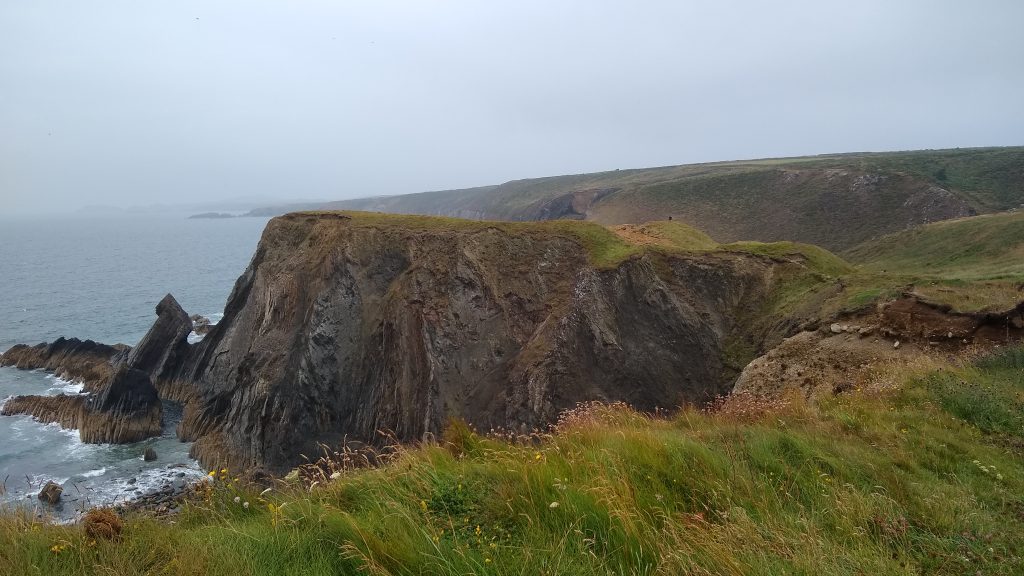
There are plenty of dramatic sheer cliffs on this section where coastal erosion is an obvious process. Every year Pembrokeshire is a little smaller than the year before and the route of the Coast Path has to be continually reviewed to ensure safety.
Pwllderi towards Penbwchdy 1 mile (1.6km)
The northern section is minor road (cul de sac). Magnificent views across Pwll Deri towards Strumble and Garn Fawr. Mostly a gentle graded section with a seat at the south end. A fairly steep slope, no stiles, five steps and three gates.
Walk Difficulty: Stiles or flights of steps or steep hills.
Walking Access Point
Garn Fawr Footpath (Grid ref: SM892397)
Footpath joins steeply up hill to Garn Fawr offers a series of circular walks including a ridge walk to Goodwick.
Worth a look
Garn Fawr and Tal-y-Gaer (Grid ref: SM894388)
Garn Fawr is an impressive Iron Age hill fort, with superb views from the top. The hill’s natural rocky outcrops are linked with walls of loose stone to form multiple defences. Beside the track leading to Tal-y-Gaer farm is a low corbelled ruin, which may be a hermit’s cell dating from the Middle Ages or earlier.
Car Park / Public Transport Access
Pwll Deri Car Park (Grid ref: SM893386)
A small car park with a view, room for only about six cars.
Information
Dewi Emrys Memorial (Grid ref: SM893385)
A memorial stone to Dewi Emrys (1879-1952), whose poem Pwllderi celebrates this area. The long rampart-like wall of Penbwchdy cliffs has been the scene of many shipwrecks.
Car Park / Public Transport Access
Bus Stop (Grid ref: SM896376)
This bus stop (and telephone box) is 0.6 miles (0.9km) from the Coast Path.
2. Penbwchdy to Aber Mawr 2.8 Miles (4.83Km)
A wild section, quite rough going in places. Magnificent views towards St David’s Head, Strumble and Garn Fawr. 20 steps, eight gates. Sheep, cattle and horses graze parts of this section.
Walk Difficulty: Stiles or flights of steps or steep hills.
Caution
Rocky Slopes (Grid ref: SM885377)
Rocky slopes. Some steep rocky slopes – take particular care in wet weather.
Caution
Cliff Edge (Grid ref: SM879372)
Cliff edge. Keep to Path. Take care in windy weather. Some sections of Path are fairly close to the cliff edge.
Walking Access Point
Pwllcrochan Footpath (Grid ref: SM886362)
Escape path to the road. No parking space.
Caution
Pwllcrochan Beach (Grid ref: SM885363)
Quite a large beach at low tide but no beach at high tide! Unfortunately there is no safe path down to it.
Caution
Cliff Edge (Grid ref: SM882354)
Cliff edge. Keep to Path. Take care in windy weather. Short sections of the Path fairly close to the cliff edge.
Caution
Aber Bach (Grid ref: SM883350)
Most of the year the small stream from inland trickles through the pebble bank. During storms or very wet weather the stream or the bank can be difficult to cross. In this case either wait for low tide or take the alternative road and footpath route around the valley.
Beach
Aber Bach Beach (Grid ref: SM883350)
Small unspoilt sandy beach with a pebble bank.
3. Aber Mawr to Abercastle 3 Miles (4.83Km)
The Coast Path rises quickly to the 150 foot high cliffs. The clifftop path is fairly level, broken by a steep descent and ascent at Pwllstrodur. On this stretch the Coast Path is perched close to the edge of the sheer sedimentary cliffs. 13 gates, 40 steps and steep gradients. Sheep and cattle graze parts of this section.
Walk Difficulty: Stiles or flights of steps or steep hills.
Car Park / Public Transport
Access Aber Mawr (Grid ref: SM884348)
Bus stop at Tregwynt Woolen Mill (Strumble Shuttle – thrice daily return – St David’s to Fishguard). Limited roadside parking for about 12 cars.
Walking Access Point
Wheelchair Accessible Viewpoint (Grid ref: SM883348)
The lower gate leads onto a short surfaced section to a viewpoint across Aber Mawr.
Information
Aber Mawr and Aber Bach (Grid ref: SM882348)
Aber Mawr. Around 20,000 years ago, towards the end of the Ice Age, the advancing Irish Sea ice sheet deposited marine sediments at various places in north Pembrokeshire. These purplish-blue clays, known as Irish Sea till, can be seen between layers of stony clay at Aber Mawr. The shingle banks at Aber Bach and Aber Mawr are often said to have been created by a violent storm in 1859, but in fact were formed by gradual processes associated with rising sea levels after the end of the Ice Age. The storm was, however, responsible for the wreck of the sailing vessel Charles Holmes, lost with all hands just north of Aber Bach. The small building at Aber Mawr was the terminus for the first Atlantic submarine telegraph cable in 1873.
Beach
Aber Mawr Beach (Grid ref: SM881345)
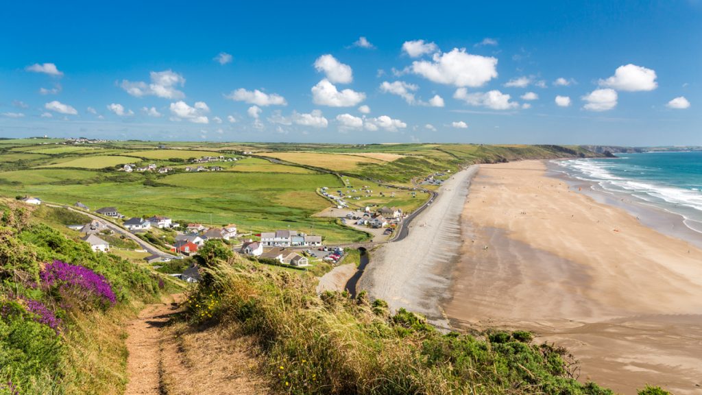
Unspoilt wide sandy beach with a pebble bank. This is one of the fastest eroding parts of the Pembrokeshire Coast Path. Parts of the beach are moving inland at up to 1 metre each year.
Walking Access Point
Aber Mawr Paths (Grid ref: SM881344)
Two bridleways and one byway. The bridleways offer a pleasant woodland extension to the walk, or a link to Mathry. The ‘white road’ (this one is a very minor public road, disused since the sea took part of it) offers another circular walk or short cuts to Abercastle or Mathry.
Caution
Morfa Cliff Edge (Grid ref: SM871345)
Eroding cliff edges. Keep to Path. Take care in windy weather. Quite long sections of Path fairly close to the cliff edge.
Beach
Pwllstrodur (Grid ref: SM866338)
Small secluded rocky beach.
Walking Access Point
Pwllstrodur Footpath (Grid ref: SM866337)
Steep uphill, often muddy with stock, returns to minor road – offers yet another circular walk or short cuts to Abercastle or Mathry.
Caution
Cliff Edge (Grid ref: SM852338)
Cliff edge. Keep to Path. Take care in windy weather. Quite long sections of path fairly close to the cliff edge.
Facilities
Mathry (Grid ref: SM879320)
The Farmers serves food and beer, shop, dive school/charter. 1.6 miles from the Coast Path.
4. Abercastle to Aber Draw (Felin) 3 Miles (4.83km)
Short sections of easier access at each end with no introduced obstructions to wheelchairs. The through Path is a dramatic section with stunning cliff scenery. 2.7 miles 4.3km 11 gates, 50 steps. Sheep, cattle and horses graze parts of this section.
Walk Difficulty: Stiles, long flights of steps, gradients up to 1:1.
Car Park / Public Transport Access
Abercastle Parking (Grid ref: SM852336)
Very limited parking, difficult to turn and get out again. Space for about four cars on the sea front – you need to be very early to get one! WC.
Car Park / Public Transport Access
Abercastle Bus Stop (Grid ref: SM853335)
The bus stop is at the little bridge on the road, about 100m from the beach. (Strumble Shuttle thrice daily return – St David’s to Fishguard).
Beach
Abercastle Beach (Grid ref: SM852336)
A sandy beach overlooked by the village. Also well used by the many boats including crab and lobster fishing boats and the local diving school.
Information
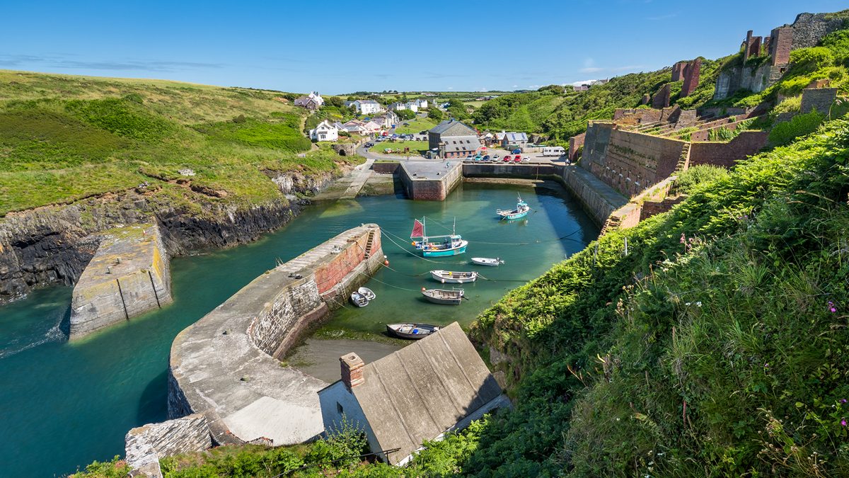
Abercastle (Grid ref: SM85263364)
Abercastle is also known as Cwm Badau (Bay of Boats). For centuries, corn, butter and oats were exported from here to Bristol and Liverpool, while limestone and anthracite were imported. The lime kiln is still in good condition and the large ruined building was once a granary. In 1876, Alfred Johnston anchored his 20 foot boat Centennial here after completing the first solo trans-Atlantic voyage.
Walking Access Point
Carreg Sampson Footpath (Grid ref: SM849337)
Returns to minor road, offers short cut to Trefin.
Worth a look
Carreg Sampson (Grid ref: SM848335)
Just off the Coast Path past Abercastle is Carreg Samson, a superb Neolithic burial chamber. Legend has it that St Samson placed the capstone in position using only his little finger. The finger is said to be buried on Ynys-y-Castell, the rocky islet at the entrance to the cove.
Caution
Cwm Badau Cliffs (Grid ref: SM850337)
Unguarded cliff edges. Keep to Path. Take care in windy weather. Long sections of Path fairly close to the cliff edge.
Worth a look
Castell Coch (Grid ref: SM840338)
An Iron Age Promontory Fort, one of over 50 Neolithic settlement sites to be found along the Pembrokeshire Coast Path National Trail. Note the impressive outer ditch dug in solid rock.
Information
Cliff Erosion (Grid ref: SM842336)
National Park and National Trust Staff have worked together here to move the entire stone wall inland four metres. The wall is a mass of sea pinks and campion in the spring.
Walking Access Point
Trefin Footpath North (Grid ref: SM840332)
National Trust Permissive footpath – cross-fields path to road near Trefin.
Walking Access Point
Trefin Footpath South (Grid ref: SM834329)
Public footpath along easy access lane to Trefin.
Beach
Aberfelin Beach (Grid ref: SM833325)
Rocky beach with good rockpools.
Information
Aberfelin Mill (Grid ref: SM833324)
The ruined mill at Aberfelin ceased operation in 1918. The mill leats are still visible on the opposite side of the road. The mill, which inspired the Archdruid Crwys to write his famous poem Melin Trefin, is maintained by the National Park Authority.
Facilities
Trefin (Grid ref: SM839325)
Village with accommodation and tearooms. The Ship Inn serves food and beer, about half a mile from the Coast Path.
5. Aber Draw (Aber Felin) to Porthgain 1.7 Miles (3.22Km)
There is a 250m steep road section near Trefin. The Coast Path follows the fairly level coastal plateau, a little inland of the cliff nearly all the way, with a short section following the field edge away from the coast. No steps, two kissing gates, 8 wicket gates, six short steep hills. Sheep, cattle and horses graze parts of this section.
Walk Difficulty: Stiles, long flights of steps, gradients up to 1:1
Car Park / Public Transport Access
Aber Felin Parking / Bus Stop (Grid ref: SM834324)
Very limited roadside parking – two cars only if carefully parked. The bus stop is in Trefin but the walker bus is ‘hail and ride’ and passes Aber Felin. Toilet in Trefin
Walking Access Point
Porthgain Footpath (Grid ref: SM819325)
Field-edge short cut to Porthgain, offers a short circular walk from Porthgain.
Caution
Porthgain to Gribinau Cliffs (Grid ref: SM816328)
Unguarded cliff edge. Keep to path. Take care in windy weather.
Information
Porthgain (Grid ref: SM814325)
In the 19th and early 20th centuries, Porthgain was a thriving industrial port. The local stone, a hard igneous rock known as diorite, was quarried for use as a building stone and for surfacing roads. Crushed and graded, it was stored in the great hoppers which still loom over the harbour, before being exported by sea. There was also a brick-works which used local clay, and much of the slate quarried at Abereiddi was shipped from here. Trade declined after the First World War and the stone-works finally closed in 1932. The National Park Authority is now responsible for conserving the harbour and industrial remains. The Row, a terrace of cottages on the west side of the village, was re-roofed using Abereiddi slates recovered from a cargo which had sunk in the 19th century.
Facilities
Porthgain Village (Grid ref: SM815325)
The Sloop Inn – one of the few pubs actually on the route of the Pembrokeshire Coast Path National Trail. Art galleries, restaurant and tea rooms.
View this section on Street View
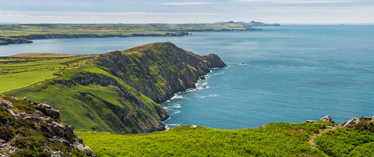
Pwll Deri (Grid ref: SM892387)
Follow the Coast Path Safety Code
- Take care on the Coast Path - it's rugged, natural terrain.
- Keep to the path, away from cliff edges and overhangs.
- Always supervise children, especially near cliff edges.
- Walking surfaces can vary considerably with the weather. Always wear strong footwear with a good grip and ankle support.
- Wear or carry warm and waterproof clothing.
- Cliff-top walking can be dangerous in high winds.
- Beware of taking shortcuts across beaches - you may be cut off by the tide. Swimming can also be dangerous.
- Do not sit under cliffs or climb them.
- Keep dogs under close control.
- The Coast Path is for walkers. It is not safe or lawful to ride horses or cycle along most of the Coast Path.
- Leave gates and property as you find them.
- Note that mobile phone coverage is unreliable on the coast.