Double check the tide tables for the two tidal crossings to avoid long detours on road. There are now no stiles on this section, except for one just south of Herbrandston on the high tide alternative route.
1. Dale to Musselwick (Low Tide Route) 1.6 Miles (3.22Km)
Often busy, road with no pavement. 0.4 miles stony causeway. 0.6 miles sandy beach which is quite difficult walking. Four gates at Musselwick Farm. Stepping stones at The Gann Crossing.
Walk Difficulty: No stiles or flights of steps, gradients less than 1:6.
Car Park / Public Transport Access
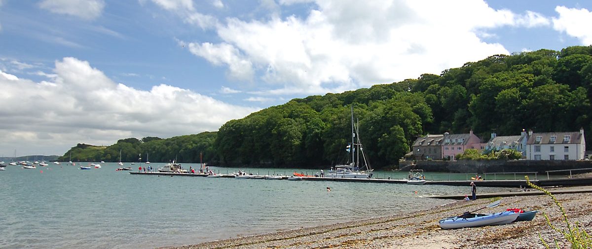
Dale Car Park (Grid ref: SM81110584)
Bus stop on Dale Seafront.(Puffin Shuttle – thrice daily return – St David’s to Milford Haven). Medium-sized Pembrokeshire County Council car park, charge in season. WC in the village.
Car Park / Public Transport Access
Pickleridge Car Park (Grid ref: SM80860663)
Hail and ride Puffin Shuttle – thrice daily return – St David’s to Milford Haven. Medium-sized, free car park.
Walking Access Point
The Gann / Pickleridge wheelchair section (Grid ref: SM80860660)
Access along spit of land that separates saltwater lagoons from the estuary. The lagoons were formed by excavation of gravel for aggregate used at Dale and Talbenny airfields. Site of Special Scientific Interest, please keep dogs under close control to avoid disturbing wildlife. Flat rough surface of naturally occurring gravel with larger stones in places (250m). There may be side growth for first 50m. Cross country chairs may travel a further 300m. WC in Dale. Wheelchair 250m. Adventure 300m.
Beach
Pickleridge / Gann Beach (Grid ref: SM81050665)
Large sheltered flat sand, silt and shingle beach. Popular with bait diggers.
Information
The Gann Pools SSSI (Grid ref: SM81160721)
North of Dale, a long shingle ridge marks the edge a huge deposit of sand and gravel. This built up alongside the melting southern edge of the Irish Sea ice sheet, about 17,000 years ago. During World War II, the deposits were worked to provide materials for Dale and Talbenny airfields. The now flooded pools and the valley are now a Site of Special Scientific Interest (SSSI), important for over-wintering birds.
Caution
The Gann Crossing (Grid ref: SM81330709)
The tidal crossing at The Gann can only be crossed for sure three and a half hours each side of low water. There is another tidal crossing four miles to the east at Sandy Haven. To be sure of crossing both crossings, try to reach the first as the tide is dropping – halfway between high and low, that way you will have plenty of time (five hours) to get to the second crossing.
Walking Access Point
The Gann Track Byway (Grid ref: SM81330700)
An alternative high tide route if the tide is not too high (the track gets submerged by spring tides). A potholed stony track. There is often an impassable deposit of rotting seaweed at the junction to the minor road. A byway is the most minor of highways to carry public vehicular rights, however this route is rarely passable by ordinary cars and there is no right to park. It does however offer a cross country cycle or horse route.
Walking Access Point
Gann Bridleway (Grid ref: SM81330700)
A bridleway links Musselwick Farm and the Gann, part of the high tide route. Also an alternative to walking along the beach. Also links with the very minor road past Trewarren offering a cross country cycle or horse route.
Walking Access Point
Musselwick Farm (Grid ref: SM81950665)
Eastern junction with high tide alternatives. Also follow the bridleway to avoid walking along the beach.
2. Pickleridge to Musselwick (High Tide Route) 3.2 Miles (4.83Km)
The tidal crossing at The Gann can only be confidently crossed three and a half hours each side of low water. The high tide route is 1.6 miles of narrow busy road with no pavement. Also 1.6 miles of farmland footpaths often with grazing cattle. One stone stile beside cattle grid, eight gates (and three gates at Musselwick).
Walk Difficulty: Stiles or flights of steps or steep hills.
3. Musselwick to Wenall Bay 1.8 Miles (3.22Km)
A steep hill to the West of Monk Haven and to the east of Monk Haven Folly. Two gates (the gate at Monk Haven Folly is not wheelchair accessible).
Walk Difficulty: Stiles or flights of steps or steep hills
Car Park / Public Transport Access
Monk Haven Car Park (Grid ref: SM83090677)
The bus stop is in the village of St Ishmael’s at the Brook Inn 0.8 miles from the coast. The car park is small and muddy, near the church 0.3 miles inland.
Walking Access Point
Monk Haven Easy Access (Grid ref: SM82830648)
Monk Haven, St Ishmael’s. SM 830067 to SM 828064. Take footpath to coast from small car park near church. Path follows wooded valley protected from salt spray by high sea wall. Views to Dale Fort. Surface is partly an old stone track, improved with rolled stone. Gradients to BT Fieldfare standard. No seats. WC at St Ishmael’s playing field. Wheelchair 520m.
Beach
Monk Haven Beach (Grid ref: SM82820639)
Small sand and shingle beach, often sheltered from the wind.
Information
Monk Haven (Grid ref: SM82820639)
The wall along the top of the beach dates from the 18th century, and marked the boundary of the Trewarren estate. The tower on the east side of the cove was built around 1860. The valley behind Monk Haven leads to the village of St Ishmaels. The sheltered aspect allows for vigorous vegetation growth and the woodland at Monk Haven.
Caution
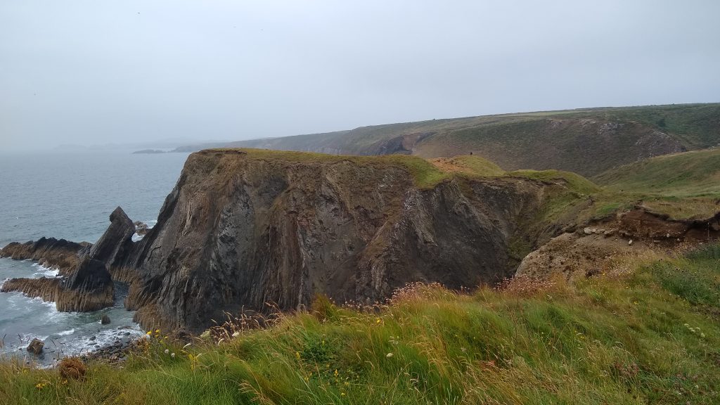
St Ishmael’s Cliffs (Grid ref: SM83000636)
Unguarded and eroding cliff edges. Keep to Path. Take care in windy weather. Quite long sections of Path fairly close to the cliff edge.
Information
Watch House Point (Grid ref: SM83420631)
Watch House Point with its decaying military buildings has a commanding view of the Haven. Used as an anti-aircraft position during the war.
Caution
St Ishmael’s Cliffs (Grid ref: SM84050674)
Unguarded and eroding cliff edges. Keep to Path. Take care in windy weather. Quite long sections of Path fairly close to the cliff edge.
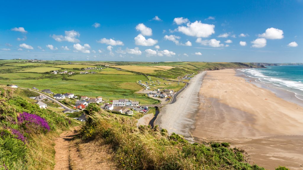
4. Wenall Bay to Sandy Haven 2.2 Miles (3.22Km)
Gentle gradients and wide views of the Haven when approached from St Ishmael’s. The steps gates and hills are all near Sandy Haven. Four wicket gates, one kissing gate, 25 steps.
Walk Difficulty: Stiles or flights of steps or steep hills
Facilities
St Ishmael’s (Grid ref: SM83420728)
Brook Inn Pub 0.6 miles from the Coast Path. Village shop.
Facilities
St Ishmael’s Playing Fields WC (Grid ref: SM83860713)
Accessible WC. Very limited roadside parking. Picnic site.
Walking Access Point
Lindsway Bay Easy Access Path (Grid ref: SM84050674)
Lindsway Bay, St Ishmael’s, towards Great Castle Head. A project focusing on removing obstructions to wheelchairs but does not provide a special surface on the coast. Tarmac path leads to picnic site and then to the cliff top. Only steep slope (1:10) is from the roadside to the WC (20m). Rest of route to coast is slightly steeper than flat. No side slope. From cliff top route follows Pembrokeshire Coast Path to Great Castle Head, slightly downhill all the way to the east (to the west five stiles have been removed, but after 0.5km gradients increase to 1:3 with cross fall). Path profile is slightly eroded in the centre; may be filled in due course. Potential return by bridleway and minor road, but for now this may only be practical by the most rugged chairs. Bridleway section is farm access track, rough in places with some slopes; may suit adventure chairs. WC at St Ishmael’s playing field. Easy Access 0.75km to second seat on Coast Path, plus up to 0.8km Easy Access path on Coast Path, 1 km bridleway, 1km road return. Total potential circuit 3.55km.
Caution
Lindsway Cliffs (Grid ref: SM84050674)
Unguarded and eroding cliff edges. Keep to Path. Take care in windy weather. Quite long sections of Path fairly close to the cliff edge.
Walking Access Point
Lindsway Bay Footpath (Grid ref: SM8430668)
This footpath descends very steeply to the beach down many stone steps.
Beach
Lindsway Bay (Grid ref: SM84320658)
Medium sandy bay with a very steep access path.
Walking Access Point
Great Castle Head Bridleway (Grid ref: SM84710617)
A bridleway link to the minor coast road, that offers a longer circular walk based on Monk Haven or St Ishmael’s.
Caution
Little Castle Head Old Path (Grid ref: SM84710671)
The footpath shown on most maps is not available, being an earlier route of the Pembrokeshire Coast Path which now follows closer to the coast.
Caution
Little Castle Head Cliffs (Grid ref: SM85520660)
Unguarded cliff edges. Keep to Path. Take care in windy weather. Short sections of Path fairly close to the cliff edge.
5. Sandy Haven High Tide Alternative 3.9 Miles (6.44Km)
A mistake with the tide tables leads to this four mile detour. It is mostly on road, at least half of which is busy main road. Much of the road is narrow, with no pavement. Not marked on most maps is a 400m off road permissive route just north of Herbrandston. Six gates, one stile.
Walk Difficulty: Road
Caution
Main Road (Grid ref: SM85930871)
Two miles of narrow and busy road with no pavement.
Car Park / Public Transport Access
Herbrandston Bus Stop (Grid ref: SM86900798)
Bus stop Puffin Shuttle – thrice daily return – St David’s to Milford Haven.
Facilities
The Taberna Inn (Grid ref: SM8680792)
B&B, beer and food.
Facilities
Herbrandston Village (Grid ref: SM86970776)
Shop and pub.
6. Sandy Haven to Gelliswick 3.5 Miles (6.44km)
Sandy Haven Pill – the local term for an inlet – is a peaceful tidal creek and can be crossed at low tide. The crossing is now available between 3 hours after high tide to three hours before high tide. The concrete stepping stones have been removed as it has not been possible to keep them level and at the right height; a new crossing has been constructed to provide a more stable level surface. If the causeway is not submerged it is possible to walk the beach to where the next stream flows across the beach (The Mun’s Mouth), and rejoin the Coast Path there.
The gradients on the Coast Path above the beach are not severe. No stiles, two flights of concrete steps at South Hook Jetty with 95 steps, two wicket gates, two kissing gates and one narrow kissing gate on South Hook Road. Despite the apparent hardness of the Old Red Sandstone, the section west of The Mun’s Mouth has one of the fastest rates of erosion on the coast. The National Trail has been realigned inland some four times here since 1989. The section East of The Mun’s Mouth is a surprisingly wild and little-used section of the Coast Path, given that it is close to a big town.
Walk Difficulty: Stiles or flights of steps or steep hills
Caution
Sandy Haven Crossing (Grid ref: SM85560749)
The tidal crossing at Sandy Haven can only be crossed for sure two and a half hours each side of low water. There is another tidal crossing four miles to the west at The Gann. To be sure of crossing both crossings, try to reach the first as the tide is dropping – half way between high and low, that way you will have plenty of time (five hours) to get to the second crossing.
Car Park / Public Transport Access
Sandy Haven Car Park (Grid ref: SM85780738)
Medium-sized free car park on the east side of the crossing, provided by the Community Council. No parking space on the west bank. Bus Stop at the village school one mile inland. No WC.
Beach
Sandy Haven (Grid ref: SM85830714)
A large flat sandy beach.
Walking Access Point
The Mun’s Mouth to Herbrandston Footpath (Grid ref: SM86330707)
An often muddy footpath, now starts from the west side of the creek. This footpath is the shortest link to Herbrandston when walking west. If the tide is nearly in, use this path to access the alternative route, as the causeway will be submerged (or wait out the tide in the pub – 0.8 miles).
Beach
Kilroom Beach (Grid ref: SM86790599)
Small secluded sandy beach. Steeply shelving. Difficult access.
Information
Stack Rock Fort (Grid ref: SM86430494)
One of several forts built along the Haven in the 1850s – 1860s, when Britain feared invasion from France under Napoleon III. They were positioned to cover each other, bringing enemy shipping under continuous fire. Initially a tower with three guns, Stack Fort was enlarged to accommodate 23 guns and 168 men. The forts protected the Royal Dockyard at Pembroke Dock.
Information
South Hook Point (Grid ref: SM86900545)
Industry and archaeology come close to the Path. The security fence to inland marks the perimeter of a dismantled oil refinery (Esso) and the site has become a haven for wildlife. The Island of Stack Rock has the remains of a powerful battery of big cannon, built in the mid 1800s. Inland is South Hook Barracks and more recent anti aircraft defences.
Information
South Hook / Little Wick Jetty (Grid ref: SM87430542)
Part of the old Esso site has been redeveloped as a Liquid Natural Gas regasification plant. This massive project called for the rebuilding of the jetty that crosses the Coast Path, as well as a 1.2m diameter pipeline to England. The huge tanks inland are for LNG storage.
Caution
South Hook / Little Wick Jetty (Grid ref: SM87430542)
Caution: beach may be blocked by spring tides, storm or surge conditions. If so, the best option is to shelter and wait until the sea drops.
Beach
Little Wick Beach (Grid ref: SM87430542)
Small sandy beach dominated by a concrete jetty.
Information
National Park Boundary (Grid ref: SM87430542)
The industrial section of the Pembrokeshire Coast is not in the National Park. The boundary across the Haven is from Little Wick Beach to Bullwell Bay. Nevertheless, the entire National Trail is managed by National Park Authority staff.
Walking Access Point
South Hook Road (Grid ref: SM88420546)
The half mile section west of Gelliswick Bay is an overgrown private road. A gentle walk with views out to sea. The narrow kissing gate has been replaced with an anti-motorcycle barrier that should allow access to wheelchairs without wing mirrors. Views over the LNG Jetty, Haven and of South Hook Barracks.
7. Gelliswick to Venn Farm 3 Miles (4.83Km)
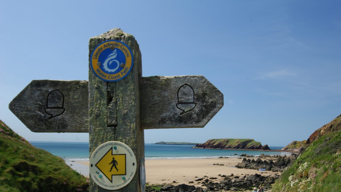
This National Trail does not have a designated route through the larger towns; the maps and guides show various recommended routes, but the walker will choose the route that suits, depending on their need for accommodation and supplies. A route has been waymarked through the towns with acorn markers stuck to lampposts and road signs, usually high up; however, these are vulnerable to both vandals and new paint. Use of a map is advised. Brown signs with the acorn have been added to street signposts etc, look out for these now between Monkton, Pembroke and Gelliswick. Also look out for the acorn symbol on the County Council’s green footpath signs.
Walk Difficulty: Road
Information
Milford Haven Waterway (Grid ref: SM88510431)
This was once a river valley, carved out along a major fault-line extending from Dale to Tenby. It was flooded when sea levels rose at the end of the Ice Age, about 10,000-5,000 years ago. The tidal creeks along both shores support a wealth of marine and bird life. The Haven is an important shipping route, also used for pleasure-boating and water-sports. The Port Authority has worked with the National Park Authority and other conservation bodies to develop an activity zoning scheme, to minimise disturbance to wildlife and residents.
Car Park / Public Transport Access
Milford Haven Railway Station (Grid ref: SM88510431)
Regular trains to Haverfordwest and stations towards London. It is possible to catch a train to Pembroke (but via Whitland) and so miss the road sections. Bus stop at Tesco opposite (Puffin Shuttle – thrice daily return – St David’s to Milford Haven)
Information
Milford Haven (Grid ref: SM90650606)
The town was founded in 1790 by Sir William Hamilton, British ambassador to the court of Naples, on land inherited from his first wife Catherine Barlow. Admiral Nelson, lover of Sir William’s second wife, Emma, was a frequent visitor. Hamilton and his nephew Charles Greville developed a major port with a ferry service to Ireland, a Royal Naval Dockyard and a fleet of whaling ships. It soon became one of the largest fishing ports in Britain. Once the railway was built, fish could be transported quickly to the big cities. The fishing industry had declined by the 1950s but Milford still has a trawler fleet and a fish market. The docks now house a museum, restaurants and a yachting marina.
Facilities
Milford Haven (Grid ref: SM90650606)
Modest town with all services: supermarkets, banks, hotels etc.
Walking Access Point
Milford Docks Easy Access Path (Grid ref: SM90410578)
Alternative route. Milford Haven Docks SM 902058 to Castle Pill SM 912054. Asphalt surfaced cycle track on old railway line, slight gradients. Parking on the docks. Maintained by Pembrokeshire County Council. Easy Access Path 1.2km.
Caution
Dangerous Road Section (Grid ref: SM91610610)
The road section just west of Milford Haven is a particularly nasty piece of road. It has fast commuting traffic and sharp bends. It is narrow with no pavement. Look out for the acorn signs that point you onto a footpath/bridleway route inland up Castle Pill. If you take the paths on the west side of the Pill there is an unexpectedly delightful walk through a community woodland.
8. Venn Farm to Hazelbeach 2.6 Miles (4.83km)
Cross fields and woodland walk. Great views of the Dragon Liquid Natural Gas Plant and the Waterston Tank Storage Depot. Ten steps, 11 gates. four large wind turbines now dominate the skyline to the eastern side of this section; two are very close to the Coast Path.
Walk Difficulty: Stiles, long flights of steps, gradients up to 1:1
Information
Oil refineries (Grid ref: SM9340501)
The Milford Haven is one of the UK’s few sheltered waterways deep enough for large oil tankers. Several refineries and related installations were opened here in the 1960s, bringing a temporary economic boom. The industry has since been scaled down, but a refinery is still in operation and there is major new development associated with gas imports. The Sea Empress oil spill in 1996 was a reminder of the potential clash of interests between industry and local employment on the one hand, and conservation and tourism on the other.
Facilities
Ferry House Inn (Grid ref: SM4750478)
B&B, beer & food.
9. Hazelbeach to Neyland 1.6 Miles (3.22km)
Only slight gradients on this road section. Half is a fairly quiet narrow road with no pavement, half is a pavement walk on the sea front.
Walk Difficulty: Road
Car Park / Public Transport Access
Hazelbeach Parking (Grid ref: SM9473904823)
Small car park. WC.
Information
Neyland (Grid ref: SM96630482)
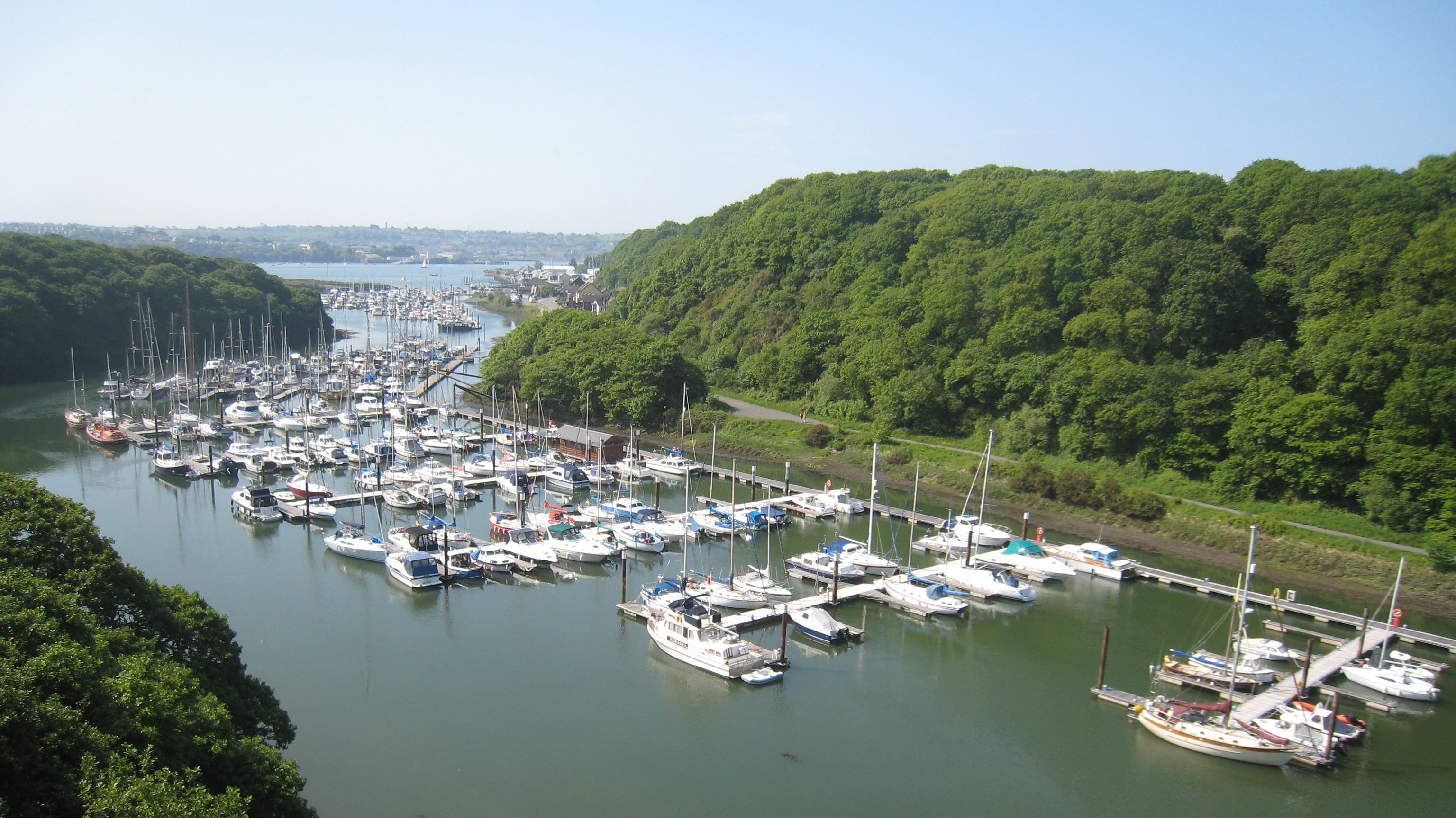
This site was chosen by Isambard Kingdom Brunel as the terminus for the South Wales Railway. Rapid development followed, with rail and port installations, a ferry service to Ireland, ship repair workshops and a small fishing fleet. In 1906, the ferry terminal was moved to Fishguard and the fishing fleet to Milford Haven. The rail link closed in the late 1960s. Today, Neyland is best known for its marina, which caters for yachts and power boats.
Car Park / Public Transport Access
Brunel Quay Car Park (Grid ref: SM96630482)
Medium-sized free car park, views of the water traffic on the Haven.
Facilities
Neyland Town (Grid ref: SM96220538)
Small town with limited services: Pub, takeaway and a few shops.
VIEW THIS SECTION ON STREET VIEW
Dale (Grid ref: SM811058)
Follow the Coast Path Safety Code
- Take care on the Coast Path - it's rugged, natural terrain.
- Keep to the path, away from cliff edges and overhangs.
- Always supervise children, especially near cliff edges.
- Walking surfaces can vary considerably with the weather. Always wear strong footwear with a good grip and ankle support.
- Wear or carry warm and waterproof clothing.
- Cliff-top walking can be dangerous in high winds.
- Beware of taking shortcuts across beaches - you may be cut off by the tide. Swimming can also be dangerous.
- Do not sit under cliffs or climb them.
- Keep dogs under close control.
- The Coast Path is for walkers. It is not safe or lawful to ride horses or cycle along most of the Coast Path.
- Leave gates and property as you find them.
- Note that mobile phone coverage is unreliable on the coast.