This section is very rugged and once away from Angle village deliberately managed to retain a remote and challenging experience. The entire stretch is coastal - no roads, no houses, few stiles and no amenities at all. Most of it has no mobile phone coverage either!
1. Angle Village to East Blockhouse 4.3 Miles (6.44km)
Sections of stone track between Angle and the Point House Inn, and at West Angle. Otherwise field edge and woodland paths sometimes with sheep. An ideal section for the less mobile walker with gentle gradients and neither steps nor stiles. 15 wicket gates. The byway between Angle and Point House floods on some spring tides for an hour or so.
Walk Difficulty: No man made obstructions to wheelchairs, ground conditions vary
Facilities
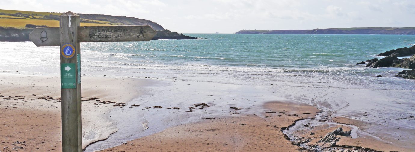
Angle Village (Grid ref: SM86570291)
Hiberia Inn, shop and post office
Car Park / Public Transport Access
Angle Bus Stop (Grid ref: SM86570291)
(Coastal Cruiser – thrice daily return – Pembroke – Freshwater East – Bosherston – Angle – Pembroke)
Information
Angle Village (Grid ref: SM86570291)
Angle is an attractive village with a mixture of modern housing and traditional cottages. The field boundaries on either side of the village are remnants of medieval field systems. It has a number of historic buildings including the church, fishermen’s chapel, dovecote and a very unusual medieval tower house.
Car Park / Public Transport Access
Angle Village Parking (Grid ref: SM86690293)
There is no formal parking at Angle Village itself. If you park near the bridge at the village end of Point lane, beware of high tides.
Walking Access Point
Old Point House Wheelchair Route (Grid ref: SM86570293)
Angle to Old Point House (pub), SM 866028 to 873031. Gradients within Fieldfare standard but surface can be potholed and rough in places, and underwater during spring tides. Stone track, not maintained for chairs, moderate cross fall in places, may suit cross country chairs best. Occasional motor use by fishermen and residents, access to lifeboat station and pub. Toilets at Freshwater West (not nearby). 0.75 km.
Walking Access Point
Village and Field Path (Grid ref: SM86720297)
A footpath lane joins from Angle Village then, runs parallel to the Coast Path for a few hundred metres. This provides a partial high tide alternative route for the Coast Path, as Point Lane is flooded on the higher tides. Four stiles, 14 steps.
Facilities
The Old Point House Inn (Grid ref: SM87340313)
Beer and food with a view. (Closed January 2020).
Information
Chapel Bay Fort (Grid ref: SM85880362)
The Coast Path passes inland of Chapel Bay Fort, one of the Victorian defences. Chapel Bay Fort is an extensive structure, hidden by woodland and scrub, but beware of wandering in the woods as there are sudden, deep ditches. It housed a powerful gun during World Wars I and II that could fire well out to sea. It now houses a private museum of weaponry, Chapel Bay Fort and Museum.
Walking Access Point
Chapel Bay Footpath (Grid ref: SM85940355)
Footpath (access track) joins here, link to minor road, this offers short circular walks, partly on road, based on Angle or West Angle Bay. No parking.
Worth a look
Thorne Island (Grid ref: SM84620382)
One of several forts built along the Haven in the 1850s – 1860s, when Britain feared invasion from France under Napoleon III. They were positioned to cover each other, bringing enemy shipping under continuous fire.
Caution
West Pill Cliffs (Grid ref: SM85140342)
Unguarded, eroding cliff edges. Keep to Path. Take care in windy weather. Short sections of Path fairly close to the cliff edge.
Car Park / Public Transport Access
West Angle Bay (Grid ref: SM85390318)
Bus stop (Coastal Cruiser – thrice daily return – Pembroke – Freshwater East – Bosherston – Angle – Pembroke). Large, National Park car park (charging in season) and WC.
Beach
West Angle Bay (Grid ref: SM85250314)
Medium-sized gently shelving sandy beach.
Facilities
West Angle Bay Café (Grid ref: SM85390318)
Wavecrest cafe.
Walking Access Point
West Angle Bay Wheelchair Route (Grid ref: SM85390318)
West Angle Bay car park towards Thorn Island gently rising path, steepest gradient is 1 in 15 for 30m. Loose stone surface, some potholes, first 300m on private car access track. Bear right at first junction (the left fork leads down a bumpy track to overlook the beach. Bear left at the second junction to follow downhill another 1:15 for 30m rolled stone and earth path to viewpoint across to Dale. No seats. Toilets at Freshwater West (not nearby). Wheelchair 390m. Further distance may be available to cross-country wheelchairs in dry weather.
Walking Access Point
West Angle Bay South Footpath (Grid ref: SM85280301)
This cross-field public footpath links to an access road providing a (mostly on road) circular return to Angle Village.
Worth a look
East Blockhouse (Grid ref: SM84210274)
The ruined cliff edge building was an Elizabethan fort. More recent defences are perched on the cliffs. Naval and anti-aircraft battery duplicated a similar one at West Blockhouse. A radar station was active here until the late 1990s.
2. East Blockhouse to Freshwater West 4.1 Miles (6.44km)
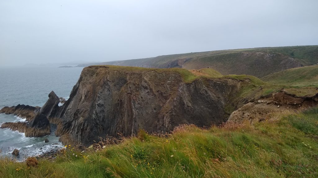
During the 1960s most of the Coast Path was cut out by a small bulldozer – this section, being one of the last to be dedicated as a right of way, was not. As a result this section has a particularly wild and open feel. Numerous very steep hills, five stiles with no provision for dog access, one kissing gate, 65 steps. This is a stunning and demanding section, a series of steep hills with colourful Old Red Sandstone cliffs streaked with yellow algae, secret coves and bays, and views – first of Linney Head then later across Freshwater West.
Walk Difficulty: Stiles, long flights of steps, gradients up to 1:1
Caution
Sheer cliffs, strenuous section (Grid ref: SM84590217)
Care should be taken not to follow sheep paths that appear to offer an easier, seaward, contour route. Be prepared as there are no escape paths, facilities or services on this five-mile section. Unguarded and eroding cliff edges. Keep to Path. Take care in windy weather. Quite long sections of Path fairly close to the cliff edge.
Worth a look
Sheep Island Iron Age Promontory Fort (Grid ref: SM84580182)
An Iron Age Promontory fort, one of over 50 Neolithic settlement sites to be found along the Pembrokeshire Coast Path National Trail.
Information
Angle Airfield (Grid ref: SM86200162)
The plateau inland was used as another World War II airfield, now reclaimed for farming.
Worth a look
Pickard Iron Age Promontory Fort (Grid ref: SM6230103)
An Iron Age promontory fort, one of over 50 Neolithic settlement sites to be found along the Pembrokeshire Coast Path National Trail.
Worth a look
Wildlife (Grid ref: SM86780084)
Look out for the rare chough (a jackdaw-like bird with bright red feet and beak, and playful of flight).
Walking Access Point
Gravel Bay Footpath (Grid ref: SM87760072)
The seaward start of this footpath is now west of that marked on most maps, following the valley. This path can be used to cross to Angle Bay, to enable a full day walk of Angle Peninsula.
Caution
Challenging cliff section (Grid ref: SM87760072)
Care should be taken not to follow sheep paths that appear to offer an easier, seaward, contour route. Be prepared as there are no escape paths, facilities or services on this five-mile section. Unguarded and eroding cliff edges. Keep to Path. Take care in windy weather. Quite long sections of Path fairly close to the cliff edge.
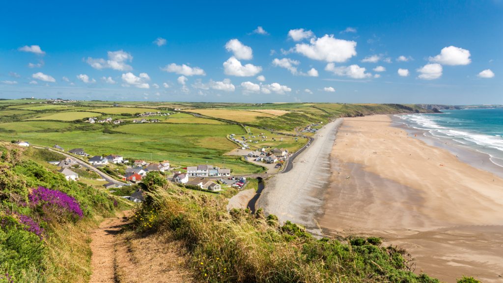
3. Freshwater West 0.7 Miles (1.61km)
A long beach backed by extensive sand dunes, very popular with surfers – there are two routes for the Coast Path. Most walkers will use the beach, but the signposted route strikes around behind the dunes, offering an alternative one-mile roadside route during storms.
Walk Difficulty: Road.
Beach
Freshwater West Beach (Grid ref: SM88110013)
A long sandy beach backed by extensive sand dunes, very popular with surfers. The surf, at times over six feet high, can be almost too exciting, the rips, undertow, long-shore current and quicksand represent very real threats. Swimming on this beach is not recommended, as the signs confirm. There is a real problem here with camping in the dunes and fires damaging the SSSI. Please, as elsewhere on the path, use campsites.
Information
Freshwater West (Grid ref: SM88110013)
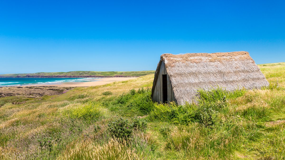
The extensive dunes are a Site of Special Scientific Interest (SSSI). In the past, the beach was famous for the edible seaweed Porphyra Umbilicalis, which can be washed, cooked and mashed to make a traditional delicacy known as laver bread. This is still sold in some food stores in Pembrokeshire, but it’s no longer from a local source. About 20 small huts for storing the seaweed were once located here. Only one remains, recently rebuilt by the Friends of the National Park. Bathing here is dangerous and there are quicksands at the north end of the beach. A submerged forest is revealed at low tide.
Car Park / Public Transport Access
Broomhill Burrows Car Park (Grid ref: SM88430044)
Junction with the minor coast road. Small, free National Park car park. The bus stops at the other, large car park to the south.
VIEW THIS SECTION ON STREET VIEW
Angle (Grid ref: SM865029)
Follow the Coast Path Safety Code
- Take care on the Coast Path - it's rugged, natural terrain.
- Keep to the path, away from cliff edges and overhangs.
- Always supervise children, especially near cliff edges.
- Walking surfaces can vary considerably with the weather. Always wear strong footwear with a good grip and ankle support.
- Wear or carry warm and waterproof clothing.
- Cliff-top walking can be dangerous in high winds.
- Beware of taking shortcuts across beaches - you may be cut off by the tide. Swimming can also be dangerous.
- Do not sit under cliffs or climb them.
- Keep dogs under close control.
- The Coast Path is for walkers. It is not safe or lawful to ride horses or cycle along most of the Coast Path.
- Leave gates and property as you find them.
- Note that mobile phone coverage is unreliable on the coast.