Mostly 30 to 70m high cliffs of volcanic origin. Gently rounded cliffs where the rock is strong and hard, sheer where there are weak strata. Infrequent steep hills. Typical of this section are the frequent rocky outcrops and loose volcanic stone. Heather and gorse abound, a dramatic blaze of colour in August.
1. Lower Town to Goodwick Parrog. 1.7 Miles (3.22Km)
Three wheelchair accessible sections at Lower Town, Marine Walk and Goodwick Parrog are separated by steep slopes or steps. The cliff section of the Pembrokeshire Coast Path around Fishguard is also called The Marine Walk.
Walk Difficulty: No man-made obstructions to wheelchairs, ground conditions vary
Information
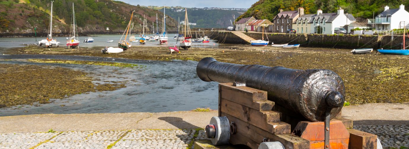
Lower Town (Grid ref: SM962371)
Mouth of the Gwaun.
When you are roughly opposite Fishguard Fort, there is an impressive view back towards Lower Town and the Gwaun Valley, which gives the town its Welsh name, Abergwaun (mouth of the Gwaun). This steep-sided valley was carved by meltwater flowing beneath an ice sheet. The cliffs on the eastern side of the inlet show spectacular exposures of volcanic rocks, resulting from violent underwater eruptions during the Ordovician period, some 470 million years ago. The layers were subsequently upended by a collision of drifting continents.
Walking Access Point
Wheelchair – Marine Walk (East) (Grid ref: SM962371)
Marine Walk (East), Lower Town Fishguard SM962371 to SM960371
Flat tarmac promenade with seats starting from ‘Skirmisher’ car park and ending at foot of steep hill (220m) or park on the other side of the bridge and follow the pavement to the old quay (440m). To BT Standard. Views across the old port. Toilets at Fishguard, Square and West St. Wheelchair 660m.
Facilities
Fishguard (Grid ref: SM956372)
Small town built on the side of a hill with a full range of shops and services.
Information
Three Towns (Grid ref: SM956371)
Two centuries ago, Fishguard’s Lower Town was an important trading centre. More than 50 ships were based here, exporting corn, butter, fish and slate to Ireland, Bristol and North Wales. Coastal trade declined with the coming of the railway, but the completion in 1906 of a new harbour and rail-head at Goodwick established Fishguard as an Irish Sea ferry port. Fishguard’s most famous historical event was the attempted French invasion of 1797 (see F). A remarkable tapestry, The Last Invasion Tapestry, made for the bicentenary celebrations, is on display in Fishguard Library. A memorial stone to Jemima Nicholas, who single-handedly rounded up some of the would-be invaders, can be seen in St Mary’s Church. The Royal Oak Inn displays the table on which the terms of surrender were signed. For more information about Fishguard, ask at the Tourist Information Centres in The Square or in Goodwick.
Walking Access Point
Wheelchair – Marine Walk (West) (Grid ref: SM950375)
Marine Walk (West), Fishguard begins as paved walk, 140m, somewhat uneven and wobbly, then becomes an asphalt strip path, refurbished in 2009. After another 50m path drops at about 1 in 9 for 40m, then levels and after another 50m rises about 1 in 9 for 30m. After a gradual gain the rise restarts at about 1:9. Cross country chairs might tackle a further 500m. Frequent seats. Toilets at Fishguard Square and West St. Wheelchair 300m plus 0.5km Easy Access.
Car Park / Public Transport Access
French Walk Car Park (Grid ref: SM950375)
Small car parking area (six cars).
Car Park / Public Transport Access
Goodwick Bridge Car Park
Small parking area for about 10 cars.
Walking Access Point
Wheelchair – Goodwick Parrog (East) (SM946380)
Park at the Fishguard end of the seafront. Purpose built wheelchair ‘stone’ paved path. No discernible gradient or cross fall. Seats and interpretation. Path along seafront causeway but well back from sea. Views of sea, ferry port, coastal slopes, play area and, inland, there is Site of Special Scientific Interest marshland. Path connects to Goodwick Parrog (West) path and the RADAR toilets across 20m short reinforced (with plastic honeycomb) grass. Wheelchair 400m.
Car Park / Public Transport Access
Goodwick Sea Front Car Park
Medium-sized free car park. WC. Cafe. Information.
2. Goodwick Parrog to Harbour Village 1 Miles (1.61Km)
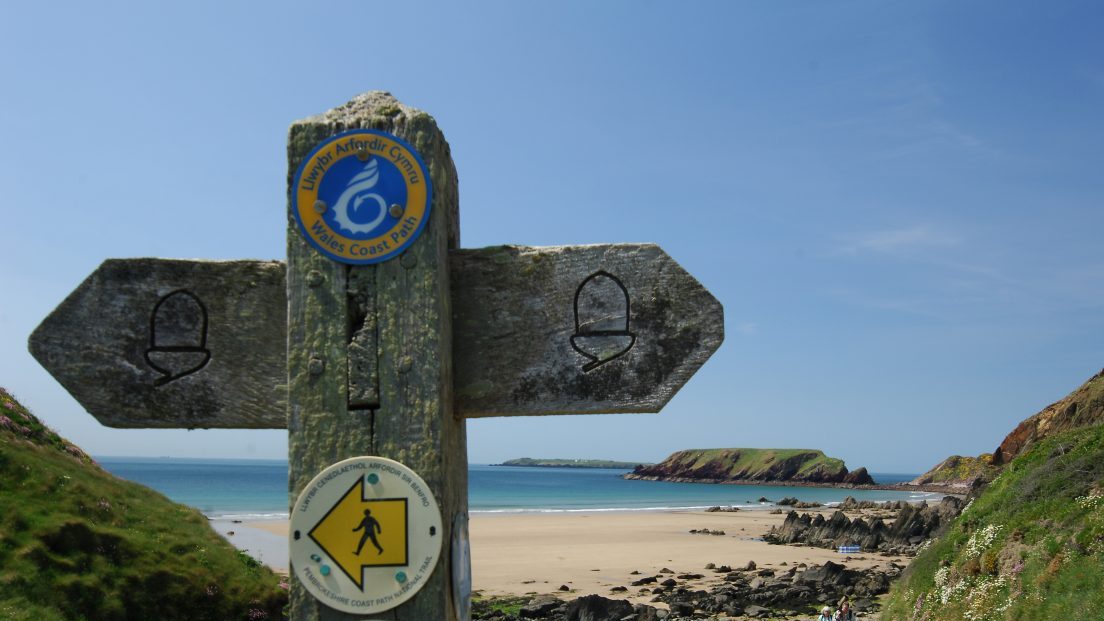
This National Trail does not have a designated route through the larger towns; the maps and guides show various recommended routes, but the walker will choose the route that suits, depending on their need for accommodation and supplies. A route has been waymarked through the towns with acorn markers stuck to lampposts and road signs, usually high up, however these are vulnerable to both vandals and new paint. Use of a map is advised.
Since Easter 2009, brown signs with the acorn have been added to street signposts etc, look out for these now through the towns. Also look out for the acorn symbol on the County Council’s green footpath signs. The present recommended route differs from the road-based route shown on most maps and guides (partly steep, narrow, no pavement).
Going west (uphill): Follow the seafront west, towards the ferry buildings. Cross the large steel footbridge that crosses the ferry car queues and railway line, turn right along the dead end road towards the Fishguard Bay Hotel, looking for a gap in the wall on the left after 110m. A zigzag path climbs steeply through the woods. Turn right and follow the road to its end.
Going east (downhill): Follow the road, as it starts to head steeply down look out for a signpost on the right, a waymark on a telegraph pole and a for a gap in the wall on the left. A zigzag path drops steeply through the woods, turn right away from the Fishguard Bay Hotel and look for a path on the left that leads to the large steel footbridge.
Walk Difficulty: Road
Walking Access Point
Wheelchair-Goodwick Parrog (West) (Grid ref: SM946380)
Park on the seafront near the entrance to the ferry terminal. Part pavement, part brick type surface. No discernible gradient or cross falls. The south-east 200m is by a popular water sports area, with seats. The north-western 500m follows top of seawall outside the ferry queue compound – no seats. Toilets are at eastern end of the water sports building. Wheelchair 0.7km.
Facilities
Goodwick Town (Grid ref: SM944382)
A good range of accommodation, pubs and restaurants.
Car Park / Public Transport Access
Goodwick Square (Grid ref: SM944382)
Bus stop (Strumble Shuttle – thrice daily return – St David’s to Fishguard).
Car Park / Public Transport Access
Goodwick Rail and Ferry Link (Grid ref: SM951388)
Trains from London at noon and midnight meet the ferry from Rosslare.
3. Harbour Village to Carnfathach 1.4 Miles (1.61Km)
Mostly gentle gradients, wild, rounded coastal slopes with rock outcrops, three gates of which two are kissing gates. Sheep, cattle and horses graze parts of this section.
Walk Difficulty: No stiles or flights of steps, gradients less than 1:6.
Car Park / Public Transport Access
Harbour Village Car Park (Grid ref: SM949391)
Small car park for about six cars. Bus stop (please allow space for the bus to turn). Views across Fishguard Bay.
Worth a look
Pen Anglas (Grid ref: SM949405)
Follow the fainter path straight ahead from the second gate to see the columnar basalt outcrops at Pen Anglas. This is the same type rock formation as found at the Giant’s Causeway in Ireland.
Walking Access Point
Crincoed Footpath (Grid ref: SM947399)
Permissive path joins linking to a series of inland circular walks.
Walking Access Point
Ciliau Footpath (Grid ref: SM939403)
National Trust Permissive footpath – often swampy, links to Llanwnda or return to Harbour Village. With the next footpath (Aber Felin), makes a nice little circuit based on Llanwnda (farmland, may be muddy, stock in fields).
4. Carnfathach to Strumble Head 4.2 Miles (6.44Km)
Some steep slopes, sheer crumbling cliffs to seaward between the more rounded harder cliffs. 120 steps, nine kissing gates, 10 wicket gates. There are coastal grazing schemes here: horses at the western end between Strumble and Porthsychan, cattle between Goodwick and Carregwasted, sheep in the middle! Please keep dogs under close control.
Walk Difficulty: Stiles, long flights of steps, gradients up to 1:1.
Caution
Cliff Edge (Grid ref: SM930402)
Eroding cliff edges. Keep to Path. Take care in windy weather. Some sections of Path fairly close to the cliff edge.
Walking Access Point
Llanwnda Footpath
Provides a link to Llanwnda, or a return to Harbour Village. With the Ciliau footpath – (National Trust Permissive) GR SM 939403, makes a nice little circuit based on Llanwnda (farmland, may be muddy, stock in fields).
Walking Access Point
Tre Howel/Castell (Grid ref: SM925403)
Uphill, mostly concrete track, returns to minor road. Makes another little circuit by using the ‘white road’ (this one is a very minor public road), to Llanwnda or Goodwick.
Information
Carreg Goffa Monument (Grid ref: SM926404)
On 22 February 1797, during the Napoleonic War, four French vessels anchored off Carregwastad and disembarked 1,400 soldiers. Many were ex-convicts and their commander was an American, William Tate, whose knowledge of French was limited. Establishing their headquarters at nearby Trehowel Farm, they occupied the Pen Caer peninsula, looting farms, slaughtering livestock and getting drunk. They eventually surrendered on Goodwick Sands.
Caution
Rocky Slopes (Grid ref: SM924405)
Rocky slopes. Some steep rocky slopes – take particular care in wet weather.
Walking Access Point
Goodhope Footpath (Grid ref: SM912406)
Rough track returns gently uphill to minor road and high level circular walks. Or turn right to follow field path to Porthsychan.
Beach
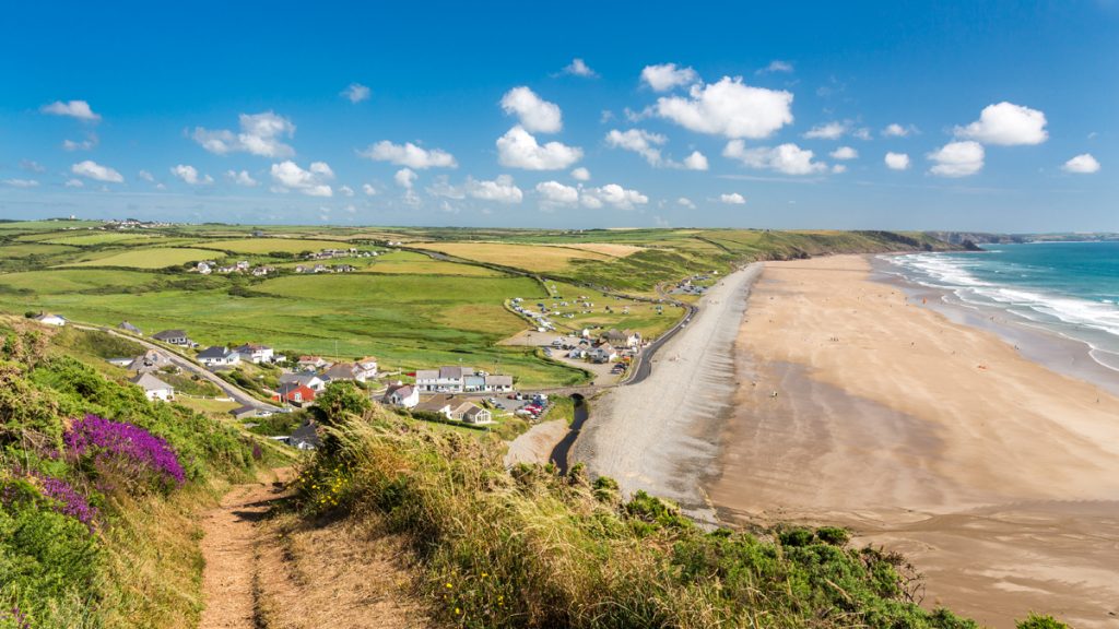
Porthsychan Beach (Grid ref: SM905407)
Large bay with a small rocky beach, popular with seals. Please do not approach seal pups, keep dogs on a lead.
Walking Access Point
Tresinwen Footpath (Grid ref: SM905407)
Wet rough track uphill returns to minor road via farm yard. Offers road circuit from Strumble Head.
Information
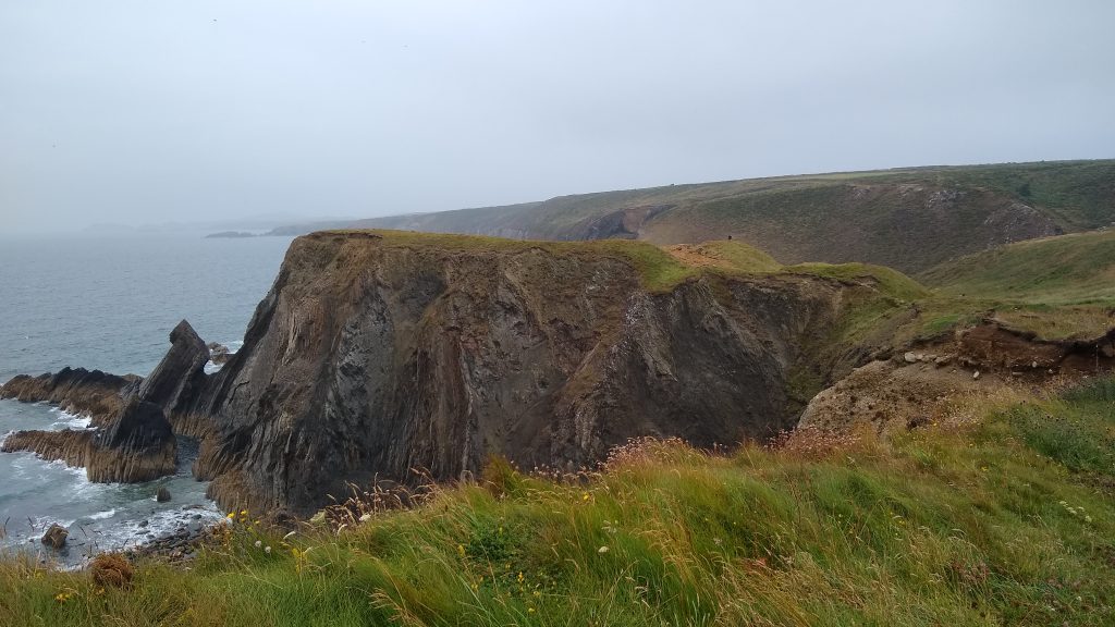
Strumble Head (Grid ref: SM898415)
The headland consists of rocks formed by volcanic action during the Ordovician period. Lava from eruptions under the sea cooled quickly into pillow shapes, while later eruptions injected more molten rock between the existing lava flows. These rock formations are visible as you approach the headland, especially around the small bay of Porthsychan.
5. Strumble to Pwll Deri. 2.8 Miles (4.83Km)
Wild, open views, mountain type vegetation on the mostly rounded cliffs of pillow lava (magma extruded underwater). The steepest gradients are near Pwll Deri. 2 stiles, 22 steps, four gates. Sheep, cattle and horses graze parts of this section.
Walk Difficulty: Stiles, long flights of steps, gradients up to 1:1.
Facilities
Strumble Head Shelter (Grid ref: SM898413)
Strumble Head is famous as a spot for watching seabirds, migrant birds and marine life. A former World War II lookout post provides shelter for wildlife-watchers and has some interpretation boards inside it. The National Park Authority has introduced ponies to graze the headland, to improve the quality of clifftop grassland and heath which are important for wildlife.
Car Park / Public Transport Access
Strumble Head (Grid ref: SM894412)
Bus stop (Strumble Shuttle – twice daily return – St David’s to Fishguard). Two parking areas to hold over 20 cars.
Information
Strumble Head Lighthouse (Grid ref: SM892412)
One of the many lighthouses around the Pembrokeshire coast. There are dramatic overfalls off the coast here and submerged rock hazards. The lighthouse was built in 1908 and cost £70,000. It is now fully automated. The light flashes four times every 15 seconds and is visible for about 50km (over 30 miles). The foghorn sounds four times a minute and can be heard for 8km (5 miles).
Information
Pen Brush (Grid ref: SM886394)
Former Ministry of Defence Buildings. Coastal grazing scheme.
Caution
Cliff Edge. Rocky Slopes (Grid ref: SM889391)
Eroding cliff edges. Keep to Path. Take care in windy weather. Rocky slopes. Some steep rocky slopes – take particular care in wet weather.
Porth Maenmelyn a rare private beach with locked access.
Worth a look
Dinas Fawr (Grid ref: SN887386)
The dramatic Iron Age Promontory Fort on the coast contrasts with the Hill Fort of Garn Fawr that
towers 200m above.
Worth a look
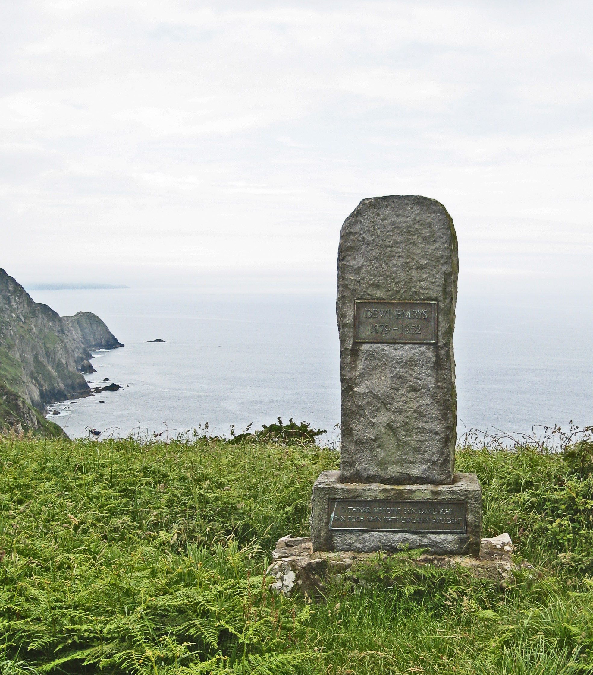
Pwll Deri Seals (Grid ref: SM889386)
The hidden beaches each side of Dinas Fawr’s ramparts are good places to see seal pups
(discreetly) in the autumn. Beware of the steep cliffs.
Facilities
Pwll Deri YHA (Grid ref: SM892387)
A Youth Hostel in one of the most stunning locations in Britain.
VIEW THIS SECTION ON STREET VIEW
Lower Town Fishguard (Grid ref: SM962371)
Follow the Coast Path Safety Code
- Take care on the Coast Path - it's rugged, natural terrain.
- Keep to the path, away from cliff edges and overhangs.
- Always supervise children, especially near cliff edges.
- Walking surfaces can vary considerably with the weather. Always wear strong footwear with a good grip and ankle support.
- Wear or carry warm and waterproof clothing.
- Cliff-top walking can be dangerous in high winds.
- Beware of taking shortcuts across beaches - you may be cut off by the tide. Swimming can also be dangerous.
- Do not sit under cliffs or climb them.
- Keep dogs under close control.
- The Coast Path is for walkers. It is not safe or lawful to ride horses or cycle along most of the Coast Path.
- Leave gates and property as you find them.
- Note that mobile phone coverage is unreliable on the coast.