Northwest of Newgale there are a series of very steep hills with up to 100 steps. South of Newgale a series of less steep hills as the plateau is broken by The Havens. There are now no stiles on this section.
1. Lower Solva to The Gribin 0.4 Miles (0.6Km)
A rising path, through woodland overlooking the harbour. Note the lime kilns at the harbour and the Iron Age settlement site on the top. 10 steps.
Walk Difficulty: Stiles or flights of steps or steep hills
Car Park / Public Transport Access
Lower Solva Bus Stop (Grid ref: SM806244)
Bus stop on Main Street (Puffin Shuttle – thrice daily return – St David’s to Milford Haven). Large Solva Community Council car park (charges apply). Accessible WC.
Walking Access Point
Gribin Footpaths 1 (Grid ref: SM805242)
A series of footpaths join, offering short circular walks based on Solva with fine views of the town and harbour.
Walking Access Point
Gribin Footpaths 2 (Grid ref: SM802239)
A series of footpaths join, offering short circular walks based on Solva with fine views of the town and harbour.
2. The Gribin to Porthmynawyd 2.1 Miles (3.22km)
Dramatic views towards Ramsey, Newgale and across St Brides Bay. This section has steep hills with many steps at each end and gentle gradients between. Grazing cattle usually west of Dinas Fawr. Five kissing gates, three wicket gates, 140 steps.
Walk Difficulty: Stiles or flights of steps or steep hills
Beach
Gwadn Beach (Grid ref: SM802237)
Medium sandy beach with a pebble bank.
Walking Access Point
Gwadn to St Elvis Footpath (Grid ref: SM803238)
This offers an inland return to Solva, via the Gribin, and a larger circular via Lochvane and Porthmynawyd. Also links to main road via farm access track.
Caution
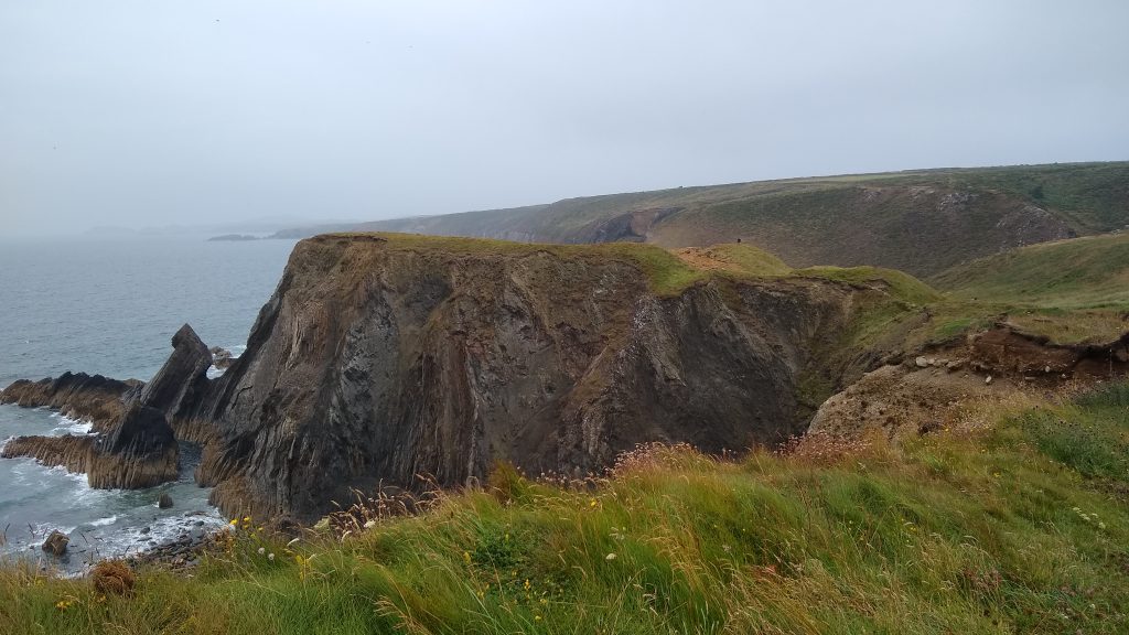
St Elvis Unguarded Cliff Edge (Grid ref: SM810236)
Eroding cliff edges. Keep to Path. Take care in windy weather. Quite long sections of Path fairly close to the cliff edge.
Walking Access Point
Porth y Bwch to St Elvis Footpath (Grid ref: SM812236)
Porth y Bwch (Dinas Fawr). This offers an inland return to Solva, via the Gribin, a larger circular via Lochvane and Porthmynawyd. Also links to main road via farm access track.
Caution
Dinas Fawr Footpath (Grid ref: SM813231)
Resist any temptation to use the footpath along Dinas Fawr. Coastal erosion has made this very perilous. This footpath is not part of the National Trail, although some maps show it as such.
Walking Access Point
Lochvane Footpath (Grid ref: SM822234)
A short circular via Pointz Castle, or a longer one via Lochvane.
Caution
Unguarded Cliff Edge (Grid ref: SM822231)
Unguarded cliff edge. Keep to Path. Take care in windy weather. Some sections of Path fairly close to the cliff edge.
3. Porthmynawyd to Newgale 1.8 Miles (3.22km)
The views continue to impress, as do the coastal rock formations. Five steep ups and downs with steps make this an energetic section. If accessed by the Cwm Bach footpath, a gentler cliff top walk is available. Two kissing gates, three wicket gates, 250 steps.
Walk Difficulty: Stiles, long flights of steps, gradients up to 1:1
Walking Access Point
Pointz Castle Footpath (Grid ref: SM826232)
This footpath has recently been legally diverted, follow the signs on site. It forms a short link to the main road (where there is a lay-by). This path offers a full half day circular walk based on Solva, with return via Pointz Castle, Lochvane and St Elvis, minor road, green lanes and field edge.
Beach
Porthmynawyd Beach (Grid ref: SM826229)
A picturesque cove, often deserted, is a pleasant spot for a swim when the tide is not full in. Sandy beach with a pebble bank.
Walking Access Point
Cwm Bach (Grid ref: SM840231)
This footpath has recently been legally diverted, follow the signs on site. A short link to the main road
Beach
Cwm Mawr Beach (Pen y Cwm Beach) (Grid ref: SM842228)
Small – medium sand and rock beach. Caution – backed by high unstable cliffs! Joins to the huge Newgale Beach at low tide.
Walking Access Point
Cwm Mawr to Pen y Cwm Footpaths (Grid ref: SM843228)
Although there are three footpaths marked on the map, only the eastern one offers trouble free access to the main road. Use this path (access track) as the shortest route to the White House YHA.
Information
Cwm Mawr (Grid ref: SM843229)
Cwm Mawr is the former site of a brick works that used the pale clay to be found there.
Caution
Cwm Mawr Cliffs (Grid ref: SM844227)
Unguarded cliff edge. Unstable eroding cliff edges. Keep to Path. Take care in windy weather. Short sections of Path fairly close to the cliff edge.
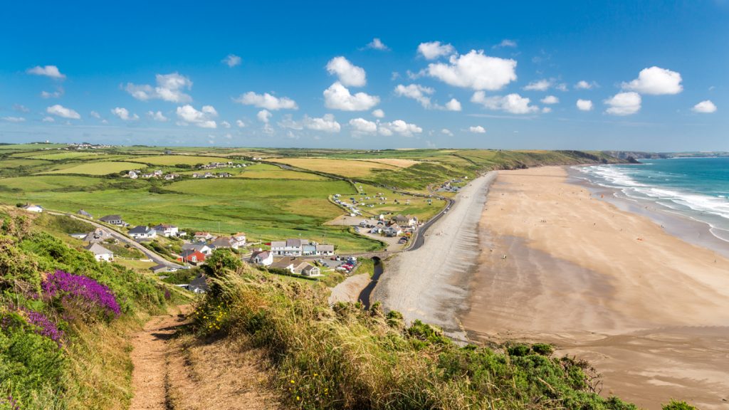
4. Newgale Beach 1.1 Miles (1.61km)
The designated Coast Path route is on the road. However a much pleasanter option is to take off one’s boots and walk along the edge of the surf, watching the surfers and small flat fish in the shallows. To avoid problems heading south from Newgale it is best to rejoin the road by the southern car park. The Coast Path leaves the road after 450m.
Walk Difficulty: Road.
Facilities
Newgale Village (Grid ref: SM847223)
Cafe, campsites, pub. Wetsuit hire and surf tuition, ice cream, WC.
Facilities
Duke of Edinburgh Pub (Grid ref: SM848221)
Food and beer.
Car Park / Public Transport Access
Newgale Bus Stop (Grid ref: SM848221)
At the Duke of Edinburgh Pub. Puffin Shuttle – thrice daily return – St David’s to Milford Haven.
Beach
Newgale Beach (Grid ref: SM847219)
A long sandy beach popular with surfers, wind surfers and swimmers. The waters of St Brides Bay are not too cold from July onwards and can be quite warm on an incoming tide when the sea has picked up the heat from the sand. One can walk on the beach all the way from Cwm Mawr to Trefrane, but only when the tide is very low as there is the danger of being cut off – knowledge of the tides is needed.
Information
Newgale Sands (Grid ref: SM847219)
This superb beach, stretching for over three km (two miles), is popular with residents and visitors alike. The long shingle ridge was created by rising sea levels at the end of the Ice Age. It includes rocks from the St Davids area and even from Scotland, carried south by the Irish Sea ice sheet. The black stumps of a drowned forest can sometimes be seen off the northern end of the beach at low tide. Newgale is under constant threat from the sea. The original Duke of Edinburgh Inn was on the seaward side of the road, but was washed away by a storm in 1896. The Brandy Brook, which flows into the sea here, marks the western end of the ‘Landsker Line’, a chain of Norman fortifications which still marks the cultural boundary between the Welsh-speaking north and English-speaking south of Pembrokeshire.
Car Park / Public Transport Access
Newgale Beach Car Park (Grid ref: SM850217)
Large Pembrokeshire County Council car park, charge. Accessible WC.
Car Park / Public Transport Access
Newgale Beach South Bus Stop (Grid ref: SM853210)
Pebbles bus stop – (Puffin Shuttle – thrice daily return ‘ St David’s to Milford Haven). Large National Park car park, charge. WC.
Facilities
Pebbles Café (Grid ref: SM853210)
Seasonal cafe, also sells beach goods. Great views.
Caution
Newgale South (Grid ref: SM850209)
The footpath marked on the OS maps no longer exists due to a landslide caused by coastal erosion. Therefore there is no safe route from the National Trail down the cliff to the southern end of Newgale beach. Walkers should keep to the designated route of the National Trail. To avoid problems heading south from Newgale it is best to rejoin the road by the Pebbles car park. The Coast Path leaves the road after 450m.
5. Newgale to Nolton Haven 1.9 Miles (3.22km)
A demanding short section, due to four very steep hills, but the gentler parts can be accessed from Maidenhall car park or Trefrane footpath. Two kissing gates, four wicket gates, 9 steps. Horses graze the coastal slopes above Maidenhall, cattle at Trefrane. Views of the full length of Newgale and of the cliffs all the way to Ramsey.
Walk Difficulty: Stiles, long flights of steps, gradients up to 1:1
Caution
Maidenhall Cliffs (Grid ref: SM854206)
Unguarded cliff edge. Eroding cliff edges. Keep to Path. Take care in windy weather. Some sections of Path fairly close to the cliff edge.
Walking Access Point
Maidenhall car park Footpath (Grid ref: SM856200)
A short permissive footpath (not shown on many maps) link to a medium-sized, free National Park car park beside the coast road.
Caution
Difficult Footpath (Grid ref: SM855197)
Footpath marked on the maps from the southern end of Newgale Sands to the Trefrane Colliery. This path is very steep, crossing smooth rock and unstable ground. This path is not recommended. A fall here is very likely particularly if carrying a backpack. Another danger is being cut off by the tide before rounding Maidenhall Point.
Information
Coal Measures – Newgale (Grid ref: SM857196)
From Newgale to just beyond Little Haven, the cliffs are mainly cut into the Coal Measures, formed about 300 million years ago during the Carboniferous period. Coal was mined at Newgale as early as the 15th century. The ruins of Trefrane Colliery, marked by the tall chimney of its engine house, overlooks the southern end of the beach. This mine was in use from the mid-19th century to 1905, and some of its galleries ran under the sea. The coal was loaded on trolleys and pulled by a traction engine to Nolton Haven for shipment.
Walking Access Point
Trefrane Footpath (Grid ref: SM856195)
A short footpath link to the minor coast road.
Caution
Ricket’s Head (Grid ref: SM8552189)
Rocky slopes. Steep rocky slope – take particular care in wet weather. Going north follow the signs – the easy path ends at a cliff!
Caution
Davey Williams Haven Cliffs (Grid ref: SM856185)
Unguarded cliff edge. Keep to Path. Take care in windy weather. Short section of path close to the cliff edge.
6. Nolton Haven to Druidston Haven 1.4 Miles (1.61km)
This section has some very sheer cliffs and active erosion threatens the National Trail. The cliff route has gentle gradients except for the steep, stepped descent to Druidston Haven. 0 stiles, 45 steps. In places the Coast Path is close to concave cliffs – resist the temptation to peer over the edge! Note the large erratic boulder wedged in a gully.
Walk Difficulty: Stiles, long flights of steps, gradients up to 1:1
Car Park / Public Transport Access
Nolton Haven Bus Stop (Grid ref: SM859186)
Bus stop (Puffin Shuttle – thrice daily return – St David’s to Milford Haven). Medium-sized, free car park. WC. Pub. Riding Stables.
Beach
Nolton Haven Beach (Grid ref: SM858185)
Small sheltered sandy beach.
Facilities
The Mariners Inn (Grid ref: SM859185)
B&B. Beer & food.
Caution
Undercut Cliffs (Grid ref: SM857182)
Unguarded cliff edge. Eroding cliff edges. Keep to Path. Take care in windy weather. Quite long sections of Path fairly close to the cliff edge.
Walking Access Point
Madoc’s Haven Escape Path (Grid ref: SM859179)
A steep difficult ascent from the beach – positively dangerous going down. Not recommended. Beware of smooth slimy rocks!
Walking Access Point
Druidston Haven to road Footpath (Grid ref: SM862172)
North beach access. A short footpath link to the minor coast road. Used by large groups of horses.
Beach
Druidston Beach (Grid ref: SM860171)
Druidston is another good beach for a swim when the tide is not right in, although groups of horse riders often canter along the beach. Medium sandy beach backed by unstable cliffs.
Worth a look
Malator aka ‘Teletubby House’ (Grid ref: SM863171)
Unusual modern underground house.
7. Druidston Haven to Druidston Chins 0.6 Miles (1.61km)
The northern section is on narrow minor road with no pavement. The southern section is across fields with gentle gradients. The southern section is a new off-road route (not marked on some maps). No stiles, three wicket gates, five steps. A donkey and sheep graze these fields.
Walk Difficulty: Stiles or flights of steps or steep hills
Car Park / Public Transport Access
Druidston Haven Bus Stop (Grid ref: SM863170)
Bus stop (Puffin Shuttle – thrice daily return – St David’s to Milford Haven). Junction with the minor coast road. Very limited roadside parking. CAUTION: if parking here, remember that big tractors and trailers with hard edges also use the road!
Walking Access Point
Druidston Village Footpath (Grid ref: SM864170)
Inland footpath offers short circular route.
Facilities
Druidston Hotel (Grid ref: SM862168)
Hotel and restaurant with a view.
Caution
Druidston Villa (Grid ref: SM862168)
Follow the Coast Path signs here, partly along the road – the paths around the Villa look tempting but are private and do not connect to the public paths!
8. Druidston Chins to Black Point 1.1 Miles (1.61km)
The northern 300m or so is surfaced for wheelchairs. The southern 1km or so has recently been re-graded and has no introduced obstructions to wheelchairs. Three wicket gates, no stiles, no steps, gentle gradients. Cattle and horses graze sometimes between the gates. Wonderful views along Druidston Haven towards Newgale and across St Bride’s Bay.
Walk Difficulty: Purpose-built path to ‘BT’ Standard for pavement wheelchairs
Car Park / Public Transport Access
Haroldston Chins Car Park (Grid ref: SM861164)
A short surfaced footpath link to the minor coast road, and very small car park for blue badge holders
Walking Access Point
Haroldston Chins Wheelchair Path (Grid ref: SM861164)
Park in the small car park beside the second cattle grid on the minor road from Broad Haven to Druidston Haven. Asphalt then rolled stone path; cross fall is negligible. Last 20m no steeper than 1 in 12; rest of path no steeper than 1 in 20, with most around 1 in 50. This path attained a BT Countryside For All Award. Two viewpoints, at 130m and 370m, and seats at approx. 130m, 210m and 370m. WCs at Broad Haven and Nolton car parks. Wheelchair 130m, Adventure 240m.
Caution
Haroldston Cliffs (Grid ref: SM861163)
Eroding cliff edges. Very unstable cliffs. Keep to Path. A number of cracks have opened up inland of the cliff!
Worth a look
Haroldston Chins (Grid ref: SM860161)
Haroldston Chins – A viewpoint with an imported limestone block seat. The Chins are a series of rotational slips majestically moving seaward.
Walking Access Point
Haroldston Chins Easy Access Path (Grid ref: SM860161)
Haroldston Chins southwards SM 860161 Further 1200m towards Broad Haven has been levelled and re-graded but not surfaced. In places path is rutted, rough and has short gradients steeper than 1 in 10. (Has been tackled by a Sterling EX3 (Classic) motorised wheelchair with no problems). Two gates. At about 900m along the rough stretch is an Iron Age fort which is slipping into the sea. WCs at Broad Haven and Nolton car parks. Easy Access path 1.2km.
Worth a look
Black Point Iron Age Promontory Fort (Grid ref: SM860152)
An Iron Age promontory fort, one of over 50 Neolithic settlement sites to be found along the Pembrokeshire Coast Path National Trail. This headland, with its fort, is slowly slipping into the sea. The landslide has been underway since the 1940s. It is believed locally to have been started by a stray torpedo or mine, but geological factors and sea erosion provide enough explanation. As you continue southwards, look back for a striking view of the huge gully which has opened up along one of the landslide’s failure planes. Note the impressive outer ditch dug in solid rock.
9. Black Point to Broad Haven 0.5 Miles (0.8Km)
A long hill – half a mile at 1:10 – with views along the beach – note weather sculpted rock formations to seaward. Two kissing gates, no stiles, five steps. Horses graze sometimes between the gates.
Walk Difficulty: Stiles or flights of steps or steep hills.
Walking Access Point
Haroldston Woods Footpath (Grid ref: SM860149)
A short permissive footpath link to the minor coast road, offers a circular walk based on Broad Haven, through Haroldston Woods.
Walking Access Point
Haroldston South Footpath (Grid ref: SM861145)
A short footpath link to the minor coast road.
Caution
Broad Haven North Cliffs (Grid ref: SM860141)
Unguarded cliff edge. Eroding cliff edges. Keep to Path. Take care in windy weather. Short sections of path fairly close to the cliff edge.
Walking Access Point
Lion Rock Easy Access Path (Grid ref: SM860141)
Lion Rock, Broad Haven, northwards SM860141. From roadside parking (two or three cars) on hill north of Broad Haven, an earth path meets the pavement. Section rises gently for 200m, negligible side slope, becoming quite steep for 50m before a flight of stone steps. Soft in places except in driest weather. WCs at Broad Haven car parks. Easy Access path 200m.
VIEW THIS SECTION ON STREET VIEW
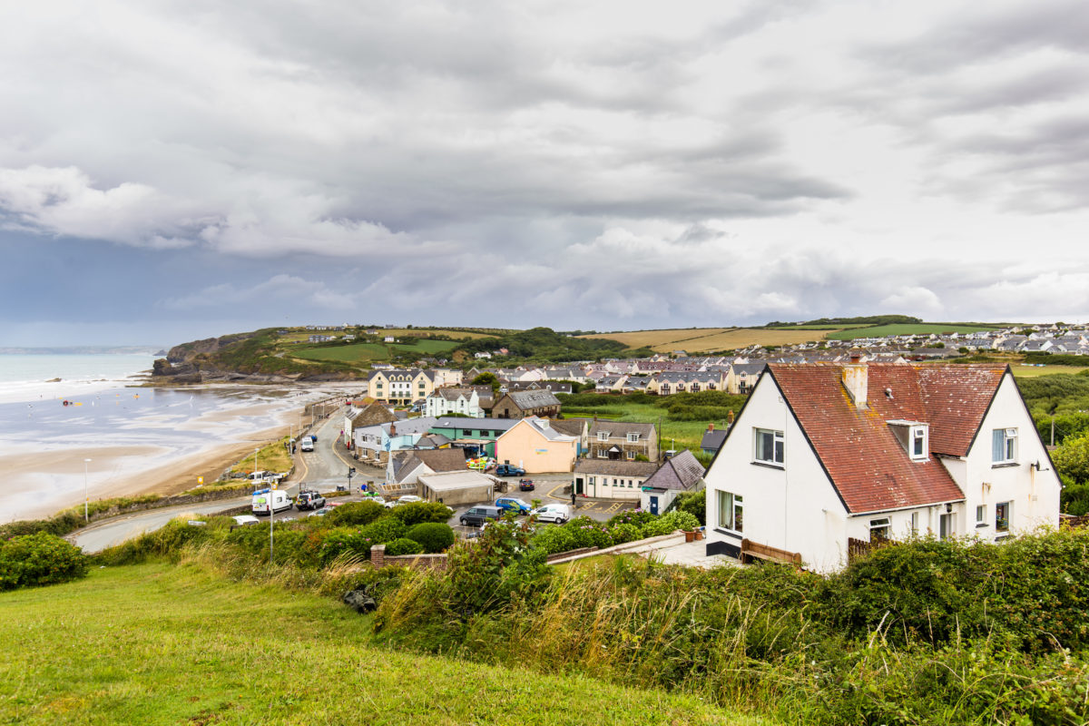
Solva (Grid ref: SM805242)
Follow the Coast Path Safety Code
- Take care on the Coast Path - it's rugged, natural terrain.
- Keep to the path, away from cliff edges and overhangs.
- Always supervise children, especially near cliff edges.
- Walking surfaces can vary considerably with the weather. Always wear strong footwear with a good grip and ankle support.
- Wear or carry warm and waterproof clothing.
- Cliff-top walking can be dangerous in high winds.
- Beware of taking shortcuts across beaches - you may be cut off by the tide. Swimming can also be dangerous.
- Do not sit under cliffs or climb them.
- Keep dogs under close control.
- The Coast Path is for walkers. It is not safe or lawful to ride horses or cycle along most of the Coast Path.
- Leave gates and property as you find them.
- Note that mobile phone coverage is unreliable on the coast.