The cliffs on this section are lower, mostly at around 40m. Although Pen Dinas rises to 142m, the level valley path (also National Trail) avoids this. Hills up from and down to the little beaches are steep but well spread out.
1. Newport Parrog to Old Lifeboat Station 0.5 miles (0.8km)
A seafront walk on access roads and surfaced causeways, with a short section on the beach at low water. The high tide alternative has a narrow section and two flights of six and 25 steps
Walk Difficulty: No man-made obstructions to wheelchairs, ground conditions vary.
Car Park / Public Transport Access
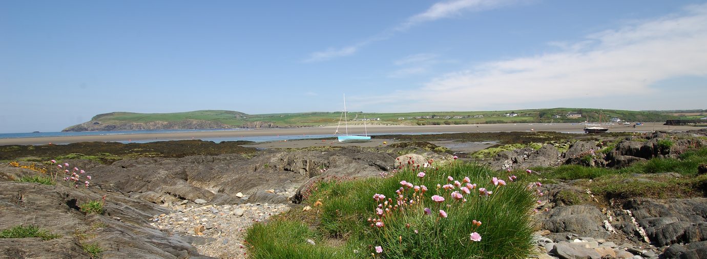
Newport Parrog (Grid ref: SN051396)
Bus stop
(Poppit Rocket – thrice daily return – Cardigan to Fishguard). Medium size car park. Accessible WC. Café nearby.
Walking Access Point
Newport Parrog (SN052397 )to Lifeboat Station (SN044397)
From Parrog car park turn right onto raised 30 foot (0.8m) wide causeway section. Low tide route on hard sand by-passes the causeway (150m). Further section also crosses the sand, making route impassable two hours each side of high tide. 250m is asphalt access road; much of remainder has concrete surface. Gradients are short and comply with BT standard. Seats. Coastal promenade. Toilets at Parrog. Wheelchair 0.7km.
2. Old Lifeboat Station to above Aber Rhigian 1 Miles (1.61km)
A fairly gentle section with no stiles and 5 shallow steps. The slopes can be slippery and difficult when wet. Some of the bays below the cliff were sea quarries for the slate walling stone that was used in Newport.
Walk Difficulty – No stiles or flights of steps, gradients less than 1:6.
Caution
Cat Rock Cliffs (Grid ref: SN039398)
Cliff edge. Keep to the Path. Take care in windy weather. Short sections of Path fairly close to the cliff edge.
Walking Access Point
Aber Step (Rhigian) Footpath (Grid ref: SN035396)
Slight uphill then turn right for a short circuit to Aber Rhigian or return to main road and upland circular walks. (Path junction modified by Order 200m to west).
3. Above Aber Rhigian to above Aber Fforest 1 Mile (1.61km)
The steep descents to the bays contrast with the nearly level clifftop. Two gates, 100 steps. Aberhigian is undeveloped while Aber Fforest has a cluster of buildings. From both Aber Rhigian and Aber Fforest delightful woodland valley paths return to the road.
Walk Difficulty: Stiles, long flights of steps, gradients up to 1:1.
Beach
Aber Rhigian Beach (Grid ref: SN032395)
Secluded beach backed by a pebble bank and marsh.
Walking Access Point
Cwm Rhigion Footpath (Grid ref: SN033394)
Steep wooded valley, tumbling streamside, return to main road.
Caution
Aber Ysgol Cliffs (Grid ref: SN029396)
Cliff edge. Keep to Path. Take care in windy weather. Some sections of Path close to the cliff edge. Parts of this cove have eroded by 5m in the last 10 years.
Walking Access Point
Aber Fforest Footpaths (Grid ref: SN029395)
Four footpaths. The eastern path is a stone track return to main road, the other paths are woodland returns to main road and Dinas.
Beach
Aber Fforest Beach (Grid ref: SN029395)
Small quiet beach backed by a pebble bank. Lime kiln.
4. Above Aberfforest to Soar Hill 0.5 Miles (0.8km)
Accessed from the west this walk has no stiles, steps or steep slopes. As usual there are great views.
Walk Difficulty: No man-made obstructions to wheelchairs, ground conditions vary.
Walking Access Point
Soar Hill (Grid ref: SN017398)
650m of wooded lane, with no introduced obstructions to wheelchairs.
5. Soar Hill to Cwm-yr-Eglwys 0.2 Miles (0.3km)
Steep road with no pavements. Traffic is usually slow but busy in season.
Walk Difficulty – Purpose built path to ‘BT’ Standard for pavement wheelchairs.
6. Cwm-yr-Eglwys Wheelchair Path to Pwllgwaelod 0.6 Miles (1.61km)
There are two dramatically contrasting designated National Trail routes between Cwm-yr-Eglwys and Pwllgwaelod. This is an all-weather path asphalt surfaced for manual wheelchairs. Four accessible gates.
Walk Difficulty: Purpose-built path to ‘BT’ Standard for pavement wheelchairs.
Car Park / Public Transport Access
Cwm-yr-Eglwys Car Park (Grid ref: SN014400)
Small Community Trust car park, charge in season. Accessible WC.
Walking Access Point
Dinas Island Wheelchair Path (Grid ref: SN012399)
Dinas Island – Cwm yr Eglwys car park (small, seasonal charge) (SN014400) to Pwllgwaelod car park (large, free) (SN005398). Purpose-made path to BT standard; cross fall is negligible. Frequent seats, four gates. Section across Cwm yr Eglwys caravan park, 90m, is concrete honeycomb surface that grass grows through. This can give a juddering effect when crossed in a chair. Good sea views (and beach) at each end. Toilets in Pwllgwaelod and Cwm yr Eglwys car parks. Wheelchair 1km.
Facilities
The Old Sailors (Grid ref: SN005399)
Restaurant.
Car Park / Public Transport Access
Pwllgwaelod Car Park (Grid ref: SN005398)
Bus stop (Poppit Rocket – twice daily return – Cardigan to Fishguard). Large free community car park. Accessible WC.
Facilities
Dinas Cross (& Brynhenllan) (Grid ref: SN012388)
Villages (0.9 miles inland) with shop, pub, accommodation, chip shop.
7. Cwm-yr-Eglwys Cliff Path to Pwllgwaelod 2.4 Miles (3.22Km)
There are two dramatically contrasting designated National Trail routes between Cwm-yr-Eglwys and Pwllgwaelod. This route is open cliff with a steep ascent to 400 feet and back down to sea level, via Dinas Head (Owned by the National Trust). Outstanding views of the coast both east and west. One dog accessible stiles, one wicket gate, three kissing gates, 120 steps. Sheep and cattle graze parts of this section. (In very wet weather, the Rock section can become very muddy, use the marked permissive alternative.)
Walk Difficulty: Stiles, long flights of steps, gradients up to 1:1.
Beach
Cwm-yr-Eglwys Beach (Grid ref: SN015400)
A small fairly quiet sandy beach.
Information
Cwm-yr-Eglwys Church (Grid ref: SN015400)
The belfry and west wall are all that remain of the 12th century church of St Brynach at Cwm-yr-Eglwys, destroyed by the great storm of 1859.
Worth a look
Needle Rock (Grid ref: SN015409)
Herring gulls, razorbills and guillemots breed on Needle Rock.
Beach
Pwllgwaelod Beach (Grid ref: SN004399)
Small fairly quiet sandy beach.
8. Pwllgwaelod to Headland West of Hescwm (Aber Bach) 1.6 Miles (3.22Km)
The steep descents to the bays contrast with the nearly-level cliff top. These grey shattered cliffs don’t quite look British, more like a flooded mesa landscape. seven stiles, one wicket gate, 110 steps. The stiles have provision for dog access. Sheep and horses graze parts of this section.
Walk Difficulty: Stiles, long flights of steps, gradients up to 1:1.
Caution
Cliff Edge (Grid ref: SN01394)
Eroding cliff edges. Keep to Path.
Beach
Pwll Gwylog (Grid ref: SM999393)
Difficult access down to this charming little secluded cove. Shingle and boulder beach.
Beach
Aber Hesgwm or Aber Bach (Grid ref: SM996386)
Small quiet beach backed by a pebble bank. Seat.
Walking Access Point
Aber Hesgwm Footpath (Grid ref: SM997385)
The road access to Aber Hesgwm (Aber Bach) is rough, very narrow with few passing places and many hairpin bends, there are no parking places. Best access is by public footpath from Dinas (SN003381).
9. Headland West of Hescwm to Aber Grugog, Penrhyn 1.4 Miles (1.61Km)
The Coast Path along this section has gentle gradients and no stiles. There is a kissing gate a quarter mile east of Penrhyn and a flight of 5 steps west of Hescwm.
Walk Difficulty: No man-made obstructions to wheelchairs, ground conditions vary
Walking Access Point
Penrhyn towards Hesgwm (Grid ref: SM997385)
Gentle gradients, stile and step free section. No public parking on the coast.
Walking Access Point
Garn Gelli (Grid ref: SM985375)
Access the Coast Path from inland – park at the layby at the top of the hill on the A487(T), follow the bridleway to Penrhyn.
10. Aber Grugog, Penrhyn to Fishguard Fort 1.7 Miles (3.22Km)
Quite a wild, though short section with heather and gorse on rough outcrops. One stile with provision for dog access, 100 steps, wet patches and steep gradients. The western three quarter mile is stile free with slight gradients. Horses graze parts of this section.
Walk Difficulty – Stiles, long flights of steps, gradients up to 1:1
Worth a look
Needle Rock (Grid ref: SM975380)
Needle Rock is an unusual pierced stack, with an arch in the base. Best views are slightly to seaward of the Coast Path.
11. Fishguard Fort to Lower Town 0.5 Miles (0Km)
The 300m path between the Fort and the road has an even surface but is quite steep. The top 100m from car park to viewpoint is a purpose built wheelchair section. A short steep road section with a pavement connects the two car parks. Look out for small directional acorn symbols stuck high up to metal poles and signs, these indicate the recommended route through or near towns. Look out also for recently put up brown fingers with the acorn symbol.
Walk Difficulty – Road.
Information
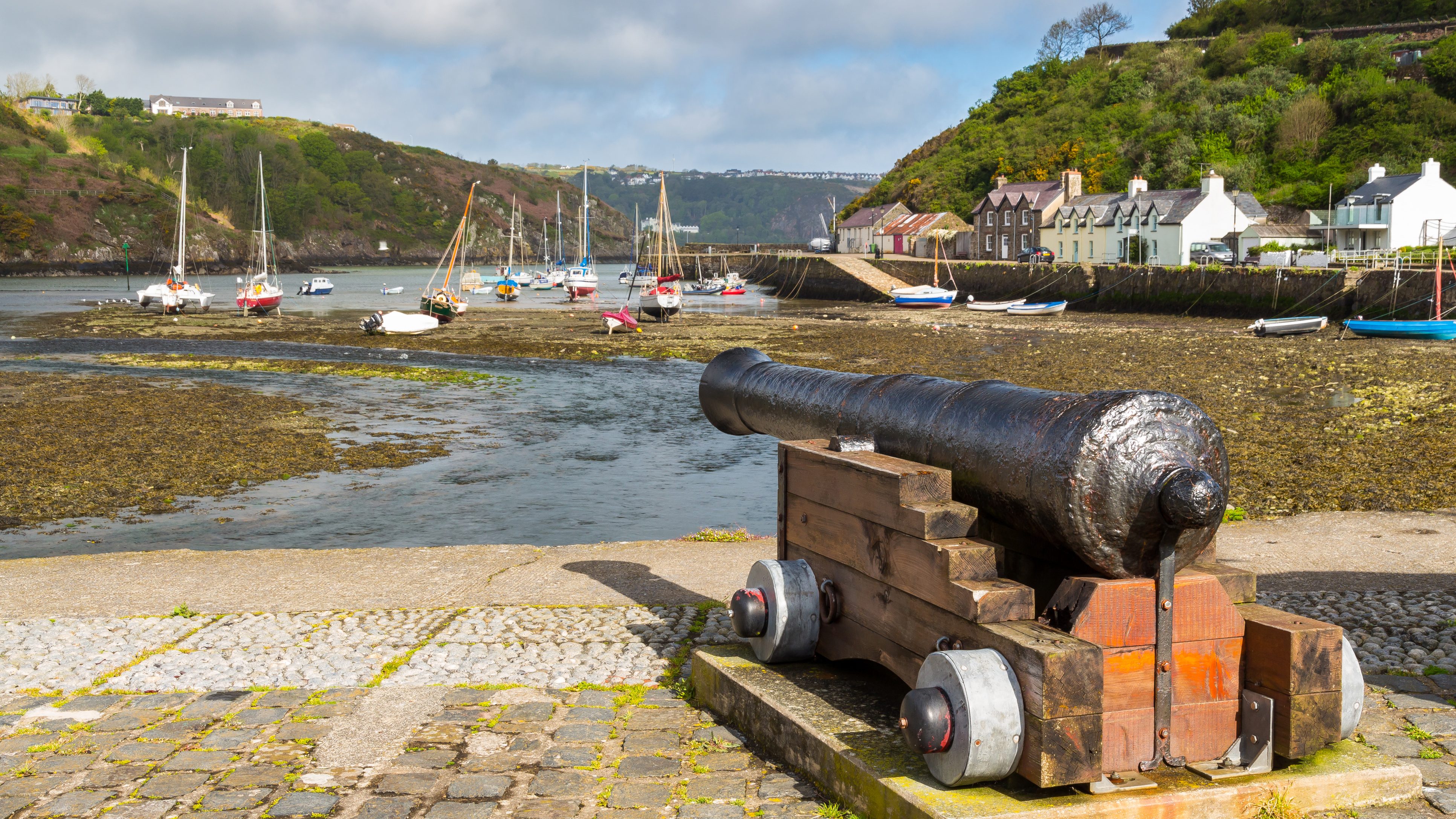
Fishguard Fort (Grid ref: SM961378)
Fishguard Fort was built in 1779-81, following a bombardment of the town by the privateer Black Prince. The fort was armed with eight nine-pounder guns. On 22 February 1797 the fort fired its guns to warn of approaching French ships, but played no further part in repelling the ‘last invasion’ (French landing of 1797). The building is now maintained by the National Park Authority.
Walking Access Point
Wheelchair – Fishguard Fort (Grid ref: SM962375)
Fishguard Fort SM 962375 from the small car park above Lower Town, on the road to Newport. The first section of rolled stone path is a steep ramp at 1:8 (with landings) for 30m. After a further 70m of gentle slope down, there is viewpoint overlooking the Fort and Bay. The path continues to the Fort with no introduced obstructions, but very steeply downhill at 1:4 for 60m. Toilets at Fishguard, Square and West St. Wheelchair 100m.
Car Park / Public Transport Access
Fishguard Fort Car Park (Grid ref: SM962375)
Small (about 8 car) car park, sometimes with an ice cream van. A popular spot for watching the ferries come and go.
Facilities
Lower Town (Grid ref: SM963371)
The Ship Pub
Car Park / Public Transport Access
Lower Town (Grid ref: SM963371)
Bus stop (Poppit Rocket – thrice daily return – Cardigan to Fishguard). Medium car park. Harbour.
View this section on Street View
Newport Parrog (Grid ref: SN051396)
Follow the Coast Path Safety Code
- Take care on the Coast Path - it's rugged, natural terrain.
- Keep to the path, away from cliff edges and overhangs.
- Always supervise children, especially near cliff edges.
- Walking surfaces can vary considerably with the weather. Always wear strong footwear with a good grip and ankle support.
- Wear or carry warm and waterproof clothing.
- Cliff-top walking can be dangerous in high winds.
- Beware of taking shortcuts across beaches - you may be cut off by the tide. Swimming can also be dangerous.
- Do not sit under cliffs or climb them.
- Keep dogs under close control.
- The Coast Path is for walkers. It is not safe or lawful to ride horses or cycle along most of the Coast Path.
- Leave gates and property as you find them.
- Note that mobile phone coverage is unreliable on the coast.